


MapSherpa Catalog
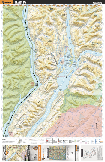
NOBC46 Granby Bay - Northern BC
Backroad Mapbooks
This recreation topographic map for the Granby Bay area highlights all the logging roads, trails and recreation features for fishing, hunting, camping, hiking, mountain biking, canoeing, kayaking, backcountry skiing, wildlife viewing, ATVing, snowmobiling and more. No other map for the area provides you this level of recreational and topographic detail. New features include private land and labelled fish species plus countless new roads, trails and recreational Points of Interest. Covering Portland Canal, Observatory Inlet, Alice Arm, Hastings Arm, Anyox, Granby Bay, Ksi Xts'at'kw Stagoo Conservancy, Carney Lake, Bessie Lake, Larcom Island and more, this map contains new features such as private land and labelled fish species. This 1:85,000 scale map covers 3,040 km2 (1,175 mi2), measuring 50 x 63.5 km (30 x 39.5 mi).
Page Size: 24 x 37 in (610 x 940 mm)
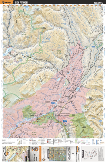
NOBC47 New Aiyansh - Northern BC
Backroad Mapbooks
This recreation topographic map for the New Aiyansh area highlights all the logging roads, trails and recreation features for fishing, hunting, camping, hiking, mountain biking, canoeing, kayaking, backcountry skiing, wildlife viewing, ATVing, snowmobiling and more. No other map for the area provides you this level of recreational and topographic detail. New features include private land and labelled fish species plus countless new roads, trails and recreational Points of Interest. Covering New Aiyansh, Nisga'a Memorial Lava Bed Prov Park, Nass Camp, Aiyansh, Dragon Lake, Gingietl Creek Ecological Reserve, Nass River, Kinskuch River, Spencer Lake, Alice Arm and more, this map contains new features such as private land and labelled fish species. This 1:85,000 scale map covers 3,040 km2 (1,175 mi2), measuring 50 x 63.5 km (30 x 39.5 mi).
Page Size: 24 x 37 in (610 x 940 mm)
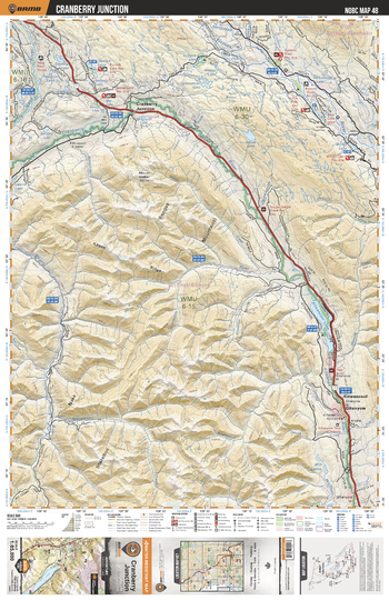
NOBC48 Cranberry Junction - Northern BC
Backroad Mapbooks
This recreation topographic map for the Cranberry Junction area highlights all the logging roads, trails and recreation features for fishing, hunting, camping, hiking, mountain biking, canoeing, kayaking, backcountry skiing, wildlife viewing, ATVing, snowmobiling and more. No other map for the area provides you this level of recreational and topographic detail. New features include private land and labelled fish species plus countless new roads, trails and recreational Points of Interest. Covering Cranberry Junction, Kitwancool Lake, Kitwancool, Gitanyow, Cranberry River, Kitwanga River, Nass River, Nass Ranges, Sweetin River, Kispoix River and more, this map contains new features such as private land and labelled fish species. This 1:85,000 scale map covers 3,040 km2 (1,175 mi2), measuring 50 x 63.5 km (30 x 39.5 mi).
Page Size: 24 x 37 in (610 x 940 mm)
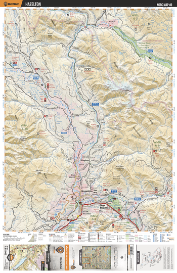
NOBC49 Hazelton - Northern BC
Backroad Mapbooks
This recreation topographic map for the Hazelton area highlights all the logging roads, trails and recreation features for fishing, hunting, camping, hiking, mountain biking, canoeing, kayaking, backcountry skiing, wildlife viewing, ATVing, snowmobiling and more. No other map for the area provides you this level of recreational and topographic detail. New features include private land and labelled fish species plus countless new roads, trails and recreational Points of Interest. Covering Gitnadoiks River Prov Park, Skeena River, Exstew River, Terrace, Zymagotitz River, Kitimat, Nechako Centre, Wedeene, DuBose, Thunderbird and more, this map contains new features such as private land and labelled fish species. This 1:85,000 scale map covers 3,040 km2 (1,175 mi2), measuring 50 x 63.5 km (30 x 39.5 mi).
Page Size: 24 x 37 in (610 x 940 mm)
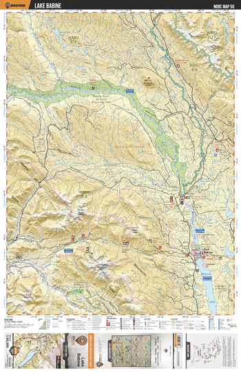
NOBC50 Lake Babine - Northern BC
Backroad Mapbooks
This recreation topographic map for the Lake Babine area highlights all the logging roads, trails and recreation features for fishing, hunting, camping, hiking, mountain biking, canoeing, kayaking, backcountry skiing, wildlife viewing, ATVing, snowmobiling and more. No other map for the area provides you this level of recreational and topographic detail. New features include private land and labelled fish species plus countless new roads, trails and recreational Points of Interest. Covering Babine River Corridor Prov Park, Nilkitkwa River, Sucker Lake, Fort Babine, Babine Lake, Suskwa River, Netalzul Mtn, Camp Lake, Netalzul Meadows Prov Park, French Peak and more, this map contains new features such as private land and labelled fish species. This 1:85,000 scale map covers 3,040 km2 (1,175 mi2), measuring 50 x 63.5 km (30 x 39.5 mi).
Page Size: 24 x 37 in (610 x 940 mm)
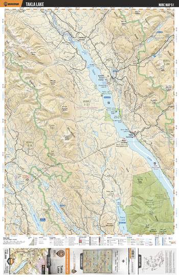
NOBC51 Takla Lake - Northern BC
Backroad Mapbooks
This recreation topographic map for the Takla Lake area highlights all the logging roads, trails and recreation features for fishing, hunting, camping, hiking, mountain biking, canoeing, kayaking, backcountry skiing, wildlife viewing, ATVing, snowmobiling and more. No other map for the area provides you this level of recreational and topographic detail. New features include private land and labelled fish species plus countless new roads, trails and recreational Points of Interest. Covering Takla Lake, Driftwood River, Takla Landing, Lovell Cove Camp, Bulkley House, Mount Blanchet Prov Park, Morrison Lake, Skeena Mtns, Diver Lake, Friday Lake and more, this map contains new features such as private land and labelled fish species. This 1:85,000 scale map covers 3,040 km2 (1,175 mi2), measuring 50 x 63.5 km (30 x 39.5 mi).
Page Size: 24 x 37 in (610 x 940 mm)
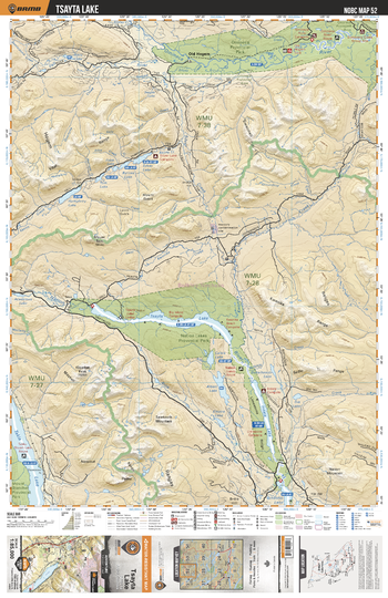
NOBC52 Tsayta Lake - Northern BC
Backroad Mapbooks
This recreation topographic map for the Tsayta Lake area highlights all the logging roads, trails and recreation features for fishing, hunting, camping, hiking, mountain biking, canoeing, kayaking, backcountry skiing, wildlife viewing, ATVing, snowmobiling and more. No other map for the area provides you this level of recreational and topographic detail. New features include private land and labelled fish species plus countless new roads, trails and recreational Points of Interest. Covering Tsayta Lake, Old Hogem, Omineca Prov Park, Nation Lakes Prov Park, Indata Lake, Tchentlo Lake, Nation River, Takla Lake, Fall River, Omineca River and more, this map contains new features such as private land and labelled fish species. This 1:85,000 scale map covers 3,040 km2 (1,175 mi2), measuring 50 x 63.5 km (30 x 39.5 mi).
Page Size: 24 x 37 in (610 x 940 mm)
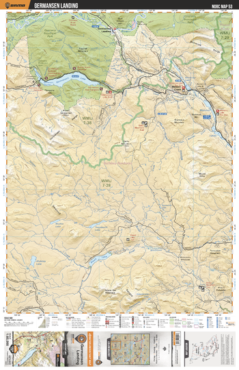
NOBC53 Germansen Landing - Northern BC
Backroad Mapbooks
This recreation topographic map for the Germansen Landing area highlights all the logging roads, trails and recreation features for fishing, hunting, camping, hiking, mountain biking, canoeing, kayaking, backcountry skiing, wildlife viewing, ATVing, snowmobiling and more. No other map for the area provides you this level of recreational and topographic detail. New features include private land and labelled fish species plus countless new roads, trails and recreational Points of Interest. Covering Germansen Lake, Omineca Prov Park, Germansen Landing, Omineca River, Germansen River, Manson Creek, Manson Lakes, Moosmoos Meadows, Wolverine Lakes, Baldy Mtn and more, this map contains new features such as private land and labelled fish species. This 1:85,000 scale map covers 3,040 km2 (1,175 mi2), measuring 50 x 63.5 km (30 x 39.5 mi).
Page Size: 24 x 37 in (610 x 940 mm)
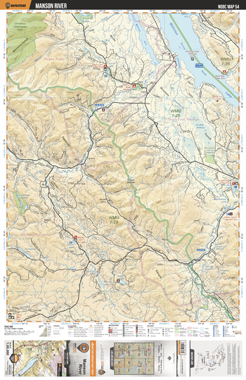
NOBC54 Manson River - Northern BC
Backroad Mapbooks
This recreation topographic map for the Manson River area highlights all the logging roads, trails and recreation features for fishing, hunting, camping, hiking, mountain biking, canoeing, kayaking, backcountry skiing, wildlife viewing, ATVing, snowmobiling and more. No other map for the area provides you this level of recreational and topographic detail. New features include private land and labelled fish species plus countless new roads, trails and recreational Points of Interest. Covering Williston Lake, Manson Reach, Manson River, Curve Lake, Omineca Prov Park, Nation River, Skunk Lake, Burden Lake, Blackwater Creek, Blackwater Creek Eco Reserve and more, this map contains new features such as private land and labelled fish species. This 1:85,000 scale map covers 3,040 km2 (1,175 mi2), measuring 50 x 63.5 km (30 x 39.5 mi).
Page Size: 24 x 37 in (610 x 940 mm)
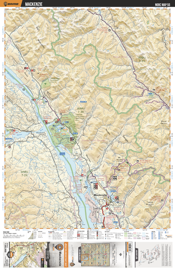
NOBC55 Mackenzie - Northern BC
Backroad Mapbooks
This recreation topographic map for the Mackenzie area highlights all the logging roads, trails and recreation features for fishing, hunting, camping, hiking, mountain biking, canoeing, kayaking, backcountry skiing, wildlife viewing, ATVing, snowmobiling and more. No other map for the area provides you this level of recreational and topographic detail. New features include private land and labelled fish species plus countless new roads, trails and recreational Points of Interest. Covering Williston Lake, Nation Arm, Mugaha Bay, Mackenzie, Mount Morfee, Heather-Dina Lakes Prov Park, Cut Thumb Bay, Burden Lake, Makenzie Demo Forest, Six Mile Bay and more, this map contains new features such as private land and labelled fish species. This 1:85,000 scale map covers 3,040 km2 (1,175 mi2), measuring 50 x 63.5 km (30 x 39.5 mi).
Page Size: 24 x 37 in (610 x 940 mm)
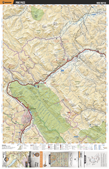
NOBC56 Pine Pass - Northern BC
Backroad Mapbooks
This recreation topographic map for the Pine Pass area highlights all the logging roads, trails and recreation features for fishing, hunting, camping, hiking, mountain biking, canoeing, kayaking, backcountry skiing, wildlife viewing, ATVing, snowmobiling and more. No other map for the area provides you this level of recreational and topographic detail. New features include private land and labelled fish species plus countless new roads, trails and recreational Points of Interest. Covering Pine Le Moray Prov Park, Azouzetta, Azu Ski Village, Bijoux Falls Prov Park, Burnt River, Lemoray, Pine Valley, Moberly River, Klin-se-za Prov Park, Hulcross and more, this map contains new features such as private land and labelled fish species. This 1:85,000 scale map covers 3,040 km2 (1,175 mi2), measuring 50 x 63.5 km (30 x 39.5 mi).
Page Size: 24 x 37 in (610 x 940 mm)
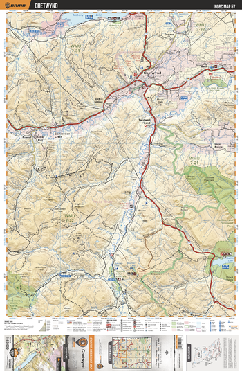
NOBC57 Chetwynd - Northern BC
Backroad Mapbooks
This recreation topographic map for the Chetwynd area highlights all the logging roads, trails and recreation features for fishing, hunting, camping, hiking, mountain biking, canoeing, kayaking, backcountry skiing, wildlife viewing, ATVing, snowmobiling and more. No other map for the area provides you this level of recreational and topographic detail. New features include private land and labelled fish species plus countless new roads, trails and recreational Points of Interest. Covering Chetwynd, Moberly Lake, Gwillim Lake, Burnt River, Dokie Siding, Twidwell Bend, Sukunka River, Lone Prairie, Pine River, Hasler Flat and more, this map contains new features such as private land and labelled fish species. This 1:85,000 scale map covers 3,040 km2 (1,175 mi2), measuring 50 x 63.5 km (30 x 39.5 mi).
Page Size: 24 x 37 in (610 x 940 mm)
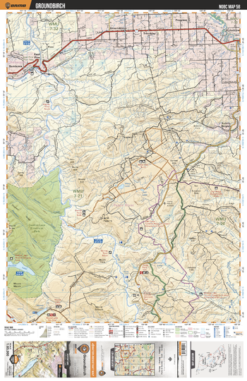
NOBC58 Groundbirch - Northern BC
Backroad Mapbooks
This recreation topographic map for the Groundbirch area highlights all the logging roads, trails and recreation features for fishing, hunting, camping, hiking, mountain biking, canoeing, kayaking, backcountry skiing, wildlife viewing, ATVing, snowmobiling and more. No other map for the area provides you this level of recreational and topographic detail. New features include private land and labelled fish species plus countless new roads, trails and recreational Points of Interest. Covering Gwillim Lake Prov Park, Moose Lake, Murray River, Pine River, Teepee Falls, Murray Canyon, Feller's Height, Tremblay, East Pine, Gwillim River and more, this map contains new features such as private land and labelled fish species. This 1:85,000 scale map covers 3,040 km2 (1,175 mi2), measuring 50 x 63.5 km (30 x 39.5 mi).
Page Size: 24 x 37 in (610 x 940 mm)
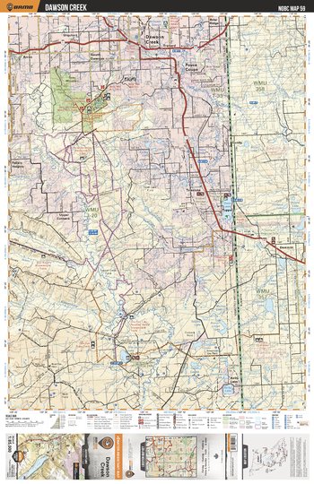
NOBC59 Dawson Creek - Northern BC
Backroad Mapbooks
This recreation topographic map for the Dawson Creek area highlights all the logging roads, trails and recreation features for fishing, hunting, camping, hiking, mountain biking, canoeing, kayaking, backcountry skiing, wildlife viewing, ATVing, snowmobiling and more. No other map for the area provides you this level of recreational and topographic detail. New features include private land and labelled fish species plus countless new roads, trails and recreational Points of Interest. Covering Dawson Creek, One Island Lake, Kelly Lake, Swan Lake, Tupper, Pouce Coupe, Kiskatinaw River, Bear Mtn, Salt Ridge, Upper Cutbank and more, this map contains new features such as private land and labelled fish species. This 1:85,000 scale map covers 3,040 km2 (1,175 mi2), measuring 50 x 63.5 km (30 x 39.5 mi).
Page Size: 24 x 37 in (610 x 940 mm)
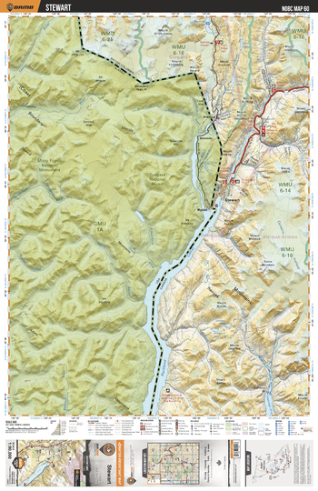
NOBC60 Stewart Park - Northern BC
Backroad Mapbooks
This recreation topographic map for the Stewart area highlights all the logging and resource roads, recreational features and trails for hiking, mountain biking, ATVing, snowmobiling, skiing, snowshoeing, fishing, camping, hunting, canoeing, kayaking, wildlife viewing and more. New features include private land and labelled fish species, plus new roads, recreational trails and Points of Interest. No other map provides you with this level of recreational and topographic detail for the Stewart area. Measuring 52.5 x 70 km (32.5 x 43.5 mi), this 1:90,000 scale map covers 3,680 km2 (1,420 mi2) in total and includes Bear River, Boundary Ranges, Cambira Icefield, Hyder, Mount Dickie, Mount Hinckley, Mount Johnson, Ninemile Mountain, Portland Canal, Tongass National Forest, Salmon Glacier, Stewart, Summit Lake and more!
Page Size: 24 x 37 in (610 x 940 mm)
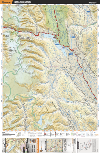
NOBC61 Meziadin Junction - Northern BC
Backroad Mapbooks
This recreation topographic map for the Meziadin Junction area highlights all the logging and resource roads, recreational features and trails for hiking, mountain biking, ATVing, snowmobiling, skiing, snowshoeing, fishing, camping, hunting, canoeing, kayaking, wildlife viewing and more. New features include private land and labelled fish species, plus new roads, recreational trails and Points of Interest. No other map for the area provides you with this level of recreational or topographic detail. Measuring 52.5 x 70 km (32.5 x 43.5 mi), this 1:90,000 scale map covers 3,680 km2 (1,420 mi2) in total and includes Meziadin Junction, Hanna-Tintina Conservancy, Bear Glacier Park, Hanna-Tintina Conservancy, Meziadin Lake Park, Meziadin Lake, White River, Nass River, Niska Lakes and more!
Page Size: 24 x 37 in (610 x 940 mm)
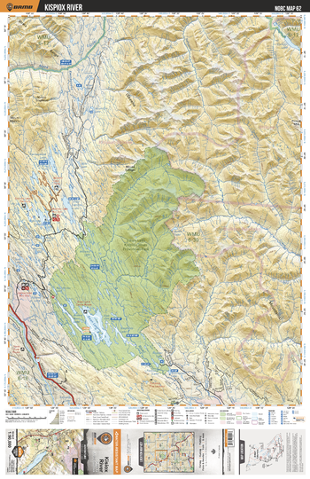
NOBC62 Kispiox River - Northern BC
Backroad Mapbooks
This recreation topographic map for the Kispiox River area highlights all the logging and resource roads, recreational features and trails for hiking, mountain biking, ATVing, snowmobiling, skiing, snowshoeing, fishing, camping, hunting, canoeing, kayaking, wildlife viewing and more. New features include private land and labelled fish species, plus new roads, recreational trails and Points of Interest. No other map for the area provides you with this level of recreational or topographic detail. Measuring 52.5 x 70 km (32.5 x 43.5 mi), this 1:90,000 scale map covers 3,680 km2 (1,420 mi2) in total and includes Swan Lake Kispiox River Park, Kispiox River, Kwinageese Lake, Bonney Lake, Jigsaw Lake, Fred Wright Lake, Brown Bear Lake, Swan Lake, Sweetin River and more!
Page Size: 24 x 37 in (610 x 940 mm)
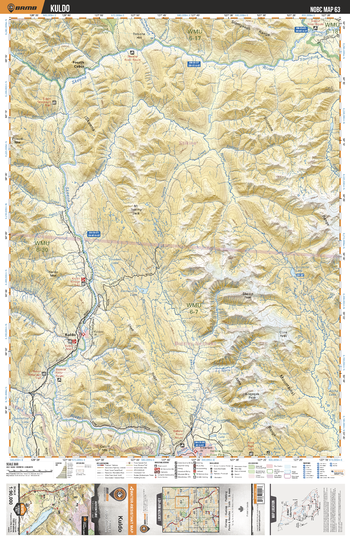
NOBC63 Kuldo - Northern BC
Backroad Mapbooks
This recreation topographic map for the Kuldo area highlights all the logging and resource roads, recreational features and trails for hiking, mountain biking, ATVing, snowmobiling, skiing, snowshoeing, fishing, camping, hunting, canoeing, kayaking, wildlife viewing and more. New features include private land and labelled fish species, plus new roads, recreational trails and Points of Interest. No other map for the area provides you with this level of recreational or topographic detail. Measuring 52.5 x 70 km (32.5 x 43.5 mi), this 1:90,000 scale map covers 3,680 km2 (1,420 mi2) in total and includes Kuldo, Fourth Cabin, Skeena River, Sicintine River, Smokee Lake, Damsumlo Lake, Shelagyote River and more!
Page Size: 24 x 37 in (610 x 940 mm)
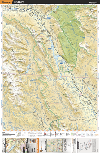
NOBC64 Bear Lake - Northern BC
Backroad Mapbooks
This recreation topographic map for the Bear Lake area highlights all the logging and resource roads, recreational features and trails for hiking, mountain biking, ATVing, snowmobiling, skiing, snowshoeing, fishing, camping, hunting, canoeing, kayaking, wildlife viewing and more. New features include private land and labelled fish species, plus new roads, recreational trails and Points of Interest. No other map for the area provides you with this level of recreational or topographic detail. Measuring 52.5 x 70 km (32.5 x 43.5 mi), this 1:90,000 scale map covers 3,680 km2 (1,420 mi2) in total and includes Bear Lake, Sustut Provincial Park, Squingula River, Motase Lake, Bear Lake, Foerster Lake, Driftwood River, Gamma Lake and more!
Page Size: 24 x 37 in (610 x 940 mm)
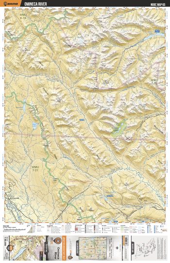
NOBC65 Omineca River - Northern BC
Backroad Mapbooks
This recreation topographic map for the Omineca River area highlights all the logging and resource roads, recreational features and trails for hiking, mountain biking, ATVing, snowmobiling, skiing, snowshoeing, fishing, camping, hunting, canoeing, kayaking, wildlife viewing and more. New features include private land and labelled fish species, plus new roads, recreational trails and Points of Interest. No other map for the area provides you with this level of recreational or topographic detail. Measuring 52.5 x 70 km (32.5 x 43.5 mi), this 1:90,000 scale map covers 3,680 km2 (1,420 mi2) in total and includes Driftwood, Nanitsch Lake, Kaza Lake, Omineca River, Tutizzi Lake and more!
Page Size: 24 x 37 in (610 x 940 mm)
No search results