


MapSherpa Catalog
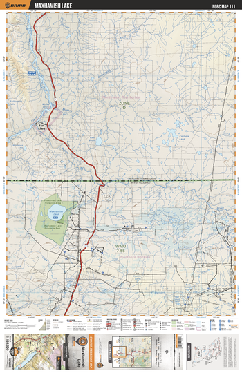
NOBC111 Maxhamish Lake - Northern BC
Backroad Mapbooks
This recreation map for the Maxhamish Lake area highlights all the logging and resource roads, recreational features and trails for hiking, mountain biking, ATVing, snowmobiling, skiing, snowshoeing, fishing, camping, hunting, canoeing, kayaking, wildlife viewing and more. New features include private land and labelled fish species, plus new roads, recreational trails and Points of Interest. No other map for the area provides you with this level of recreational or topographic detail. Measuring 105 x 140 km (65 x 87 mi), this 1:185,000 scale map covers 14,750 km2 (5,695 mi2) in total and includes Maxhamish Lake, Fort Liard, Maxhamish Lake Provincial Park, Maxhamish Lake Protected Area, Petitot River, Liard River, Coles Lake and more!
Page Size: 24 x 37 in (610 x 940 mm)
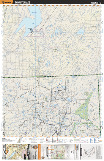
NOBC112 Thinahtea Lake - Northern BC
Backroad Mapbooks
This recreation map for the Thinahtea Lake area highlights all the logging and resource roads, recreational features and trails for hiking, mountain biking, ATVing, snowmobiling, skiing, snowshoeing, fishing, camping, hunting, canoeing, kayaking, wildlife viewing and more. New features include private land and labelled fish species, plus new roads, recreational trails and Points of Interest. No other map for the area provides you with this level of recreational or topographic detail. Measuring 105 x 140 km (65 x 87 mi), this 1:185,000 scale map covers 14,750 km2 (5,695 mi2) in total and includes Thinahtea Lake, Thinahtea South Protected Area, Petitot River, July Lake, June Lake, Thinahtea North Protected Area, Thinahtea Creek, North Helmet Airfield and more!
Page Size: 24 x 37 in (610 x 940 mm)
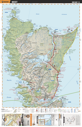
NOBC113 Masset - Northern BC
Backroad Mapbooks
This recreation map for the Masset area highlights all the logging and resource roads, recreational features and trails for hiking, mountain biking, ATVing, snowmobiling, skiing, snowshoeing, fishing, camping, hunting, canoeing, kayaking, wildlife viewing and more. New features include private land and labelled fish species, plus new roads, recreational trails and Points of Interest. No other map for the area provides you with this level of recreational or topographic detail. Measuring 105 x 140 km (65 x 87 mi), this 1:185,000 scale map covers 14,750 km2 (5,695 mi2) in total and includes Queen Charlotte Islands, Queen Charlotte City, Sandspit, Skidegate, Port Clements, Masset, Masset Inlet, Shannon Bay, Sheilds Bay, Yakoun Lake and more!
Page Size: 24 x 37 in (610 x 940 mm)
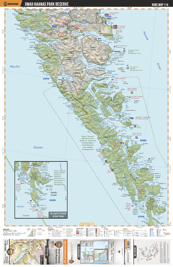
NOBC114 Gwaii Haanas Park Reserve - Northern BC
Backroad Mapbooks
This recreation map for the Gwaii Haanas Park Reserve area highlights all the logging and resource roads, recreational features and trails for hiking, mountain biking, ATVing, snowmobiling, skiing, snowshoeing, fishing, camping, hunting, canoeing, kayaking, wildlife viewing and more. New features include private land and labelled fish species, plus new roads, recreational trails and Points of Interest. No other map for the area provides you with this level of recreational or topographic detail. Measuring 105 x 140 km (65 x 87 mi), this 1:185,000 scale map covers 14,750 km2 (5,695 mi2) in total and includes Moresby Island, Lagoon Bay, Rose Harbour, Gwaii Hanaas National Park Reserve, Tanu, Jedway, Mosquito Lake, Thurston Harbour, New Clew, Cheatl and more!
Page Size: 24 x 37 in (610 x 940 mm)
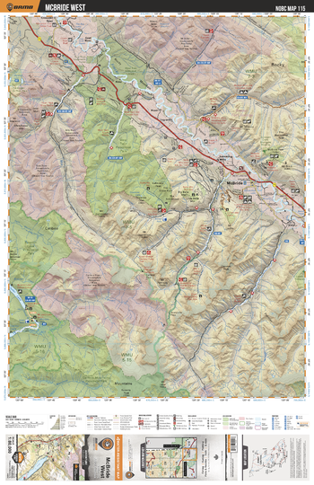
NOBC115 McBride Area - Northern BC Topo
Backroad Mapbooks
This recreation topographic map for McBride and the Robson Valley features all the logging roads, recreational features and trails for hiking, mountain biking, ATVing, snowmobiling, skiing, snowshoeing, fishing, camping, hunting, canoeing, kayaking, wildlife viewing and more. New features include private land and labelled fish species, plus new roads, recreational trails and Points of Interest. No other map provides you with this level of recreational and topographic detail for the McBride area. Measuring 104 x 69 km (64.5 x 43 mi), this map covers 7,135 km2 (2,755 mi2) in total, including Crescent Spur, Dunster, Goat River, Harvey, Isaac Lake, McBride, Mt. Renshaw, Lamming Mills, McCabe, Poser, Raush Valley, and Tete Jaune Cache, along with Bowron Lake Provincial Park, Small River Caves Provincial Park, West Twin Provincial Park, Willmore Wilderness Provincial Park and more.
Page Size: 24 x 37 in (610 x 940 mm)
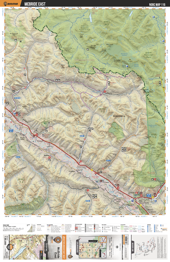
NOBC116 McBride Area East - Northern BC Topo
Backroad Mapbooks
This recreation topographic map for McBride and the Robson Valley features all the logging roads, recreational features and trails for hiking, mountain biking, ATVing, snowmobiling, skiing, snowshoeing, fishing, camping, hunting, canoeing, kayaking, wildlife viewing and more. New features include private land and labelled fish species, plus new roads, recreational trails and Points of Interest. No other map provides you with this level of recreational and topographic detail for the McBride area. Measuring 104 x 69 km (64.5 x 43 mi), this map covers 7,135 km2 (2,755 mi2) in total, including Crescent Spur, Dunster, Goat River, Harvey, Isaac Lake, McBride, Mt. Renshaw, Lamming Mills, McCabe, Poser, Raush Valley, and Tete Jaune Cache, along with Bowron Lake Provincial Park, Small River Caves Provincial Park, West Twin Provincial Park, Willmore Wilderness Provincial Park and more.
Page Size: 24 x 37 in (610 x 940 mm)
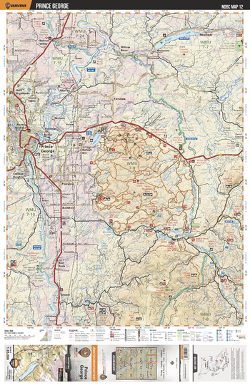
NOBC12 Prince George - Northern BC
Backroad Mapbooks
This recreation topographic map for the Prince George area highlights all the logging roads, trails and recreation features for fishing, hunting, camping, hiking, mountain biking, canoeing, kayaking, backcountry skiing, wildlife viewing, ATVing, snowmobiling and more. No other map for the area provides you this level of recreational and topographic detail. New features include private land and labelled fish species plus countless new roads, trails and recreational Points of Interest. Covering Prince George, Eaglet Lake, Red Rock, Willow River, Salmon Valley, Tabot Lake, Newlands, Fort George Canyon Prov Park, Stoner, Ferndale and more, this map contains new features such as private land and labelled fish species. This 1:85,000 scale map covers 3,040 km2 (1,175 mi2), measuring 50 x 63.5 km (30 x 39.5 mi).
Page Size: 24 x 37 in (610 x 940 mm)
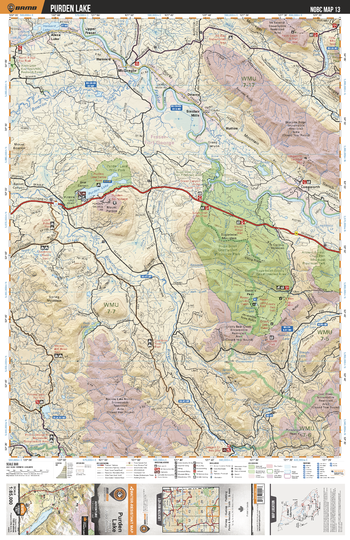
NOBC13 Purden Lake - Northern BC
Backroad Mapbooks
This recreation topographic map for the Purden Lake area highlights all the logging roads, trails and recreation features for fishing, hunting, camping, hiking, mountain biking, canoeing, kayaking, backcountry skiing, wildlife viewing, ATVing, snowmobiling and more. No other map for the area provides you this level of recreational and topographic detail. New features include private land and labelled fish species plus countless new roads, trails and recreational Points of Interest. Covering Sugarbowl Grizzly Den Prov Park, Purden Lake Prov Park, Pitoney Lake, Fraser River, Evanoff Prov Park, McGregor, Bowron River, Lake Tumuch, Hansard Lake and more, this map contains new features such as private land and labelled fish species. This 1:85,000 scale map covers 3,040 km2 (1,175 mi2), measuring 50 x 63.5 km (30 x 39.5 mi).
Page Size: 24 x 37 in (610 x 940 mm)
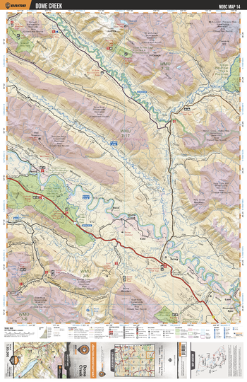
NOBC14 Dome Creek - Northern BC
Backroad Mapbooks
This recreation topographic map for the Dome Creek area highlights all the logging roads, trails and recreation features for fishing, hunting, camping, hiking, mountain biking, canoeing, kayaking, backcountry skiing, wildlife viewing, ATVing, snowmobiling and more. No other map for the area provides you this level of recreational and topographic detail. New features include private land and labelled fish species plus countless new roads, trails and recreational Points of Interest. Covering Kakwa Prov Park, McGregor River, Torpy River, Dome Creek, Evanoff Prov Park, Close-to the-Edge Prov Park, Slim Creek Prov Park, Loos, Crescent Spur, Holy Cross Mtn and more, this map contains new features such as private land and labelled fish species. This 1:85,000 scale map covers 3,040 km2 (1,175 mi2), measuring 50 x 63.5 km (30 x 39.5 mi).
Page Size: 24 x 37 in (610 x 940 mm)
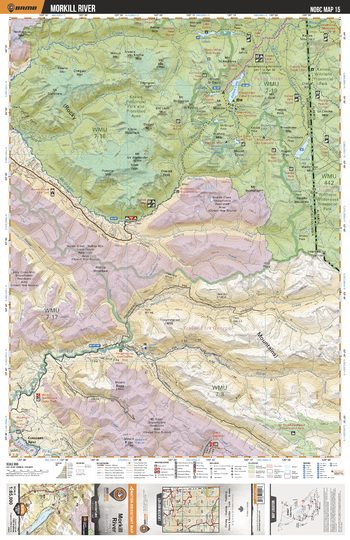
NOBC15 Morkill River - Northern BC
Backroad Mapbooks
This recreation topographic map for the Morkill River area highlights all the logging roads, trails and recreation features for fishing, hunting, camping, hiking, mountain biking, canoeing, kayaking, backcountry skiing, wildlife viewing, ATVing, snowmobiling and more. No other map for the area provides you this level of recreational and topographic detail. New features include private land and labelled fish species plus countless new roads, trails and recreational Points of Interest. Covering Kakwa Prov Park, Kakwa Lake, Broadview Mtn, McGregor River, Morkill River, Crescent Spur, Cecelia Lake, Jarvis Lakes, Kakwa Wildland Park, Jarvis Creek and more, this map contains new features such as private land and labelled fish species. This 1:85,000 scale map covers 3,040 km2 (1,175 mi2), measuring 50 x 63.5 km (30 x 39.5 mi).
Page Size: 24 x 37 in (610 x 940 mm)
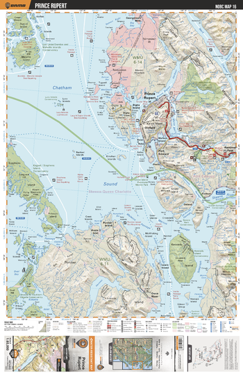
NOBC16 Prince Rupert - Northern BC
Backroad Mapbooks
This recreation topographic map for the Prince Rupert area highlights all the logging roads, trails and recreation features for fishing, hunting, camping, hiking, mountain biking, canoeing, kayaking, backcountry skiing, wildlife viewing, ATVing, snowmobiling and more. No other map for the area provides you this level of recreational and topographic detail. New features include private land and labelled fish species plus countless new roads, trails and recreational Points of Interest. Covering Chatham Sound, Prince Rupert, Lucy Islands, Digby Island, Kennedy Island, Porcher Island, Oona River, Stephens Island, Melville Island, Dunira Island and more, this map contains new features such as private land and labelled fish species. This 1:85,000 scale map covers 3,040 km2 (1,175 mi2), measuring 50 x 63.5 km (30 x 39.5 mi).
Page Size: 24 x 37 in (610 x 940 mm)
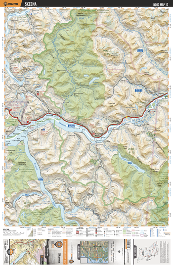
NOBC17 Skeena - Northern BC
Backroad Mapbooks
This recreation topographic map for the Skeena area highlights all the logging roads, trails and recreation features for fishing, hunting, camping, hiking, mountain biking, canoeing, kayaking, backcountry skiing, wildlife viewing, ATVing, snowmobiling and more. No other map for the area provides you this level of recreational and topographic detail. New features include private land and labelled fish species plus countless new roads, trails and recreational Points of Interest. Covering Skeena, Skeena River, Khyex Conservancy, Telegraph Point, Kwinitsa, Tyee, Ecstall River, Salvus, Gitnadoiks River Prov Park, Khyex River and more, this map contains new features such as private land and labelled fish species. This 1:85,000 scale map covers 3,040 km2 (1,175 mi2), measuring 50 x 63.5 km (30 x 39.5 mi).
Page Size: 24 x 37 in (610 x 940 mm)
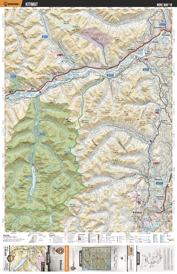
NOBC18 Kitimat - Northern BC
Backroad Mapbooks
This recreation topographic map for the Kitimat area highlights all the logging roads, trails and recreation features for fishing, hunting, camping, hiking, mountain biking, canoeing, kayaking, backcountry skiing, wildlife viewing, ATVing, snowmobiling and more. No other map for the area provides you this level of recreational and topographic detail. New features include private land and labelled fish species plus countless new roads, trails and recreational Points of Interest. Covering Gitnadoiks River Prov Park, Skeena River, Exstew River, Terrace, Zymagotitz River, Kitimat, Nechako Centre, Wedeene, DuBose, Thunderbird and more, this map contains new features such as private land and labelled fish species. This 1:85,000 scale map covers 3,040 km2 (1,175 mi2), measuring 50 x 63.5 km (30 x 39.5 mi).
Page Size: 24 x 37 in (610 x 940 mm)
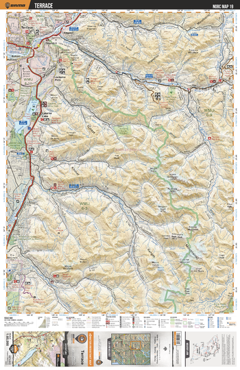
NOBC19 Terrace - Northern BC
Backroad Mapbooks
This recreation topographic map for the Terrace area highlights all the logging roads, trails and recreation features for fishing, hunting, camping, hiking, mountain biking, canoeing, kayaking, backcountry skiing, wildlife viewing, ATVing, snowmobiling and more. No other map for the area provides you this level of recreational and topographic detail. New features include private land and labelled fish species plus countless new roads, trails and recreational Points of Interest. Covering Lakelse Lake, Terrace, Kitimat River, Copper River, Kitnayakwa River, Jackpine Flats, Nalbeelah Creek Wetlands Prov Park, Hai Lake Mount Herman Prov Park, Mount Elizabeth and more, this map contains new features such as private land and labelled fish species. This 1:85,000 scale map covers 3,040 km2 (1,175 mi2), measuring 50 x 63.5 km (30 x 39.5 mi).
Page Size: 24 x 37 in (610 x 940 mm)
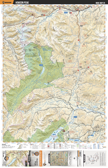
NOBC20 Howson Peak - Northern BC
Backroad Mapbooks
This recreation topographic map for the Howson Peak area highlights all the logging roads, trails and recreation features for fishing, hunting, camping, hiking, mountain biking, canoeing, kayaking, backcountry skiing, wildlife viewing, ATVing, snowmobiling and more. No other map for the area provides you this level of recreational and topographic detail. New features include private land and labelled fish species plus countless new roads, trails and recreational Points of Interest. Covering Tazdli Wyiez Bin Burnie-Shea Prov Park, Thautil River, Telkwa River, Morice River, Morice Lake, Morice Lake Prov Park, Burnie River, Lower Burnie Lake, Upper Burnie Lake, Mooseskin Johnny Lake and more, this map contains new features such as private land and labelled fish species. This 1:85,000 scale map covers 3,040 km2 (1,175 mi2), measuring 50 x 63.5 km (30 x 39.5 mi).
Page Size: 24 x 37 in (610 x 940 mm)
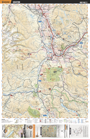
NOBC21 Houston - Northern BC
Backroad Mapbooks
This recreation topographic map for the Houston area highlights all the logging roads, trails and recreation features for fishing, hunting, camping, hiking, mountain biking, canoeing, kayaking, backcountry skiing, wildlife viewing, ATVing, snowmobiling and more. No other map for the area provides you this level of recreational and topographic detail. New features include private land and labelled fish species plus countless new roads, trails and recreational Points of Interest. Covering Houston, Parrot Lakes, Houston, Bulkley River, North Bulkley, Barrett Lake, Walcott, Morice River, Robin Creek, Nadine Mtn and more, this map contains new features such as private land and labelled fish species. This 1:85,000 scale map covers 3,040 km2 (1,175 mi2), measuring 50 x 63.5 km (30 x 39.5 mi).
Page Size: 24 x 37 in (610 x 940 mm)
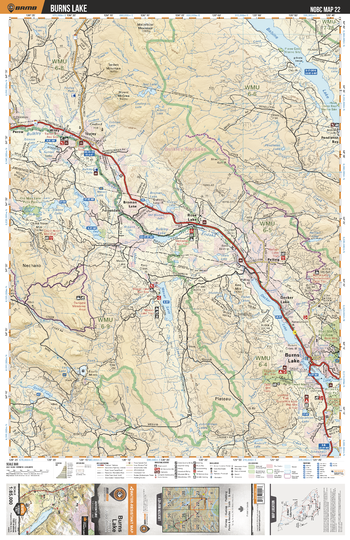
NOBC22 Burns Lake - Northern BC
Backroad Mapbooks
This recreation topographic map for the Burns Lake area highlights all the logging roads, trails and recreation features for fishing, hunting, camping, hiking, mountain biking, canoeing, kayaking, backcountry skiing, wildlife viewing, ATVing, snowmobiling and more. No other map for the area provides you this level of recreational and topographic detail. New features include private land and labelled fish species plus countless new roads, trails and recreational Points of Interest. Covering Babine Lake, Bulkley River, Burns Lake, Maxan Lake, Rose Lake, Wiley, Topley, Pendleton Bay, Endako River, Decker Lake and more, this map contains new features such as private land and labelled fish species. This 1:85,000 scale map covers 3,040 km2 (1,175 mi2), measuring 50 x 63.5 km (30 x 39.5 mi).
Page Size: 24 x 37 in (610 x 940 mm)
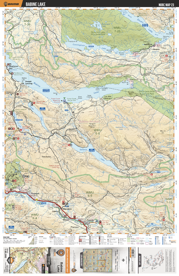
NOBC23 Babine Lake - Northern BC
Backroad Mapbooks
This recreation topographic map for the Babine Lake area highlights all the logging roads, trails and recreation features for fishing, hunting, camping, hiking, mountain biking, canoeing, kayaking, backcountry skiing, wildlife viewing, ATVing, snowmobiling and more. No other map for the area provides you this level of recreational and topographic detail. New features include private land and labelled fish species plus countless new roads, trails and recreational Points of Interest. Covering Rubyrock Lake, Stuart Lake, Babine Lake, Taltapin Lake, Augier Lake, Pinkut Lake, Boer Mtn Rec Area, Pendleton Bay, Yekooche, Sheraton and more, this map contains new features such as private land and labelled fish species. This 1:85,000 scale map covers 3,040 km2 (1,175 mi2), measuring 50 x 63.5 km (30 x 39.5 mi).
Page Size: 24 x 37 in (610 x 940 mm)
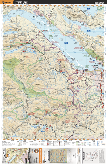
NOBC24 Stuart Lake - Northern BC
Backroad Mapbooks
This recreation topographic map for the Stuart Lake area highlights all the logging roads, trails and recreation features for fishing, hunting, camping, hiking, mountain biking, canoeing, kayaking, backcountry skiing, wildlife viewing, ATVing, snowmobiling and more. No other map for the area provides you this level of recreational and topographic detail. New features include private land and labelled fish species plus countless new roads, trails and recreational Points of Interest. Covering Stuart Lake, Tezzeron Lake, Pinchi Lake, Camsell Lake, Fort St James, Grassham Lake, Ormond Lake, Sutherland River, Whitefish Lake, Ormond Lake and more, this map contains new features such as private land and labelled fish species. This 1:85,000 scale map covers 3,040 km2 (1,175 mi2), measuring 50 x 63.5 km (30 x 39.5 mi).
Page Size: 24 x 37 in (610 x 940 mm)
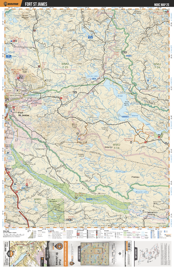
NOBC25 Fort St James - Northern BC
Backroad Mapbooks
This recreation topographic map for the Fort St James area highlights all the logging roads, trails and recreation features for fishing, hunting, camping, hiking, mountain biking, canoeing, kayaking, backcountry skiing, wildlife viewing, ATVing, snowmobiling and more. No other map for the area provides you this level of recreational and topographic detail. New features include private land and labelled fish species plus countless new roads, trails and recreational Points of Interest. Covering Fort St James, Great Beaver Lake, Stuart River Prov Park, Stuart River, Jumping Lake, Salmon River, Necoslie River, Margaret River, Blue Mtn Demo Forest and more, this map contains new features such as private land and labelled fish species. This 1:85,000 scale map covers 3,040 km2 (1,175 mi2), measuring 50 x 63.5 km (30 x 39.5 mi).
Page Size: 24 x 37 in (610 x 940 mm)
No search results