


MapSherpa Catalog
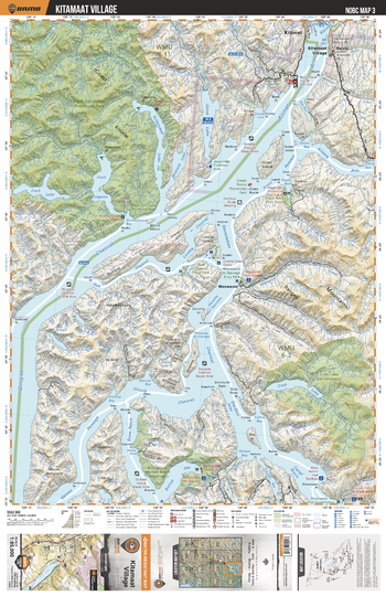
NOBC03 Kitamaat Village - Northern BC
Backroad Mapbooks
This recreation topographic map for the Kitamaat Village area highlights all the logging roads, trails and recreation features for fishing, hunting, camping, hiking, mountain biking, canoeing, kayaking, backcountry skiing, wildlife viewing, ATVing, snowmobiling and more. No other map for the area provides you this level of recreational and topographic detail. New features include private land and labelled fish species plus countless new roads, trails and recreational Points of Interest. Covering Foch Gilttoyees Prov Park, Weewanie, Kitimat, Gribble Island, Douglas Channel, Hawkesbury Island, Eagle Bay, Coste Rocks, Devastation Channel, Kitimaat Village and more, this map contains new features such as private land and labelled fish species. This 1:85,000 scale map covers 3,040 km2 (1,175 mi2), measuring 50 x 63.5 km (30 x 39.5 mi).
Page Size: 24 x 37 in (610 x 940 mm)
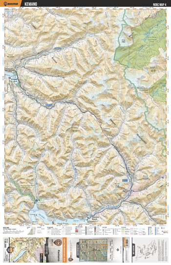
NOBC04 Kemano - Northern BC
Backroad Mapbooks
This recreation topographic map for the Kemano area highlights all the logging roads, trails and recreation features for fishing, hunting, camping, hiking, mountain biking, canoeing, kayaking, backcountry skiing, wildlife viewing, ATVing, snowmobiling and more. No other map for the area provides you this level of recreational and topographic detail. New features include private land and labelled fish species plus countless new roads, trails and recreational Points of Interest. Covering Atna River Prov Park, Morice Lake Prov Park, Kildala Arm, Kildala River, Kemano, Kemano Beach, Owyacumish River Prov Park, Gardner Canal, Kemano River, Dala River and more, this map contains new features such as private land and labelled fish species. This 1:85,000 scale map covers 3,040 km2 (1,175 mi2), measuring 50 x 63.5 km (30 x 39.5 mi).
Page Size: 24 x 37 in (610 x 940 mm)
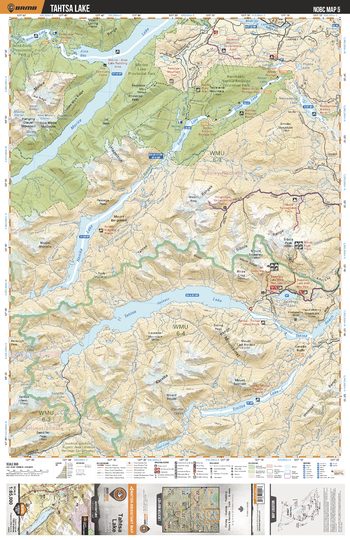
NOBC05 Tahtsa Lake - Northern BC
Backroad Mapbooks
This recreation topographic map for the Tahtsa Lake area highlights all the logging roads, trails and recreation features for fishing, hunting, camping, hiking, mountain biking, canoeing, kayaking, backcountry skiing, wildlife viewing, ATVing, snowmobiling and more. No other map for the area provides you this level of recreational and topographic detail. New features include private land and labelled fish species plus countless new roads, trails and recreational Points of Interest. Covering Tahtsa Lake, Troitsa Lake, Nanika Lake, Morice Lake, Atna Bay, Atna Lake, Kidprice Lake, Stepp Lake, Nanika-Kidprice Prov Park, Morice Lake Prov Park and more, this map contains new features such as private land and labelled fish species. This 1:85,000 scale map covers 3,040 km2 (1,175 mi2), measuring 50 x 63.5 km (30 x 39.5 mi).
Page Size: 24 x 37 in (610 x 940 mm)
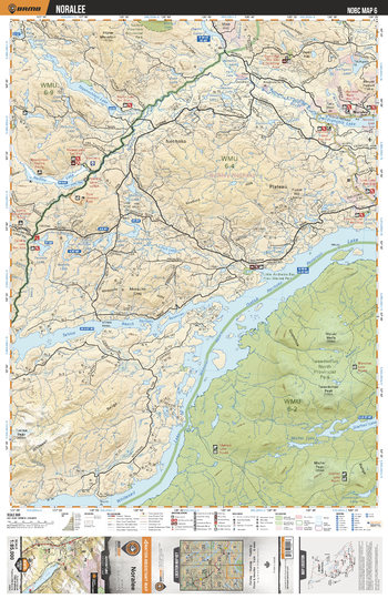
NOBC06 Noralee - Northern BC
Backroad Mapbooks
This recreation topographic map for the Noralee area highlights all the logging roads, trails and recreation features for fishing, hunting, camping, hiking, mountain biking, canoeing, kayaking, backcountry skiing, wildlife viewing, ATVing, snowmobiling and more. No other map for the area provides you this level of recreational and topographic detail. New features include private land and labelled fish species plus countless new roads, trails and recreational Points of Interest. Covering Tweedsmuir Prov Park, Whitesail Lake, Ootsa Lake, Tahtsa Reach, Nadina Lake, Francois Lake, Noralee, Tagetochlain Lake, Nadina River, Whitesail Range and more, this map contains new features such as private land and labelled fish species. This 1:85,000 scale map covers 3,040 km2 (1,175 mi2), measuring 50 x 63.5 km (30 x 39.5 mi).
Page Size: 24 x 37 in (610 x 940 mm)
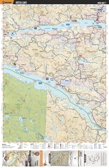
NOBC07 Ootsa Lake - Northern BC
Backroad Mapbooks
This recreation topographic map for the Ootsa Lake area highlights all the logging roads, trails and recreation features for fishing, hunting, camping, hiking, mountain biking, canoeing, kayaking, backcountry skiing, wildlife viewing, ATVing, snowmobiling and more. No other map for the area provides you this level of recreational and topographic detail. New features include private land and labelled fish species plus countless new roads, trails and recreational Points of Interest. Covering Tweedsmuir Prov Park, Ootsa Lake, Marilla, Wistaria, Francois Lake, Takysie Lake, Clemretta, McDonalds Landing, Southbank, Cheslatta River and more, this map contains new features such as private land and labelled fish species. This 1:85,000 scale map covers 3,040 km2 (1,175 mi2), measuring 50 x 63.5 km (30 x 39.5 mi).
Page Size: 24 x 37 in (610 x 940 mm)
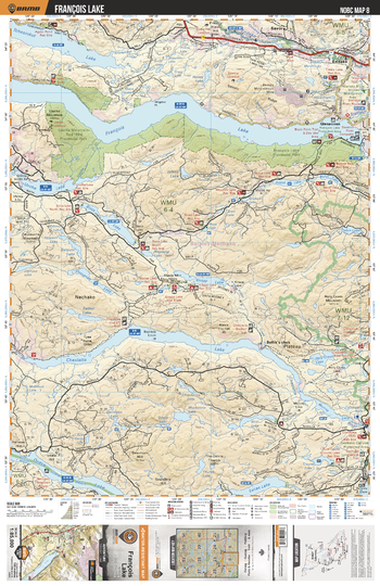
NOBC08 Francois Lake - Northern BC
Backroad Mapbooks
This recreation topographic map for the Francois Lake area highlights all the logging roads, trails and recreation features for fishing, hunting, camping, hiking, mountain biking, canoeing, kayaking, backcountry skiing, wildlife viewing, ATVing, snowmobiling and more. No other map for the area provides you this level of recreational and topographic detail. New features include private land and labelled fish species plus countless new roads, trails and recreational Points of Interest. Covering Francois Lake, Cheslatta Lake, Knapp Lake, Binta Lake, Tchesinkut Lake, Endako, Murray Lake, Intata Reach, Lucas Lake, Uncha Mountan-Red Hills Prov Park and more, this map contains new features such as private land and labelled fish species. This 1:85,000 scale map covers 3,040 km2 (1,175 mi2), measuring 50 x 63.5 km (30 x 39.5 mi).
Page Size: 24 x 37 in (610 x 940 mm)
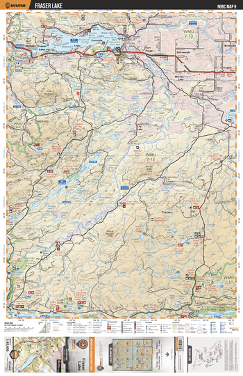
NOBC09 Fraser Lake - Northern BC
Backroad Mapbooks
This recreation topographic map for the Fraser Lake area highlights all the logging roads, trails and recreation features for fishing, hunting, camping, hiking, mountain biking, canoeing, kayaking, backcountry skiing, wildlife viewing, ATVing, snowmobiling and more. No other map for the area provides you this level of recreational and topographic detail. New features include private land and labelled fish species plus countless new roads, trails and recreational Points of Interest. Covering Fraser Lake, Nechako Canyon Protected Area, Nechako River, Tahultzu Lake, Hallett Lake, Fort Fraser, Stellako, Engen, Tachick Lake, Paddle Lake and more, this map contains new features such as private land and labelled fish species. This 1:85,000 scale map covers 3,040 km2 (1,175 mi2), measuring 50 x 63.5 km (30 x 39.5 mi).
Page Size: 24 x 37 in (610 x 940 mm)
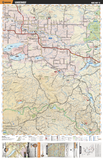
NOBC10 Vanderhoof - Northern BC
Backroad Mapbooks
This recreation topographic map for the Vanderhoof area highlights all the logging roads, trails and recreation features for fishing, hunting, camping, hiking, mountain biking, canoeing, kayaking, backcountry skiing, wildlife viewing, ATVing, snowmobiling and more. No other map for the area provides you this level of recreational and topographic detail. New features include private land and labelled fish species plus countless new roads, trails and recreational Points of Interest. Covering Vanderhoof, Sinkut River, Cluculz Lake, Nechako River, Stuart River Prov Park, Nulki Lake, Tachick Lake, Grizzly Lake, Sinkut Lake, Hulat and more, this map contains new features such as private land and labelled fish species. This 1:85,000 scale map covers 3,040 km2 (1,175 mi2), measuring 50 x 63.5 km (30 x 39.5 mi).
Page Size: 24 x 37 in (610 x 940 mm)
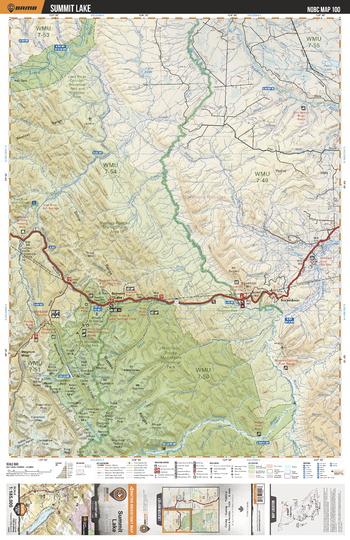
NOBC100 Summit Lake - Northern BC
Backroad Mapbooks
This recreation map for the Summit Lake area highlights all the logging and resource roads, recreational features and trails for hiking, mountain biking, ATVing, snowmobiling, skiing, snowshoeing, fishing, camping, hunting, canoeing, kayaking, wildlife viewing and more. New features include private land and labelled fish species, plus new roads, recreational trails and Points of Interest. No other map for the area provides you with this level of recreational or topographic detail. Measuring 105 x 140 km (65 x 87 mi), this 1:185,000 scale map covers 14,750 km2 (5,695 mi2) in total and includes Summit Lake, Steamboat, Dunedin River, Fort Nelson River, Mt Gunnell, Toad River, Muskwa River, Tuchodi River, Stone Mountain Prov Park, Northern Rocky Mountains Prov Park and more!
Page Size: 24 x 37 in (610 x 940 mm)
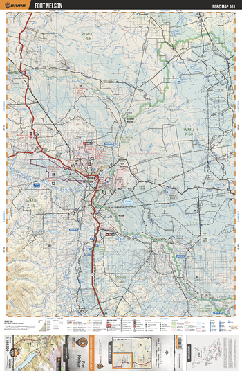
NOBC101 Fort Nelson - Northern BC
Backroad Mapbooks
This recreation map for the Fort Nelson area highlights all the logging and resource roads, recreational features and trails for hiking, mountain biking, ATVing, snowmobiling, skiing, snowshoeing, fishing, camping, hunting, canoeing, kayaking, wildlife viewing and more. New features include private land and labelled fish species, plus new roads, recreational trails and Points of Interest. No other map for the area provides you with this level of recreational or topographic detail. Measuring 105 x 140 km (65 x 87 mi), this 1:185,000 scale map covers 14,750 km2 (5,695 mi2) in total and includes Fort Nelson, Fort Nelson River, Muskwa River, Snake River, Elleh, Ekwan, Fontas, Klua, Old Fort Nelson, Prophet River and more!
Page Size: 24 x 37 in (610 x 940 mm)
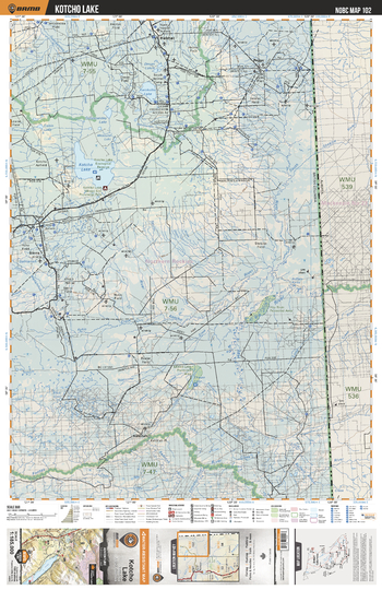
NOBC102 Kotcho Lake - Northern BC
Backroad Mapbooks
This recreation map for the Kotcho Lake area highlights all the logging and resource roads, recreational features and trails for hiking, mountain biking, ATVing, snowmobiling, skiing, snowshoeing, fishing, camping, hunting, canoeing, kayaking, wildlife viewing and more. New features include private land and labelled fish species, plus new roads, recreational trails and Points of Interest. No other map for the area provides you with this level of recreational or topographic detail. Measuring 105 x 140 km (65 x 87 mi), this 1:185,000 scale map covers 14,750 km2 (5,695 mi2) in total and includes Kotcho Lake, Hay River, Kahntah, Fontas River, Kwokullie Lake, Yoyo, Kotcho River, Shekilie River, Outaanetday Lake, Cabin Lake, Ekwan Lake and more!
Page Size: 24 x 37 in (610 x 940 mm)
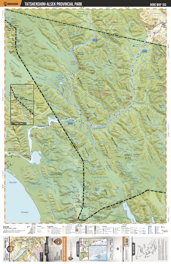
NOBC103 Tatshenshini Alsek Provincial Park - Northern BC
Backroad Mapbooks
This recreation map for the Tatshenshini Alsek Provincial Park area highlights all the logging and resource roads, recreational features and trails for hiking, mountain biking, ATVing, snowmobiling, skiing, snowshoeing, fishing, camping, hunting, canoeing, kayaking, wildlife viewing and more. New features include private land and labelled fish species, plus new roads, recreational trails and Points of Interest. No other map for the area provides you with this level of recreational or topographic detail. Measuring 105 x 140 km (65 x 87 mi), this 1:185,000 scale map covers 14,750 km2 (5,695 mi2) in total and includes Tatshenshini-Alsek Prov Park, Tatshenshini River, Battle Lake, Firewood Lake, Alsek River, Onion Lake, St Elias Mountains, Kluane National Park, Vern Ritchie Lake, Turnback Canyon and more!
Page Size: 24 x 37 in (610 x 940 mm)
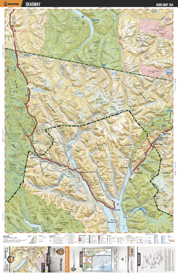
NOBC104 Skagway - Northern BC
Backroad Mapbooks
This recreation map for the Skagway area highlights all the logging and resource roads, recreational features and trails for hiking, mountain biking, ATVing, snowmobiling, skiing, snowshoeing, fishing, camping, hunting, canoeing, kayaking, wildlife viewing and more. New features include private land and labelled fish species, plus new roads, recreational trails and Points of Interest. No other map for the area provides you with this level of recreational or topographic detail. Measuring 105 x 140 km (65 x 87 mi), this 1:185,000 scale map covers 14,750 km2 (5,695 mi2) in total and includes Tatshenshini Alsek Prov Park, Kusawa Lake, White Pass, Fraser, Skagway, Linderman, Kelsall Lake, Goodwin Lake, Bennett Lake, Pleasant Camp and more!
Page Size: 24 x 37 in (610 x 940 mm)
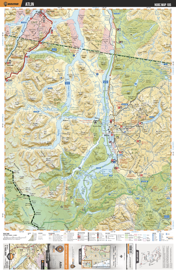
NOBC105 Atlin - Northern BC
Backroad Mapbooks
This recreation map for the Atlin area highlights all the logging and resource roads, recreational features and trails for hiking, mountain biking, ATVing, snowmobiling, skiing, snowshoeing, fishing, camping, hunting, canoeing, kayaking, wildlife viewing and more. New features include private land and labelled fish species, plus new roads, recreational trails and Points of Interest. No other map for the area provides you with this level of recreational or topographic detail. Measuring 105 x 140 km (65 x 87 mi), this 1:185,000 scale map covers 14,750 km2 (5,695 mi2) in total and includes Atlin, Atlin Prov Park, Atlin Lake, Surprise Lake, Tagish (Taku) Lake, Tutshi Lake, Bennett Lake, Sloko Lake, Fantail Lake, Rupert, Discovery and more!
Page Size: 24 x 37 in (610 x 940 mm)
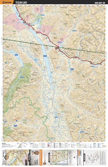
NOBC106 Teslin Lake - Northern BC
Backroad Mapbooks
This recreation map for the Teslin Lake area highlights all the logging and resource roads, recreational features and trails for hiking, mountain biking, ATVing, snowmobiling, skiing, snowshoeing, fishing, camping, hunting, canoeing, kayaking, wildlife viewing and more. New features include private land and labelled fish species, plus new roads, recreational trails and Points of Interest. No other map for the area provides you with this level of recreational or topographic detail. Measuring 105 x 140 km (65 x 87 mi), this 1:185,000 scale map covers 14,750 km2 (5,695 mi2) in total and includes Teslin Lake, Morley River, Gladys Lake, Swan Lake, Morley Lake, Kedahda Lake, Four Mile Lake, Hyland Hill, Hall Lake and more!
Page Size: 24 x 37 in (610 x 940 mm)
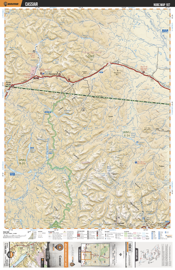
NOBC107 Cassiar - Northern BC
Backroad Mapbooks
This recreation map for the Cassiar area highlights all the logging and resource roads, recreational features and trails for hiking, mountain biking, ATVing, snowmobiling, skiing, snowshoeing, fishing, camping, hunting, canoeing, kayaking, wildlife viewing and more. New features include private land and labelled fish species, plus new roads, recreational trails and Points of Interest. No other map for the area provides you with this level of recreational or topographic detail. Measuring 105 x 140 km (65 x 87 mi), this 1:185,000 scale map covers 14,750 km2 (5,695 mi2) in total and includes Rancheria, Cassiar, Meister River, Liard River, Little Moose River, Swift River, Rancheria River, One Ace Mountain, Klinkit Lake, McNaughton Lakes and more!
Page Size: 24 x 37 in (610 x 940 mm)
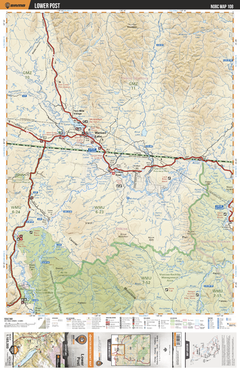
NOBC108 Lower Post - Northern BC
Backroad Mapbooks
This recreation map for the Lower Post area highlights all the logging and resource roads, recreational features and trails for hiking, mountain biking, ATVing, snowmobiling, skiing, snowshoeing, fishing, camping, hunting, canoeing, kayaking, wildlife viewing and more. New features include private land and labelled fish species, plus new roads, recreational trails and Points of Interest. No other map for the area provides you with this level of recreational or topographic detail. Measuring 105 x 140 km (65 x 87 mi), this 1:185,000 scale map covers 14,750 km2 (5,695 mi2) in total and includes Watson Lake, Bova Lake Prov Park, Muskwa-Kechika Management Area, Kechika River, Lower Post, Dease River, Liard River, Hyland River, Dot Lake, Dodo Lakes and more!
Page Size: 24 x 37 in (610 x 940 mm)
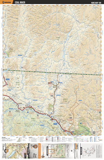
NOBC109 Coal River - Northern BC
Backroad Mapbooks
This recreation map for the Coal River area highlights all the logging and resource roads, recreational features and trails for hiking, mountain biking, ATVing, snowmobiling, skiing, snowshoeing, fishing, camping, hunting, canoeing, kayaking, wildlife viewing and more. New features include private land and labelled fish species, plus new roads, recreational trails and Points of Interest. No other map for the area provides you with this level of recreational or topographic detail. Measuring 105 x 140 km (65 x 87 mi), this 1:185,000 scale map covers 14,750 km2 (5,695 mi2) in total and includes Maxhamish Lake, Kuskwa-Kechika Management Area, Smith River, Liard River, Skooks Landing, Coal River, Fireside, Grayling River, West Lake, Triangle Lake and more!
Page Size: 24 x 37 in (610 x 940 mm)
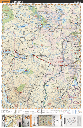
NOBC11 Chilako River - Northern BC
Backroad Mapbooks
This recreation topographic map for the Chilako River area highlights all the logging roads, trails and recreation features for fishing, hunting, camping, hiking, mountain biking, canoeing, kayaking, backcountry skiing, wildlife viewing, ATVing, snowmobiling and more. No other map for the area provides you this level of recreational and topographic detail. New features include private land and labelled fish species plus countless new roads, trails and recreational Points of Interest. Covering Prince George, Mud River, Naltesby Lake, Nadsilnich Lake, Eskers Prov Park, Stuart River Prov Park, Nechako River, Chilako River, Naltesby Lake, Dahl Lake Prov Park and more, this map contains new features such as private land and labelled fish species. This 1:85,000 scale map covers 3,040 km2 (1,175 mi2), measuring 50 x 63.5 km (30 x 39.5 mi).
Page Size: 24 x 37 in (610 x 940 mm)
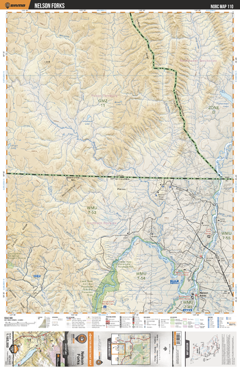
NOBC110 Nelson Fork - Northern BC
Backroad Mapbooks
This recreation map for the Nelson Fork area highlights all the logging and resource roads, recreational features and trails for hiking, mountain biking, ATVing, snowmobiling, skiing, snowshoeing, fishing, camping, hunting, canoeing, kayaking, wildlife viewing and more. New features include private land and labelled fish species, plus new roads, recreational trails and Points of Interest. No other map for the area provides you with this level of recreational or topographic detail. Measuring 105 x 140 km (65 x 87 mi), this 1:185,000 scale map covers 14,750 km2 (5,695 mi2) in total and includes Liard River, Nelson Forks, Beaver River, Thinahtea Lake, July Lake, Petitot River, Scatter River Old Growth Prov Park, Liard River Corridor Prov Park and more!
Page Size: 24 x 37 in (610 x 940 mm)
No search results