


MapSherpa Catalog
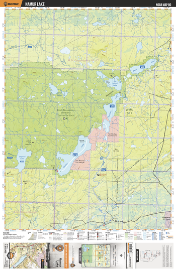
NOAB80 Namur Lake - Northern Alberta Topo
Backroad Mapbooks
This recreation topographic map for the Namur Lake area highlights all the logging and resource roads, multi-use trails for hikers, mountain bikers, horseback riders, cross-country skiers and snowshoers, motorized trails for ATVers and snowmobilers, fishing lakes and rivers, recreation areas, campgrounds, day-use areas, viewpoints, backcountry campsites, work camps, backcountry huts and cabins and more. No other map for the area provides you with this level of recreational or topographic detail. Special features include private land, labelled fish species and countless new roads, trails and recreational Points of Interest. This map also features enhanced oil & gas resource information, more detailed water features and seismic line corridors. Covering 1,268 km2 (490 mi2), this 1:85,000 scale map measures 96 x 127 km (59.5 x 79 mi). Included on the map are Namur Lake, Legend Lake, Gardiner Lake, Sand Lake, Birch Mountains Wildland Provincial Park, Ells River, Birch River and more!
Page Size: 24 x 37 in (610 x 940 mm)
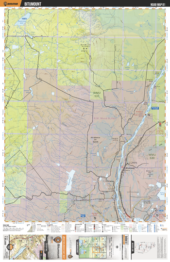
NOAB81 Bitumount - Northern Alberta Topo
Backroad Mapbooks
This recreation topographic map for the Bitumount area highlights all the logging and resource roads, multi-use trails for hikers, mountain bikers, horseback riders, cross-country skiers and snowshoers, motorized trails for ATVers and snowmobilers, fishing lakes and rivers, recreation areas, campgrounds, day-use areas, viewpoints, backcountry campsites, work camps, backcountry huts and cabins and more. No other map for the area provides you with this level of recreational or topographic detail. Special features include private land, labelled fish species and countless new roads, trails and recreational Points of Interest. This map also features enhanced oil & gas resource information, more detailed water features and seismic line corridors. Covering 1,268 km2 (490 mi2), this 1:85,000 scale map measures 96 x 127 km (59.5 x 79 mi). Included on the map are Bitumount, Athabasca Oil Sands, Eaglenest Lake, Athabasca River, Muskeg River, Oakley Lake, Calumet Lake and more!
Page Size: 24 x 37 in (610 x 940 mm)
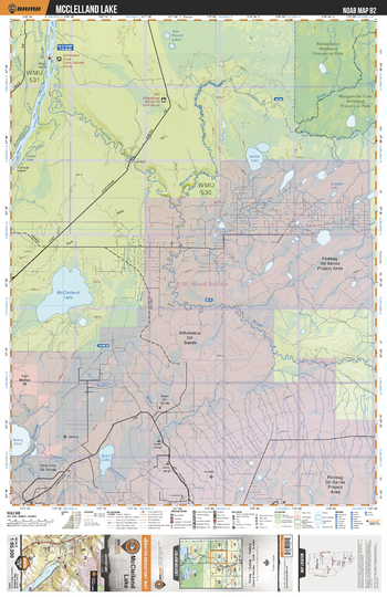
NOAB82 McCelland Lake - Northern Alberta Topo
Backroad Mapbooks
This recreation topographic map for the McCelland Lake area highlights all the logging and resource roads, multi-use trails for hikers, mountain bikers, horseback riders, cross-country skiers and snowshoers, motorized trails for ATVers and snowmobilers, fishing lakes and rivers, recreation areas, campgrounds, day-use areas, viewpoints, backcountry campsites, work camps, backcountry huts and cabins and more. No other map for the area provides you with this level of recreational or topographic detail. Special features include private land, labelled fish species and countless new roads, trails and recreational Points of Interest. This map also features enhanced oil & gas resource information, more detailed water features and seismic line corridors. Covering 1,268 km2 (490 mi2), this 1:85,000 scale map measures 96 x 127 km (59.5 x 79 mi). Included on the map are McClelland Lake, Athabasca River, Marguerite River, Audet Lake, Marguerite River Wildland Provincial Park, Firebag Oil Sands, Athabasca Oil Sands, Kearl Lake and more!
Page Size: 24 x 37 in (610 x 940 mm)
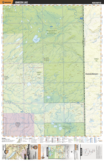
NOAB83 Johnson Lake - Northern Alberta Topo
Backroad Mapbooks
This recreation topographic map for the Johnson Lake area highlights all the logging and resource roads, multi-use trails for hikers, mountain bikers, horseback riders, cross-country skiers and snowshoers, motorized trails for ATVers and snowmobilers, fishing lakes and rivers, recreation areas, campgrounds, day-use areas, viewpoints, backcountry campsites, work camps, backcountry huts and cabins and more. No other map for the area provides you with this level of recreational or topographic detail. Special features include private land, labelled fish species and countless new roads, trails and recreational Points of Interest. This map also features enhanced oil & gas resource information, more detailed water features and seismic line corridors. Covering 1,268 km2 (490 mi2), this 1:85,000 scale map measures 96 x 127 km (59.5 x 79 mi). Included on the map are Johnson Lake, Marguerite River Wildland Provincial Park, Firebag River, Richardson River, Otter Lakes and more!
Page Size: 24 x 37 in (610 x 940 mm)
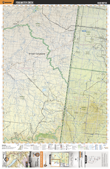
NOAB84 Foulwater Creek - Northern Alberta Topo
Backroad Mapbooks
This recreation topographic map for the Foulwater Creek area highlights all the logging and resource roads, multi-use trails for hikers, mountain bikers, horseback riders, cross-country skiers and snowshoers, motorized trails for ATVers and snowmobiles, fishing lakes and rivers, recreation areas, campgrounds, day-use areas, viewpoints, backcountry campsites, work camps, backcountry huts and cabins and more. No other map for the area provides you with this level of recreational or topographic detail. New features include private land and labelled fish species and countless new roads, trails and Points of Interest. Also includes enhanced oil & gas resource information, Township and Range grids, more detailed water features and seismic line corridors. Covering 12,168 km2 (4,698 mi2), this 1:165,000 scale map measures 96 x 127 km (59.5 x 79 mi). Included on the map are Fontas River, Hay River, Little Buffalo River, Kahntah River, Etthithun, Cautley River, Foulwater Creek, Tanghe Creek, Werniuk Creek, Levellers Creek and more!
Page Size: 24 x 37 in (610 x 940 mm)
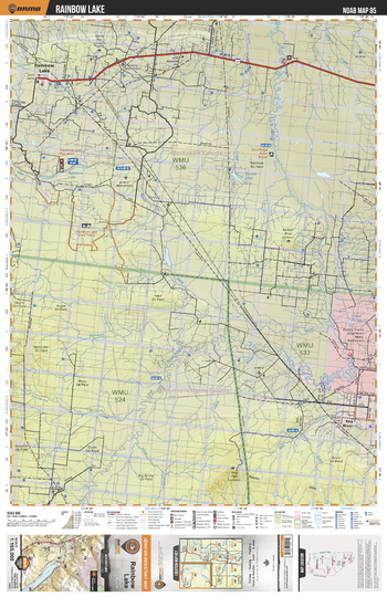
NOAB85 Rainbow Lake - Northern Alberta Topo
Backroad Mapbooks
This recreation topographic map for the Rainbow Lake area highlights all the logging and resource roads, multi-use trails for hikers, mountain bikers, horseback riders, cross-country skiers and snowshoers, motorized trails for ATVers and snowmobilers, fishing lakes and rivers, recreation areas, campgrounds, day-use areas, viewpoints, backcountry campsites, work camps, backcountry huts and cabins and more. No other map for the area provides you with this level of recreational or topographic detail. Special features include private land, labelled fish species and countless new roads, trails and recreational Points of Interest. This map also features enhanced oil & gas resource information, more detailed water features and seismic line corridors. Covering 12,170 km2 (4,700 mi2), this 1:165,000 scale map measures 96 x 127 km (60 x 79 mi). Included on the map are Chinchaga River, Rainbow Lake, Hay River, Keg River, Basset Lake, Chain Ponds, Waniandy Creek, Rainbow Lake Pond, Haig River and more!
Page Size: 24 x 37 in (610 x 940 mm)
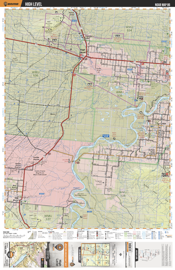
NOAB86 High Level - Northern Alberta Topo
Backroad Mapbooks
This recreation topographic map for the High Level area highlights all the logging and resource roads, multi-use trails for hikers, mountain bikers, horseback riders, cross-country skiers and snowshoers, motorized trails for ATVers and snowmobilers, fishing lakes and rivers, recreation areas, campgrounds, day-use areas, viewpoints, backcountry campsites, work camps, backcountry huts and cabins and more. No other map for the area provides you with this level of recreational or topographic detail. Special features include private land, labelled fish species and countless new roads, trails and recreational Points of Interest. This map also features enhanced oil & gas resource information, more detailed water features and seismic line corridors. Covering 12,170 km2 (4,700 mi2), this 1:165,000 scale map measures 96 x 127 km (60 x 79 mi). Included on the map are La Crete, Keg River, Carcajou, High Level, Footner Lake, Peace River, Paddle Prairie, Bushe River, Buffalo Head Prairie, Hutch Lake and more!
Page Size: 24 x 37 in (610 x 940 mm)
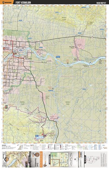
NOAB87 Fort Vermillion - Northern Alberta Topo
Backroad Mapbooks
This recreation topographic map for the Fort Vermillion area highlights all the logging and resource roads, multi-use trails for hikers, mountain bikers, horseback riders, cross-country skiers and snowshoers, motorized trails for ATVers and snowmobilers, fishing lakes and rivers, recreation areas, campgrounds, day-use areas, viewpoints, backcountry campsites, work camps, backcountry huts and cabins and more. No other map for the area provides you with this level of recreational or topographic detail. Special features include private land, labelled fish species and countless new roads, trails and recreational Points of Interest. This map also features enhanced oil & gas resource information, more detailed water features and seismic line corridors. Covering 12,170 km2 (4,700 mi2), this 1:165,000 scale map measures 96 x 127 km (60 x 79 mi). Included on the map are Peace River, Fort Vermilion, Rocky Lake, Gull Lake, Wabasca River, Mikkwa River, Little Red River, John D`Or, Boyer, Wadlin Lake and more!
Page Size: 24 x 37 in (610 x 940 mm)
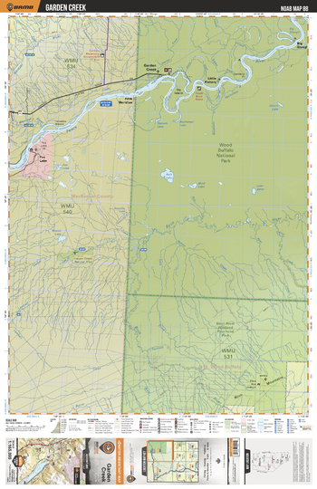
NOAB88 Garden Creek - Northern Alberta Topo
Backroad Mapbooks
This recreation topographic map for the Garden Creek area highlights all the logging and resource roads, multi-use trails for hikers, mountain bikers, horseback riders, cross-country skiers and snowshoers, motorized trails for ATVers and snowmobilers, fishing lakes and rivers, recreation areas, campgrounds, day-use areas, viewpoints, backcountry campsites, work camps, backcountry huts and cabins and more. No other map for the area provides you with this level of recreational or topographic detail. Special features include private land, labelled fish species and countless new roads, trails and recreational Points of Interest. This map also features enhanced oil & gas resource information, more detailed water features and seismic line corridors. Covering 12,170 km2 (4,700 mi2), this 1:165,000 scale map measures 96 x 127 km (60 x 79 mi). Included on the map are Peace River, Garden Creek, Little Fisher, Big Slough, Fifth Meridian, Fox Lake, Wood Buffalo National Park, Ruis Lake, Birch Mountains, Birch River and more!
Page Size: 24 x 37 in (610 x 940 mm)
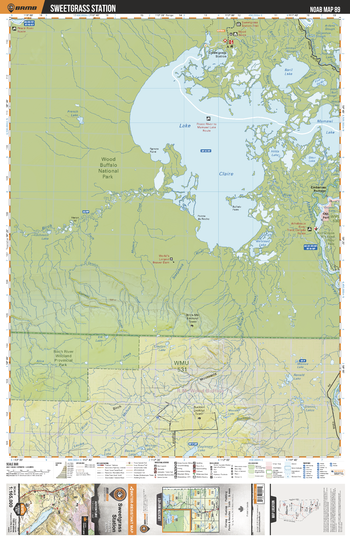
NOAB89 Sweetgrass Station - Northern Alberta Topo
Backroad Mapbooks
This recreation topographic map for the Sweetgrass Station area highlights all the logging and resource roads, multi-use trails for hikers, mountain bikers, horseback riders, cross-country skiers and snowshoers, motorized trails for ATVers and snowmobilers, fishing lakes and rivers, recreation areas, campgrounds, day-use areas, viewpoints, backcountry campsites, work camps, backcountry huts and cabins and more. No other map for the area provides you with this level of recreational or topographic detail. Special features include private land, labelled fish species and countless new roads, trails and recreational Points of Interest. This map also features enhanced oil & gas resource information, more detailed water features and seismic line corridors. Covering 12,170 km2 (4,700 mi2), this 1:165,000 scale map measures 96 x 127 km (60 x 79 mi). Included on the map are Lake Claire, Mamawi Lake, Baril Lake, Hilda Lake, Wood Buffalo National Park, Sweetgrass Station, Old Fort, Embarras Portage, Birch River, Athabasca River and more!
Page Size: 24 x 37 in (610 x 940 mm)
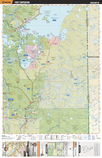
NOAB90 Fort Chipewyan - Northern Alberta Topo
Backroad Mapbooks
This recreation topographic map for the Fort Chipewyan area highlights all the logging and resource roads, multi-use trails for hikers, mountain bikers, horseback riders, cross-country skiers and snowshoers, motorized trails for ATVers and snowmobilers, fishing lakes and rivers, recreation areas, campgrounds, day-use areas, viewpoints, backcountry campsites, work camps, backcountry huts and cabins and more. No other map for the area provides you with this level of recreational or topographic detail. Special features include private land, labelled fish species and countless new roads, trails and recreational Points of Interest. This map also features enhanced oil & gas resource information, more detailed water features and seismic line corridors. Covering 12,170 km2 (4,700 mi2), this 1:165,000 scale map measures 96 x 127 km (60 x 79 mi). Included on the map are Lake Athabasca, Richardson Lake, Richardson River Dunes Prov Park, Marguerite River Prov Park, Wood Buffalo National Park, Maybelle River Prov Park, Jackfish, Fort Chipewyan, Riviere des Rochers, Old Fort River and more!
Page Size: 24 x 37 in (610 x 940 mm)
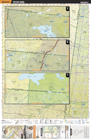
NOAB91 Petitot River - Northern Alberta Topo
Backroad Mapbooks
This recreation topographic map for the Petitot River area highlights all the logging and resource roads, multi-use trails for hikers, mountain bikers, horseback riders, cross-country skiers and snowshoers, motorized trails for ATVers and snowmobilers, fishing lakes and rivers, recreation areas, campgrounds, day-use areas, viewpoints, backcountry campsites, work camps, backcountry huts and cabins and more. No other map for the area provides you with this level of recreational or topographic detail. Special features include private land, labelled fish species and countless new roads, trails and recreational Points of Interest. This map also features enhanced oil & gas resource information, more detailed water features and seismic line corridors. Covering 12,170 km2 (4,700 mi2), this 1:165,000 scale map measures 96 x 127 km (60 x 79 mi). Included on the map are Bistcho Lake, Cameron Hills, Indian Cabins, Buffalo Lake, Hay River, Beatty Lake, Bistcho Lake, Petitot River, Wood Buffalo National Park, Copp Lake and more!
Page Size: 24 x 37 in (610 x 940 mm)
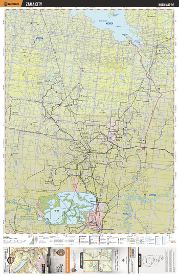
NOAB92 Zama City - Northern Alberta Topo
Backroad Mapbooks
This recreation topographic map for the Zama City area highlights all the logging and resource roads, multi-use trails for hikers, mountain bikers, horseback riders, cross-country skiers and snowshoers, motorized trails for ATVers and snowmobilers, fishing lakes and rivers, recreation areas, campgrounds, day-use areas, viewpoints, backcountry campsites, work camps, backcountry huts and cabins and more. No other map for the area provides you with this level of recreational or topographic detail. Special features include private land, labelled fish species and countless new roads, trails and recreational Points of Interest. This map also features enhanced oil & gas resource information, more detailed water features and seismic line corridors. Covering 12,170 km2 (4,700 mi2), this 1:165,000 scale map measures 96 x 127 km (60 x 79 mi). Included on the map are Zama Lake, Hay Lake, Habay, Assumption, Zama City, Hay-Zama Lakes Prov Park, Bistcho Lake, Cameron Hills, Wally Lake, Hay River and more!
Page Size: 24 x 37 in (610 x 940 mm)
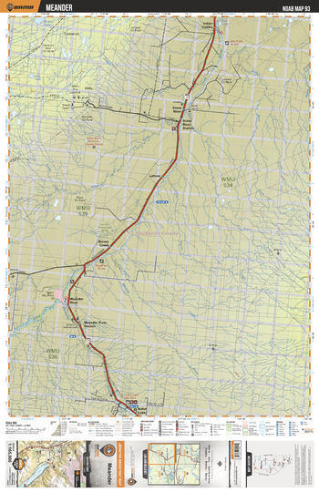
NOAB93 Meander - Northern Alberta Topo
Backroad Mapbooks
This recreation topographic map for the Meander area highlights all the logging and resource roads, multi-use trails for hikers, mountain bikers, horseback riders, cross-country skiers and snowshoers, motorized trails for ATVers and snowmobilers, fishing lakes and rivers, recreation areas, campgrounds, day-use areas, viewpoints, backcountry campsites, work camps, backcountry huts and cabins and more. No other map for the area provides you with this level of recreational or topographic detail. Special features include private land, labelled fish species and countless new roads, trails and recreational Points of Interest. This map also features enhanced oil & gas resource information, more detailed water features and seismic line corridors. Covering 12,170 km2 (4,700 mi2), this 1:165,000 scale map measures 96 x 127 km (60 x 79 mi). Included on the map are Meander River, Meander River Station, Hutch Lake, Slavey Creek, Steen River, Steen River Station, Indian Cabins, Hay River, Lutose, Cameron Hills and more!
Page Size: 24 x 37 in (610 x 940 mm)
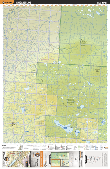
NOAB94 Margaret Lake - Northern Alberta Topo
Backroad Mapbooks
This recreation topographic map for the Margaret Lake area highlights all the logging and resource roads, multi-use trails for hikers, mountain bikers, horseback riders, cross-country skiers and snowshoers, motorized trails for ATVers and snowmobilers, fishing lakes and rivers, recreation areas, campgrounds, day-use areas, viewpoints, backcountry campsites, work camps, backcountry huts and cabins and more. No other map for the area provides you with this level of recreational or topographic detail. Special features include private land, labelled fish species and countless new roads, trails and recreational Points of Interest. This map also features enhanced oil & gas resource information, more detailed water features and seismic line corridors. Covering 12,170 km2 (4,700 mi2), this 1:165,000 scale map measures 96 x 127 km (60 x 79 mi). Included on the map are Wood Buffalo National Park, Caribou Mountains Prov Park, Margaret Lake, Eva Lake, Semo Lake, Caribou Lake, Hotte Lake, Ponton River, Whitesand River, Rocky Island Lake and more!
Page Size: 24 x 37 in (610 x 940 mm)
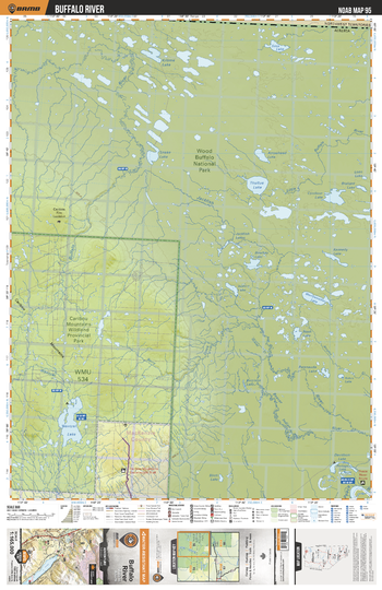
NOAB95 Buffalo River - Northern Alberta Topo
Backroad Mapbooks
This recreation topographic map for the Buffalo River area highlights all the logging and resource roads, multi-use trails for hikers, mountain bikers, horseback riders, cross-country skiers and snowshoers, motorized trails for ATVers and snowmobilers, fishing lakes and rivers, recreation areas, campgrounds, day-use areas, viewpoints, backcountry campsites, work camps, backcountry huts and cabins and more. No other map for the area provides you with this level of recreational or topographic detail. Special features include private land, labelled fish species and countless new roads, trails and recreational Points of Interest. This map also features enhanced oil & gas resource information, more detailed water features and seismic line corridors. Covering 12,170 km2 (4,700 mi2), this 1:165,000 scale map measures 96 x 127 km (60 x 79 mi). Included on the map are Wood Buffalo National Park, Caribou Mountains Prov Park, Wentzel Lake, Jackfish River, Buffalo River, Snake Lake, Thultue Lake, Conibear Lake, Merryweather Lake, Davidson Lake and more!
Page Size: 24 x 37 in (610 x 940 mm)
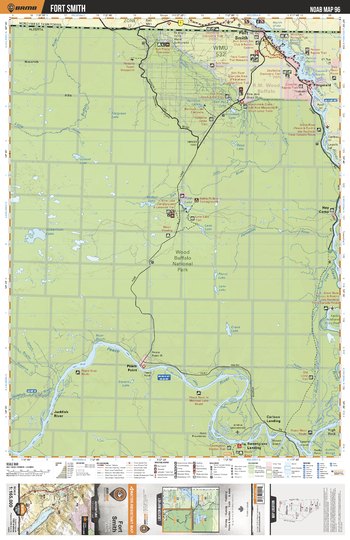
NOAB96 Fort Smith - Northern Alberta Topo
Backroad Mapbooks
This recreation topographic map for the Fort Smith area highlights all the logging and resource roads, multi-use trails for hikers, mountain bikers, horseback riders, cross-country skiers and snowshoers, motorized trails for ATVers and snowmobilers, fishing lakes and rivers, recreation areas, campgrounds, day-use areas, viewpoints, backcountry campsites, work camps, backcountry huts and cabins and more. No other map for the area provides you with this level of recreational or topographic detail. Special features include private land, labelled fish species and countless new roads, trails and recreational Points of Interest. This map also features enhanced oil & gas resource information, more detailed water features and seismic line corridors. Covering 12,170 km2 (4,700 mi2), this 1:165,000 scale map measures 96 x 127 km (60 x 79 mi). Included on the map are Wood Buffalo National Park, Peace River, Carlson Landing, Slave River, Hay Camp, Fort Smith, Pine Lake, Fitzgerald, Hornaday River, Little Buffalo River and more!
Page Size: 24 x 37 in (610 x 940 mm)
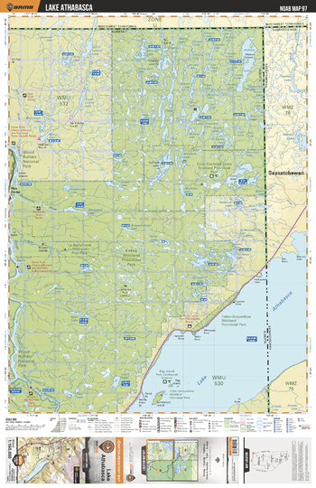
NOAB97 Lake Athabasca - Northern Alberta Topo
Backroad Mapbooks
This recreation topographic map for the Lake Athabasca area highlights all the logging and resource roads, multi-use trails for hikers, mountain bikers, horseback riders, cross-country skiers and snowshoers, motorized trails for ATVers and snowmobilers, fishing lakes and rivers, recreation areas, campgrounds, day-use areas, viewpoints, backcountry campsites, work camps, backcountry huts and cabins and more. No other map for the area provides you with this level of recreational or topographic detail. Special features include private land, labelled fish species and countless new roads, trails and recreational Points of Interest. This map also features enhanced oil & gas resource information, more detailed water features and seismic line corridors. Covering 12,170 km2 (4,700 mi2), this 1:165,000 scale map measures 96 x 127 km (60 x 79 mi). Included on the map are Colin-Cornwall Lakes Prov Park, Lake Athabasca, Slave River, La Butte Creek Prov Park, Fidler-Greywillow Prov Park, Riviere des Rochers, Ryan Lake, Bocquene River, Andrew Lake, Dog River and more!
Page Size: 24 x 37 in (610 x 940 mm)
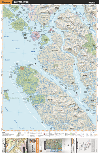
NOBC01 Port Canaveral - Northern BC
Backroad Mapbooks
This recreation topographic map for the Port Canaveral area highlights all the logging roads, trails and recreation features for fishing, hunting, camping, hiking, mountain biking, canoeing, kayaking, backcountry skiing, wildlife viewing, ATVing, snowmobiling and more. No other map for the area provides you this level of recreational and topographic detail. New features include private land and labelled fish species plus countless new roads, trails and recreational Points of Interest. Covering Banks Island, McCauley Island, Port Canaveral, Kitkatla, Pitt Island, Markle Island, Anger Island, Porcher Island, Dolphin Island and Goschen Island, this map contains new features such as private land and labelled fish species. This 1:85,000 scale map covers 3,040 km2 (1,175 mi2), measuring 50 x 63.5 km (30 x 39.5 mi).
Page Size: 24 x 37 in (610 x 940 mm)
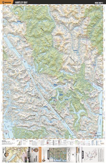
NOBC02 Hartley Bay - Northern BC
Backroad Mapbooks
This recreation topographic map for the Hartley Bay area highlights all the logging roads, trails and recreation features for fishing, hunting, camping, hiking, mountain biking, canoeing, kayaking, backcountry skiing, wildlife viewing, ATVing, snowmobiling and more. No other map for the area provides you this level of recreational and topographic detail. New features include private land and labelled fish species plus countless new roads, trails and recreational Points of Interest. Covering Pitt Island, Coast Mtns, Lowe Inlet, Gamble Lake, Hartley Bay, Kitkiata Inlet, Gavel Lake, Foch Gilttoyees Prov Park, Kumealon Lake, Baker Inlet and more, this map contains new features such as private land and labelled fish species. This 1:85,000 scale map covers 3,040 km2 (1,175 mi2), measuring 50 x 63.5 km (30 x 39.5 mi).
Page Size: 24 x 37 in (610 x 940 mm)
No search results