


MapSherpa Catalog
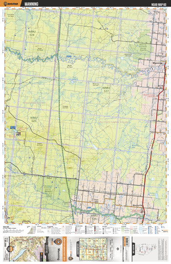
NOAB60 Manning - Northern Alberta Topo
Backroad Mapbooks
This recreation topographic map for the Manning area highlights all the logging and resource roads, multi-use trails for hikers, mountain bikers, horseback riders, cross-country skiers and snowshoers, motorized trails for ATVers and snowmobilers, fishing lakes and rivers, recreation areas, campgrounds, day-use areas, viewpoints, backcountry campsites, work camps, backcountry huts and cabins and more. No other map for the area provides you with this level of recreational or topographic detail. Special features include private land, labelled fish species and countless new roads, trails and recreational Points of Interest. This map also features enhanced oil & gas resource information, more detailed water features and seismic line corridors. Covering 1,268 km2 (490 mi2), this 1:85,000 scale map measures 96 x 127 km (59.5 x 79 mi). Included on the map are Manning, Notikewin River, Whitemud River, Cub Lakes, Sulphur Lake, Lovet Creek, Helen Lake, Murdock Lake, North Star and more!
Page Size: 24 x 37 in (610 x 940 mm)
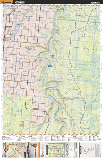
NOAB61 Notikewin - Northern Alberta Topo
Backroad Mapbooks
This recreation topographic map for the Notikewin area highlights all the logging and resource roads, multi-use trails for hikers, mountain bikers, horseback riders, cross-country skiers and snowshoers, motorized trails for ATVers and snowmobilers, fishing lakes and rivers, recreation areas, campgrounds, day-use areas, viewpoints, backcountry campsites, work camps, backcountry huts and cabins and more. No other map for the area provides you with this level of recreational or topographic detail. Special features include private land, labelled fish species and countless new roads, trails and recreational Points of Interest. This map also features enhanced oil & gas resource information, more detailed water features and seismic line corridors. Covering 1,268 km2 (490 mi2), this 1:85,000 scale map measures 96 x 127 km (59.5 x 79 mi). Included on the map are Notikewin, Manning, Peave River, Little Cadotte River, Notikewin River, Whitemud River, Cadotte River, Driftwood Lake and more!
Page Size: 24 x 37 in (610 x 940 mm)
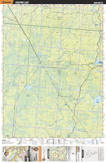
NOAB62 Jackpine Lake - Northern Alberta Topo
Backroad Mapbooks
This recreation topographic map for the Jackpine Lake area highlights all the logging and resource roads, multi-use trails for hikers, mountain bikers, horseback riders, cross-country skiers and snowshoers, motorized trails for ATVers and snowmobilers, fishing lakes and rivers, recreation areas, campgrounds, day-use areas, viewpoints, backcountry campsites, work camps, backcountry huts and cabins and more. No other map for the area provides you with this level of recreational or topographic detail. Special features include private land, labelled fish species and countless new roads, trails and recreational Points of Interest. This map also features enhanced oil & gas resource information, more detailed water features and seismic line corridors. Covering 1,268 km2 (490 mi2), this 1:85,000 scale map measures 96 x 127 km (59.5 x 79 mi). Included on the map are Jackpine Lake, Otter Lakes, Haig Lake, Wolverine Lake, Otter River ,Jackpine Creek and more!
Page Size: 24 x 37 in (610 x 940 mm)
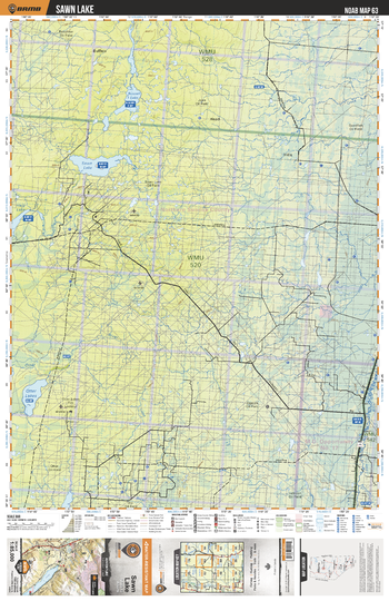
NOAB63 Sawn Lake - Northern Alberta Topo
Backroad Mapbooks
This recreation topographic map for the Sawn Lake area highlights all the logging and resource roads, multi-use trails for hikers, mountain bikers, horseback riders, cross-country skiers and snowshoers, motorized trails for ATVers and snowmobilers, fishing lakes and rivers, recreation areas, campgrounds, day-use areas, viewpoints, backcountry campsites, work camps, backcountry huts and cabins and more. No other map for the area provides you with this level of recreational or topographic detail. Special features include private land, labelled fish species and countless new roads, trails and recreational Points of Interest. This map also features enhanced oil & gas resource information, more detailed water features and seismic line corridors. Covering 1,268 km2 (490 mi2), this 1:85,000 scale map measures 96 x 127 km (59.5 x 79 mi). Included on the map are Otter Lakes, Sawn Lakes, Russell Lake, Loom River, Lafond Creek and more!
Page Size: 24 x 37 in (610 x 940 mm)
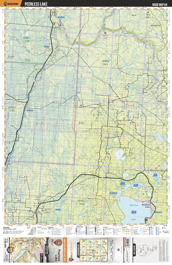
NOAB64 Peerless Lake - Northern Alberta Topo
Backroad Mapbooks
This recreation topographic map for the Peerless Lake area highlights all the logging and resource roads, multi-use trails for hikers, mountain bikers, horseback riders, cross-country skiers and snowshoers, motorized trails for ATVers and snowmobilers, fishing lakes and rivers, recreation areas, campgrounds, day-use areas, viewpoints, backcountry campsites, work camps, backcountry huts and cabins and more. No other map for the area provides you with this level of recreational or topographic detail. Special features include private land, labelled fish species and countless new roads, trails and recreational Points of Interest. This map also features enhanced oil & gas resource information, more detailed water features and seismic line corridors. Covering 1,268 km2 (490 mi2), this 1:85,000 scale map measures 96 x 127 km (59.5 x 79 mi). Included on the map are Peerless Lake, Long Lake,Round Lake, Loon River, Wabasca River, Crooked Creek, Kidney Lake, Panny River, Goodfish Lake and more!
Page Size: 24 x 37 in (610 x 940 mm)
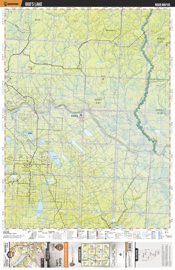
NOAB65 God's Lake - Northern Alberta Topo
Backroad Mapbooks
This recreation topographic map for the God's Lake area highlights all the logging and resource roads, multi-use trails for hikers, mountain bikers, horseback riders, cross-country skiers and snowshoers, motorized trails for ATVers and snowmobilers, fishing lakes and rivers, recreation areas, campgrounds, day-use areas, viewpoints, backcountry campsites, work camps, backcountry huts and cabins and more. No other map for the area provides you with this level of recreational or topographic detail. Special features include private land, labelled fish species and countless new roads, trails and recreational Points of Interest. This map also features enhanced oil & gas resource information, more detailed water features and seismic line corridors. Covering 1,268 km2 (490 mi2), this 1:85,000 scale map measures 96 x 127 km (59.5 x 79 mi). Included on the map are God's Lake, Liege River, Wabasca River, Quitting Lake, Goosegrass Lake, Corn Lake, Kidney Lake and more!
Page Size: 24 x 37 in (610 x 940 mm)
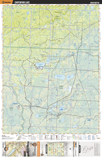
NOAB66 Chipewyan Lake - Northern Alberta Topo
Backroad Mapbooks
This recreation topographic map for the Chipewyan Lake area highlights all the logging and resource roads, multi-use trails for hikers, mountain bikers, horseback riders, cross-country skiers and snowshoers, motorized trails for ATVers and snowmobilers, fishing lakes and rivers, recreation areas, campgrounds, day-use areas, viewpoints, backcountry campsites, work camps, backcountry huts and cabins and more. No other map for the area provides you with this level of recreational or topographic detail. Special features include private land, labelled fish species and countless new roads, trails and recreational Points of Interest. This map also features enhanced oil & gas resource information, more detailed water features and seismic line corridors. Covering 1,268 km2 (490 mi2), this 1:85,000 scale map measures 96 x 127 km (59.5 x 79 mi). Included on the map are Chipewyan Lake, Carrot Lake, Chipewyan River, Mink Lake, Grew Lake, Island Lake, MacKay River, Wabasca River, Whistwow Lake and more!
Page Size: 24 x 37 in (610 x 940 mm)
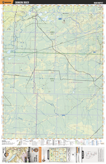
NOAB67 Dunkirk River - Northern Alberta Topo
Backroad Mapbooks
This recreation topographic map for the Dunkirk River area highlights all the logging and resource roads, multi-use trails for hikers, mountain bikers, horseback riders, cross-country skiers and snowshoers, motorized trails for ATVers and snowmobilers, fishing lakes and rivers, recreation areas, campgrounds, day-use areas, viewpoints, backcountry campsites, work camps, backcountry huts and cabins and more. No other map for the area provides you with this level of recreational or topographic detail. Special features include private land, labelled fish species and countless new roads, trails and recreational Points of Interest. This map also features enhanced oil & gas resource information, more detailed water features and seismic line corridors. Covering 1,268 km2 (490 mi2), this 1:85,000 scale map measures 96 x 127 km (59.5 x 79 mi). Included on the map are Dunkirk River, MacKay River, Dover River, Ells River, Snipe Creek, Rabbit Lake and more!
Page Size: 24 x 37 in (610 x 940 mm)
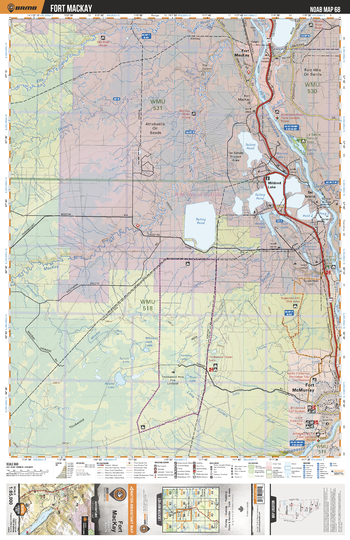
NOAB68 Fort Mackay - Northern Alberta Topo
Backroad Mapbooks
This recreation topographic map for the Fort Mackay area highlights all the logging and resource roads, multi-use trails for hikers, mountain bikers, horseback riders, cross-country skiers and snowshoers, motorized trails for ATVers and snowmobilers, fishing lakes and rivers, recreation areas, campgrounds, day-use areas, viewpoints, backcountry campsites, work camps, backcountry huts and cabins and more. No other map for the area provides you with this level of recreational or topographic detail. Special features include private land, labelled fish species and countless new roads, trails and recreational Points of Interest. This map also features enhanced oil & gas resource information, more detailed water features and seismic line corridors. Covering 1,268 km2 (490 mi2), this 1:85,000 scale map measures 96 x 127 km (59.5 x 79 mi). Included on the map are Fort MacKay, Athabasca Oil Sands, Ells River, Fort McMurray, Athabasca River, Mildred Lake, MacKay River, Round Lake, Little Fishery River and more!
Page Size: 24 x 37 in (610 x 940 mm)
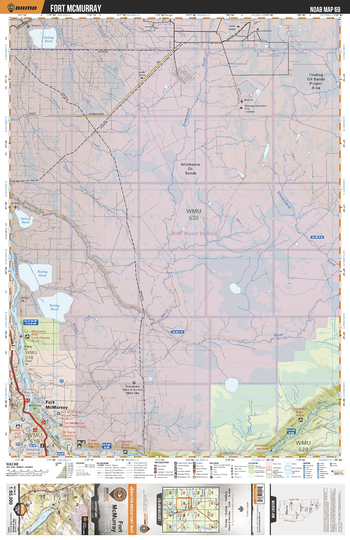
NOAB69 Fort McMurray - Northern Alberta Topo
Backroad Mapbooks
This recreation topographic map for the Fort McMurray area highlights all the logging and resource roads, multi-use trails for hikers, mountain bikers, horseback riders, cross-country skiers and snowshoers, motorized trails for ATVers and snowmobilers, fishing lakes and rivers, recreation areas, campgrounds, day-use areas, viewpoints, backcountry campsites, work camps, backcountry huts and cabins and more. No other map for the area provides you with this level of recreational or topographic detail. Special features include private land, labelled fish species and countless new roads, trails and recreational Points of Interest. This map also features enhanced oil & gas resource information, more detailed water features and seismic line corridors. Covering 1,268 km2 (490 mi2), this 1:85,000 scale map measures 96 x 127 km (59.5 x 79 mi). Included on the map are Fort McMurray, Athabasca Oil Sands, Steepbank River, North Steepbank River, Athabasca River, Clearwater River and more!
Page Size: 24 x 37 in (610 x 940 mm)
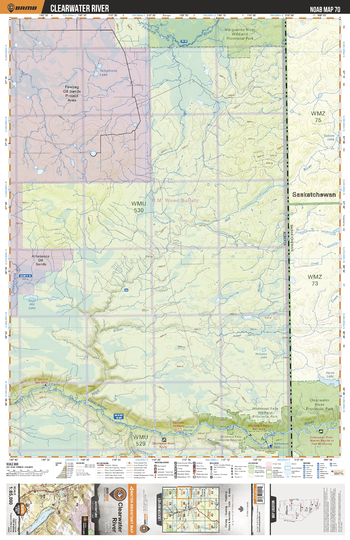
NOAB70 Clearwater River - Northern Alberta Topo
Backroad Mapbooks
This recreation topographic map for the Clearwater River area highlights all the logging and resource roads, multi-use trails for hikers, mountain bikers, horseback riders, cross-country skiers and snowshoers, motorized trails for ATVers and snowmobilers, fishing lakes and rivers, recreation areas, campgrounds, day-use areas, viewpoints, backcountry campsites, work camps, backcountry huts and cabins and more. No other map for the area provides you with this level of recreational or topographic detail. Special features include private land, labelled fish species and countless new roads, trails and recreational Points of Interest. This map also features enhanced oil & gas resource information, more detailed water features and seismic line corridors. Covering 1,268 km2 (490 mi2), this 1:85,000 scale map measures 96 x 127 km (59.5 x 79 mi). Included on the map are Clearwater River, Whitemud Falls Wildland Provincial Park, Clearwater River Provincial Park, Marguerite River Wildland Provincial Park, High Hill Lake, Telephone Lake and more!
Page Size: 24 x 37 in (610 x 940 mm)
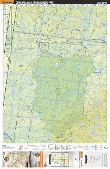
NOAB71 Chinchaga Wildland Prov Park - Northern Alberta Topo
Backroad Mapbooks
This recreation topographic map for the Chinchaga Wildland Prov Park area highlights all the logging and resource roads, multi-use trails for hikers, mountain bikers, horseback riders, cross-country skiers and snowshoers, motorized trails for ATVers and snowmobilers, fishing lakes and rivers, recreation areas, campgrounds, day-use areas, viewpoints, backcountry campsites, work camps, backcountry huts and cabins and more. No other map for the area provides you with this level of recreational or topographic detail. Special features include private land, labelled fish species and countless new roads, trails and recreational Points of Interest. This map also features enhanced oil & gas resource information, more detailed water features and seismic line corridors. Covering 1,268 km2 (490 mi2), this 1:85,000 scale map measures 96 x 127 km (59.5 x 79 mi). Included on the map are Chinchaga Wildland Provincial Park, Doig River, Chinchaga River, Osland Lakes and more!
Page Size: 24 x 37 in (610 x 940 mm)
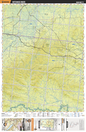
NOAB72 Hotchkiss River - Northern Alberta Topo
Backroad Mapbooks
This recreation topographic map for the Hotchkiss River area highlights all the logging and resource roads, multi-use trails for hikers, mountain bikers, horseback riders, cross-country skiers and snowshoers, motorized trails for ATVers and snowmobilers, fishing lakes and rivers, recreation areas, campgrounds, day-use areas, viewpoints, backcountry campsites, work camps, backcountry huts and cabins and more. No other map for the area provides you with this level of recreational or topographic detail. Special features include private land, labelled fish species and countless new roads, trails and recreational Points of Interest. This map also features enhanced oil & gas resource information, more detailed water features and seismic line corridors. Covering 1,268 km2 (490 mi2), this 1:85,000 scale map measures 96 x 127 km (59.5 x 79 mi). Included on the map are Hotchkiss River, Chinchaga River, Notikewin River and more!
Page Size: 24 x 37 in (610 x 940 mm)
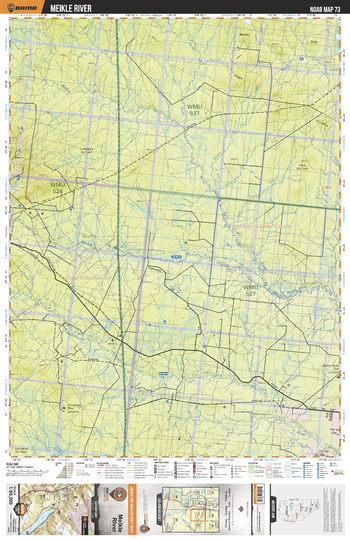
NOAB73 Meikle River - Northern Alberta Topo
Backroad Mapbooks
This recreation topographic map for the Meikle River area highlights all the logging and resource roads, multi-use trails for hikers, mountain bikers, horseback riders, cross-country skiers and snowshoers, motorized trails for ATVers and snowmobilers, fishing lakes and rivers, recreation areas, campgrounds, day-use areas, viewpoints, backcountry campsites, work camps, backcountry huts and cabins and more. No other map for the area provides you with this level of recreational or topographic detail. Special features include private land, labelled fish species and countless new roads, trails and recreational Points of Interest. This map also features enhanced oil & gas resource information, more detailed water features and seismic line corridors. Covering 1,268 km2 (490 mi2), this 1:85,000 scale map measures 96 x 127 km (59.5 x 79 mi). Included on the map are Meikle River, Botha River, Hotchkiss River, Kemp River and more!
Page Size: 24 x 37 in (610 x 940 mm)
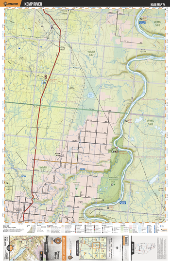
NOAB74 Kemp River - Northern Alberta Topo
Backroad Mapbooks
This recreation topographic map for the Kemp River area highlights all the logging and resource roads, multi-use trails for hikers, mountain bikers, horseback riders, cross-country skiers and snowshoers, motorized trails for ATVers and snowmobilers, fishing lakes and rivers, recreation areas, campgrounds, day-use areas, viewpoints, backcountry campsites, work camps, backcountry huts and cabins and more. No other map for the area provides you with this level of recreational or topographic detail. Special features include private land, labelled fish species and countless new roads, trails and recreational Points of Interest. This map also features enhanced oil & gas resource information, more detailed water features and seismic line corridors. Covering 1,268 km2 (490 mi2), this 1:85,000 scale map measures 96 x 127 km (59.5 x 79 mi). Included on the map are Kemp River, Peace River, Notikewin Provincial Park, Hawk Hills, Kemp River, Meikle River, Nina Lake, Crumy Lake, Twin Lakes and more!
Page Size: 24 x 37 in (610 x 940 mm)
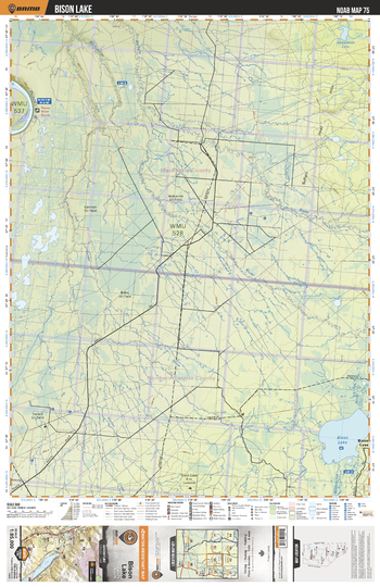
NOAB75 Bison Lake - Northern Alberta Topo
Backroad Mapbooks
This recreation topographic map for the Bison Lake area highlights all the logging and resource roads, multi-use trails for hikers, mountain bikers, horseback riders, cross-country skiers and snowshoers, motorized trails for ATVers and snowmobilers, fishing lakes and rivers, recreation areas, campgrounds, day-use areas, viewpoints, backcountry campsites, work camps, backcountry huts and cabins and more. No other map for the area provides you with this level of recreational or topographic detail. Special features include private land, labelled fish species and countless new roads, trails and recreational Points of Interest. This map also features enhanced oil & gas resource information, more detailed water features and seismic line corridors. Covering 1,268 km2 (490 mi2), this 1:85,000 scale map measures 96 x 127 km (59.5 x 79 mi). Included on the map are Bison Lake, Peace River, Buffalo River, Wolverine River, Donaldson Lake and more!
Page Size: 24 x 37 in (610 x 940 mm)
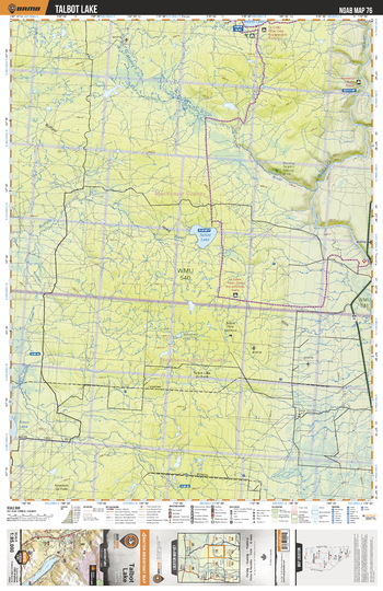
NOAB76 Talbot Lake - Northern Alberta Topo
Backroad Mapbooks
This recreation topographic map for the Talbot Lake area highlights all the logging and resource roads, multi-use trails for hikers, mountain bikers, horseback riders, cross-country skiers and snowshoers, motorized trails for ATVers and snowmobilers, fishing lakes and rivers, recreation areas, campgrounds, day-use areas, viewpoints, backcountry campsites, work camps, backcountry huts and cabins and more. No other map for the area provides you with this level of recreational or topographic detail. Special features include private land, labelled fish species and countless new roads, trails and recreational Points of Interest. This map also features enhanced oil & gas resource information, more detailed water features and seismic line corridors. Covering 1,268 km2 (490 mi2), this 1:85,000 scale map measures 96 x 127 km (59.5 x 79 mi). Included on the map are Talbot Lake, Muddy River, Rossbear Lake, Buffalo River, Wadlin Lake, Wabasca River and more!
Page Size: 24 x 37 in (610 x 940 mm)
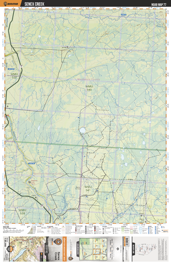
NOAB77 Senex Creek - Northern Alberta Topo
Backroad Mapbooks
This recreation topographic map for the Senex Creek area highlights all the logging and resource roads, multi-use trails for hikers, mountain bikers, horseback riders, cross-country skiers and snowshoers, motorized trails for ATVers and snowmobilers, fishing lakes and rivers, recreation areas, campgrounds, day-use areas, viewpoints, backcountry campsites, work camps, backcountry huts and cabins and more. No other map for the area provides you with this level of recreational or topographic detail. Special features include private land, labelled fish species and countless new roads, trails and recreational Points of Interest. This map also features enhanced oil & gas resource information, more detailed water features and seismic line corridors. Covering 1,268 km2 (490 mi2), this 1:85,000 scale map measures 96 x 127 km (59.5 x 79 mi). Included on the map are Senex Creek, Wabasca River, Panny River, Mikkwa River, Owl Creek and more!
Page Size: 24 x 37 in (610 x 940 mm)
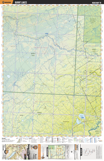
NOAB78 Burnt Lakes - Northern Alberta Topo
Backroad Mapbooks
This recreation topographic map for the Burnt Lakes area highlights all the logging and resource roads, multi-use trails for hikers, mountain bikers, horseback riders, cross-country skiers and snowshoers, motorized trails for ATVers and snowmobilers, fishing lakes and rivers, recreation areas, campgrounds, day-use areas, viewpoints, backcountry campsites, work camps, backcountry huts and cabins and more. No other map for the area provides you with this level of recreational or topographic detail. Special features include private land, labelled fish species and countless new roads, trails and recreational Points of Interest. This map also features enhanced oil & gas resource information, more detailed water features and seismic line corridors. Covering 1,268 km2 (490 mi2), this 1:85,000 scale map measures 96 x 127 km (59.5 x 79 mi). Included on the map are Burnt Lake, Mikkwa River, Burnt River, Sputina River, Lazar Lake, Little Island Lake, Liege River and more!
Page Size: 24 x 37 in (610 x 940 mm)
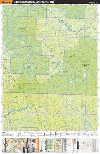
NOAB79 Birch Mountains Wildland Prov Park - Northern Alberta Topo
Backroad Mapbooks
This recreation topographic map for the Birch Mountains Wildland Prov Park area highlights all the logging and resource roads, multi-use trails for hikers, mountain bikers, horseback riders, cross-country skiers and snowshoers, motorized trails for ATVers and snowmobilers, fishing lakes and rivers, recreation areas, campgrounds, day-use areas, viewpoints, backcountry campsites, work camps, backcountry huts and cabins and more. No other map for the area provides you with this level of recreational or topographic detail. Special features include private land, labelled fish species and countless new roads, trails and recreational Points of Interest. This map also features enhanced oil & gas resource information, more detailed water features and seismic line corridors. Covering 1,268 km2 (490 mi2), this 1:85,000 scale map measures 96 x 127 km (59.5 x 79 mi). Included on the map are Birch Mountains Wildland Provincial Park, Birch River, Mikkwa River, Liege River, Whytenow Lake, Mahigun Lake, Antler Lake and more!
Page Size: 24 x 37 in (610 x 940 mm)
No search results