


MapSherpa Catalog
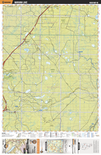
NOAB40 Mariana Lake - Northern Alberta Topo
Backroad Mapbooks
This recreation topographic map for the Mariana Lake area highlights all the logging and resource roads, multi-use trails for hikers, mountain bikers, horseback riders, cross-country skiers and snowshoers, motorized trails for ATVers and snowmobilers, fishing lakes and rivers, recreation areas, campgrounds, day-use areas, viewpoints, backcountry campsites, work camps, backcountry huts and cabins and more. No other map for the area provides you with this level of recreational or topographic detail. Special features include private land, labelled fish species and countless new roads, trails and recreational Points of Interest. This map also features enhanced oil & gas resource information, more detailed water features and seismic line corridors. Covering 1,268 km2 (490 mi2), this 1:85,000 scale map measures 96 x 127 km (59.5 x 79 mi). Included on the map are Crow Lake Prov Park, Mariana Lake, House River, Base Lake, Thornbury Lake, Christina River, Egg Lake, Lagoon Lake, Crow Lake, May River and more!
Page Size: 24 x 37 in (610 x 940 mm)
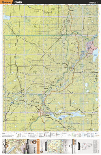
NOAB41 Conklin - Northern Alberta Topo
Backroad Mapbooks
This recreation topographic map for the Conklin area highlights all the logging and resource roads, multi-use trails for hikers, mountain bikers, horseback riders, cross-country skiers and snowshoers, motorized trails for ATVers and snowmobilers, fishing lakes and rivers, recreation areas, campgrounds, day-use areas, viewpoints, backcountry campsites, work camps, backcountry huts and cabins and more. No other map for the area provides you with this level of recreational or topographic detail. Special features include private land, labelled fish species and countless new roads, trails and recreational Points of Interest. This map also features enhanced oil & gas resource information, more detailed water features and seismic line corridors. Covering 1,268 km2 (490 mi2), this 1:85,000 scale map measures 96 x 127 km (59.5 x 79 mi). Included on the map are Christina Lake, Christina River, Janvier, Conklin, Bohn Lake, May River, Chard, Jackfish River, Leismer, Quigley and more!
Page Size: 24 x 37 in (610 x 940 mm)
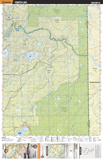
NOAB42 Cowper Lake - Northern Alberta Topo
Backroad Mapbooks
This recreation topographic map for the Cowper Lake area highlights all the logging and resource roads, multi-use trails for hikers, mountain bikers, horseback riders, cross-country skiers and snowshoers, motorized trails for ATVers and snowmobilers, fishing lakes and rivers, recreation areas, campgrounds, day-use areas, viewpoints, backcountry campsites, work camps, backcountry huts and cabins and more. No other map for the area provides you with this level of recreational or topographic detail. Special features include private land, labelled fish species and countless new roads, trails and recreational Points of Interest. This map also features enhanced oil & gas resource information, more detailed water features and seismic line corridors. Covering 1,268 km2 (490 mi2), this 1:85,000 scale map measures 96 x 127 km (59.5 x 79 mi). Included on the map are Cowper Lake, Bohn Lake, Winefred Lake, Winefred River, Christina River, Dillon River, Landels River, Graham Creek, Graham Lake, Hook Lake and more!
Page Size: 24 x 37 in (610 x 940 mm)
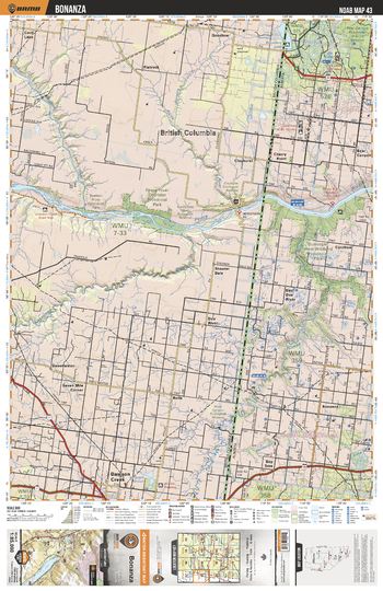
NOAB43 Bonanza - Northern Alberta Topo
Backroad Mapbooks
This recreation topographic map for the Bonanza area highlights all the logging and resource roads, multi-use trails for hikers, mountain bikers, horseback riders, cross-country skiers and snowshoers, motorized trails for ATVers and snowmobilers, fishing lakes and rivers, recreation areas, campgrounds, day-use areas, viewpoints, backcountry campsites, work camps, backcountry huts and cabins and more. No other map for the area provides you with this level of recreational or topographic detail. Special features include private land, labelled fish species and countless new roads, trails and recreational Points of Interest. This map also features enhanced oil & gas resource information, more detailed water features and seismic line corridors. Covering 1,268 km2 (490 mi2), this 1:85,000 scale map measures 96 x 127 km (59.5 x 79 mi). Included on the map are Bonanza, Peace River, Beatton River, Bear Canyon, Cherry Point, Boundary Lake, Bay Tree, Pouce Coupe River, Cotillion, Dunvegan West Prov Park and more!
Page Size: 24 x 37 in (610 x 940 mm)
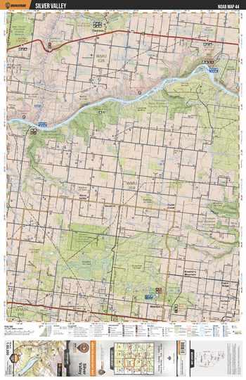
NOAB44 Silver Valley - Northern Alberta Topo
Backroad Mapbooks
This recreation topographic map for the Silver Valley area highlights all the logging and resource roads, multi-use trails for hikers, mountain bikers, horseback riders, cross-country skiers and snowshoers, motorized trails for ATVers and snowmobilers, fishing lakes and rivers, recreation areas, campgrounds, day-use areas, viewpoints, backcountry campsites, work camps, backcountry huts and cabins and more. No other map for the area provides you with this level of recreational or topographic detail. Special features include private land, labelled fish species and countless new roads, trails and recreational Points of Interest. This map also features enhanced oil & gas resource information, more detailed water features and seismic line corridors. Covering 1,268 km2 (490 mi2), this 1:85,000 scale map measures 96 x 127 km (59.5 x 79 mi). Included on the map are Peace River, Whitburn, Poplar Ridge, Blueberry Mountain, Dunvegan West Prov Park, Many Islands, Clear River, Silver Valley, Mooneshine Lake Prov Park and more!
Page Size: 24 x 37 in (610 x 940 mm)
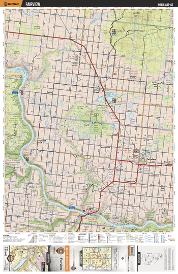
NOAB45 Fairview - Northern Alberta Topo
Backroad Mapbooks
This recreation topographic map for the Fairview area highlights all the logging and resource roads, multi-use trails for hikers, mountain bikers, horseback riders, cross-country skiers and snowshoers, motorized trails for ATVers and snowmobilers, fishing lakes and rivers, recreation areas, campgrounds, day-use areas, viewpoints, backcountry campsites, work camps, backcountry huts and cabins and more. No other map for the area provides you with this level of recreational or topographic detail. Special features include private land, labelled fish species and countless new roads, trails and recreational Points of Interest. This map also features enhanced oil & gas resource information, more detailed water features and seismic line corridors. Covering 1,268 km2 (490 mi2), this 1:85,000 scale map measures 96 x 127 km (59.5 x 79 mi). Included on the map are Hines Creek, Fairview, Dunvegan West Prov Park, Montagneuse River, Peace River, Peace River Prov Park, Dunvegan, Lake George, Highland Park, Deer Hill and more!
Page Size: 24 x 37 in (610 x 940 mm)
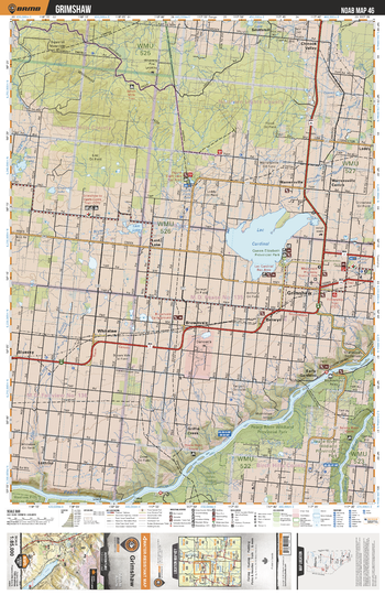
NOAB46 Grimshaw - Northern Alberta Topo
Backroad Mapbooks
This recreation topographic map for the Grimshaw area highlights all the logging and resource roads, multi-use trails for hikers, mountain bikers, horseback riders, cross-country skiers and snowshoers, motorized trails for ATVers and snowmobilers, fishing lakes and rivers, recreation areas, campgrounds, day-use areas, viewpoints, backcountry campsites, work camps, backcountry huts and cabins and more. No other map for the area provides you with this level of recreational or topographic detail. Special features include private land, labelled fish species and countless new roads, trails and recreational Points of Interest. This map also features enhanced oil & gas resource information, more detailed water features and seismic line corridors. Covering 1,268 km2 (490 mi2), this 1:85,000 scale map measures 96 x 127 km (59.5 x 79 mi). Included on the map are Lac Cardinal, Grimshaw, Peace River Prov Park, Smoky River, Peace River, Leith (Little Burnt) River, Figure Eight Lake, Chinook Valley, Early Gardens and more!
Page Size: 24 x 37 in (610 x 940 mm)
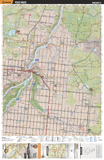
NOAB47 Peace River - Northern Alberta Topo
Backroad Mapbooks
This recreation topographic map for the Peace River area highlights all the logging and resource roads, multi-use trails for hikers, mountain bikers, horseback riders, cross-country skiers and snowshoers, motorized trails for ATVers and snowmobilers, fishing lakes and rivers, recreation areas, campgrounds, day-use areas, viewpoints, backcountry campsites, work camps, backcountry huts and cabins and more. No other map for the area provides you with this level of recreational or topographic detail. Special features include private land, labelled fish species and countless new roads, trails and recreational Points of Interest. This map also features enhanced oil & gas resource information, more detailed water features and seismic line corridors. Covering 1,268 km2 (490 mi2), this 1:85,000 scale map measures 96 x 127 km (59.5 x 79 mi). Included on the map are Smoky River, Peace River, Nampa, Leddy Lake, Peace River Prov Park, Hearth River, Greene Valley Prov Park, Lake St Germain, Three Creeks Prov Grazing Reserve, Harmon Valley and more!
Page Size: 24 x 37 in (610 x 940 mm)
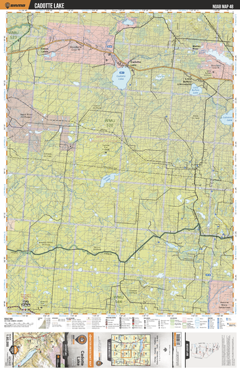
NOAB48 Cadotte Lake - Northern Alberta Topo
Backroad Mapbooks
This recreation topographic map for the Cadotte Lake area highlights all the logging and resource roads, multi-use trails for hikers, mountain bikers, horseback riders, cross-country skiers and snowshoers, motorized trails for ATVers and snowmobilers, fishing lakes and rivers, recreation areas, campgrounds, day-use areas, viewpoints, backcountry campsites, work camps, backcountry huts and cabins and more. No other map for the area provides you with this level of recreational or topographic detail. Special features include private land, labelled fish species and countless new roads, trails and recreational Points of Interest. This map also features enhanced oil & gas resource information, more detailed water features and seismic line corridors. Covering 1,268 km2 (490 mi2), this 1:85,000 scale map measures 96 x 127 km (59.5 x 79 mi). Included on the map are Cadotte Lake, Little Buffalo Lake, Marten River, Cadotte River, Lemmy Lake, Otter River, Golden Lake, Simon Lakes, Seal Lake, Lubicon Lake and more!
Page Size: 24 x 37 in (610 x 940 mm)
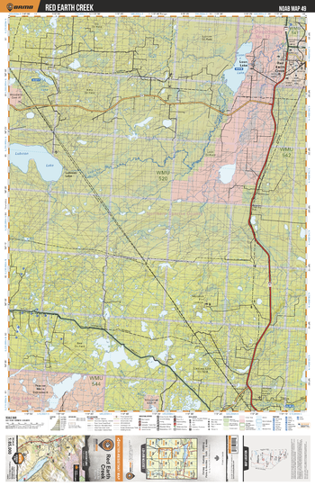
NOAB49 Red Earth Creek - Northern Alberta Topo
Backroad Mapbooks
This recreation topographic map for the Red Earth Creek area highlights all the logging and resource roads, multi-use trails for hikers, mountain bikers, horseback riders, cross-country skiers and snowshoers, motorized trails for ATVers and snowmobilers, fishing lakes and rivers, recreation areas, campgrounds, day-use areas, viewpoints, backcountry campsites, work camps, backcountry huts and cabins and more. No other map for the area provides you with this level of recreational or topographic detail. Special features include private land, labelled fish species and countless new roads, trails and recreational Points of Interest. This map also features enhanced oil & gas resource information, more detailed water features and seismic line corridors. Covering 1,268 km2 (490 mi2), this 1:85,000 scale map measures 96 x 127 km (59.5 x 79 mi). Included on the map are Loon Lake, Lubicon Lake, Lubicon River, Red Earth Creek, Joker Lake, Mink River, Utikuma River and more!
Page Size: 24 x 37 in (610 x 940 mm)
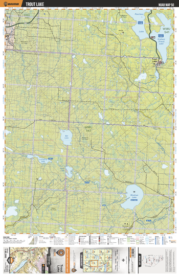
NOAB50 Trout Lake - Northern Alberta Topo
Backroad Mapbooks
This recreation topographic map for the Trout Lake area highlights all the logging and resource roads, multi-use trails for hikers, mountain bikers, horseback riders, cross-country skiers and snowshoers, motorized trails for ATVers and snowmobilers, fishing lakes and rivers, recreation areas, campgrounds, day-use areas, viewpoints, backcountry campsites, work camps, backcountry huts and cabins and more. No other map for the area provides you with this level of recreational or topographic detail. Special features include private land, labelled fish species and countless new roads, trails and recreational Points of Interest. This map also features enhanced oil & gas resource information, more detailed water features and seismic line corridors. Covering 1,268 km2 (490 mi2), this 1:85,000 scale map measures 96 x 127 km (59.5 x 79 mi). Included on the map are Muskwa Lake, Graham Lake, Peerless Lake, Trout Lake, Maria Lake, Bat Lake, Cranberry Lake, Shoal Lake, Muskwa River, Utikuma River and more!
Page Size: 24 x 37 in (610 x 940 mm)
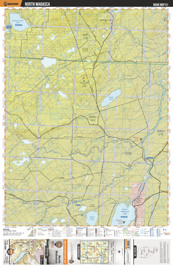
NOAB51 North Wabasca - Northern Alberta Topo
Backroad Mapbooks
This recreation topographic map for the North Wabasca area highlights all the logging and resource roads, multi-use trails for hikers, mountain bikers, horseback riders, cross-country skiers and snowshoers, motorized trails for ATVers and snowmobilers, fishing lakes and rivers, recreation areas, campgrounds, day-use areas, viewpoints, backcountry campsites, work camps, backcountry huts and cabins and more. No other map for the area provides you with this level of recreational or topographic detail. Special features include private land, labelled fish species and countless new roads, trails and recreational Points of Interest. This map also features enhanced oil & gas resource information, more detailed water features and seismic line corridors. Covering 1,268 km2 (490 mi2), this 1:85,000 scale map measures 96 x 127 km (59.5 x 79 mi). Included on the map are North Wabasca Lake, Godin Lake, Muskwa River, Trout River, Tepee Lake, Vandersteen Lake, Corn Lake, Woodenhouse River, Wabasca River and more!
Page Size: 24 x 37 in (610 x 940 mm)
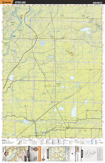
NOAB52 Otter Lake - Northern Alberta Topo
Backroad Mapbooks
This recreation topographic map for the Otter Lake area highlights all the logging and resource roads, multi-use trails for hikers, mountain bikers, horseback riders, cross-country skiers and snowshoers, motorized trails for ATVers and snowmobilers, fishing lakes and rivers, recreation areas, campgrounds, day-use areas, viewpoints, backcountry campsites, work camps, backcountry huts and cabins and more. No other map for the area provides you with this level of recreational or topographic detail. Special features include private land, labelled fish species and countless new roads, trails and recreational Points of Interest. This map also features enhanced oil & gas resource information, more detailed water features and seismic line corridors. Covering 1,268 km2 (490 mi2), this 1:85,000 scale map measures 96 x 127 km (59.5 x 79 mi). Included on the map are Otter Lake, Wabasca River, Fighting Lake, Diaper Lake, Wood Buffalo River, Wood Buffalo Lake, Kamistikowik Lake, Woodenhouse River, Buffalo Creek and more!
Page Size: 24 x 37 in (610 x 940 mm)
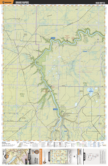
NOAB53 Grand Rapids - Northern Alberta Topo
Backroad Mapbooks
This recreation topographic map for the Grand Rapids area highlights all the logging and resource roads, multi-use trails for hikers, mountain bikers, horseback riders, cross-country skiers and snowshoers, motorized trails for ATVers and snowmobilers, fishing lakes and rivers, recreation areas, campgrounds, day-use areas, viewpoints, backcountry campsites, work camps, backcountry huts and cabins and more. No other map for the area provides you with this level of recreational or topographic detail. Special features include private land, labelled fish species and countless new roads, trails and recreational Points of Interest. This map also features enhanced oil & gas resource information, more detailed water features and seismic line corridors. Covering 1,268 km2 (490 mi2), this 1:85,000 scale map measures 96 x 127 km (59.5 x 79 mi). Included on the map are Grand Rapids Prov Park, Athabasca River, House River, Grand Rapids, Algar Lake, Buffalo Creek, Brule Rapids, Horse River, Algar River, Livock River and more!
Page Size: 24 x 37 in (610 x 940 mm)
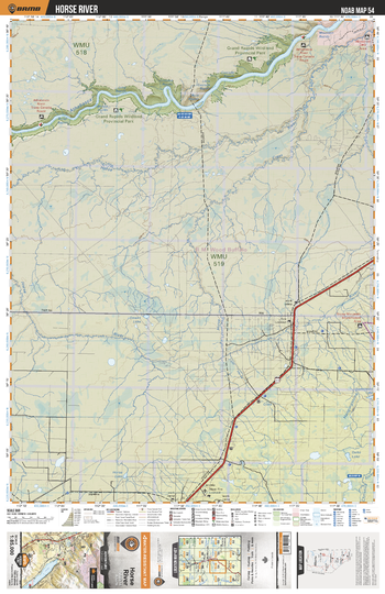
NOAB54 Horse River - Northern Alberta Topo
Backroad Mapbooks
This recreation topographic map for the Horse River area highlights all the logging and resource roads, multi-use trails for hikers, mountain bikers, horseback riders, cross-country skiers and snowshoers, motorized trails for ATVers and snowmobilers, fishing lakes and rivers, recreation areas, campgrounds, day-use areas, viewpoints, backcountry campsites, work camps, backcountry huts and cabins and more. No other map for the area provides you with this level of recreational or topographic detail. Special features include private land, labelled fish species and countless new roads, trails and recreational Points of Interest. This map also features enhanced oil & gas resource information, more detailed water features and seismic line corridors. Covering 1,268 km2 (490 mi2), this 1:85,000 scale map measures 96 x 127 km (59.5 x 79 mi). Included on the map are Grand Rapids Prov Park, Athabasca River, Boiler Rapids, Long Rapids, Crooked Rapids, Rock Rapids, Little Cascade Rapids, Cascade Rapids, Mountain Rapids, Horse River and more!
Page Size: 24 x 37 in (610 x 940 mm)
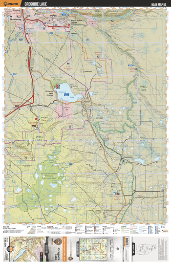
NOAB55 Gregoire Lake - Northern Alberta Topo
Backroad Mapbooks
This recreation topographic map for the Gregoire Lake area highlights all the logging and resource roads, multi-use trails for hikers, mountain bikers, horseback riders, cross-country skiers and snowshoers, motorized trails for ATVers and snowmobilers, fishing lakes and rivers, recreation areas, campgrounds, day-use areas, viewpoints, backcountry campsites, work camps, backcountry huts and cabins and more. No other map for the area provides you with this level of recreational or topographic detail. Special features include private land, labelled fish species and countless new roads, trails and recreational Points of Interest. This map also features enhanced oil & gas resource information, more detailed water features and seismic line corridors. Covering 1,268 km2 (490 mi2), this 1:85,000 scale map measures 96 x 127 km (59.5 x 79 mi). Included on the map are Stony Mountain Prov Park, Gregoire Lake, Cheecham, Engstrom Lake, Anzac, Fort McMurray, Christina River, Gregoire River, Hangingstone River, Clearwater River and more!
Page Size: 24 x 37 in (610 x 940 mm)
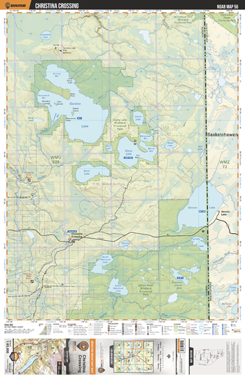
NOAB56 Christina Crossing - Northern Alberta Topo
Backroad Mapbooks
This recreation topographic map for the Christina Crossing area highlights all the logging and resource roads, multi-use trails for hikers, mountain bikers, horseback riders, cross-country skiers and snowshoers, motorized trails for ATVers and snowmobilers, fishing lakes and rivers, recreation areas, campgrounds, day-use areas, viewpoints, backcountry campsites, work camps, backcountry huts and cabins and more. No other map for the area provides you with this level of recreational or topographic detail. Special features include private land, labelled fish species and countless new roads, trails and recreational Points of Interest. This map also features enhanced oil & gas resource information, more detailed water features and seismic line corridors. Covering 1,268 km2 (490 mi2), this 1:85,000 scale map measures 96 x 127 km (59.5 x 79 mi). Included on the map are Christina Crossing, Gordon Lake, Gipsy Lake Prov Park, Garson Lake, Birch Lake, Shortt Lake, Christina River, Formby Lake, Kimowin Lake, Watchusk Lakes and more!
Page Size: 24 x 37 in (610 x 940 mm)
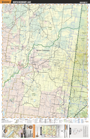
NOAB57 North Boundry Lake - Northern Alberta Topo
Backroad Mapbooks
This recreation topographic map for the North Boundry Lake area highlights all the logging and resource roads, multi-use trails for hikers, mountain bikers, horseback riders, cross-country skiers and snowshoers, motorized trails for ATVers and snowmobilers, fishing lakes and rivers, recreation areas, campgrounds, day-use areas, viewpoints, backcountry campsites, work camps, backcountry huts and cabins and more. No other map for the area provides you with this level of recreational or topographic detail. Special features include private land, labelled fish species and countless new roads, trails and recreational Points of Interest. This map also features enhanced oil & gas resource information, more detailed water features and seismic line corridors. Covering 1,268 km2 (490 mi2), this 1:85,000 scale map measures 96 x 127 km (59.5 x 79 mi). Included on the map are North Boundary Lake, Bear Canyon Grazing Reserve, Doig River, Osborn River and more!
Page Size: 24 x 37 in (610 x 940 mm)
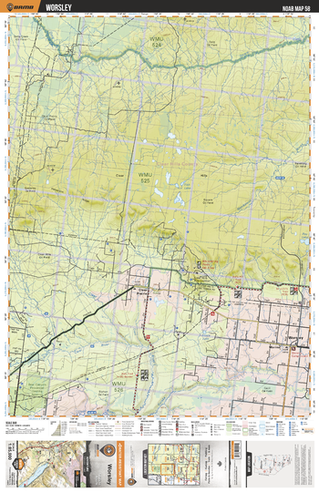
NOAB58 Worsley - Northern Alberta Topo
Backroad Mapbooks
This recreation topographic map for the Worsley area highlights all the logging and resource roads, multi-use trails for hikers, mountain bikers, horseback riders, cross-country skiers and snowshoers, motorized trails for ATVers and snowmobilers, fishing lakes and rivers, recreation areas, campgrounds, day-use areas, viewpoints, backcountry campsites, work camps, backcountry huts and cabins and more. No other map for the area provides you with this level of recreational or topographic detail. Special features include private land, labelled fish species and countless new roads, trails and recreational Points of Interest. This map also features enhanced oil & gas resource information, more detailed water features and seismic line corridors. Covering 1,268 km2 (490 mi2), this 1:85,000 scale map measures 96 x 127 km (59.5 x 79 mi). Included on the map are Worsley, Eureka River, Doig River, Notikewin River, Little Clear River, Bear Canyon Grazing Reserve, Whispering Pines Ski Area, Clear Hills Fire Lookout, Fish Lake and more!
Page Size: 24 x 37 in (610 x 940 mm)
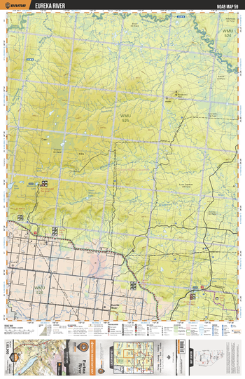
NOAB59 Eureka River - Northern Alberta Topo
Backroad Mapbooks
This recreation topographic map for the Eureka River area highlights all the logging and resource roads, multi-use trails for hikers, mountain bikers, horseback riders, cross-country skiers and snowshoers, motorized trails for ATVers and snowmobilers, fishing lakes and rivers, recreation areas, campgrounds, day-use areas, viewpoints, backcountry campsites, work camps, backcountry huts and cabins and more. No other map for the area provides you with this level of recreational or topographic detail. Special features include private land, labelled fish species and countless new roads, trails and recreational Points of Interest. This map also features enhanced oil & gas resource information, more detailed water features and seismic line corridors. Covering 1,268 km2 (490 mi2), this 1:85,000 scale map measures 96 x 127 km (59.5 x 79 mi). Included on the map are Eureka River, Notikewin River, Whitemud River, South Whitemud River, Ray Lake, Square Creek and more!
Page Size: 24 x 37 in (610 x 940 mm)
No search results