


MapSherpa Catalog
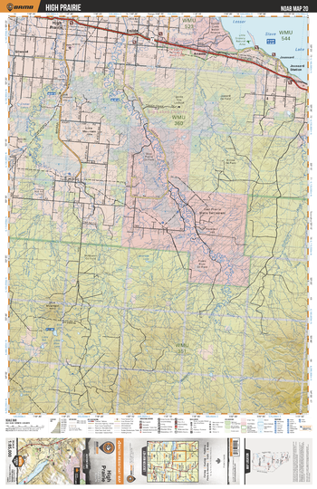
NOAB20 High Prairie - Northern Alberta Topo
Backroad Mapbooks
This recreation topographic map for the High Prairie area highlights all the logging and resource roads, multi-use trails for hikers, mountain bikers, horseback riders, cross-country skiers and snowshoers, motorized trails for ATVers and snowmobilers, fishing lakes and rivers, recreation areas, campgrounds, day-use areas, viewpoints, backcountry campsites, work camps, backcountry huts and cabins and more. No other map for the area provides you with this level of recreational or topographic detail. Special features include private land, labelled fish species and countless new roads, trails and recreational Points of Interest. This map also features enhanced oil & gas resource information, more detailed water features and seismic line corridors. Covering 1,268 km2 (490 mi2), this 1:85,000 scale map measures 96 x 127 km (59.5 x 79 mi). Included on the map are East Prairie River, Lesser Slave Lake, Enilda, High Prairie, Prairie River, Arcadia, Joussard Station, Joussard, Blue Mtn, Driftpile River and more!
Page Size: 24 x 37 in (610 x 940 mm)
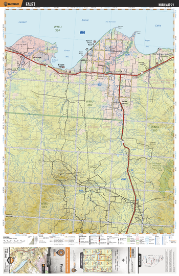
NOAB21 Faust - Northern Alberta Topo
Backroad Mapbooks
This recreation topographic map for the Faust area highlights all the logging and resource roads, multi-use trails for hikers, mountain bikers, horseback riders, cross-country skiers and snowshoers, motorized trails for ATVers and snowmobilers, fishing lakes and rivers, recreation areas, campgrounds, day-use areas, viewpoints, backcountry campsites, work camps, backcountry huts and cabins and more. No other map for the area provides you with this level of recreational or topographic detail. Special features include private land, labelled fish species and countless new roads, trails and recreational Points of Interest. This map also features enhanced oil & gas resource information, more detailed water features and seismic line corridors. Covering 1,268 km2 (490 mi2), this 1:85,000 scale map measures 96 x 127 km (59.5 x 79 mi). Included on the map are Lesser Slave Lake, Faust, Swan Valley, Assineau, Driftpile, Kinuso, Spruce Point Park, Swan River, House Mtn, Grizzly Ridge Prov Park and more!
Page Size: 24 x 37 in (610 x 940 mm)
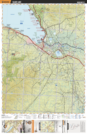
NOAB22 Slave Lake - Northern Alberta Topo
Backroad Mapbooks
This recreation topographic map for the Slave Lake area highlights all the logging and resource roads, multi-use trails for hikers, mountain bikers, horseback riders, cross-country skiers and snowshoers, motorized trails for ATVers and snowmobilers, fishing lakes and rivers, recreation areas, campgrounds, day-use areas, viewpoints, backcountry campsites, work camps, backcountry huts and cabins and more. No other map for the area provides you with this level of recreational or topographic detail. Special features include private land, labelled fish species and countless new roads, trails and recreational Points of Interest. This map also features enhanced oil & gas resource information, more detailed water features and seismic line corridors. Covering 1,268 km2 (490 mi2), this 1:85,000 scale map measures 96 x 127 km (59.5 x 79 mi). Included on the map are Lesser Slave Lake, Slave Lake, Mitsue Lake, Canyon Creek, Muskeg Lake, Grizzly Ridge Prov Park, Lesser Slave River, Overlea, Widewater, Wagner and more!
Page Size: 24 x 37 in (610 x 940 mm)
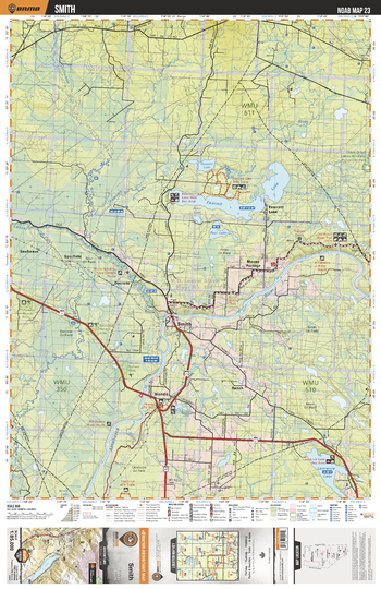
NOAB23 Smith - Northern Alberta Topo
Backroad Mapbooks
This recreation topographic map for the Smith area highlights all the logging and resource roads, multi-use trails for hikers, mountain bikers, horseback riders, cross-country skiers and snowshoers, motorized trails for ATVers and snowmobilers, fishing lakes and rivers, recreation areas, campgrounds, day-use areas, viewpoints, backcountry campsites, work camps, backcountry huts and cabins and more. No other map for the area provides you with this level of recreational or topographic detail. Special features include private land, labelled fish species and countless new roads, trails and recreational Points of Interest. This map also features enhanced oil & gas resource information, more detailed water features and seismic line corridors. Covering 1,268 km2 (490 mi2), this 1:85,000 scale map measures 96 x 127 km (59.5 x 79 mi). Included on the map are Fawcett Lake, Smith, Lesser Slave River, Lawrence Lake, Hondo, Athabasca River, Salteaux River, Mooser Portage, Spurfield, Decrene and more!
Page Size: 24 x 37 in (610 x 940 mm)
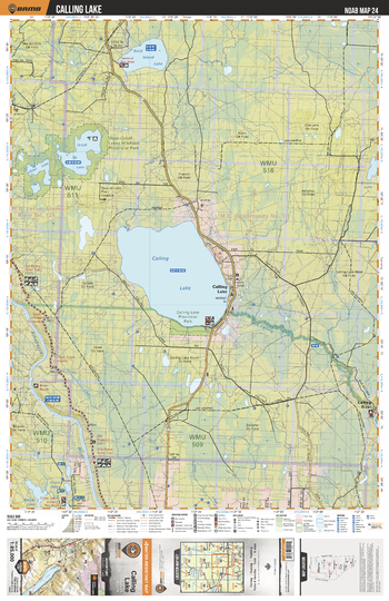
NOAB24 Calling Lake - Northern Alberta Topo
Backroad Mapbooks
This recreation topographic map for the Calling Lake area highlights all the logging and resource roads, multi-use trails for hikers, mountain bikers, horseback riders, cross-country skiers and snowshoers, motorized trails for ATVers and snowmobilers, fishing lakes and rivers, recreation areas, campgrounds, day-use areas, viewpoints, backcountry campsites, work camps, backcountry huts and cabins and more. No other map for the area provides you with this level of recreational or topographic detail. Special features include private land, labelled fish species and countless new roads, trails and recreational Points of Interest. This map also features enhanced oil & gas resource information, more detailed water features and seismic line corridors. Covering 1,268 km2 (490 mi2), this 1:85,000 scale map measures 96 x 127 km (59.5 x 79 mi). Included on the map are Calling Lake, Rock Island Lake, Orloff Lake, Otter Lake, Calling River, Athabasca River, Calling Lake Prov Park, Otter-Orloff Lakes Prov Park, Amadou Lake, Tomato Creek and more!
Page Size: 24 x 37 in (610 x 940 mm)
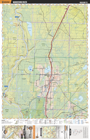
NOAB25 Wandering River - Northern Alberta Topo
Backroad Mapbooks
This recreation topographic map for the Wandering River area highlights all the logging and resource roads, multi-use trails for hikers, mountain bikers, horseback riders, cross-country skiers and snowshoers, motorized trails for ATVers and snowmobilers, fishing lakes and rivers, recreation areas, campgrounds, day-use areas, viewpoints, backcountry campsites, work camps, backcountry huts and cabins and more. No other map for the area provides you with this level of recreational or topographic detail. Special features include private land, labelled fish species and countless new roads, trails and recreational Points of Interest. This map also features enhanced oil & gas resource information, more detailed water features and seismic line corridors. Covering 1,268 km2 (490 mi2), this 1:85,000 scale map measures 96 x 127 km (59.5 x 79 mi). Included on the map are La Biche River Prov Park, Calling River, Athabasca River, Wandering River, Avenir, Breynat, Lyle Lake, Corrigall (Round) Lake, McMillan Lake, Amesbury and more!
Page Size: 24 x 37 in (610 x 940 mm)
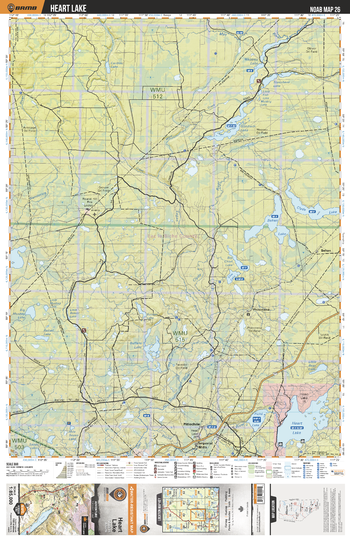
NOAB26 Heart Lake - Northern Alberta Topo
Backroad Mapbooks
This recreation topographic map for the Heart Lake area highlights all the logging and resource roads, multi-use trails for hikers, mountain bikers, horseback riders, cross-country skiers and snowshoers, motorized trails for ATVers and snowmobilers, fishing lakes and rivers, recreation areas, campgrounds, day-use areas, viewpoints, backcountry campsites, work camps, backcountry huts and cabins and more. No other map for the area provides you with this level of recreational or topographic detail. Special features include private land, labelled fish species and countless new roads, trails and recreational Points of Interest. This map also features enhanced oil & gas resource information, more detailed water features and seismic line corridors. Covering 1,268 km2 (490 mi2), this 1:85,000 scale map measures 96 x 127 km (59.5 x 79 mi). Included on the map are Heart Lake, Piche Lake, Imperial Mills, Pitlochrie, Goodwin Lake, Steepbank Lake, Wappau Lake, Philomena, Behan, Behan Lake and more!
Page Size: 24 x 37 in (610 x 940 mm)
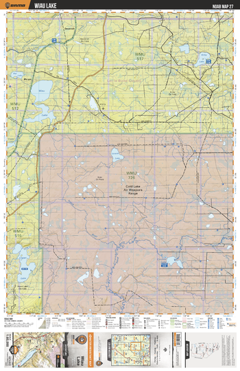
NOAB27 Wiau Lake - Northern Alberta Topo
Backroad Mapbooks
This recreation topographic map for the Wiau Lake area highlights all the logging and resource roads, multi-use trails for hikers, mountain bikers, horseback riders, cross-country skiers and snowshoers, motorized trails for ATVers and snowmobilers, fishing lakes and rivers, recreation areas, campgrounds, day-use areas, viewpoints, backcountry campsites, work camps, backcountry huts and cabins and more. No other map for the area provides you with this level of recreational or topographic detail. Special features include private land, labelled fish species and countless new roads, trails and recreational Points of Interest. This map also features enhanced oil & gas resource information, more detailed water features and seismic line corridors. Covering 1,268 km2 (490 mi2), this 1:85,000 scale map measures 96 x 127 km (59.5 x 79 mi). Included on the map are Wiau Lake, Logan Lake, Cold Lake Air Weapons Range, Caribou Lake, Sand River, Ipiatik Lake, Rat Lake, Kirby Lake, Devenish, Margie and more!
Page Size: 24 x 37 in (610 x 940 mm)
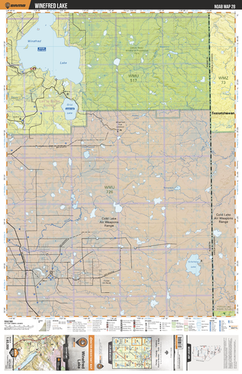
NOAB28 Winefred Lake - Northern Alberta Topo
Backroad Mapbooks
This recreation topographic map for the Winefred Lake area highlights all the logging and resource roads, multi-use trails for hikers, mountain bikers, horseback riders, cross-country skiers and snowshoers, motorized trails for ATVers and snowmobilers, fishing lakes and rivers, recreation areas, campgrounds, day-use areas, viewpoints, backcountry campsites, work camps, backcountry huts and cabins and more. No other map for the area provides you with this level of recreational or topographic detail. Special features include private land, labelled fish species and countless new roads, trails and recreational Points of Interest. This map also features enhanced oil & gas resource information, more detailed water features and seismic line corridors. Covering 1,268 km2 (490 mi2), this 1:85,000 scale map measures 96 x 127 km (59.5 x 79 mi). Included on the map are Cold Lake Air Weapons Range, Sand River, Scheltens Lake, Grist Lake, Winifred Lake, Tamarack Lake, Underwood Lake, Dillon River, Nisbet Lake, Royemma Lake and more!
Page Size: 24 x 37 in (610 x 940 mm)
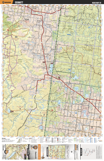
NOAB29 Demmitt - Northern Alberta Topo
Backroad Mapbooks
This recreation topographic map for the Demmitt area highlights all the logging and resource roads, multi-use trails for hikers, mountain bikers, horseback riders, cross-country skiers and snowshoers, motorized trails for ATVers and snowmobilers, fishing lakes and rivers, recreation areas, campgrounds, day-use areas, viewpoints, backcountry campsites, work camps, backcountry huts and cabins and more. No other map for the area provides you with this level of recreational or topographic detail. Special features include private land, labelled fish species and countless new roads, trails and recreational Points of Interest. This map also features enhanced oil & gas resource information, more detailed water features and seismic line corridors. Covering 1,268 km2 (490 mi2), this 1:85,000 scale map measures 96 x 127 km (59.5 x 79 mi). Included on the map are Dawson Creek, Demmitt, Lymburn, Brainard, Updike Lake, Goodfare, Tupper, Swan Lake, Grundy, Pouce Coupe River and more!
Page Size: 24 x 37 in (610 x 940 mm)
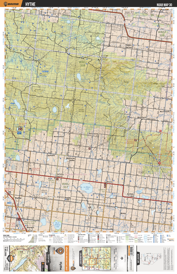
NOAB30 Hythe - Northern Alberta Topo
Backroad Mapbooks
This recreation topographic map for the Hythe area highlights all the logging and resource roads, multi-use trails for hikers, mountain bikers, horseback riders, cross-country skiers and snowshoers, motorized trails for ATVers and snowmobilers, fishing lakes and rivers, recreation areas, campgrounds, day-use areas, viewpoints, backcountry campsites, work camps, backcountry huts and cabins and more. No other map for the area provides you with this level of recreational or topographic detail. Special features include private land, labelled fish species and countless new roads, trails and recreational Points of Interest. This map also features enhanced oil & gas resource information, more detailed water features and seismic line corridors. Covering 1,268 km2 (490 mi2), this 1:85,000 scale map measures 96 x 127 km (59.5 x 79 mi). Included on the map are Hythe, Buffalo Lake, Valhalla Centre, Spring Lake, Westmark, Northmark, Happy Valley, White Mtn, Blooming Valley, La Glace Lake and more!
Page Size: 24 x 37 in (610 x 940 mm)
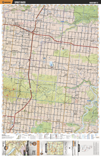
NOAB31 Spirit River - Northern Alberta Topo
Backroad Mapbooks
This recreation topographic map for the Spirit River area highlights all the logging and resource roads, multi-use trails for hikers, mountain bikers, horseback riders, cross-country skiers and snowshoers, motorized trails for ATVers and snowmobilers, fishing lakes and rivers, recreation areas, campgrounds, day-use areas, viewpoints, backcountry campsites, work camps, backcountry huts and cabins and more. No other map for the area provides you with this level of recreational or topographic detail. Special features include private land, labelled fish species and countless new roads, trails and recreational Points of Interest. This map also features enhanced oil & gas resource information, more detailed water features and seismic line corridors. Covering 1,268 km2 (490 mi2), this 1:85,000 scale map measures 96 x 127 km (59.5 x 79 mi). Included on the map are Saddle (Burnt) River, Kakut Lake, Smoky River, Bad Heart River, Sexsmith, Spirit River, Rycroft, Peace River Prov Park, Fitzsimmons, Belloy and more!
Page Size: 24 x 37 in (610 x 940 mm)
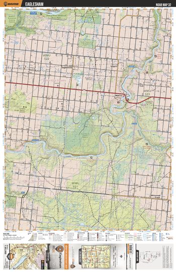
NOAB32 Eaglesham - Northern Alberta Topo
Backroad Mapbooks
This recreation topographic map for the Eaglesham area highlights all the logging and resource roads, multi-use trails for hikers, mountain bikers, horseback riders, cross-country skiers and snowshoers, motorized trails for ATVers and snowmobilers, fishing lakes and rivers, recreation areas, campgrounds, day-use areas, viewpoints, backcountry campsites, work camps, backcountry huts and cabins and more. No other map for the area provides you with this level of recreational or topographic detail. Special features include private land, labelled fish species and countless new roads, trails and recreational Points of Interest. This map also features enhanced oil & gas resource information, more detailed water features and seismic line corridors. Covering 1,268 km2 (490 mi2), this 1:85,000 scale map measures 96 x 127 km (59.5 x 79 mi). Included on the map are Smoky River, Little Smoky River, Watino, Four Mile Creek Grazing Reserve, Pease River Prov Park, Tangent, Eaglesham, Whitemud Creek, Codesa, Culp and more!
Page Size: 24 x 37 in (610 x 940 mm)
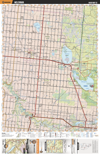
NOAB33 McLennan - Northern Alberta Topo
Backroad Mapbooks
This recreation topographic map for the McLennan area highlights all the logging and resource roads, multi-use trails for hikers, mountain bikers, horseback riders, cross-country skiers and snowshoers, motorized trails for ATVers and snowmobilers, fishing lakes and rivers, recreation areas, campgrounds, day-use areas, viewpoints, backcountry campsites, work camps, backcountry huts and cabins and more. No other map for the area provides you with this level of recreational or topographic detail. Special features include private land, labelled fish species and countless new roads, trails and recreational Points of Interest. This map also features enhanced oil & gas resource information, more detailed water features and seismic line corridors. Covering 1,268 km2 (490 mi2), this 1:85,000 scale map measures 96 x 127 km (59.5 x 79 mi). Included on the map are Winagami Lake Prov Park, Kimiwan Lake, Falher, McLennan, Kenzie, Little Smoky River, Girouxville, Lac Magloire, Jean Cote, Maurice Lake and more!
Page Size: 24 x 37 in (610 x 940 mm)
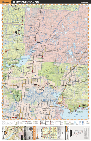
NOAB34 Hillard's Bay Prov Park - Northern Alberta Topo
Backroad Mapbooks
This recreation topographic map for the Hillard's Bay Prov Park area highlights all the logging and resource roads, multi-use trails for hikers, mountain bikers, horseback riders, cross-country skiers and snowshoers, motorized trails for ATVers and snowmobilers, fishing lakes and rivers, recreation areas, campgrounds, day-use areas, viewpoints, backcountry campsites, work camps, backcountry huts and cabins and more. No other map for the area provides you with this level of recreational or topographic detail. Special features include private land, labelled fish species and countless new roads, trails and recreational Points of Interest. This map also features enhanced oil & gas resource information, more detailed water features and seismic line corridors. Covering 1,268 km2 (490 mi2), this 1:85,000 scale map measures 96 x 127 km (59.5 x 79 mi). Included on the map are Grouard Mission, Buffalo Bay, High Priarie, Heart River Reservoir, Winagami Prov Park, South Heart River, Salt Prairie, Hilliard`s Bay Prov Park, Lesser Slave Lake and more!
Page Size: 24 x 37 in (610 x 940 mm)
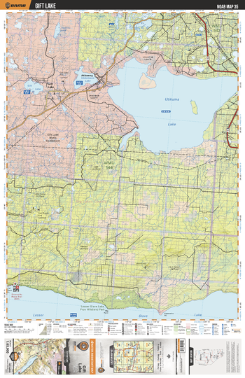
NOAB35 Gift Lake - Northern Alberta Topo
Backroad Mapbooks
This recreation topographic map for the Gift Lake area highlights all the logging and resource roads, multi-use trails for hikers, mountain bikers, horseback riders, cross-country skiers and snowshoers, motorized trails for ATVers and snowmobilers, fishing lakes and rivers, recreation areas, campgrounds, day-use areas, viewpoints, backcountry campsites, work camps, backcountry huts and cabins and more. No other map for the area provides you with this level of recreational or topographic detail. Special features include private land, labelled fish species and countless new roads, trails and recreational Points of Interest. This map also features enhanced oil & gas resource information, more detailed water features and seismic line corridors. Covering 1,268 km2 (490 mi2), this 1:85,000 scale map measures 96 x 127 km (59.5 x 79 mi). Included on the map are Utikuma Lake, Atikameg, Gift Lake, Lesser Slave Lake Prov Park, Hilliard`s Bay Prov Park, Utikumasis Lake, Lesser Slave Lake, Narrows Creek, Utikuma River, Little Horse Lake and more!
Page Size: 24 x 37 in (610 x 940 mm)
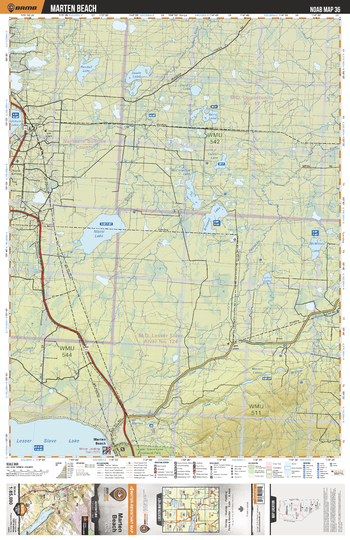
NOAB36 Marten Beach - Northern Alberta Topo
Backroad Mapbooks
This recreation topographic map for the Marten Beach area highlights all the logging and resource roads, multi-use trails for hikers, mountain bikers, horseback riders, cross-country skiers and snowshoers, motorized trails for ATVers and snowmobilers, fishing lakes and rivers, recreation areas, campgrounds, day-use areas, viewpoints, backcountry campsites, work camps, backcountry huts and cabins and more. No other map for the area provides you with this level of recreational or topographic detail. Special features include private land, labelled fish species and countless new roads, trails and recreational Points of Interest. This map also features enhanced oil & gas resource information, more detailed water features and seismic line corridors. Covering 1,268 km2 (490 mi2), this 1:85,000 scale map measures 96 x 127 km (59.5 x 79 mi). Included on the map are Nipisi Lake, Lesser Slave Lake Prov Park, Marten Beach, Lesser Slave Lake, Brintnell Lake, McMillan Lake, McConachie Lake, Berry Lake, Sawle Lake, Randall Lake and more!
Page Size: 24 x 37 in (610 x 940 mm)
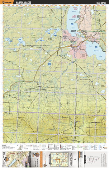
NOAB37 Wabasca Lakes - Northern Alberta Topo
Backroad Mapbooks
This recreation topographic map for the Wabasca Lakes area highlights all the logging and resource roads, multi-use trails for hikers, mountain bikers, horseback riders, cross-country skiers and snowshoers, motorized trails for ATVers and snowmobilers, fishing lakes and rivers, recreation areas, campgrounds, day-use areas, viewpoints, backcountry campsites, work camps, backcountry huts and cabins and more. No other map for the area provides you with this level of recreational or topographic detail. Special features include private land, labelled fish species and countless new roads, trails and recreational Points of Interest. This map also features enhanced oil & gas resource information, more detailed water features and seismic line corridors. Covering 1,268 km2 (490 mi2), this 1:85,000 scale map measures 96 x 127 km (59.5 x 79 mi). Included on the map are North Wabasca Lake, South Wabasca Lake, Mistehae Lake, Willow River, Wabasca-Desmairas, Sander Lake, McLeod Lake, Weaver Lake, Pastecho Lake, Pastecho River and more!
Page Size: 24 x 37 in (610 x 940 mm)
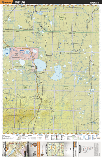
NOAB38 Sandy Lakes - Northern Alberta Topo
Backroad Mapbooks
This recreation topographic map for the Sandy Lakes area highlights all the logging and resource roads, multi-use trails for hikers, mountain bikers, horseback riders, cross-country skiers and snowshoers, motorized trails for ATVers and snowmobilers, fishing lakes and rivers, recreation areas, campgrounds, day-use areas, viewpoints, backcountry campsites, work camps, backcountry huts and cabins and more. No other map for the area provides you with this level of recreational or topographic detail. Special features include private land, labelled fish species and countless new roads, trails and recreational Points of Interest. This map also features enhanced oil & gas resource information, more detailed water features and seismic line corridors. Covering 1,268 km2 (490 mi2), this 1:85,000 scale map measures 96 x 127 km (59.5 x 79 mi). Included on the map are Sandy Lake, Pelican Lake, Island Lake, South Wabasca Lake, Pelican River, Muskeg River, Crooked River, Horsetail Lake, Long Lake, Wabasca River and more!
Page Size: 24 x 37 in (610 x 940 mm)
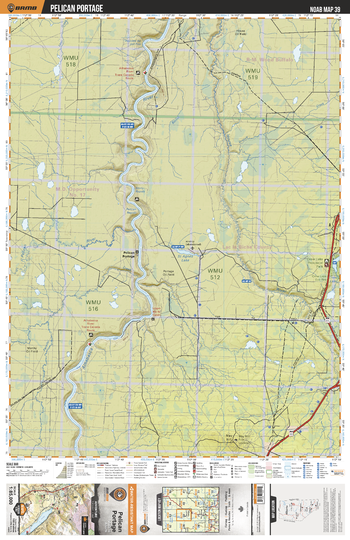
NOAB39 Pelican Portage - Northern Alberta Topo
Backroad Mapbooks
This recreation topographic map for the Pelican Portage area highlights all the logging and resource roads, multi-use trails for hikers, mountain bikers, horseback riders, cross-country skiers and snowshoers, motorized trails for ATVers and snowmobilers, fishing lakes and rivers, recreation areas, campgrounds, day-use areas, viewpoints, backcountry campsites, work camps, backcountry huts and cabins and more. No other map for the area provides you with this level of recreational or topographic detail. Special features include private land, labelled fish species and countless new roads, trails and recreational Points of Interest. This map also features enhanced oil & gas resource information, more detailed water features and seismic line corridors. Covering 1,268 km2 (490 mi2), this 1:85,000 scale map measures 96 x 127 km (59.5 x 79 mi). Included on the map are Athabasca River, House River, Agnes Lake, Pelican Portage, Mary Hill, Pelican River, Parallel Creek, Dropoff Creek, Crow Lake Prov Park, Boivin Creek and more!
Page Size: 24 x 37 in (610 x 940 mm)
No search results