


MapSherpa Catalog
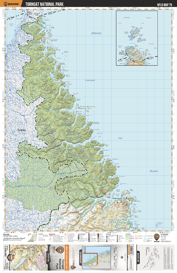
NLNL76 Torngat National Park - Newfoundland and Labrador Topo
Backroad Mapbooks
This recreation topographic map for Torngat National Park Labrador highlights all the logging/resource roads, hunting areas, fishing lakes & streams, campsites, paddling routes for canoeing and kayaking, wildlife viewing areas, multi-use trails for hiking, biking, horseback riding, cross-country skiing and snowshoeing, motorized trails for ATVing and snowmobiling & more. Covering 49,475 km2 (19,100 mi2), this 1:330,000 scale map measures 193 x 256.5 km (120 x 159 mi), providing you with more topographic and recreational detail for the Fortune area than any other map on the market. Special features include countless roads, trails and recreational Points of Interest. Included on this map are Torngat National Park, Saglek Bay, Nachavak Fiord and more!
Page Size: 24 x 37 in (610 x 940 mm)
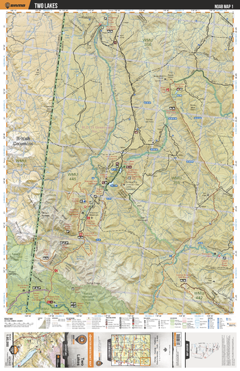
NOAB01 Two Lakes - Northern Alberta Topo
Backroad Mapbooks
This recreation topographic map for the Two Lakes area highlights all the logging and resource roads, multi-use trails for hikers, mountain bikers, horseback riders, cross-country skiers and snowshoers, motorized trails for ATVers and snowmobilers, fishing lakes and rivers, recreation areas, campgrounds, day-use areas, viewpoints, backcountry campsites, work camps, backcountry huts and cabins and more. No other map for the area provides you with this level of recreational or topographic detail. Special features include private land, labelled fish species and countless new roads, trails and recreational Points of Interest. This map also features enhanced oil & gas resource information, more detailed water features and seismic line corridors. Covering 1,268 km2 (490 mi2), this 1:85,000 scale map measures 96 x 127 km (59.5 x 79 mi). Included on the map are Kakwa River, Gunderson Creek, Narraway River, Torrens River, Horn Ridge, Kakwa Falls, Copton Ridge, Cutbank River, The Nose, Snaky Creek and more!
Page Size: 24 x 37 in (610 x 940 mm)
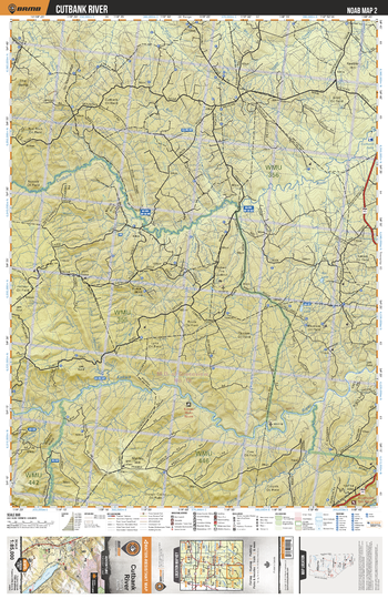
NOAB02 Cutbank River - Northern Alberta Topo
Backroad Mapbooks
This recreation topographic map for the Cutbank River area highlights all the logging and resource roads, multi-use trails for hikers, mountain bikers, horseback riders, cross-country skiers and snowshoers, motorized trails for ATVers and snowmobilers, fishing lakes and rivers, recreation areas, campgrounds, day-use areas, viewpoints, backcountry campsites, work camps, backcountry huts and cabins and more. No other map for the area provides you with this level of recreational or topographic detail. Special features include private land, labelled fish species and countless new roads, trails and recreational Points of Interest. This map also features enhanced oil & gas resource information, more detailed water features and seismic line corridors. Covering 1,268 km2 (490 mi2), this 1:85,000 scale map measures 96 x 127 km (59.5 x 79 mi). Included on the map are Kakwa River, Copton Creek, Cutbank River, Long Lake, Rat Lake, Prairie Creek, Wolf Creek, Pinto Creek and more!
Page Size: 24 x 37 in (610 x 940 mm)
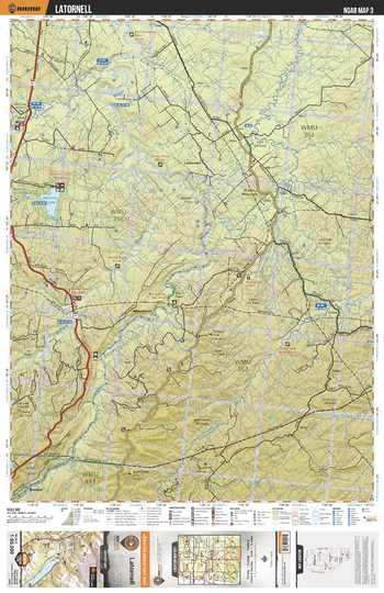
NOAB03 Latornell - Northern Alberta Topo
Backroad Mapbooks
This recreation topographic map for the Latornell area highlights all the logging and resource roads, multi-use trails for hikers, mountain bikers, horseback riders, cross-country skiers and snowshoers, motorized trails for ATVers and snowmobilers, fishing lakes and rivers, recreation areas, campgrounds, day-use areas, viewpoints, backcountry campsites, work camps, backcountry huts and cabins and more. No other map for the area provides you with this level of recreational or topographic detail. Special features include private land, labelled fish species and countless new roads, trails and recreational Points of Interest. This map also features enhanced oil & gas resource information, more detailed water features and seismic line corridors. Covering 1,268 km2 (490 mi2), this 1:85,000 scale map measures 96 x 127 km (59.5 x 79 mi). Included on the map are Musreau Lake, Latornell River, Simonette River, Smoky River, Botten, Kakwa River, Amundson, Latornell, Cutbank River, Moose River and more!
Page Size: 24 x 37 in (610 x 940 mm)
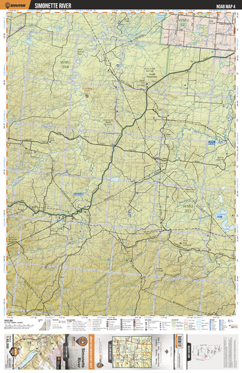
NOAB04 Simonette River - Northern Alberta Topo
Backroad Mapbooks
This recreation topographic map for the Simonette River area highlights all the logging and resource roads, multi-use trails for hikers, mountain bikers, horseback riders, cross-country skiers and snowshoers, motorized trails for ATVers and snowmobilers, fishing lakes and rivers, recreation areas, campgrounds, day-use areas, viewpoints, backcountry campsites, work camps, backcountry huts and cabins and more. No other map for the area provides you with this level of recreational or topographic detail. Special features include private land, labelled fish species and countless new roads, trails and recreational Points of Interest. This map also features enhanced oil & gas resource information, more detailed water features and seismic line corridors. Covering 1,268 km2 (490 mi2), this 1:85,000 scale map measures 96 x 127 km (59.5 x 79 mi). Included on the map are Crooked Lake, Grassy Lake, Waskahigan River, Simonette River, Jackfish Lake, Deep Valley Creek, Tony Creek, Moose Lake, Grassy Lake, Snuff Mtn and more!
Page Size: 24 x 37 in (610 x 940 mm)
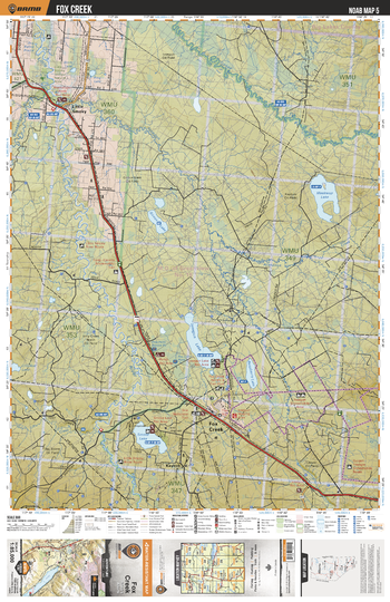
NOAB05 Fox Creek - Northern Alberta Topo
Backroad Mapbooks
This recreation topographic map for the Fox Creek area highlights all the logging and resource roads, multi-use trails for hikers, mountain bikers, horseback riders, cross-country skiers and snowshoers, motorized trails for ATVers and snowmobilers, fishing lakes and rivers, recreation areas, campgrounds, day-use areas, viewpoints, backcountry campsites, work camps, backcountry huts and cabins and more. No other map for the area provides you with this level of recreational or topographic detail. Special features include private land, labelled fish species and countless new roads, trails and recreational Points of Interest. This map also features enhanced oil & gas resource information, more detailed water features and seismic line corridors. Covering 1,268 km2 (490 mi2), this 1:85,000 scale map measures 96 x 127 km (59.5 x 79 mi). Included on the map are Meekwap Lake, Fox Creek, Smoke Lake, Iosegun Lake, Raspberry Lake, Giroux Lake, Little Smoky, Little Smoky River, Waskahigan River, Kaybob and more!
Page Size: 24 x 37 in (610 x 940 mm)
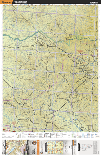
NOAB06 Virginia Hills - Northern Alberta Topo
Backroad Mapbooks
This recreation topographic map for the Virginia Hills area highlights all the logging and resource roads, multi-use trails for hikers, mountain bikers, horseback riders, cross-country skiers and snowshoers, motorized trails for ATVers and snowmobilers, fishing lakes and rivers, recreation areas, campgrounds, day-use areas, viewpoints, backcountry campsites, work camps, backcountry huts and cabins and more. No other map for the area provides you with this level of recreational or topographic detail. Special features include private land, labelled fish species and countless new roads, trails and recreational Points of Interest. This map also features enhanced oil & gas resource information, more detailed water features and seismic line corridors. Covering 1,268 km2 (490 mi2), this 1:85,000 scale map measures 96 x 127 km (59.5 x 79 mi). Included on the map are Goose River, Sakwatamau River, Freeman River, Goose Mtn Eco Reserve, Virginia Hills, Clover Oil Field and more!
Page Size: 24 x 37 in (610 x 940 mm)
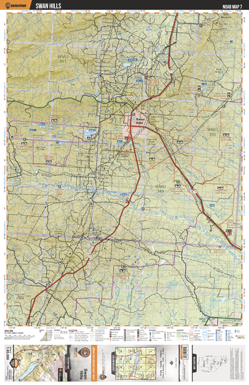
NOAB07 Swan Hills - Northern Alberta Topo
Backroad Mapbooks
This recreation topographic map for the Swan Hills area highlights all the logging and resource roads, multi-use trails for hikers, mountain bikers, horseback riders, cross-country skiers and snowshoers, motorized trails for ATVers and snowmobilers, fishing lakes and rivers, recreation areas, campgrounds, day-use areas, viewpoints, backcountry campsites, work camps, backcountry huts and cabins and more. No other map for the area provides you with this level of recreational or topographic detail. Special features include private land, labelled fish species and countless new roads, trails and recreational Points of Interest. This map also features enhanced oil & gas resource information, more detailed water features and seismic line corridors. Covering 1,268 km2 (490 mi2), this 1:85,000 scale map measures 96 x 127 km (59.5 x 79 mi). Included on the map are Swan Hills, Freeman River, Morse River, Morse Lake, Krause Lake, Gilroy Lakes, Tamarack Lake, Freeman Lake, Swan River, Moosehorn River and more!
Page Size: 24 x 37 in (610 x 940 mm)
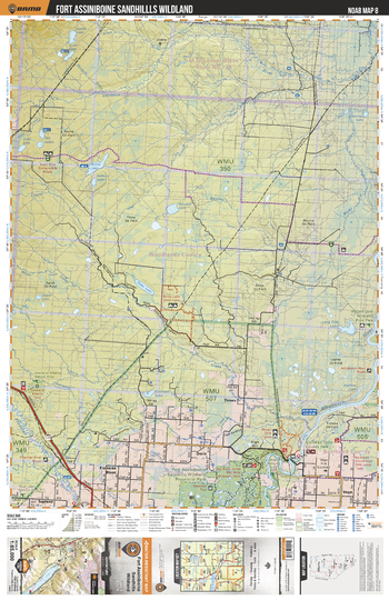
NOAB08 Fort Assiniboine Sandhills Wildland - Northern Alberta Topo
Backroad Mapbooks
This recreation topographic map for the Fort Assiniboine Sandhills Wildland area highlights all the logging and resource roads, multi-use trails for hikers, mountain bikers, horseback riders, cross-country skiers and snowshoers, motorized trails for ATVers and snowmobilers, fishing lakes and rivers, recreation areas, campgrounds, day-use areas, viewpoints, backcountry campsites, work camps, backcountry huts and cabins and more. No other map for the area provides you with this level of recreational or topographic detail. Special features include private land, labelled fish species and countless new roads, trails and recreational Points of Interest. This map also features enhanced oil & gas resource information, more detailed water features and seismic line corridors. Covering 1,268 km2 (490 mi2), this 1:85,000 scale map measures 96 x 127 km (59.5 x 79 mi). Included on the map are Fort Assiniboine Sandhills Wildland Prov Park, Klondike Ferry County Park, High Hill, Athabasca River, Freeman River, Coutts River, Roche Lake, Windfall Lake, Long End Lake, Salteaux River and more!
Page Size: 24 x 37 in (610 x 940 mm)
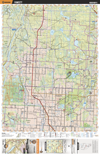
NOAB09 Fawcett - Northern Alberta Topo
Backroad Mapbooks
This recreation topographic map for the Fawcett area highlights all the logging and resource roads, multi-use trails for hikers, mountain bikers, horseback riders, cross-country skiers and snowshoers, motorized trails for ATVers and snowmobilers, fishing lakes and rivers, recreation areas, campgrounds, day-use areas, viewpoints, backcountry campsites, work camps, backcountry huts and cabins and more. No other map for the area provides you with this level of recreational or topographic detail. Special features include private land, labelled fish species and countless new roads, trails and recreational Points of Interest. This map also features enhanced oil & gas resource information, more detailed water features and seismic line corridors. Covering 1,268 km2 (490 mi2), this 1:85,000 scale map measures 96 x 127 km (59.5 x 79 mi). Included on the map are Hubert Lake Wildland Prov Park, Goodridge Lake, Jarvie, Fawcett, Cross (Steele) Lake, Francis Lake, Tieland, Flatbush, Athabasca River, Chisholm and more!
Page Size: 24 x 37 in (610 x 940 mm)
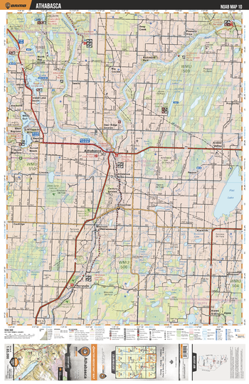
NOAB10 Athabasca - Northern Alberta Topo
Backroad Mapbooks
This recreation topographic map for the Athabasca area highlights all the logging and resource roads, multi-use trails for hikers, mountain bikers, horseback riders, cross-country skiers and snowshoers, motorized trails for ATVers and snowmobilers, fishing lakes and rivers, recreation areas, campgrounds, day-use areas, viewpoints, backcountry campsites, work camps, backcountry huts and cabins and more. No other map for the area provides you with this level of recreational or topographic detail. Special features include private land, labelled fish species and countless new roads, trails and recreational Points of Interest. This map also features enhanced oil & gas resource information, more detailed water features and seismic line corridors. Covering 1,268 km2 (490 mi2), this 1:85,000 scale map measures 96 x 127 km (59.5 x 79 mi). Included on the map are Athabasca, White Gull, Island Lake, Baptiste Lake, Perryvale, Kinikinik, Athabasca River, Flat Lake, Amber Valley, Tawatinaw River and more!
Page Size: 24 x 37 in (610 x 940 mm)
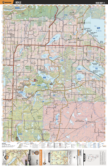
NOAB11 Boyle - Northern Alberta Topo
Backroad Mapbooks
This recreation topographic map for the Boyle area highlights all the logging and resource roads, multi-use trails for hikers, mountain bikers, horseback riders, cross-country skiers and snowshoers, motorized trails for ATVers and snowmobilers, fishing lakes and rivers, recreation areas, campgrounds, day-use areas, viewpoints, backcountry campsites, work camps, backcountry huts and cabins and more. No other map for the area provides you with this level of recreational or topographic detail. Special features include private land, labelled fish species and countless new roads, trails and recreational Points of Interest. This map also features enhanced oil & gas resource information, more detailed water features and seismic line corridors. Covering 1,268 km2 (490 mi2), this 1:85,000 scale map measures 96 x 127 km (59.5 x 79 mi). Included on the map are Lac la Biche, Missawawi Lake, North Buck Lake, Charron Lake, Buffalo Lake, Skeleton Lake, Long Lake, Boyle, Plamondon, Atmore and more!
Page Size: 24 x 37 in (610 x 940 mm)
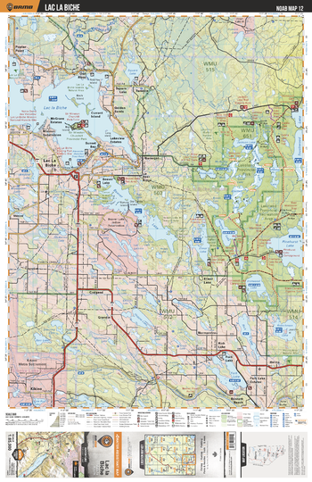
NOAB12 Lac La Biche - Northern Alberta Topo
Backroad Mapbooks
This recreation topographic map for the Lac La Biche area highlights all the logging and resource roads, multi-use trails for hikers, mountain bikers, horseback riders, cross-country skiers and snowshoers, motorized trails for ATVers and snowmobilers, fishing lakes and rivers, recreation areas, campgrounds, day-use areas, viewpoints, backcountry campsites, work camps, backcountry huts and cabins and more. No other map for the area provides you with this level of recreational or topographic detail. Special features include private land, labelled fish species and countless new roads, trails and recreational Points of Interest. This map also features enhanced oil & gas resource information, more detailed water features and seismic line corridors. Covering 1,268 km2 (490 mi2), this 1:85,000 scale map measures 96 x 127 km (59.5 x 79 mi). Included on the map are Lac la Biche, Lakeland Provincial Park, Lakeland Provincial Recreation Area, Beaver Lake, Amisk River, Fork Lake, Square Lake, Jackson Lake and more!
Page Size: 24 x 37 in (610 x 940 mm)
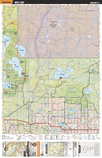
NOAB13 Wolf Lake - Northern Alberta Topo
Backroad Mapbooks
This recreation topographic map for the Wolf Lake area highlights all the logging and resource roads, multi-use trails for hikers, mountain bikers, horseback riders, cross-country skiers and snowshoers, motorized trails for ATVers and snowmobilers, fishing lakes and rivers, recreation areas, campgrounds, day-use areas, viewpoints, backcountry campsites, work camps, backcountry huts and cabins and more. No other map for the area provides you with this level of recreational or topographic detail. Special features include private land, labelled fish species and countless new roads, trails and recreational Points of Interest. This map also features enhanced oil & gas resource information, more detailed water features and seismic line corridors. Covering 1,268 km2 (490 mi2), this 1:85,000 scale map measures 96 x 127 km (59.5 x 79 mi). Included on the map are Lakeland Provincial Recreation Area,Cold Lake Air Weapons Range,Wolf Lake,Beaver River,Seibert Lake,Spencer Lake,Touchwood Lake,Sand River and more!
Page Size: 24 x 37 in (610 x 940 mm)
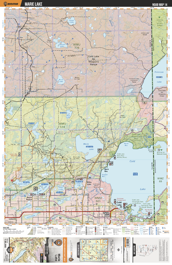
NOAB14 Marie Lake - Northern Alberta Topo
Backroad Mapbooks
This recreation topographic map for the Marie Lake area highlights all the logging and resource roads, multi-use trails for hikers, mountain bikers, horseback riders, cross-country skiers and snowshoers, motorized trails for ATVers and snowmobilers, fishing lakes and rivers, recreation areas, campgrounds, day-use areas, viewpoints, backcountry campsites, work camps, backcountry huts and cabins and more. No other map for the area provides you with this level of recreational or topographic detail. Special features include private land, labelled fish species and countless new roads, trails and recreational Points of Interest. This map also features enhanced oil & gas resource information, more detailed water features and seismic line corridors. Covering 1,268 km2 (490 mi2), this 1:85,000 scale map measures 96 x 127 km (59.5 x 79 mi). Included on the map are Cold Lake Air Weapons Range, Cold Lake,Primrose Lake,Cold Lake Provincial Park,Meadow Lake Provincial Park,Marie Lake,Crane Lake and more!
Page Size: 24 x 37 in (610 x 940 mm)
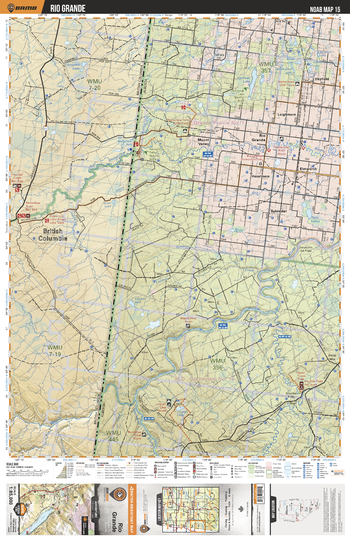
NOAB15 Rio Grande - Northern Alberta Topo
Backroad Mapbooks
This recreation topographic map for the Rio Grande area highlights all the logging and resource roads, multi-use trails for hikers, mountain bikers, horseback riders, cross-country skiers and snowshoers, motorized trails for ATVers and snowmobilers, fishing lakes and rivers, recreation areas, campgrounds, day-use areas, viewpoints, backcountry campsites, work camps, backcountry huts and cabins and more. No other map for the area provides you with this level of recreational or topographic detail. Special features include private land, labelled fish species and countless new roads, trails and recreational Points of Interest. This map also features enhanced oil & gas resource information, more detailed water features and seismic line corridors. Covering 1,268 km2 (490 mi2), this 1:85,000 scale map measures 96 x 127 km (59.5 x 79 mi). Included on the map are Rio Grande, Hazelmere, Wapiti River, Hayfield, Redwillow River, Sylvester, Shuttler Flats, Lingrell Lake, Mount Valley, Elmworth and more!
Page Size: 24 x 37 in (610 x 940 mm)
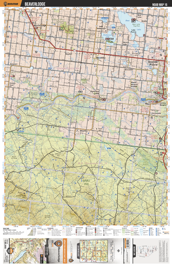
NOAB16 Beaverlodge - Northern Alberta Topo
Backroad Mapbooks
This recreation topographic map for the Beaverlodge area highlights all the logging and resource roads, multi-use trails for hikers, mountain bikers, horseback riders, cross-country skiers and snowshoers, motorized trails for ATVers and snowmobilers, fishing lakes and rivers, recreation areas, campgrounds, day-use areas, viewpoints, backcountry campsites, work camps, backcountry huts and cabins and more. No other map for the area provides you with this level of recreational or topographic detail. Special features include private land, labelled fish species and countless new roads, trails and recreational Points of Interest. This map also features enhanced oil & gas resource information, more detailed water features and seismic line corridors. Covering 1,268 km2 (490 mi2), this 1:85,000 scale map measures 96 x 127 km (59.5 x 79 mi). Included on the map are Bear Lake, Saskatoon Lake, Wapiti River, Beaverlodge, Grande Prairie, Wapiti, Pinto Mtn, Campbell Ridge, Pipestone Creek, Wembley and more!
Page Size: 24 x 37 in (610 x 940 mm)
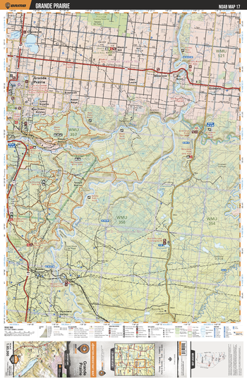
NOAB17 Grande Prairie - Northern Alberta Topo
Backroad Mapbooks
This recreation topographic map for the Grande Prairie area highlights all the logging and resource roads, multi-use trails for hikers, mountain bikers, horseback riders, cross-country skiers and snowshoers, motorized trails for ATVers and snowmobilers, fishing lakes and rivers, recreation areas, campgrounds, day-use areas, viewpoints, backcountry campsites, work camps, backcountry huts and cabins and more. No other map for the area provides you with this level of recreational or topographic detail. Special features include private land, labelled fish species and countless new roads, trails and recreational Points of Interest. This map also features enhanced oil & gas resource information, more detailed water features and seismic line corridors. Covering 1,268 km2 (490 mi2), this 1:85,000 scale map measures 96 x 127 km (59.5 x 79 mi). Included on the map are Wapiti River, Smoky River, Grande Prairie, Clairmont, Clairmont Lake, Simonette River, Economy Lake, Bear River Crown Reserve, Goodwin, Kleskun Kill and more!
Page Size: 24 x 37 in (610 x 940 mm)
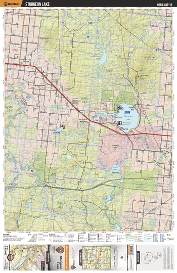
NOAB18 Sturgeon Lake - Northern Alberta Topo
Backroad Mapbooks
This recreation topographic map for the Sturgeon Lake area highlights all the logging and resource roads, multi-use trails for hikers, mountain bikers, horseback riders, cross-country skiers and snowshoers, motorized trails for ATVers and snowmobilers, fishing lakes and rivers, recreation areas, campgrounds, day-use areas, viewpoints, backcountry campsites, work camps, backcountry huts and cabins and more. No other map for the area provides you with this level of recreational or topographic detail. Special features include private land, labelled fish species and countless new roads, trails and recreational Points of Interest. This map also features enhanced oil & gas resource information, more detailed water features and seismic line corridors. Covering 1,268 km2 (490 mi2), this 1:85,000 scale map measures 96 x 127 km (59.5 x 79 mi). Included on the map are Sturgeon Lake, Sturgeon Heights, Crooked Creek, Debolt, Goose Lake, Simonette River, Swan Lake, Puskwaskau Lake, Cozy Cove, Calais and more!
Page Size: 24 x 37 in (610 x 940 mm)
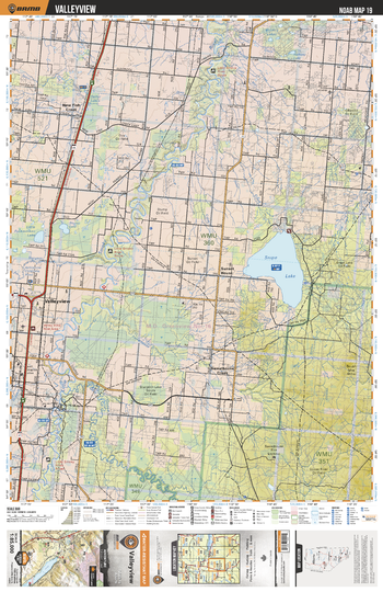
NOAB19 Valleyview - Northern Alberta Topo
Backroad Mapbooks
This recreation topographic map for the Valleyview area highlights all the logging and resource roads, multi-use trails for hikers, mountain bikers, horseback riders, cross-country skiers and snowshoers, motorized trails for ATVers and snowmobilers, fishing lakes and rivers, recreation areas, campgrounds, day-use areas, viewpoints, backcountry campsites, work camps, backcountry huts and cabins and more. No other map for the area provides you with this level of recreational or topographic detail. Special features include private land, labelled fish species and countless new roads, trails and recreational Points of Interest. This map also features enhanced oil & gas resource information, more detailed water features and seismic line corridors. Covering 1,268 km2 (490 mi2), this 1:85,000 scale map measures 96 x 127 km (59.5 x 79 mi). Included on the map are Snipe Lake, Little Smoky River, Valleyview, Goose River, Sweathouse Creek, New Fish Creek, Little Puskwaskau Lake, Stump Lake, Sunset House, Muskeg Lakes and more!
Page Size: 24 x 37 in (610 x 940 mm)
No search results