


MapSherpa Catalog
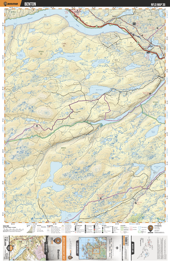
NLNL36 Benton - Newfoundland and Labrador Topo
Backroad Mapbooks
This recreation topographic map for Benton highlights all the logging/resource roads, hunting areas, fishing lakes & streams, campsites, paddling routes for canoeing and kayaking, wildlife viewing areas, multi-use trails for hiking, biking, horseback riding, cross-country skiing and snowshoeing, motorized trails for ATVing and snowmobiling & more. Covering 3,040 km2 (1,170 mi2), this 1:85,000 scale map measures 48 x 63.5 km (30 x 39.5 mi), providing you with more topographic and recreational detail for the Fortune area than any other map on the market. Special features include countless roads, trails and recreational Points of Interest. Included on this map are Benton, Deer Pond, Gambo Pond, North Pond, Gander Lake, Terra Nova Lake, Riverhead Brook, Northwest River, Bay du Nord Wilderness Reserve and more!
Page Size: 24 x 37 in (610 x 940 mm)
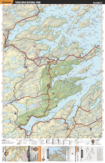
NLNL37 Terra Nova National Park - Newfoundland and Labrador Topo
Backroad Mapbooks
This recreation topographic map for Terra Nova National Park highlights all the logging/resource roads, hunting areas, fishing lakes & streams, campsites, paddling routes for canoeing and kayaking, wildlife viewing areas, multi-use trails for hiking, biking, horseback riding, cross-country skiing and snowshoeing, motorized trails for ATVing and snowmobiling & more. Covering 3,040 km2 (1,170 mi2), this 1:85,000 scale map measures 48 x 63.5 km (30 x 39.5 mi), providing you with more topographic and recreational detail for the Fortune area than any other map on the market. Special features include countless roads, trails and recreational Points of Interest. Included on this map are Terra Nova National Park, Clode Sound, Bonavista Bay, Goose Bay, Pitts Pond, Maccles Lake, Alexander Bay and more!
Page Size: 24 x 37 in (610 x 940 mm)
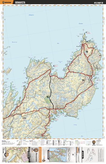
NLNL38 Bonavista - Newfoundland and Labrador Topo
Backroad Mapbooks
This recreation topographic map for Bonavista highlights all the logging/resource roads, hunting areas, fishing lakes & streams, campsites, paddling routes for canoeing and kayaking, wildlife viewing areas, multi-use trails for hiking, biking, horseback riding, cross-country skiing and snowshoeing, motorized trails for ATVing and snowmobiling & more. Covering 3,040 km2 (1,170 mi2), this 1:85,000 scale map measures 48 x 63.5 km (30 x 39.5 mi), providing you with more topographic and recreational detail for the Fortune area than any other map on the market. Special features include countless roads, trails and recreational Points of Interest. Included on this map are Bonavista, Bonavista Bay, Blackhead Bay, Trinity Bay, Lockston Path Provincial Park, Trouty River and more!
Page Size: 24 x 37 in (610 x 940 mm)
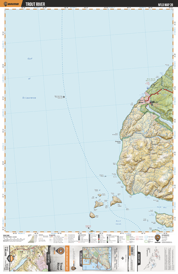
NLNL39 Trout River - Newfoundland and Labrador Topo
Backroad Mapbooks
This recreation topographic map for Trout River highlights all the logging/resource roads, hunting areas, fishing lakes & streams, campsites, paddling routes for canoeing and kayaking, wildlife viewing areas, multi-use trails for hiking, biking, horseback riding, cross-country skiing and snowshoeing, motorized trails for ATVing and snowmobiling & more. Covering 3,040 km2 (1,170 mi2), this 1:85,000 scale map measures 48 x 63.5 km (30 x 39.5 mi), providing you with more topographic and recreational detail for the Fortune area than any other map on the market. Special features include countless roads, trails and recreational Points of Interest. Included on this map are Trout River, Gros Morne National Park, Gregory RiverTrout River Big Pond and more!
Page Size: 24 x 37 in (610 x 940 mm)
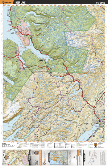
NLNL40 Deer Lake - Newfoundland and Labrador Topo
Backroad Mapbooks
This recreation topographic map for Deer Lake highlights all the logging/resource roads, hunting areas, fishing lakes & streams, campsites, paddling routes for canoeing and kayaking, wildlife viewing areas, multi-use trails for hiking, biking, horseback riding, cross-country skiing and snowshoeing, motorized trails for ATVing and snowmobiling & more. Covering 3,040 km2 (1,170 mi2), this 1:85,000 scale map measures 48 x 63.5 km (30 x 39.5 mi), providing you with more topographic and recreational detail for the Fortune area than any other map on the market. Special features include countless roads, trails and recreational Points of Interest. Included on this map are Deer Lake, Gros Morne National Park, Bonne Bay, Rocky Harbour, Bonne Bay Big Pond, Lomond River and more!
Page Size: 24 x 37 in (610 x 940 mm)
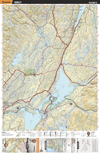
NLNL41 Howley - Newfoundland and Labrador Topo
Backroad Mapbooks
This recreation topographic map for Howley highlights all the logging/resource roads, hunting areas, fishing lakes & streams, campsites, paddling routes for canoeing and kayaking, wildlife viewing areas, multi-use trails for hiking, biking, horseback riding, cross-country skiing and snowshoeing, motorized trails for ATVing and snowmobiling & more. Covering 3,040 km2 (1,170 mi2), this 1:85,000 scale map measures 48 x 63.5 km (30 x 39.5 mi), providing you with more topographic and recreational detail for the Fortune area than any other map on the market. Special features include countless roads, trails and recreational Points of Interest. Included on this map are Howley, Grand Lake, Sandy Lake, Adies Pond, Hampden Bay, Upper Humber River, Hampden River, Adies River and more!
Page Size: 24 x 37 in (610 x 940 mm)
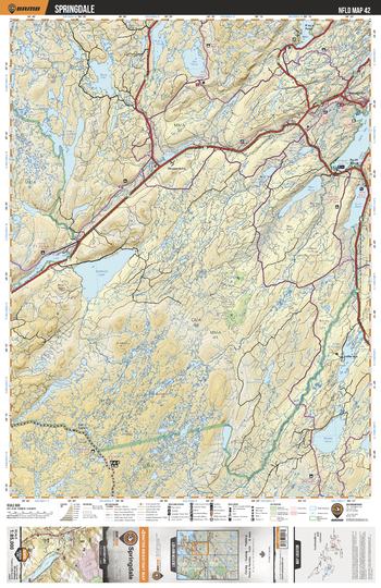
NLNL42 Springdale - Newfoundland and Labrador Topo
Backroad Mapbooks
This recreation topographic map for Springdale highlights all the logging/resource roads, hunting areas, fishing lakes & streams, campsites, paddling routes for canoeing and kayaking, wildlife viewing areas, multi-use trails for hiking, biking, horseback riding, cross-country skiing and snowshoeing, motorized trails for ATVing and snowmobiling & more. Covering 3,040 km2 (1,170 mi2), this 1:85,000 scale map measures 48 x 63.5 km (30 x 39.5 mi), providing you with more topographic and recreational detail for the Fortune area than any other map on the market. Special features include countless roads, trails and recreational Points of Interest. Included on this map are Springdale, Sheffield Lake, Indian River, Sandy Brook, Dawes Pond, Great Gull Lake, Halls Bay, Goodyear's Cove Park and more!
Page Size: 24 x 37 in (610 x 940 mm)
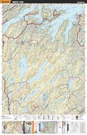
NLNL43 Robert's Arm - Newfoundland and Labrador Topo
Backroad Mapbooks
This recreation topographic map for Robert's Arm highlights all the logging/resource roads, hunting areas, fishing lakes & streams, campsites, paddling routes for canoeing and kayaking, wildlife viewing areas, multi-use trails for hiking, biking, horseback riding, cross-country skiing and snowshoeing, motorized trails for ATVing and snowmobiling & more. Covering 3,040 km2 (1,170 mi2), this 1:85,000 scale map measures 48 x 63.5 km (30 x 39.5 mi), providing you with more topographic and recreational detail for the Fortune area than any other map on the market. Special features include countless roads, trails and recreational Points of Interest. Included on this map are Robert's Arm, Notre Dame Bay, Halls Bay, New Bay Pond, New Bay River, Seal Bay, North Twin Lake, South Twin Lake and more!
Page Size: 24 x 37 in (610 x 940 mm)
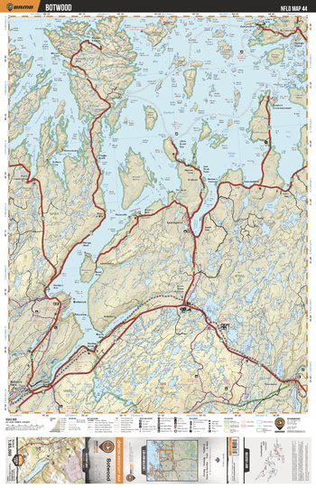
NLNL44 Botwood - Newfoundland and Labrador Topo
Backroad Mapbooks
This recreation topographic map for Botwood highlights all the logging/resource roads, hunting areas, fishing lakes & streams, campsites, paddling routes for canoeing and kayaking, wildlife viewing areas, multi-use trails for hiking, biking, horseback riding, cross-country skiing and snowshoeing, motorized trails for ATVing and snowmobiling & more. Covering 3,040 km2 (1,170 mi2), this 1:85,000 scale map measures 48 x 63.5 km (30 x 39.5 mi), providing you with more topographic and recreational detail for the Fortune area than any other map on the market. Special features include countless roads, trails and recreational Points of Interest. Included on this map are Botwood, Bay OF Exploits, Indian Cove Neck Park, Loon Bay, Indian Arm Pond, Dildo Pond, Indian Arm and more!
Page Size: 24 x 37 in (610 x 940 mm)
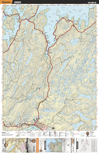
NLNL45 Gander - Newfoundland and Labrador Topo
Backroad Mapbooks
This recreation topographic map for Gander highlights all the logging/resource roads, hunting areas, fishing lakes & streams, campsites, paddling routes for canoeing and kayaking, wildlife viewing areas, multi-use trails for hiking, biking, horseback riding, cross-country skiing and snowshoeing, motorized trails for ATVing and snowmobiling & more. Covering 3,040 km2 (1,170 mi2), this 1:85,000 scale map measures 48 x 63.5 km (30 x 39.5 mi), providing you with more topographic and recreational detail for the Fortune area than any other map on the market. Special features include countless roads, trails and recreational Points of Interest. Included on this map are Gander, Gander Bay, Hamilton Sound, Gander River, Rocky Bay, Jonathan's Pond Provincial Park and more!
Page Size: 24 x 37 in (610 x 940 mm)
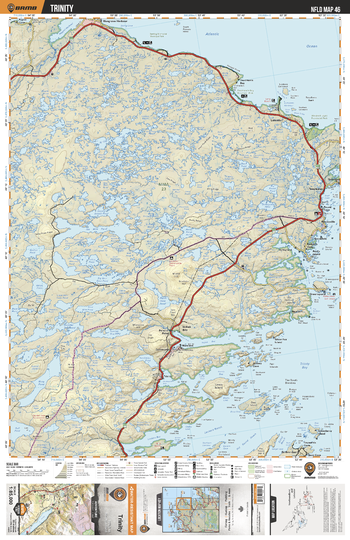
NLNL46 Trinity - Newfoundland and Labrador Topo
Backroad Mapbooks
This recreation topographic map for Trinity highlights all the logging/resource roads, hunting areas, fishing lakes & streams, campsites, paddling routes for canoeing and kayaking, wildlife viewing areas, multi-use trails for hiking, biking, horseback riding, cross-country skiing and snowshoeing, motorized trails for ATVing and snowmobiling & more. Covering 3,040 km2 (1,170 mi2), this 1:85,000 scale map measures 48 x 63.5 km (30 x 39.5 mi), providing you with more topographic and recreational detail for the Fortune area than any other map on the market. Special features include countless roads, trails and recreational Points of Interest. Included on this map are Trinity Bay, Deadman's Bay Provincial Park, Windmill Bight Provincial Park, Ten Mile Pond, Lockers Reach and more!
Page Size: 24 x 37 in (610 x 940 mm)
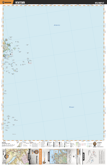
NLNL47 Newtown - Newfoundland and Labrador Topo
Backroad Mapbooks
This recreation topographic map for Newtown highlights all the logging/resource roads, hunting areas, fishing lakes & streams, campsites, paddling routes for canoeing and kayaking, wildlife viewing areas, multi-use trails for hiking, biking, horseback riding, cross-country skiing and snowshoeing, motorized trails for ATVing and snowmobiling & more. Covering 3,040 km2 (1,170 mi2), this 1:85,000 scale map measures 48 x 63.5 km (30 x 39.5 mi), providing you with more topographic and recreational detail for the Fortune area than any other map on the market. Special features include countless roads, trails and recreational Points of Interest. Included on this map are Newton, Cabot Islands, Pinchards Island and more!
Page Size: 24 x 37 in (610 x 940 mm)
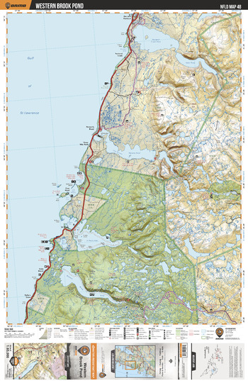
NLNL48 Western Brook Pond - Newfoundland and Labrador Topo
Backroad Mapbooks
This recreation topographic map for Western Brook Pond highlights all the logging/resource roads, hunting areas, fishing lakes & streams, campsites, paddling routes for canoeing and kayaking, wildlife viewing areas, multi-use trails for hiking, biking, horseback riding, cross-country skiing and snowshoeing, motorized trails for ATVing and snowmobiling & more. Covering 3,040 km2 (1,170 mi2), this 1:85,000 scale map measures 48 x 63.5 km (30 x 39.5 mi), providing you with more topographic and recreational detail for the Fortune area than any other map on the market. Special features include countless roads, trails and recreational Points of Interest. Included on this map are Western Brook Pond, Portland Creek pond, Parsons Pond, Gros Morne National Park, St Pauls Inlet, Main River Waterway Provincial Park and more!
Page Size: 24 x 37 in (610 x 940 mm)
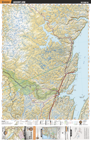
NLNL49 Jackson's Arm - Newfoundland and Labrador Topo
Backroad Mapbooks
This recreation topographic map for Jackson's Arm highlights all the logging/resource roads, hunting areas, fishing lakes & streams, campsites, paddling routes for canoeing and kayaking, wildlife viewing areas, multi-use trails for hiking, biking, horseback riding, cross-country skiing and snowshoeing, motorized trails for ATVing and snowmobiling & more. Covering 3,040 km2 (1,170 mi2), this 1:85,000 scale map measures 48 x 63.5 km (30 x 39.5 mi), providing you with more topographic and recreational detail for the Fortune area than any other map on the market. Special features include countless roads, trails and recreational Points of Interest. Included on this map are Jackson's Arm, White Bay, Main River Waterway Provincial Park, Main River, Hampden Bay, Sop's Arm Park and more!
Page Size: 24 x 37 in (610 x 940 mm)
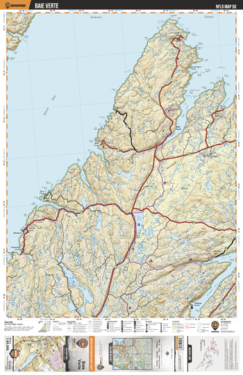
NLNL50 Baie Verte - Newfoundland and Labrador Topo
Backroad Mapbooks
This recreation topographic map for Baie Verte highlights all the logging/resource roads, hunting areas, fishing lakes & streams, campsites, paddling routes for canoeing and kayaking, wildlife viewing areas, multi-use trails for hiking, biking, horseback riding, cross-country skiing and snowshoeing, motorized trails for ATVing and snowmobiling & more. Covering 3,040 km2 (1,170 mi2), this 1:85,000 scale map measures 48 x 63.5 km (30 x 39.5 mi), providing you with more topographic and recreational detail for the Fortune area than any other map on the market. Special features include countless roads, trails and recreational Points of Interest. Included on this map are Baie Verte, White Bay, Flat Water Pond, Wild Cove Pond, Flatwood Pond Provincial Park, Baie Verte, Verte River and more!
Page Size: 24 x 37 in (610 x 940 mm)
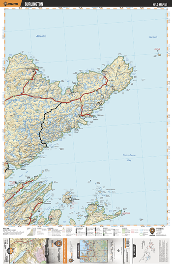
NLNL51 Burlington - Newfoundland and Labrador Topo
Backroad Mapbooks
This recreation topographic map for Burlington highlights all the logging/resource roads, hunting areas, fishing lakes & streams, campsites, paddling routes for canoeing and kayaking, wildlife viewing areas, multi-use trails for hiking, biking, horseback riding, cross-country skiing and snowshoeing, motorized trails for ATVing and snowmobiling & more. Covering 3,040 km2 (1,170 mi2), this 1:85,000 scale map measures 48 x 63.5 km (30 x 39.5 mi), providing you with more topographic and recreational detail for the Fortune area than any other map on the market. Special features include countless roads, trails and recreational Points of Interest. Included on this map are Burlington, Green Bay, Notre Dame Bay, Red Cliff Pond, Stakes Pond and more!
Page Size: 24 x 37 in (610 x 940 mm)
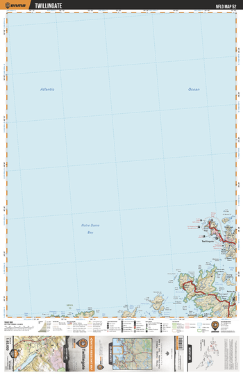
NLNL52 Twillingate - Newfoundland and Labrador Topo
Backroad Mapbooks
This recreation topographic map for Twillingate highlights all the logging/resource roads, hunting areas, fishing lakes & streams, campsites, paddling routes for canoeing and kayaking, wildlife viewing areas, multi-use trails for hiking, biking, horseback riding, cross-country skiing and snowshoeing, motorized trails for ATVing and snowmobiling & more. Covering 3,040 km2 (1,170 mi2), this 1:85,000 scale map measures 48 x 63.5 km (30 x 39.5 mi), providing you with more topographic and recreational detail for the Fortune area than any other map on the market. Special features include countless roads, trails and recreational Points of Interest. Included on this map are Twillingate, Friday Bay, Chance Harbour, Dildo Run Provincial Park and more!
Page Size: 24 x 37 in (610 x 940 mm)
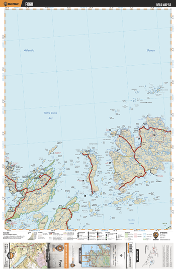
NLNL53 Fogo - Newfoundland and Labrador Topo
Backroad Mapbooks
This recreation topographic map for Fogo highlights all the logging/resource roads, hunting areas, fishing lakes & streams, campsites, paddling routes for canoeing and kayaking, wildlife viewing areas, multi-use trails for hiking, biking, horseback riding, cross-country skiing and snowshoeing, motorized trails for ATVing and snowmobiling & more. Covering 3,040 km2 (1,170 mi2), this 1:85,000 scale map measures 48 x 63.5 km (30 x 39.5 mi), providing you with more topographic and recreational detail for the Fortune area than any other map on the market. Special features include countless roads, trails and recreational Points of Interest. Included on this map are Fogo, Notre Dame Bay, Dildo Run Provincial Park, Shoal Bay, Hamilton Sound and more!
Page Size: 24 x 37 in (610 x 940 mm)
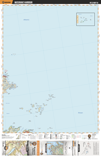
NLNL54 Musgrave Harbour - Newfoundland and Labrador Topo
Backroad Mapbooks
This recreation topographic map for Musgrave Harbour highlights all the logging/resource roads, hunting areas, fishing lakes & streams, campsites, paddling routes for canoeing and kayaking, wildlife viewing areas, multi-use trails for hiking, biking, horseback riding, cross-country skiing and snowshoeing, motorized trails for ATVing and snowmobiling & more. Covering 3,040 km2 (1,170 mi2), this 1:85,000 scale map measures 48 x 63.5 km (30 x 39.5 mi), providing you with more topographic and recreational detail for the Fortune area than any other map on the market. Special features include countless roads, trails and recreational Points of Interest. Included on this map are Musgrave Harbour, Fogo Island, Tilting, Wadham Islands and more!
Page Size: 24 x 37 in (610 x 940 mm)
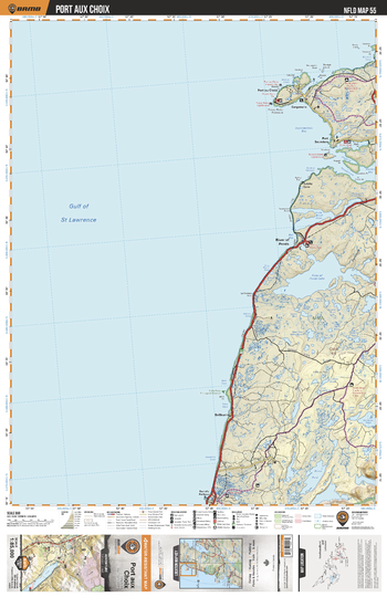
NLNL55 Port aux Choix - Newfoundland and Labrador Topo
Backroad Mapbooks
This recreation topographic map for Port aux Choix highlights all the logging/resource roads, hunting areas, fishing lakes & streams, campsites, paddling routes for canoeing and kayaking, wildlife viewing areas, multi-use trails for hiking, biking, horseback riding, cross-country skiing and snowshoeing, motorized trails for ATVing and snowmobiling & more. Covering 3,040 km2 (1,170 mi2), this 1:85,000 scale map measures 48 x 63.5 km (30 x 39.5 mi), providing you with more topographic and recreational detail for the Fortune area than any other map on the market. Special features include countless roads, trails and recreational Points of Interest. Included on this map are Port aux Choix, River Of Ponds Lake, Brians Pond, Little Brook Pond, Hawkes Bay, Ingornachoix Bay and more!
Page Size: 24 x 37 in (610 x 940 mm)
No search results