


MapSherpa Catalog
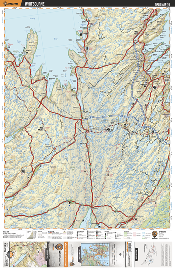
NLNL16 Whitbourne - Newfoundland and Labrador Topo
Backroad Mapbooks
This recreation topographic map for Whitbourne highlights all the logging/resource roads, hunting areas, fishing lakes & streams, campsites, paddling routes for canoeing and kayaking, wildlife viewing areas, multi-use trails for hiking, biking, horseback riding, cross-country skiing and snowshoeing, motorized trails for ATVing and snowmobiling & more. Covering 3,040 km2 (1,170 mi2), this 1:85,000 scale map measures 48 x 63.5 km (30 x 39.5 mi), providing you with more topographic and recreational detail for the Fortune area than any other map on the market. Special features include countless roads, trails and recreational Points of Interest. Included on this map are Whitbourne, Trinity Bay, Bellvue Beach Provincial Park, Avalon Wilderness Reserve, Dildo Pond and more!
Page Size: 24 x 37 in (610 x 940 mm)
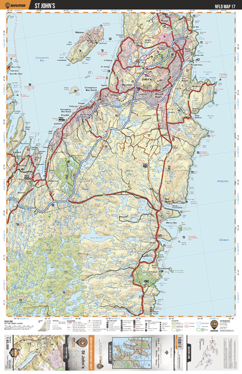
NLNL17 St John's - Newfoundland and Labrador Topo
Backroad Mapbooks
This recreation topographic map for St John's highlights all the logging/resource roads, hunting areas, fishing lakes & streams, campsites, paddling routes for canoeing and kayaking, wildlife viewing areas, multi-use trails for hiking, biking, horseback riding, cross-country skiing and snowshoeing, motorized trails for ATVing and snowmobiling & more. Covering 3,040 km2 (1,170 mi2), this 1:85,000 scale map measures 48 x 63.5 km (30 x 39.5 mi), providing you with more topographic and recreational detail for the Fortune area than any other map on the market. Special features include countless roads, trails and recreational Points of Interest. Included on this map are St John's, Conception Bay, Butter Pot Provincial Park, La Manche Provincial Park, Holyrood Bay and more!
Page Size: 24 x 37 in (610 x 940 mm)
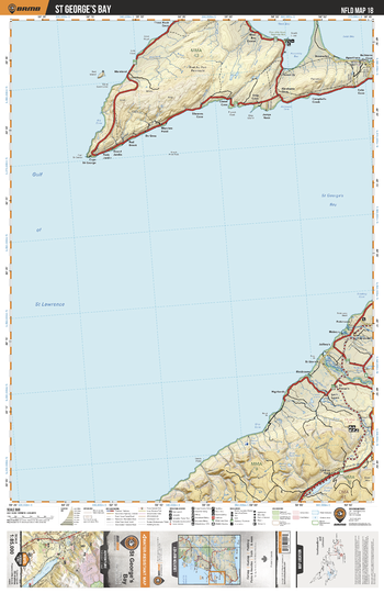
NLNL18 St George's Bay - Newfoundland and Labrador Topo
Backroad Mapbooks
This recreation topographic map for St George's Bay highlights all the logging/resource roads, hunting areas, fishing lakes & streams, campsites, paddling routes for canoeing and kayaking, wildlife viewing areas, multi-use trails for hiking, biking, horseback riding, cross-country skiing and snowshoeing, motorized trails for ATVing and snowmobiling & more. Covering 3,040 km2 (1,170 mi2), this 1:85,000 scale map measures 48 x 63.5 km (30 x 39.5 mi), providing you with more topographic and recreational detail for the Fortune area than any other map on the market. Special features include countless roads, trails and recreational Points of Interest. Included on this map are St George's Bay, Piccadilly Head Regional Park, Codroy Pond, Crabbes River, Highlands River and more!
Page Size: 24 x 37 in (610 x 940 mm)
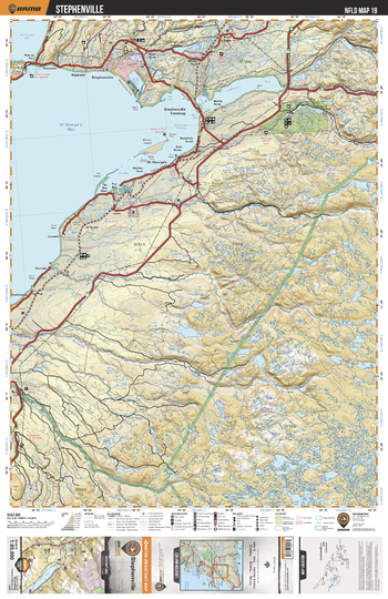
NLNL19 Stephenville - Newfoundland and Labrador Topo
Backroad Mapbooks
This recreation topographic map for Stephenville highlights all the logging/resource roads, hunting areas, fishing lakes & streams, campsites, paddling routes for canoeing and kayaking, wildlife viewing areas, multi-use trails for hiking, biking, horseback riding, cross-country skiing and snowshoeing, motorized trails for ATVing and snowmobiling & more. Covering 3,040 km2 (1,170 mi2), this 1:85,000 scale map measures 48 x 63.5 km (30 x 39.5 mi), providing you with more topographic and recreational detail for the Fortune area than any other map on the market. Special features include countless roads, trails and recreational Points of Interest. Included on this map are Stephenville, St George's Bay, Port au Port Bay, Baranchois Pond Provincial Park, Robinson River, Crabbes River, Highland River and more!
Page Size: 24 x 37 in (610 x 940 mm)
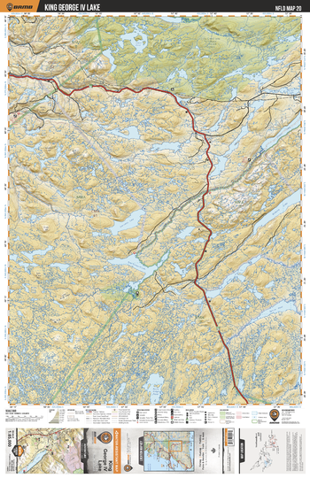
NLNL20 King George IV Lake - Newfoundland and Labrador Topo
Backroad Mapbooks
This recreation topographic map for King George IV Lake highlights all the logging/resource roads, hunting areas, fishing lakes & streams, campsites, paddling routes for canoeing and kayaking, wildlife viewing areas, multi-use trails for hiking, biking, horseback riding, cross-country skiing and snowshoeing, motorized trails for ATVing and snowmobiling & more. Covering 3,040 km2 (1,170 mi2), this 1:85,000 scale map measures 48 x 63.5 km (30 x 39.5 mi), providing you with more topographic and recreational detail for the Fortune area than any other map on the market. Special features include countless roads, trails and recreational Points of Interest. Included on this map are King George IV Lake, Little Grand Lake Provisional Ecological Reserve, Lloyds River, Cormacks Lake, Victoria Lake, Spruce Pond and more!
Page Size: 24 x 37 in (610 x 940 mm)
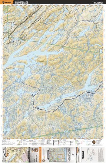
NLNL21 Granite Lake - Newfoundland and Labrador Topo
Backroad Mapbooks
This recreation topographic map for Granite Lake highlights all the logging/resource roads, hunting areas, fishing lakes & streams, campsites, paddling routes for canoeing and kayaking, wildlife viewing areas, multi-use trails for hiking, biking, horseback riding, cross-country skiing and snowshoeing, motorized trails for ATVing and snowmobiling & more. Covering 3,040 km2 (1,170 mi2), this 1:85,000 scale map measures 48 x 63.5 km (30 x 39.5 mi), providing you with more topographic and recreational detail for the Fortune area than any other map on the market. Special features include countless roads, trails and recreational Points of Interest. Included on this map are Granit Lake, Victoria Lake, Burnt Pond, Lloyds River, Red Cross Lake, White Bear River, Grey River, Victoria River and more!
Page Size: 24 x 37 in (610 x 940 mm)
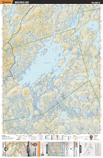
NLNL22 Meelpaeg Lake - Newfoundland and Labrador Topo
Backroad Mapbooks
This recreation topographic map for Meelpaeg Lake highlights all the logging/resource roads, hunting areas, fishing lakes & streams, campsites, paddling routes for canoeing and kayaking, wildlife viewing areas, multi-use trails for hiking, biking, horseback riding, cross-country skiing and snowshoeing, motorized trails for ATVing and snowmobiling & more. Covering 3,040 km2 (1,170 mi2), this 1:85,000 scale map measures 48 x 63.5 km (30 x 39.5 mi), providing you with more topographic and recreational detail for the Fortune area than any other map on the market. Special features include countless roads, trails and recreational Points of Interest. Included on this map are Meelapage Lake, Crooked Lake, Cold Spring Pond, Great Burnt Lake, Dollard Pond, Island Pond, Rogerson Lake and more!
Page Size: 24 x 37 in (610 x 940 mm)
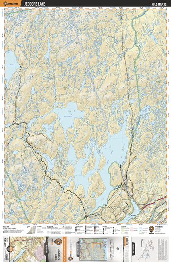
NLNL23 Jeddore Lake - Newfoundland and Labrador Topo
Backroad Mapbooks
This recreation topographic map for Jeddore Lake highlights all the logging/resource roads, hunting areas, fishing lakes & streams, campsites, paddling routes for canoeing and kayaking, wildlife viewing areas, multi-use trails for hiking, biking, horseback riding, cross-country skiing and snowshoeing, motorized trails for ATVing and snowmobiling & more. Covering 3,040 km2 (1,170 mi2), this 1:85,000 scale map measures 48 x 63.5 km (30 x 39.5 mi), providing you with more topographic and recreational detail for the Fortune area than any other map on the market. Special features include countless roads, trails and recreational Points of Interest. Included on this map are Jeddore Lake, Round Pond, Great Burnt Lake, Northwest Gander River, Hatcher Cove, Matthews Pond, Salmon River and more!
Page Size: 24 x 37 in (610 x 940 mm)
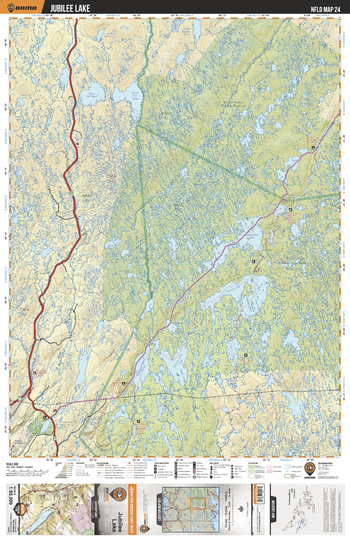
NLNL24 Jubilee Lake - Newfoundland and Labrador Topo
Backroad Mapbooks
This recreation topographic map for Jubilee Lake highlights all the logging/resource roads, hunting areas, fishing lakes & streams, campsites, paddling routes for canoeing and kayaking, wildlife viewing areas, multi-use trails for hiking, biking, horseback riding, cross-country skiing and snowshoeing, motorized trails for ATVing and snowmobiling & more. Covering 3,040 km2 (1,170 mi2), this 1:85,000 scale map measures 48 x 63.5 km (30 x 39.5 mi), providing you with more topographic and recreational detail for the Fortune area than any other map on the market. Special features include countless roads, trails and recreational Points of Interest. Included on this map are Jubilee Lake, Bay du Nord Wilderness Reserve, Middle Ridge Wildlife Reserve, Great Gull Lake, Bay du Nord River, Conne River and more!
Page Size: 24 x 37 in (610 x 940 mm)
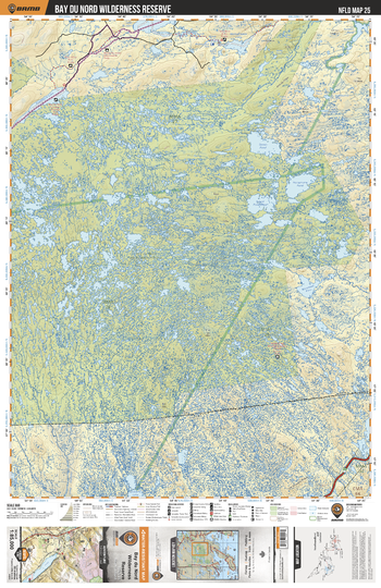
NLNL25 Bay du Nord Wilderness Reserve - Newfoundland and Labrador Topo
Backroad Mapbooks
This recreation topographic map for Bay du Nord Wilderness Reserve highlights all the logging/resource roads, hunting areas, fishing lakes & streams, campsites, paddling routes for canoeing and kayaking, wildlife viewing areas, multi-use trails for hiking, biking, horseback riding, cross-country skiing and snowshoeing, motorized trails for ATVing and snowmobiling & more. Covering 3,040 km2 (1,170 mi2), this 1:85,000 scale map measures 48 x 63.5 km (30 x 39.5 mi), providing you with more topographic and recreational detail for the Fortune area than any other map on the market. Special features include countless roads, trails and recreational Points of Interest. Included on this map are Bay du Nord Wilderness Reserve, Harbour River, Northwest River, Hole River, Ocean Pond, Island West Pond, Kepenkeck Lake and more!
Page Size: 24 x 37 in (610 x 940 mm)
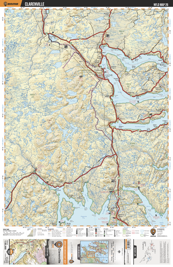
NLNL26 Clarenville - Newfoundland and Labrador Topo
Backroad Mapbooks
This recreation topographic map for Clarenville highlights all the logging/resource roads, hunting areas, fishing lakes & streams, campsites, paddling routes for canoeing and kayaking, wildlife viewing areas, multi-use trails for hiking, biking, horseback riding, cross-country skiing and snowshoeing, motorized trails for ATVing and snowmobiling & more. Covering 3,040 km2 (1,170 mi2), this 1:85,000 scale map measures 48 x 63.5 km (30 x 39.5 mi), providing you with more topographic and recreational detail for the Fortune area than any other map on the market. Special features include countless roads, trails and recreational Points of Interest. Included on this map are Clarenville, Placentia Bay, Trinity Bay, Black River Pond, Thornburn Lake, Goose Pond, Tug Pond, Gull Pond and more!
Page Size: 24 x 37 in (610 x 940 mm)
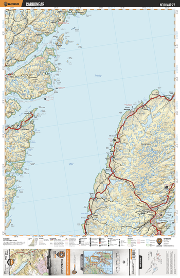
NLNL27 Carbonear - Newfoundland and Labrador Topo
Backroad Mapbooks
This recreation topographic map for Carbonear highlights all the logging/resource roads, hunting areas, fishing lakes & streams, campsites, paddling routes for canoeing and kayaking, wildlife viewing areas, multi-use trails for hiking, biking, horseback riding, cross-country skiing and snowshoeing, motorized trails for ATVing and snowmobiling & more. Covering 3,040 km2 (1,170 mi2), this 1:85,000 scale map measures 48 x 63.5 km (30 x 39.5 mi), providing you with more topographic and recreational detail for the Fortune area than any other map on the market. Special features include countless roads, trails and recreational Points of Interest. Included on this map are Carbonear, Trinity Bay, Random Sound, Smith Sound, Southport, British Harbour, Pitmans Pond and more!
Page Size: 24 x 37 in (610 x 940 mm)
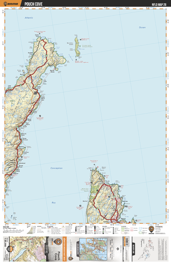
NLNL28 Pouch Cove - Newfoundland and Labrador Topo
Backroad Mapbooks
This recreation topographic map for Pouch Cove highlights all the logging/resource roads, hunting areas, fishing lakes & streams, campsites, paddling routes for canoeing and kayaking, wildlife viewing areas, multi-use trails for hiking, biking, horseback riding, cross-country skiing and snowshoeing, motorized trails for ATVing and snowmobiling & more. Covering 3,040 km2 (1,170 mi2), this 1:85,000 scale map measures 48 x 63.5 km (30 x 39.5 mi), providing you with more topographic and recreational detail for the Fortune area than any other map on the market. Special features include countless roads, trails and recreational Points of Interest. Included on this map are Pouch Cove, Conception Bay, Marine Drive Provincial Park Reserve, Western Bay, Bay de Verde, Baccalieu Island Ecological Reserve and more!
Page Size: 24 x 37 in (610 x 940 mm)
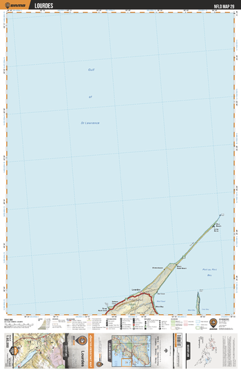
NLNL29 Lourdes - Newfoundland and Labrador Topo
Backroad Mapbooks
This recreation topographic map for Lourdes highlights all the logging/resource roads, hunting areas, fishing lakes & streams, campsites, paddling routes for canoeing and kayaking, wildlife viewing areas, multi-use trails for hiking, biking, horseback riding, cross-country skiing and snowshoeing, motorized trails for ATVing and snowmobiling & more. Covering 3,040 km2 (1,170 mi2), this 1:85,000 scale map measures 48 x 63.5 km (30 x 39.5 mi), providing you with more topographic and recreational detail for the Fortune area than any other map on the market. Special features include countless roads, trails and recreational Points of Interest. Included on this map are Lourdes, Gulf of St Lawrence, Port au Port Bay and more!
Page Size: 24 x 37 in (610 x 940 mm)
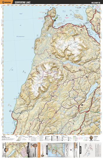
NLNL30 Serpentine Lake - Newfoundland and Labrador Topo
Backroad Mapbooks
This recreation topographic map for Serpentine Lake highlights all the logging/resource roads, hunting areas, fishing lakes & streams, campsites, paddling routes for canoeing and kayaking, wildlife viewing areas, multi-use trails for hiking, biking, horseback riding, cross-country skiing and snowshoeing, motorized trails for ATVing and snowmobiling & more. Covering 3,040 km2 (1,170 mi2), this 1:85,000 scale map measures 48 x 63.5 km (30 x 39.5 mi), providing you with more topographic and recreational detail for the Fortune area than any other map on the market. Special features include countless roads, trails and recreational Points of Interest. Included on this map are Serpentine Lake, Bay of Islands, Serpentine Lake, Georges Lake, Humber Arm, Blow Me Down Provincial Park, Fox Island River and more!
Page Size: 24 x 37 in (610 x 940 mm)
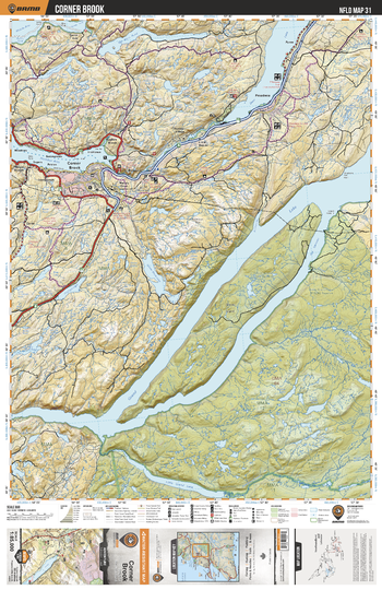
NLNL31 Corner Brook - Newfoundland and Labrador Topo
Backroad Mapbooks
This recreation topographic map for Corner Brook highlights all the logging/resource roads, hunting areas, fishing lakes & streams, campsites, paddling routes for canoeing and kayaking, wildlife viewing areas, multi-use trails for hiking, biking, horseback riding, cross-country skiing and snowshoeing, motorized trails for ATVing and snowmobiling & more. Covering 3,040 km2 (1,170 mi2), this 1:85,000 scale map measures 48 x 63.5 km (30 x 39.5 mi), providing you with more topographic and recreational detail for the Fortune area than any other map on the market. Special features include countless roads, trails and recreational Points of Interest. Included on this map are Corner Brook, Grand Lake, Little Grand Lake Provisional Ecological Reserve, Humber River, Deer Lake, Little Grand Lake Wildlife Reserve and more!
Page Size: 24 x 37 in (610 x 940 mm)
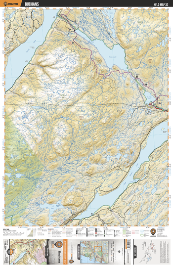
NLNL32 Buchans - Newfoundland and Labrador Topo
Backroad Mapbooks
This recreation topographic map for Buchans highlights all the logging/resource roads, hunting areas, fishing lakes & streams, campsites, paddling routes for canoeing and kayaking, wildlife viewing areas, multi-use trails for hiking, biking, horseback riding, cross-country skiing and snowshoeing, motorized trails for ATVing and snowmobiling & more. Covering 3,040 km2 (1,170 mi2), this 1:85,000 scale map measures 48 x 63.5 km (30 x 39.5 mi), providing you with more topographic and recreational detail for the Fortune area than any other map on the market. Special features include countless roads, trails and recreational Points of Interest. Included on this map are Buchans, Grand Lake, Hinds Lake, Buchans Lake, Red Indian Lake, Lake, Little Grand Lake Wildlife Reserve, Star Lake and more!
Page Size: 24 x 37 in (610 x 940 mm)
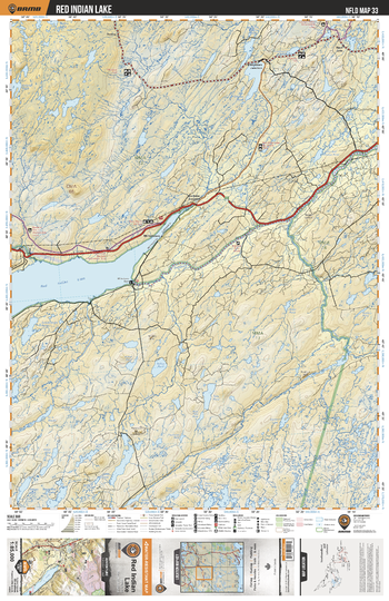
NLNL33 Red Indian Lake - Newfoundland and Labrador Topo
Backroad Mapbooks
This recreation topographic map for Red Indian Lake highlights all the logging/resource roads, hunting areas, fishing lakes & streams, campsites, paddling routes for canoeing and kayaking, wildlife viewing areas, multi-use trails for hiking, biking, horseback riding, cross-country skiing and snowshoeing, motorized trails for ATVing and snowmobiling & more. Covering 3,040 km2 (1,170 mi2), this 1:85,000 scale map measures 48 x 63.5 km (30 x 39.5 mi), providing you with more topographic and recreational detail for the Fortune area than any other map on the market. Special features include countless roads, trails and recreational Points of Interest. Included on this map are Red Indian Lake, Exploits River, Victoria River, Noel Paul's Brook, Joe Glodes Pond, Lake Ambrose, March's Brook and more!
Page Size: 24 x 37 in (610 x 940 mm)
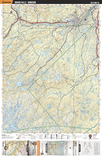
NLNL34 Grand Falls - Windsor - Newfoundland and Labrador Topo
Backroad Mapbooks
This recreation topographic map for Grand Falls - Windsor highlights all the logging/resource roads, hunting areas, fishing lakes & streams, campsites, paddling routes for canoeing and kayaking, wildlife viewing areas, multi-use trails for hiking, biking, horseback riding, cross-country skiing and snowshoeing, motorized trails for ATVing and snowmobiling & more. Covering 3,040 km2 (1,170 mi2), this 1:85,000 scale map measures 48 x 63.5 km (30 x 39.5 mi), providing you with more topographic and recreational detail for the Fortune area than any other map on the market. Special features include countless roads, trails and recreational Points of Interest. Included on this map are Grand Falls, Exploits River, Sandy Lake, Great Rattling Brook, Stony Lake, Pistol Lake and more!
Page Size: 24 x 37 in (610 x 940 mm)
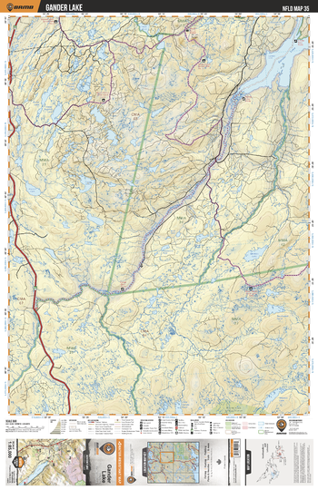
NLNL35 Gander Lake - Newfoundland and Labrador Topo
Backroad Mapbooks
This recreation topographic map for Gander Lake highlights all the logging/resource roads, hunting areas, fishing lakes & streams, campsites, paddling routes for canoeing and kayaking, wildlife viewing areas, multi-use trails for hiking, biking, horseback riding, cross-country skiing and snowshoeing, motorized trails for ATVing and snowmobiling & more. Covering 3,040 km2 (1,170 mi2), this 1:85,000 scale map measures 48 x 63.5 km (30 x 39.5 mi), providing you with more topographic and recreational detail for the Fortune area than any other map on the market. Special features include countless roads, trails and recreational Points of Interest. Included on this map are Gander Lake, Northwest Gander River, Great Gull River, Crowe Lake, Caribou Lake, Lewis Pond and more!
Page Size: 24 x 37 in (610 x 940 mm)
No search results