


MapSherpa Catalog
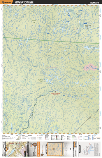
NEON96 Attawapiskat River - Northeastern Ontario Topo
Backroad Mapbooks
This recreation topographic map for Attawapiskat River highlights all the logging/resource roads, hunting areas, fishing lakes & streams, campsites, paddling routes for canoeing and kayaking, wildlife viewing areas, multi-use trails for hiking, biking, horseback riding, cross-country skiing and snowshoeing, motorized trails for ATVing and snowmobiling & more. Covering 48,670 km2 (18,890 mi2), this 1:330,000 scale map measures 191 x 254 km (119 x 158 mi), providing you with more topographic and recreational detail for the Ogoki area than any other map on the market. New features include Crown land areas, countless new roads and trails plus additional recreational Points of Interest. Included on this map are Attawapiskat River, Muketei River, Ekwan River, Opinnagau Lake, Stutton Lake, Stutton River, North Washagami River and more!
Page Size: 24 x 37 in (610 x 940 mm)
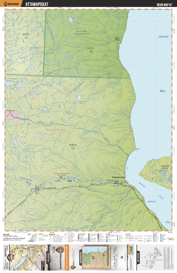
NEON97 Attawapiskat - Northeastern Ontario Topo
Backroad Mapbooks
This recreation topographic map for Attawapiskat highlights all the logging/resource roads, hunting areas, fishing lakes & streams, campsites, paddling routes for canoeing and kayaking, wildlife viewing areas, multi-use trails for hiking, biking, horseback riding, cross-country skiing and snowshoeing, motorized trails for ATVing and snowmobiling & more. Covering 48,670 km2 (18,890 mi2), this 1:330,000 scale map measures 191 x 254 km (119 x 158 mi), providing you with more topographic and recreational detail for the Ogoki area than any other map on the market. New features include Crown land areas, countless new roads and trails plus additional recreational Points of Interest. Included on this map are James Bay, Akimiski Strait, Attawapiskat, Attawapiskat River, Kapiskau River, Polar Bear Prov Park, Ekwan River, Patchepawapoka River, Lake River and more!
Page Size: 24 x 37 in (610 x 940 mm)
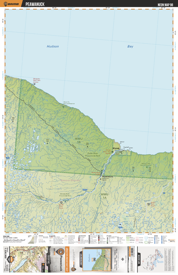
NEON98 Peawanuck - Northeastern Ontario Topo
Backroad Mapbooks
This recreation topographic map for Peawanuck highlights all the logging/resource roads, hunting areas, fishing lakes & streams, campsites, paddling routes for canoeing and kayaking, wildlife viewing areas, multi-use trails for hiking, biking, horseback riding, cross-country skiing and snowshoeing, motorized trails for ATVing and snowmobiling & more. Covering 48,670 km2 (18,890 mi2), this 1:330,000 scale map measures 191 x 254 km (119 x 158 mi), providing you with more topographic and recreational detail for the Ogoki area than any other map on the market. New features include Crown land areas, countless new roads and trails plus additional recreational Points of Interest. Included on this map are Hudson Bay, Winisk River Prov Park, Winisk River, Shamattawa River, Peawanuck, Winisk, Polar Bear Prov Park, Sutton River and more!
Page Size: 24 x 37 in (610 x 940 mm)
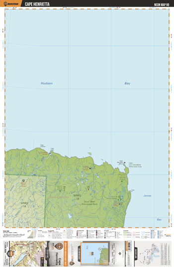
NEON99 Cape Henrietta - Northeastern Ontario Topo
Backroad Mapbooks
This recreation topographic map for Cape Henrietta highlights all the logging/resource roads, hunting areas, fishing lakes & streams, campsites, paddling routes for canoeing and kayaking, wildlife viewing areas, multi-use trails for hiking, biking, horseback riding, cross-country skiing and snowshoeing, motorized trails for ATVing and snowmobiling & more. Covering 48,670 km2 (18,890 mi2), this 1:330,000 scale map measures 191 x 254 km (119 x 158 mi), providing you with more topographic and recreational detail for the Ogoki area than any other map on the market. New features include Crown land areas, countless new roads and trails plus additional recreational Points of Interest. Included on this map are Polar Bear Prov Park, James Bay, Hudson Bay, Sutton River, Cape Henrietta-Maria Wilderness Area and more!
Page Size: 24 x 37 in (610 x 940 mm)
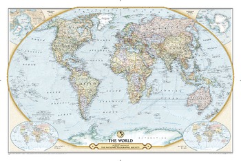
NGS 125th Anniversary World Map
National Geographic
This special edition map commemorates the National Geographic Society's 125th Anniversary with a modern spin on a classic map design. The map portrays a contemporary political world accompanied by two insets, showing the world as it appeared in 1888 and 1988-the Society's founding and centennial years. The design features an attractive color palette, clear borders, national capitals and major cities, airports, notable peaks, major rivers and lakes, and stunning ocean topography. This map makes for a beautiful object d'art as well as a wonderful conversation piece.
Page Size: 46 x 30.5 in (1166 x 773 mm)
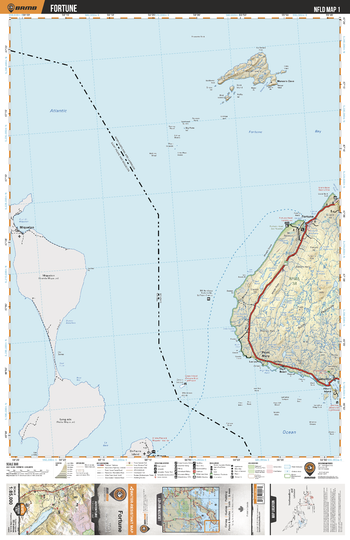
NLNL01 Fortune - Labrador City - Newfoundland and Labrador Topo
Backroad Mapbooks
This recreation topographic map for Fortune highlights all the logging/resource roads, hunting areas, fishing lakes & streams, campsites, paddling routes for canoeing and kayaking, wildlife viewing areas, multi-use trails for hiking, biking, horseback riding, cross-country skiing and snowshoeing, motorized trails for ATVing and snowmobiling & more. Covering 3,040 km2 (1,170 mi2), this 1:85,000 scale map measures 48 x 63.5 km (30 x 39.5 mi), providing you with more topographic and recreational detail for the Fortune area than any other map on the market. Special features include countless roads, trails and recreational Points of Interest. Included on this map are Allan’s Island, Brunette Island, Burin Peninsula, Calmer, Fortune, Fortune Head Lighthouse, Green Island, High Beach, Lamaline, Mercer’s Cove and Point Mary, plus the French islands of Sainte-Pierre and Miquelon.
Page Size: 24 x 37 in (610 x 940 mm)
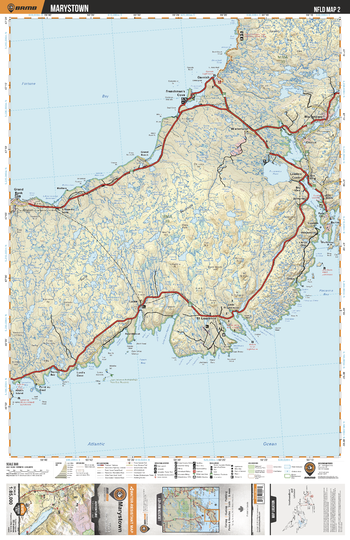
NLNL02 Marystown - Newfoundland and Labrador Topo
Backroad Mapbooks
This recreation topographic map for Marystown highlights all the logging/resource roads, hunting areas, fishing lakes & streams, campsites, paddling routes for canoeing and kayaking, wildlife viewing areas, multi-use trails for hiking, biking, horseback riding, cross-country skiing and snowshoeing, motorized trails for ATVing and snowmobiling & more. Covering 3,040 km2 (1,170 mi2), this 1:85,000 scale map measures 48 x 63.5 km (30 x 39.5 mi), providing you with more topographic and recreational detail for the Fortune area than any other map on the market. Special features include countless roads, trails and recreational Points of Interest. Included on this map are Marystown, Freshwater Pond, Placentia Bay, Frenchmans Cove, Garnish Pong, Garnish and more!
Page Size: 24 x 37 in (610 x 940 mm)
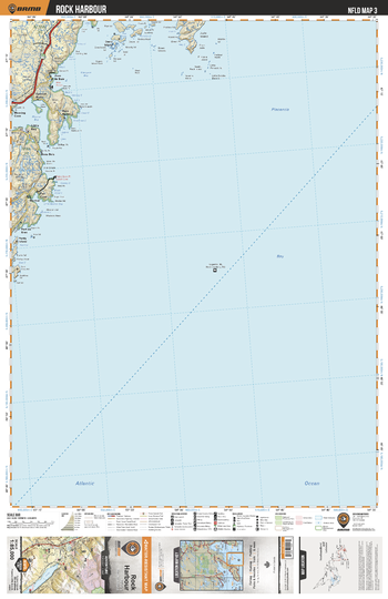
NLNL03 Rock Harbour - Newfoundland and Labrador Topo
Backroad Mapbooks
This recreation topographic map for Rock Harbour highlights all the logging/resource roads, hunting areas, fishing lakes & streams, campsites, paddling routes for canoeing and kayaking, wildlife viewing areas, multi-use trails for hiking, biking, horseback riding, cross-country skiing and snowshoeing, motorized trails for ATVing and snowmobiling & more. Covering 3,040 km2 (1,170 mi2), this 1:85,000 scale map measures 48 x 63.5 km (30 x 39.5 mi), providing you with more topographic and recreational detail for the Fortune area than any other map on the market. Special features include countless roads, trails and recreational Points of Interest. Included on this map are Rock Harbour, Davis Island, D'Argent Bay, Jude Island, Mortier Bay and more!
Page Size: 24 x 37 in (610 x 940 mm)
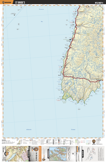
NLNL04 St Bride's - Newfoundland and Labrador Topo
Backroad Mapbooks
This recreation topographic map for St Bride's highlights all the logging/resource roads, hunting areas, fishing lakes & streams, campsites, paddling routes for canoeing and kayaking, wildlife viewing areas, multi-use trails for hiking, biking, horseback riding, cross-country skiing and snowshoeing, motorized trails for ATVing and snowmobiling & more. Covering 3,040 km2 (1,170 mi2), this 1:85,000 scale map measures 48 x 63.5 km (30 x 39.5 mi), providing you with more topographic and recreational detail for the Fortune area than any other map on the market. Special features include countless roads, trails and recreational Points of Interest. Included on this map are St Brides, Placentia Bay, Cape St Mary's Ecological Reserve, Gooseberry Cove Provincial Park, Bucket River and more!
Page Size: 24 x 37 in (610 x 940 mm)
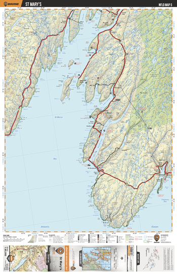
NLNL05 St Mary's - Newfoundland and Labrador Topo
Backroad Mapbooks
This recreation topographic map for St Mary's highlights all the logging/resource roads, hunting areas, fishing lakes & streams, campsites, paddling routes for canoeing and kayaking, wildlife viewing areas, multi-use trails for hiking, biking, horseback riding, cross-country skiing and snowshoeing, motorized trails for ATVing and snowmobiling & more. Covering 3,040 km2 (1,170 mi2), this 1:85,000 scale map measures 48 x 63.5 km (30 x 39.5 mi), providing you with more topographic and recreational detail for the Fortune area than any other map on the market. Special features include countless roads, trails and recreational Points of Interest. Included on this map are Trepassey, Trepassey Bay, Avalon Wilderness Area, Holyrood Pond, Riverhead, St Mary's and more!
Page Size: 24 x 37 in (610 x 940 mm)
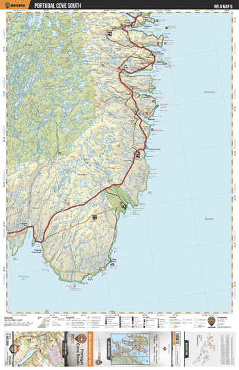
NLNL06 Portugal Cove South - Newfoundland and Labrador Topo
Backroad Mapbooks
This recreation topographic map for Portugal Cove South highlights all the logging/resource roads, hunting areas, fishing lakes & streams, campsites, paddling routes for canoeing and kayaking, wildlife viewing areas, multi-use trails for hiking, biking, horseback riding, cross-country skiing and snowshoeing, motorized trails for ATVing and snowmobiling & more. Covering 3,040 km2 (1,170 mi2), this 1:85,000 scale map measures 48 x 63.5 km (30 x 39.5 mi), providing you with more topographic and recreational detail for the Fortune area than any other map on the market. Special features include countless roads, trails and recreational Points of Interest. Included on this map are Portugal Cove South, Chance Cove Provincial Park, Avalon Wilderness Reserve, Stevens Pond and more!
Page Size: 24 x 37 in (610 x 940 mm)
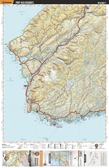
NLNL07 Port aux Basques - Newfoundland and Labrador Topo
Backroad Mapbooks
This recreation topographic map for Port aux Basques highlights all the logging/resource roads, hunting areas, fishing lakes & streams, campsites, paddling routes for canoeing and kayaking, wildlife viewing areas, multi-use trails for hiking, biking, horseback riding, cross-country skiing and snowshoeing, motorized trails for ATVing and snowmobiling & more. Covering 3,040 km2 (1,170 mi2), this 1:85,000 scale map measures 48 x 63.5 km (30 x 39.5 mi), providing you with more topographic and recreational detail for the Fortune area than any other map on the market. Special features include countless roads, trails and recreational Points of Interest. Included on this map are Port aux Basques, St Georges Bay, Gulf of St Lawrence, JT Cheeseman Provincial Park, Grand Codroy, Provincial Park, Codroy River and more!
Page Size: 24 x 37 in (610 x 940 mm)
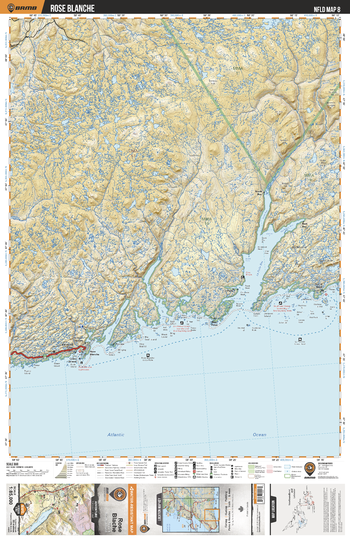
NLNL08 Rose Blanche - Newfoundland and Labrador Topo
Backroad Mapbooks
This recreation topographic map for Rose Blanche highlights all the logging/resource roads, hunting areas, fishing lakes & streams, campsites, paddling routes for canoeing and kayaking, wildlife viewing areas, multi-use trails for hiking, biking, horseback riding, cross-country skiing and snowshoeing, motorized trails for ATVing and snowmobiling & more. Covering 3,040 km2 (1,170 mi2), this 1:85,000 scale map measures 48 x 63.5 km (30 x 39.5 mi), providing you with more topographic and recreational detail for the Fortune area than any other map on the market. Special features include countless roads, trails and recreational Points of Interest. Included on this map are Rose Blanche, La Poile Bay, Garia Bay, West Point, North Bay, Bay Le Moine and more!
Page Size: 24 x 37 in (610 x 940 mm)
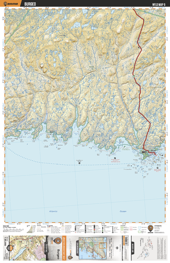
NLNL09 Burgeo - Newfoundland and Labrador Topo
Backroad Mapbooks
This recreation topographic map for Burgeo highlights all the logging/resource roads, hunting areas, fishing lakes & streams, campsites, paddling routes for canoeing and kayaking, wildlife viewing areas, multi-use trails for hiking, biking, horseback riding, cross-country skiing and snowshoeing, motorized trails for ATVing and snowmobiling & more. Covering 3,040 km2 (1,170 mi2), this 1:85,000 scale map measures 48 x 63.5 km (30 x 39.5 mi), providing you with more topographic and recreational detail for the Fortune area than any other map on the market. Special features include countless roads, trails and recreational Points of Interest. Included on this map are Burgeo, Grandy Brook, Sandbanks Provincial Park, Burnt Head Cove, Connoire Bay and more!
Page Size: 24 x 37 in (610 x 940 mm)
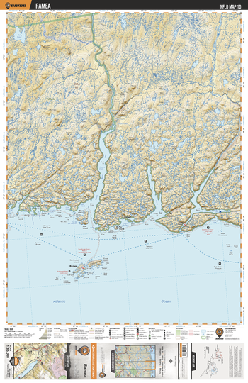
NLNL10 Ramea - Newfoundland and Labrador Topo
Backroad Mapbooks
This recreation topographic map for Ramea highlights all the logging/resource roads, hunting areas, fishing lakes & streams, campsites, paddling routes for canoeing and kayaking, wildlife viewing areas, multi-use trails for hiking, biking, horseback riding, cross-country skiing and snowshoeing, motorized trails for ATVing and snowmobiling & more. Covering 3,040 km2 (1,170 mi2), this 1:85,000 scale map measures 48 x 63.5 km (30 x 39.5 mi), providing you with more topographic and recreational detail for the Fortune area than any other map on the market. Special features include countless roads, trails and recreational Points of Interest. Included on this map are Ramea, White Bear Bay, White Bear River, Grey River, Bay de Vieux, Top Pond and more!
Page Size: 24 x 37 in (610 x 940 mm)
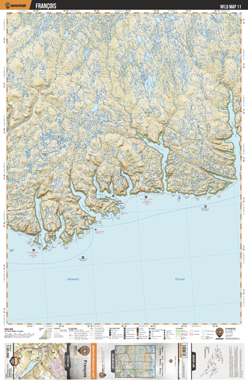
NLNL11 Francois - Newfoundland and Labrador Topo
Backroad Mapbooks
This recreation topographic map for Francois highlights all the logging/resource roads, hunting areas, fishing lakes & streams, campsites, paddling routes for canoeing and kayaking, wildlife viewing areas, multi-use trails for hiking, biking, horseback riding, cross-country skiing and snowshoeing, motorized trails for ATVing and snowmobiling & more. Covering 3,040 km2 (1,170 mi2), this 1:85,000 scale map measures 48 x 63.5 km (30 x 39.5 mi), providing you with more topographic and recreational detail for the Fortune area than any other map on the market. Special features include countless roads, trails and recreational Points of Interest. Included on this map are Francois, Grey River, Hare Bay, Chaleur Bay, Dolland Brook, Facheux Bay, Dragon Bay and more!
Page Size: 24 x 37 in (610 x 940 mm)
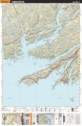
NLNL12 Harbour Breton - Newfoundland and Labrador Topo
Backroad Mapbooks
This recreation topographic map for Harbour Breton highlights all the logging/resource roads, hunting areas, fishing lakes & streams, campsites, paddling routes for canoeing and kayaking, wildlife viewing areas, multi-use trails for hiking, biking, horseback riding, cross-country skiing and snowshoeing, motorized trails for ATVing and snowmobiling & more. Covering 3,040 km2 (1,170 mi2), this 1:85,000 scale map measures 48 x 63.5 km (30 x 39.5 mi), providing you with more topographic and recreational detail for the Fortune area than any other map on the market. Special features include countless roads, trails and recreational Points of Interest. Included on this map are Harbour Breton, Connaigre Bay, Hermitage Bay, Bay d'Espoit, Seal Cove and more!
Page Size: 24 x 37 in (610 x 940 mm)
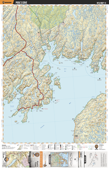
NLNL13 Pool's Cove - Newfoundland and Labrador Topo
Backroad Mapbooks
This recreation topographic map for Pool's Cove highlights all the logging/resource roads, hunting areas, fishing lakes & streams, campsites, paddling routes for canoeing and kayaking, wildlife viewing areas, multi-use trails for hiking, biking, horseback riding, cross-country skiing and snowshoeing, motorized trails for ATVing and snowmobiling & more. Covering 3,040 km2 (1,170 mi2), this 1:85,000 scale map measures 48 x 63.5 km (30 x 39.5 mi), providing you with more topographic and recreational detail for the Fortune area than any other map on the market. Special features include countless roads, trails and recreational Points of Interest. Included on this map are Pool's Cove, Belle Bay, Fortune Bay, Bay du Nord Wilderness Reserve, Mal Bay, Bay du Nord River and more!
Page Size: 24 x 37 in (610 x 940 mm)
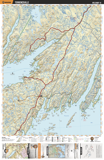
NLNL14 Terrenceville - Newfoundland and Labrador Topo
Backroad Mapbooks
This recreation topographic map for Terrenceville highlights all the logging/resource roads, hunting areas, fishing lakes & streams, campsites, paddling routes for canoeing and kayaking, wildlife viewing areas, multi-use trails for hiking, biking, horseback riding, cross-country skiing and snowshoeing, motorized trails for ATVing and snowmobiling & more. Covering 3,040 km2 (1,170 mi2), this 1:85,000 scale map measures 48 x 63.5 km (30 x 39.5 mi), providing you with more topographic and recreational detail for the Fortune area than any other map on the market. Special features include countless roads, trails and recreational Points of Interest. Included on this map are Terrenceville, Fortune Bay, Placentia Bay, Paradise Sound, Long Harbour, Gisborne Lake and more!
Page Size: 24 x 37 in (610 x 940 mm)
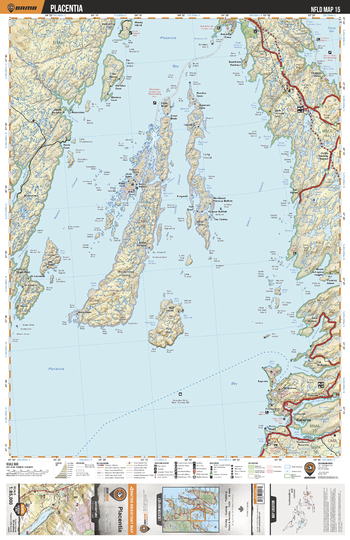
NLNL15 Placentia - Newfoundland and Labrador Topo
Backroad Mapbooks
This recreation topographic map for Placentia highlights all the logging/resource roads, hunting areas, fishing lakes & streams, campsites, paddling routes for canoeing and kayaking, wildlife viewing areas, multi-use trails for hiking, biking, horseback riding, cross-country skiing and snowshoeing, motorized trails for ATVing and snowmobiling & more. Covering 3,040 km2 (1,170 mi2), this 1:85,000 scale map measures 48 x 63.5 km (30 x 39.5 mi), providing you with more topographic and recreational detail for the Fortune area than any other map on the market. Special features include countless roads, trails and recreational Points of Interest. Included on this map are Placentia, Placentia Bay, Long Island, Merasheen Island, Sandy Harbour River, Trinity Bay and more!
Page Size: 24 x 37 in (610 x 940 mm)
No search results