


MapSherpa Catalog
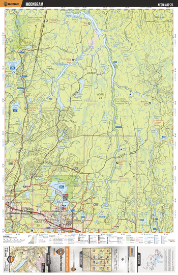
NEON76 Moonbeam - Northeastern Ontario Topo
Backroad Mapbooks
This recreation topographic map for Moonbeam highlights all the logging/resource roads, hunting areas, fishing lakes & streams, campsites, paddling routes for canoeing and kayaking, wildlife viewing areas, multi-use trails for hiking, biking, horseback riding, cross-country skiing and snowshoeing, motorized trails for ATVing and snowmobiling & more. Covering 3,040 km2 (1,170 mi2), this 1:85,000 scale map measures 48 x 63.5 km (30 x 39.5 mi), providing you with more topographic and recreational detail for the Meldrum Bay area than any other map on the market. New features include Crown land areas, countless new roads and trails plus additional recreational Points of Interest. Included on this map are Moonbeam, Remi Lake, Audrey Lake, Lily Lake, Groundhog River, Groundhog River Waterway Provincial Park and more!
Page Size: 24 x 37 in (610 x 940 mm)
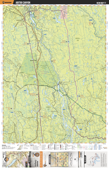
NEON77 Abitibi Canyon - Northeastern Ontario Topo
Backroad Mapbooks
This recreation topographic map for Abitibi Canyon highlights all the logging/resource roads, hunting areas, fishing lakes & streams, campsites, paddling routes for canoeing and kayaking, wildlife viewing areas, multi-use trails for hiking, biking, horseback riding, cross-country skiing and snowshoeing, motorized trails for ATVing and snowmobiling & more. Covering 3,040 km2 (1,170 mi2), this 1:85,000 scale map measures 48 x 63.5 km (30 x 39.5 mi), providing you with more topographic and recreational detail for the Meldrum Bay area than any other map on the market. New features include Crown land areas, countless new roads and trails plus additional recreational Points of Interest. Included on this map are Abitibi Canyon, Abitibi River, Little Abitibi River, Mattagami River, Beniah Lake, Takwata Lake and more!
Page Size: 24 x 37 in (610 x 940 mm)
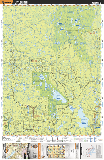
NEON78 Little Abitibi - Northeastern Ontario Topo
Backroad Mapbooks
This recreation topographic map for Little Abitibi highlights all the logging/resource roads, hunting areas, fishing lakes & streams, campsites, paddling routes for canoeing and kayaking, wildlife viewing areas, multi-use trails for hiking, biking, horseback riding, cross-country skiing and snowshoeing, motorized trails for ATVing and snowmobiling & more. Covering 3,040 km2 (1,170 mi2), this 1:85,000 scale map measures 48 x 63.5 km (30 x 39.5 mi), providing you with more topographic and recreational detail for the Meldrum Bay area than any other map on the market. New features include Crown land areas, countless new roads and trails plus additional recreational Points of Interest. Included on this map are Little Abitibi, Little Abitibi Provincial Park, Harris Lake, Pierre Lake, Hughes Lake, Sangster Lake and more!
Page Size: 24 x 37 in (610 x 940 mm)
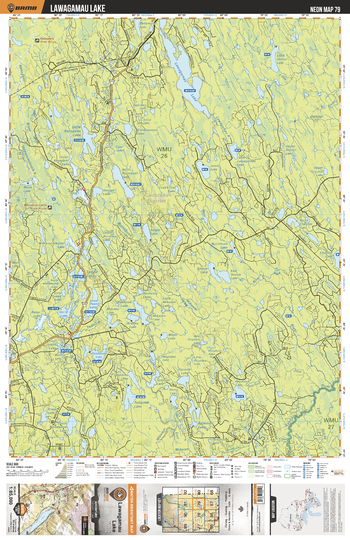
NEON79 Lawagamu Lake - Northeastern Ontario Topo
Backroad Mapbooks
This recreation topographic map for Lawagamu Lake highlights all the logging/resource roads, hunting areas, fishing lakes & streams, campsites, paddling routes for canoeing and kayaking, wildlife viewing areas, multi-use trails for hiking, biking, horseback riding, cross-country skiing and snowshoeing, motorized trails for ATVing and snowmobiling & more. Covering 3,040 km2 (1,170 mi2), this 1:85,000 scale map measures 48 x 63.5 km (30 x 39.5 mi), providing you with more topographic and recreational detail for the Meldrum Bay area than any other map on the market. New features include Crown land areas, countless new roads and trails plus additional recreational Points of Interest. Included on this map are Lawagamau Lake, Lawagamau River, Little Detour Lake, Floodwood Lake, Lower Tweed Lake and more!
Page Size: 24 x 37 in (610 x 940 mm)
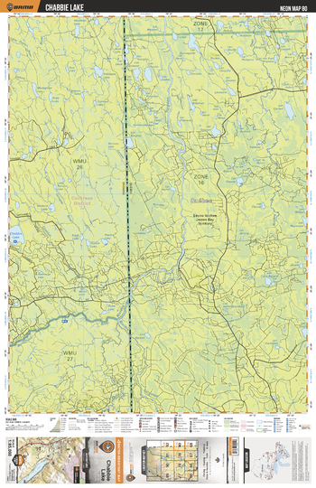
NEON80 Chabbie Lake - Northeastern Ontario Topo
Backroad Mapbooks
This recreation topographic map for Chabbie Lake highlights all the logging/resource roads, hunting areas, fishing lakes & streams, campsites, paddling routes for canoeing and kayaking, wildlife viewing areas, multi-use trails for hiking, biking, horseback riding, cross-country skiing and snowshoeing, motorized trails for ATVing and snowmobiling & more. Covering 3,040 km2 (1,170 mi2), this 1:85,000 scale map measures 48 x 63.5 km (30 x 39.5 mi), providing you with more topographic and recreational detail for the Meldrum Bay area than any other map on the market. New features include Crown land areas, countless new roads and trails plus additional recreational Points of Interest. Included on this map are Chabbie Lake, Burntbush River, Turcotte River, Monaghan Lake, Atkinson Lake and more!
Page Size: 24 x 37 in (610 x 940 mm)
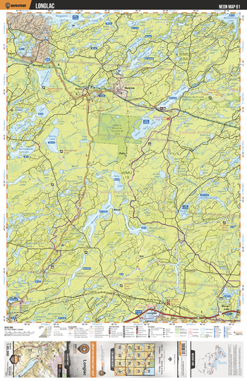
NEON81 Longlac - Northeastern Ontario Topo
Backroad Mapbooks
This recreation topographic map for Longlac highlights all the logging/resource roads, hunting areas, fishing lakes & streams, campsites, paddling routes for canoeing and kayaking, wildlife viewing areas, multi-use trails for hiking, biking, horseback riding, cross-country skiing and snowshoeing, motorized trails for ATVing and snowmobiling & more. Covering 3,040 km2 (1,170 mi2), this 1:85,000 scale map measures 48 x 63.5 km (30 x 39.5 mi), providing you with more topographic and recreational detail for the Meldrum Bay area than any other map on the market. New features include Crown land areas, countless new roads and trails plus additional recreational Points of Interest. Included on this map are Longlac, Nakina Moraine Provincial Park, Murky Lake, Fleming Lake, Springwater Lake, Burrows Lake and more!
Page Size: 24 x 37 in (610 x 940 mm)
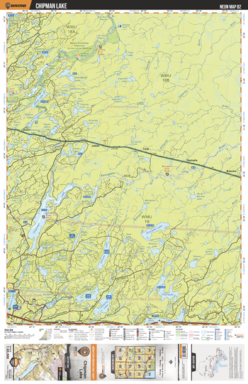
NEON82 Chipman Lake - Northeastern Ontario Topo
Backroad Mapbooks
This recreation topographic map for Chipman Lake highlights all the logging/resource roads, hunting areas, fishing lakes & streams, campsites, paddling routes for canoeing and kayaking, wildlife viewing areas, multi-use trails for hiking, biking, horseback riding, cross-country skiing and snowshoeing, motorized trails for ATVing and snowmobiling & more. Covering 3,040 km2 (1,170 mi2), this 1:85,000 scale map measures 48 x 63.5 km (30 x 39.5 mi), providing you with more topographic and recreational detail for the Meldrum Bay area than any other map on the market. New features include Crown land areas, countless new roads and trails plus additional recreational Points of Interest. Included on this map are Chipman Lake, Shacabac Lake, Kenogami River, Fernow Lake, Flint Lake, Klotz Lake, Buell Lake and more!
Page Size: 24 x 37 in (610 x 940 mm)
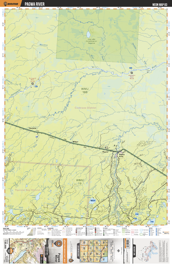
NEON83 Pagwa River - Northeastern Ontario Topo
Backroad Mapbooks
This recreation topographic map for Pagwa River highlights all the logging/resource roads, hunting areas, fishing lakes & streams, campsites, paddling routes for canoeing and kayaking, wildlife viewing areas, multi-use trails for hiking, biking, horseback riding, cross-country skiing and snowshoeing, motorized trails for ATVing and snowmobiling & more. Covering 3,040 km2 (1,170 mi2), this 1:85,000 scale map measures 48 x 63.5 km (30 x 39.5 mi), providing you with more topographic and recreational detail for the Meldrum Bay area than any other map on the market. New features include Crown land areas, countless new roads and trails plus additional recreational Points of Interest. Included on this map are Pagwa River, Eureka Lake, Sunshine Lake, Flint River, Kenogami River and more!
Page Size: 24 x 37 in (610 x 940 mm)
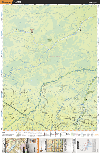
NEON84 Savoff - Northeastern Ontario Topo
Backroad Mapbooks
This recreation topographic map for Savoff highlights all the logging/resource roads, hunting areas, fishing lakes & streams, campsites, paddling routes for canoeing and kayaking, wildlife viewing areas, multi-use trails for hiking, biking, horseback riding, cross-country skiing and snowshoeing, motorized trails for ATVing and snowmobiling & more. Covering 3,040 km2 (1,170 mi2), this 1:85,000 scale map measures 48 x 63.5 km (30 x 39.5 mi), providing you with more topographic and recreational detail for the Meldrum Bay area than any other map on the market. New features include Crown land areas, countless new roads and trails plus additional recreational Points of Interest. Included on this map are Savoff, Kenogami River, Otasawian River, Pagwachuan River, Nagagamisis Provincial Park and more!
Page Size: 24 x 37 in (610 x 940 mm)
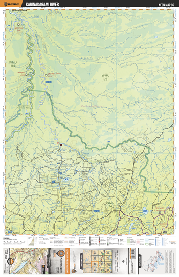
NEON85 Kabinakagami River - Northeastern Ontario Topo
Backroad Mapbooks
This recreation topographic map for Kabinakagami River highlights all the logging/resource roads, hunting areas, fishing lakes & streams, campsites, paddling routes for canoeing and kayaking, wildlife viewing areas, multi-use trails for hiking, biking, horseback riding, cross-country skiing and snowshoeing, motorized trails for ATVing and snowmobiling & more. Covering 3,040 km2 (1,170 mi2), this 1:85,000 scale map measures 48 x 63.5 km (30 x 39.5 mi), providing you with more topographic and recreational detail for the Meldrum Bay area than any other map on the market. New features include Crown land areas, countless new roads and trails plus additional recreational Points of Interest. Included on this map are Kabinakagami River, Nagagamisis Provincial Park, Otasawian River, Nagagami River and more!
Page Size: 24 x 37 in (610 x 940 mm)
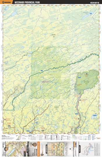
NEON86 Missinaibi Provincial Park - Northeastern Ontario Topo
Backroad Mapbooks
This recreation topographic map for Missinaibi Provincial Park highlights all the logging/resource roads, hunting areas, fishing lakes & streams, campsites, paddling routes for canoeing and kayaking, wildlife viewing areas, multi-use trails for hiking, biking, horseback riding, cross-country skiing and snowshoeing, motorized trails for ATVing and snowmobiling & more. Covering 3,040 km2 (1,170 mi2), this 1:85,000 scale map measures 48 x 63.5 km (30 x 39.5 mi), providing you with more topographic and recreational detail for the Meldrum Bay area than any other map on the market. New features include Crown land areas, countless new roads and trails plus additional recreational Points of Interest. Included on this map are Missinaibi Provincial Park, Missinaibi River, Pivabiska River, Coal River, Ritchie Lake and more!
Page Size: 24 x 37 in (610 x 940 mm)
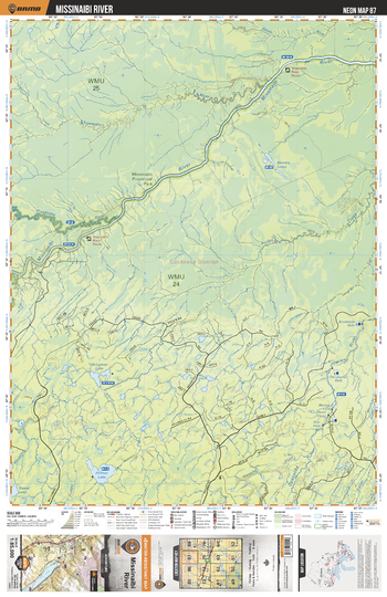
NEON87 Missinaibi River - Northeastern Ontario Topo
Backroad Mapbooks
This recreation topographic map for Missinaibi River highlights all the logging/resource roads, hunting areas, fishing lakes & streams, campsites, paddling routes for canoeing and kayaking, wildlife viewing areas, multi-use trails for hiking, biking, horseback riding, cross-country skiing and snowshoeing, motorized trails for ATVing and snowmobiling & more. Covering 3,040 km2 (1,170 mi2), this 1:85,000 scale map measures 48 x 63.5 km (30 x 39.5 mi), providing you with more topographic and recreational detail for the Meldrum Bay area than any other map on the market. New features include Crown land areas, countless new roads and trails plus additional recreational Points of Interest. Included on this map are Missinaibi River, Missinaibi Provincial Park, Hilmer Lake, Opasatika River and more!
Page Size: 24 x 37 in (610 x 940 mm)
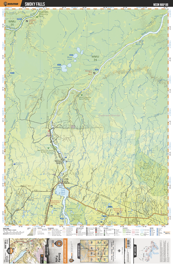
NEON88 Smoky Falls - Northeastern Ontario Topo
Backroad Mapbooks
This recreation topographic map for Smoky Falls highlights all the logging/resource roads, hunting areas, fishing lakes & streams, campsites, paddling routes for canoeing and kayaking, wildlife viewing areas, multi-use trails for hiking, biking, horseback riding, cross-country skiing and snowshoeing, motorized trails for ATVing and snowmobiling & more. Covering 3,040 km2 (1,170 mi2), this 1:85,000 scale map measures 48 x 63.5 km (30 x 39.5 mi), providing you with more topographic and recreational detail for the Meldrum Bay area than any other map on the market. New features include Crown land areas, countless new roads and trails plus additional recreational Points of Interest. Included on this map are Smoky Falls, Mattagami River, Campbell Lake, Little Long Rapids, Missinabi River Provincial Park and more!
Page Size: 24 x 37 in (610 x 940 mm)
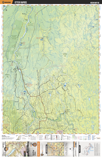
NEON89 Otter Rapids - Northeastern Ontario Topo
Backroad Mapbooks
This recreation topographic map for Otter Rapids highlights all the logging/resource roads, hunting areas, fishing lakes & streams, campsites, paddling routes for canoeing and kayaking, wildlife viewing areas, multi-use trails for hiking, biking, horseback riding, cross-country skiing and snowshoeing, motorized trails for ATVing and snowmobiling & more. Covering 3,040 km2 (1,170 mi2), this 1:185,000 scale map measures 48 x 63.5 km (30 x 39.5 mi), providing you with more topographic and recreational detail for the Meldrum Bay area than any other map on the market. New features include Crown land areas, countless new roads and trails plus additional recreational Points of Interest. Included on this map are Otter Rapids, Williams Island Provincial Nature Reserve Park, Abitibi River, Little Abitibi River and more!
Page Size: 24 x 37 in (610 x 940 mm)
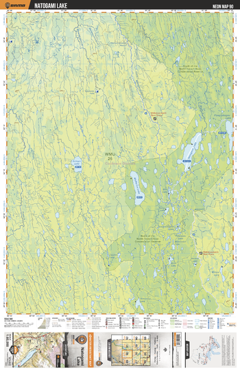
NEON90 Natogami Lake - Northeastern Ontario Topo
Backroad Mapbooks
This recreation topographic map for Natogami Lake highlights all the logging/resource roads, hunting areas, fishing lakes & streams, campsites, paddling routes for canoeing and kayaking, wildlife viewing areas, multi-use trails for hiking, biking, horseback riding, cross-country skiing and snowshoeing, motorized trails for ATVing and snowmobiling & more. Covering 3,040 km2 (1,170 mi2), this 1:185,000 scale map measures 48 x 63.5 km (30 x 39.5 mi), providing you with more topographic and recreational detail for the Meldrum Bay area than any other map on the market. New features include Crown land areas, countless new roads and trails plus additional recreational Points of Interest. Included on this map are Natogami Lake, McParlon Lake, North of the North French River Conservation Reserve, Tomorrow Lake and more!
Page Size: 24 x 37 in (610 x 940 mm)
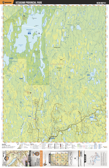
NEON91 Kesagami Provincial Park - Northeastern Ontario Topo
Backroad Mapbooks
This recreation topographic map for Kesagami Provincial Park highlights all the logging/resource roads, hunting areas, fishing lakes & streams, campsites, paddling routes for canoeing and kayaking, wildlife viewing areas, multi-use trails for hiking, biking, horseback riding, cross-country skiing and snowshoeing, motorized trails for ATVing and snowmobiling & more. Covering 3,040 km2 (1,170 mi2), this 1:185,000 scale map measures 48 x 63.5 km (30 x 39.5 mi), providing you with more topographic and recreational detail for the Meldrum Bay area than any other map on the market. New features include Crown land areas, countless new roads and trails plus additional recreational Points of Interest. Included on this map are Kesagami Provincial Park, Kesagami Lake, Edgar Lake, Shashiskau River, Lawagamau River and more!
Page Size: 24 x 37 in (610 x 940 mm)
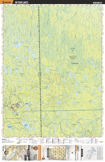
NEON92 Detour Lakes - Northeastern Ontario Topo
Backroad Mapbooks
This recreation topographic map for Detour Lakes highlights all the logging/resource roads, hunting areas, fishing lakes & streams, campsites, paddling routes for canoeing and kayaking, wildlife viewing areas, multi-use trails for hiking, biking, horseback riding, cross-country skiing and snowshoeing, motorized trails for ATVing and snowmobiling & more. Covering 3,040 km2 (1,170 mi2), this 1:185,000 scale map measures 48 x 63.5 km (30 x 39.5 mi), providing you with more topographic and recreational detail for the Meldrum Bay area than any other map on the market. New features include Crown land areas, countless new roads and trails plus additional recreational Points of Interest. Included on this map are Detour Lakes, Sunday Lake, Corner Lakes, Thomas Lake, Miles Lake, Sagimeo Lake and more!
Page Size: 24 x 37 in (610 x 940 mm)
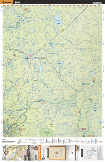
NEON93 Ogoki - Northeastern Ontario Topo
Backroad Mapbooks
This recreation topographic map for Ogoki highlights all the logging/resource roads, hunting areas, fishing lakes & streams, campsites, paddling routes for canoeing and kayaking, wildlife viewing areas, multi-use trails for hiking, biking, horseback riding, cross-country skiing and snowshoeing, motorized trails for ATVing and snowmobiling & more. Covering 48,670 km2 (18,890 mi2), this 1:330,000 scale map measures 191 x 254 km (119 x 158 mi), providing you with more topographic and recreational detail for the Ogoki area than any other map on the market. New features include Crown land areas, countless new roads and trails plus additional recreational Points of Interest. Included on this map are Albany River, Albany River Provincial Park, Attawapiskat River, Jog Lake Conservation Area, Kenogami River, Mammamattawa, Nakina Northeast Waterway Conservation Reserve, Ogoki River, Otoskwin-Attawapiskat River Provincial Park and more!
Page Size: 24 x 37 in (610 x 940 mm)
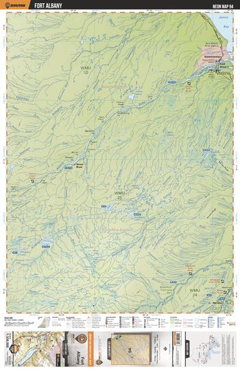
NEON94 Fort Albany - Northeastern Ontario Topo
Backroad Mapbooks
This recreation topographic map for Fort Albany highlights all the logging/resource roads, hunting areas, fishing lakes & streams, campsites, paddling routes for canoeing and kayaking, wildlife viewing areas, multi-use trails for hiking, biking, horseback riding, cross-country skiing and snowshoeing, motorized trails for ATVing and snowmobiling & more. Covering 48,670 km2 (18,890 mi2), this 1:330,000 scale map measures 191 x 254 km (119 x 158 mi), providing you with more topographic and recreational detail for the Ogoki area than any other map on the market. New features include Crown land areas, countless new roads and trails plus additional recreational Points of Interest. Included on this map are James Bay, Kashechewan, Fort Albany, Albany River, Ghost River, Missinaibi Prov Park, Missinaibi River, Mattagami River, Abitibi River, Ranoke and more!
Page Size: 24 x 37 in (610 x 940 mm)
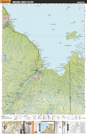
NEON95 Moosonee Moose Factory - Northeastern Ontario Topo
Backroad Mapbooks
This recreation topographic map for Moosonee Moose Factory highlights all the logging/resource roads, hunting areas, fishing lakes & streams, campsites, paddling routes for canoeing and kayaking, wildlife viewing areas, multi-use trails for hiking, biking, horseback riding, cross-country skiing and snowshoeing, motorized trails for ATVing and snowmobiling & more. Covering 48,670 km2 (18,890 mi2), this 1:330,000 scale map measures 191 x 254 km (119 x 158 mi), providing you with more topographic and recreational detail for the Ogoki area than any other map on the market. New features include Crown land areas, countless new roads and trails plus additional recreational Points of Interest. Included on this map are James Bay, Moose Factory, Moosonee, Harricanaw River, Kesagami River, Kesagami Prov Park, Abitibi River, Moose River, Fort Albany, Kashechewan and more!
Page Size: 24 x 37 in (610 x 940 mm)
No search results