


MapSherpa Catalog
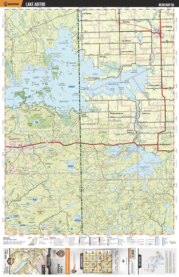
NEON56 Lake Abitibi - Northeastern Ontario Topo
Backroad Mapbooks
This recreation topographic map for Lake Abitibi highlights all the logging/resource roads, hunting areas, fishing lakes & streams, campsites, paddling routes for canoeing and kayaking, wildlife viewing areas, multi-use trails for hiking, biking, horseback riding, cross-country skiing and snowshoeing, motorized trails for ATVing and snowmobiling & more. Covering 3,040 km2 (1,170 mi2), this 1:85,000 scale map measures 48 x 63.5 km (30 x 39.5 mi), providing you with more topographic and recreational detail for the Meldrum Bay area than any other map on the market. New features include Crown land areas, countless new roads and trails plus additional recreational Points of Interest. Included on this map are Lake Abitibi, McDiarmid Lake, Lightning River, Webster Lake, Magusi River, Okikodosik Bay, Trollode Lake, Teddy Bear Marsh, Dokis Creek, Mattawasaga River and more!
Page Size: 24 x 37 in (610 x 940 mm)
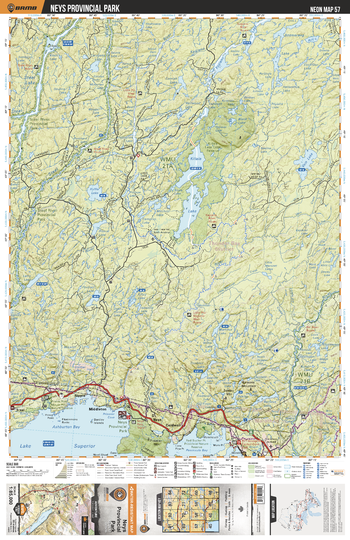
NEON57 Neys Provincial Park - Northeastern Ontario Topo
Backroad Mapbooks
This recreation topographic map for Neys Provincial Park highlights all the logging/resource roads, hunting areas, fishing lakes & streams, campsites, paddling routes for canoeing and kayaking, wildlife viewing areas, multi-use trails for hiking, biking, horseback riding, cross-country skiing and snowshoeing, motorized trails for ATVing and snowmobiling & more. Covering 3,040 km2 (1,170 mi2), this 1:85,000 scale map measures 48 x 63.5 km (30 x 39.5 mi), providing you with more topographic and recreational detail for the Meldrum Bay area than any other map on the market. New features include Crown land areas, countless new roads and trails plus additional recreational Points of Interest. Included on this map are Killala Lake, Vein Lake, Ruffle Lake, Steel River, Kagiano Lake, Boomerang Lake, Ashburton Bay, Red Sucker Point Prov Nature Reserve, Neys Prov Park, Pic River and more!
Page Size: 24 x 37 in (610 x 940 mm)
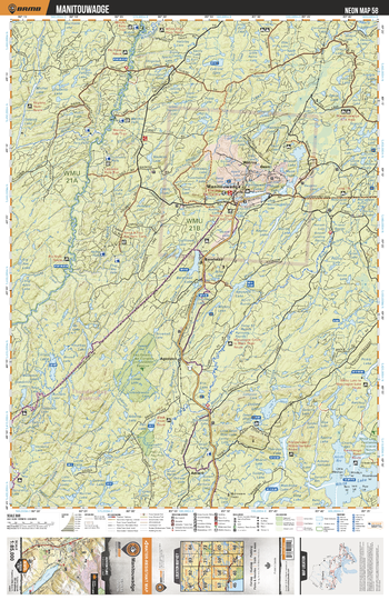
NEON58 Manitouwadge - Northeastern Ontario Topo
Backroad Mapbooks
This recreation topographic map for Manitouwadge highlights all the logging/resource roads, hunting areas, fishing lakes & streams, campsites, paddling routes for canoeing and kayaking, wildlife viewing areas, multi-use trails for hiking, biking, horseback riding, cross-country skiing and snowshoeing, motorized trails for ATVing and snowmobiling & more. Covering 3,040 km2 (1,170 mi2), this 1:85,000 scale map measures 48 x 63.5 km (30 x 39.5 mi), providing you with more topographic and recreational detail for the Meldrum Bay area than any other map on the market. New features include Crown land areas, countless new roads and trails plus additional recreational Points of Interest. Included on this map are White Lake, Manitouwadge, Pic River, Willroy, Barehead, Agonzon, Amwri, Theresa Lake, Ravine Lake, Black River and more!
Page Size: 24 x 37 in (610 x 940 mm)
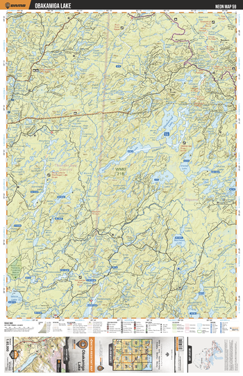
NEON59 Obakamiga Lake - Northeastern Ontario Topo
Backroad Mapbooks
This recreation topographic map for Obakamiga Lake highlights all the logging/resource roads, hunting areas, fishing lakes & streams, campsites, paddling routes for canoeing and kayaking, wildlife viewing areas, multi-use trails for hiking, biking, horseback riding, cross-country skiing and snowshoeing, motorized trails for ATVing and snowmobiling & more. Covering 3,040 km2 (1,170 mi2), this 1:85,000 scale map measures 48 x 63.5 km (30 x 39.5 mi), providing you with more topographic and recreational detail for the Meldrum Bay area than any other map on the market. New features include Crown land areas, countless new roads and trails plus additional recreational Points of Interest. Included on this map are Obakamiga Lake, Granitehill Lake, Matthews Lake, Shekak Lake, Tocheri Lake, Garnham Lake, Gum River, Shabotik River, Kwinkwaga River, Obakamiga River and more!
Page Size: 24 x 37 in (610 x 940 mm)
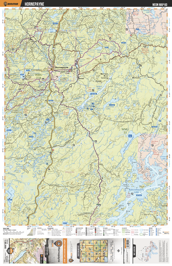
NEON60 Hornepayne - Northeastern Ontario Topo
Backroad Mapbooks
This recreation topographic map for Hornepayne highlights all the logging/resource roads, hunting areas, fishing lakes & streams, campsites, paddling routes for canoeing and kayaking, wildlife viewing areas, multi-use trails for hiking, biking, horseback riding, cross-country skiing and snowshoeing, motorized trails for ATVing and snowmobiling & more. Covering 3,040 km2 (1,170 mi2), this 1:85,000 scale map measures 48 x 63.5 km (30 x 39.5 mi), providing you with more topographic and recreational detail for the Meldrum Bay area than any other map on the market. New features include Crown land areas, countless new roads and trails plus additional recreational Points of Interest. Included on this map are Kabinakagami Lake, Beaton River, Hornepayne, Larkin Lake, Lennon, Shekak River, Becker, Shekak, Morrison River Landing, Penhurst and more!
Page Size: 24 x 37 in (610 x 940 mm)
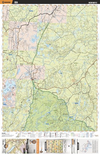
NEON61 Oba - Northeastern Ontario Topo
Backroad Mapbooks
This recreation topographic map for Oba highlights all the logging/resource roads, hunting areas, fishing lakes & streams, campsites, paddling routes for canoeing and kayaking, wildlife viewing areas, multi-use trails for hiking, biking, horseback riding, cross-country skiing and snowshoeing, motorized trails for ATVing and snowmobiling & more. Covering 3,040 km2 (1,170 mi2), this 1:85,000 scale map measures 48 x 63.5 km (30 x 39.5 mi), providing you with more topographic and recreational detail for the Meldrum Bay area than any other map on the market. New features include Crown land areas, countless new roads and trails plus additional recreational Points of Interest. Included on this map are Oba, Cameron Lake, Mattawitchewan River, Akron, Oba River, Edison Lake, Kabinakagami River, Mattawishkwia River, Wigwam River, Mawgi Lakes and more!
Page Size: 24 x 37 in (610 x 940 mm)
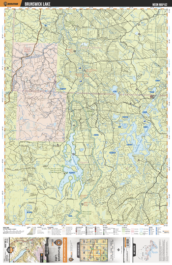
NEON62 Brunswick Lake - Northeastern Ontario Topo
Backroad Mapbooks
This recreation topographic map for Brunswick Lake highlights all the logging/resource roads, hunting areas, fishing lakes & streams, campsites, paddling routes for canoeing and kayaking, wildlife viewing areas, multi-use trails for hiking, biking, horseback riding, cross-country skiing and snowshoeing, motorized trails for ATVing and snowmobiling & more. Covering 3,040 km2 (1,170 mi2), this 1:85,000 scale map measures 48 x 63.5 km (30 x 39.5 mi), providing you with more topographic and recreational detail for the Meldrum Bay area than any other map on the market. New features include Crown land areas, countless new roads and trails plus additional recreational Points of Interest. Included on this map are Opasatika Lake, Penelton Lake, Brunswick Lake, Rufus Lake, Opasatika River, Missinaibi Prov Park, Missinaibi River, Brunswick River, Mattawitchewan River, Goat River and more!
Page Size: 24 x 37 in (610 x 940 mm)
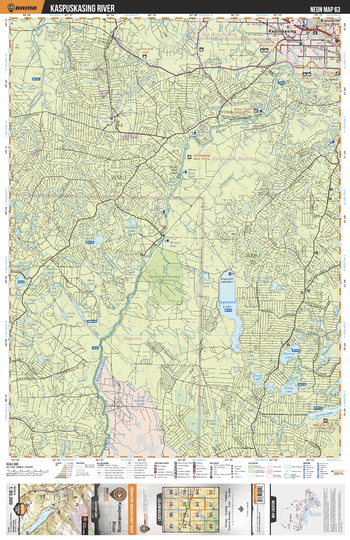
NEON63 Kapuskasing River - Northeastern Ontario Topo
Backroad Mapbooks
This recreation topographic map for Kapuskasing River highlights all the logging/resource roads, hunting areas, fishing lakes & streams, campsites, paddling routes for canoeing and kayaking, wildlife viewing areas, multi-use trails for hiking, biking, horseback riding, cross-country skiing and snowshoeing, motorized trails for ATVing and snowmobiling & more. Covering 3,040 km2 (1,170 mi2), this 1:85,000 scale map measures 48 x 63.5 km (30 x 39.5 mi), providing you with more topographic and recreational detail for the Meldrum Bay area than any other map on the market. New features include Crown land areas, countless new roads and trails plus additional recreational Points of Interest. Included on this map are Saganash Lake, Kapuskasing River, Kapuskasing, Lost River, Opasatika River, Graveyard Creek, Keenoa Lake, Griffin Lake, Wakusimi River, Saganash River and more!
Page Size: 24 x 37 in (610 x 940 mm)
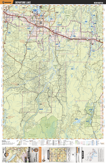
NEON64 Departure Lake - Northeastern Ontario Topo
Backroad Mapbooks
This recreation topographic map for Departure Lak highlights all the logging/resource roads, hunting areas, fishing lakes & streams, campsites, paddling routes for canoeing and kayaking, wildlife viewing areas, multi-use trails for hiking, biking, horseback riding, cross-country skiing and snowshoeing, motorized trails for ATVing and snowmobiling & more. Covering 3,040 km2 (1,170 mi2), this 1:85,000 scale map measures 48 x 63.5 km (30 x 39.5 mi), providing you with more topographic and recreational detail for the Meldrum Bay area than any other map on the market. New features include Crown land areas, countless new roads and trails plus additional recreational Points of Interest. Included on this map are Moonbeam, Fauquier, Strickland, Departure Lake, Kitigan, Remi Lake, Laidlaw Lake, Oke Lake, Groundhog River, Wakusimi River and more!
Page Size: 24 x 37 in (610 x 940 mm)
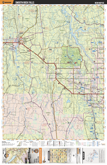
NEON65 Smooth Rock Falls - Northeastern Ontario Topo
Backroad Mapbooks
This recreation topographic map for Smooth Rock Falls highlights all the logging/resource roads, hunting areas, fishing lakes & streams, campsites, paddling routes for canoeing and kayaking, wildlife viewing areas, multi-use trails for hiking, biking, horseback riding, cross-country skiing and snowshoeing, motorized trails for ATVing and snowmobiling & more. Covering 3,040 km2 (1,170 mi2), this 1:85,000 scale map measures 48 x 63.5 km (30 x 39.5 mi), providing you with more topographic and recreational detail for the Meldrum Bay area than any other map on the market. New features include Crown land areas, countless new roads and trails plus additional recreational Points of Interest. Included on this map are Smooth Rock Falls, Abitibi River, Frederick House River, Greenwater Prov Park, Eddie Lake, Jacksonboro, Muskego River, Mattagami River, Deception Lake, Driftwood and more!
Page Size: 24 x 37 in (610 x 940 mm)
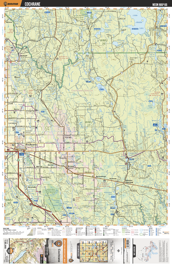
NEON66 Cochrane - Northeastern Ontario Topo
Backroad Mapbooks
This recreation topographic map for Cochrane highlights all the logging/resource roads, hunting areas, fishing lakes & streams, campsites, paddling routes for canoeing and kayaking, wildlife viewing areas, multi-use trails for hiking, biking, horseback riding, cross-country skiing and snowshoeing, motorized trails for ATVing and snowmobiling & more. Covering 3,040 km2 (1,170 mi2), this 1:85,000 scale map measures 48 x 63.5 km (30 x 39.5 mi), providing you with more topographic and recreational detail for the Meldrum Bay area than any other map on the market. New features include Crown land areas, countless new roads and trails plus additional recreational Points of Interest. Included on this map are Cochrane, Little Abitibi Lake, Frederick House River, Abitibi River, Whithington Lake, Chin Lake, Foisie River, Withington Lake, Rofter Lake, Potter Lake and more!
Page Size: 24 x 37 in (610 x 940 mm)
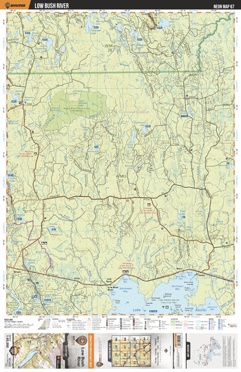
NEON67 Low Bush River - Northeastern Ontario Topo
Backroad Mapbooks
This recreation topographic map for Low Bush River highlights all the logging/resource roads, hunting areas, fishing lakes & streams, campsites, paddling routes for canoeing and kayaking, wildlife viewing areas, multi-use trails for hiking, biking, horseback riding, cross-country skiing and snowshoeing, motorized trails for ATVing and snowmobiling & more. Covering 3,040 km2 (1,170 mi2), this 1:85,000 scale map measures 48 x 63.5 km (30 x 39.5 mi), providing you with more topographic and recreational detail for the Meldrum Bay area than any other map on the market. New features include Crown land areas, countless new roads and trails plus additional recreational Points of Interest. Included on this map are Lake Abitibi, Kabika River, Eades, Mace, Low Bush, Low Bush River, Kirke, Little Abitibi River, Bingle, Circle River and more!
Page Size: 24 x 37 in (610 x 940 mm)
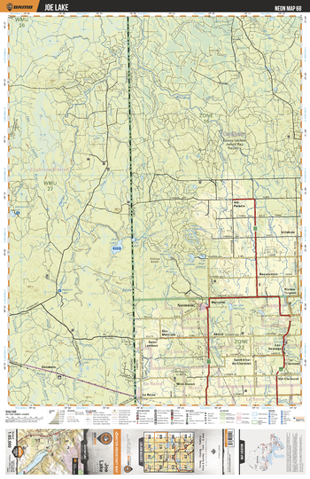
NEON68 Joe Lake - Northeastern Ontario Topo
Backroad Mapbooks
This recreation topographic map for Joe Lake highlights all the logging/resource roads, hunting areas, fishing lakes & streams, campsites, paddling routes for canoeing and kayaking, wildlife viewing areas, multi-use trails for hiking, biking, horseback riding, cross-country skiing and snowshoeing, motorized trails for ATVing and snowmobiling & more. Covering 3,040 km2 (1,170 mi2), this 1:85,000 scale map measures 48 x 63.5 km (30 x 39.5 mi), providing you with more topographic and recreational detail for the Meldrum Bay area than any other map on the market. New features include Crown land areas, countless new roads and trails plus additional recreational Points of Interest. Included on this map are Patten River, Goodwen, Aylen River, Joe Lake, Abbotsford Lake, Abbotsford Creek, East Kabika River, Little Clive River, Hepburn Lake, South Patten River and more!
Page Size: 24 x 37 in (610 x 940 mm)
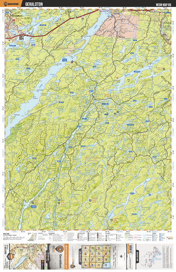
NEON69 Geraldton - Northeastern Ontario Topo
Backroad Mapbooks
This recreation topographic map for Geraldton highlights all the logging/resource roads, hunting areas, fishing lakes & streams, campsites, paddling routes for canoeing and kayaking, wildlife viewing areas, multi-use trails for hiking, biking, horseback riding, cross-country skiing and snowshoeing, motorized trails for ATVing and snowmobiling & more. Covering 3,040 km2 (1,170 mi2), this 1:85,000 scale map measures 48 x 63.5 km (30 x 39.5 mi), providing you with more topographic and recreational detail for the Meldrum Bay area than any other map on the market. New features include Crown land areas, countless new roads and trails plus additional recreational Points of Interest. Included on this map are Geraldton, Long Lake, Macleod Provincial Park, McKay Lake, Steel River, Steel Lake, Little Pic River and more!
Page Size: 24 x 37 in (610 x 940 mm)
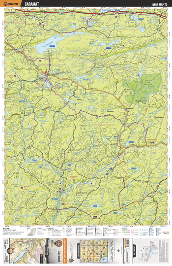
NEON70 Caramat - Northeastern Ontario Topo
Backroad Mapbooks
This recreation topographic map for Caramat highlights all the logging/resource roads, hunting areas, fishing lakes & streams, campsites, paddling routes for canoeing and kayaking, wildlife viewing areas, multi-use trails for hiking, biking, horseback riding, cross-country skiing and snowshoeing, motorized trails for ATVing and snowmobiling & more. Covering 3,040 km2 (1,170 mi2), this 1:85,000 scale map measures 48 x 63.5 km (30 x 39.5 mi), providing you with more topographic and recreational detail for the Meldrum Bay area than any other map on the market. New features include Crown land areas, countless new roads and trails plus additional recreational Points of Interest. Included on this map are Caramat, Pagwachuan Lake, Pagwachuan River, Klotz Lake, Caramat Lake, Slim Jim Lake Conservation Reservation and more!
Page Size: 24 x 37 in (610 x 940 mm)
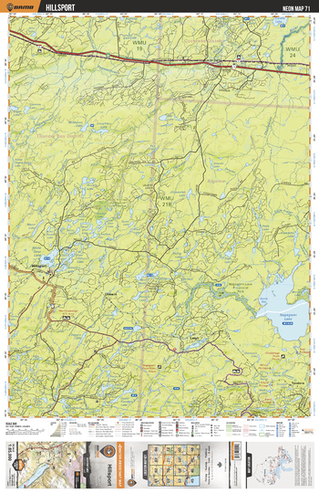
NEON71 Hillsport - Northeastern Ontario Topo
Backroad Mapbooks
This recreation topographic map for Hillsport highlights all the logging/resource roads, hunting areas, fishing lakes & streams, campsites, paddling routes for canoeing and kayaking, wildlife viewing areas, multi-use trails for hiking, biking, horseback riding, cross-country skiing and snowshoeing, motorized trails for ATVing and snowmobiling & more. Covering 3,040 km2 (1,170 mi2), this 1:85,000 scale map measures 48 x 63.5 km (30 x 39.5 mi), providing you with more topographic and recreational detail for the Meldrum Bay area than any other map on the market. New features include Crown land areas, countless new roads and trails plus additional recreational Points of Interest. Included on this map are Hillsport, Nagagami Lake, White Otter Lake, Osawin River, Nagagami Lake Provincial Park, Otasawian River and more!
Page Size: 24 x 37 in (610 x 940 mm)
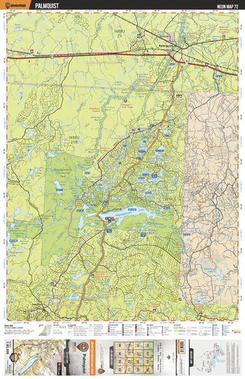
NEON72 Palmquist - Northeastern Ontario Topo
Backroad Mapbooks
This recreation topographic map for Palmquist highlights all the logging/resource roads, hunting areas, fishing lakes & streams, campsites, paddling routes for canoeing and kayaking, wildlife viewing areas, multi-use trails for hiking, biking, horseback riding, cross-country skiing and snowshoeing, motorized trails for ATVing and snowmobiling & more. Covering 3,040 km2 (1,170 mi2), this 1:85,000 scale map measures 48 x 63.5 km (30 x 39.5 mi), providing you with more topographic and recreational detail for the Meldrum Bay area than any other map on the market. New features include Crown land areas, countless new roads and trails plus additional recreational Points of Interest. Included on this map are Palmquist, Shekak River, Nagagamisis Lake, Nagagamisis Provincial Park, Nagagami Lake Provincial Park and more!
Page Size: 24 x 37 in (610 x 940 mm)
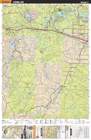
NEON73 Fushimi Lake - Northeastern Ontario Topo
Backroad Mapbooks
This recreation topographic map for Fushimi Lake highlights all the logging/resource roads, hunting areas, fishing lakes & streams, campsites, paddling routes for canoeing and kayaking, wildlife viewing areas, multi-use trails for hiking, biking, horseback riding, cross-country skiing and snowshoeing, motorized trails for ATVing and snowmobiling & more. Covering 3,040 km2 (1,170 mi2), this 1:85,000 scale map measures 48 x 63.5 km (30 x 39.5 mi), providing you with more topographic and recreational detail for the Meldrum Bay area than any other map on the market. New features include Crown land areas, countless new roads and trails plus additional recreational Points of Interest. Included on this map are Fushimi Lake, Constance Lake, Nassau Lake, Valentine Lake, Mattawishkwia River, Valentine River and more!
Page Size: 24 x 37 in (610 x 940 mm)
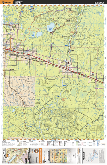
NEON74 Hearst - Northeastern Ontario Topo
Backroad Mapbooks
This recreation topographic map for Hearst highlights all the logging/resource roads, hunting areas, fishing lakes & streams, campsites, paddling routes for canoeing and kayaking, wildlife viewing areas, multi-use trails for hiking, biking, horseback riding, cross-country skiing and snowshoeing, motorized trails for ATVing and snowmobiling & more. Covering 3,040 km2 (1,170 mi2), this 1:85,000 scale map measures 48 x 63.5 km (30 x 39.5 mi), providing you with more topographic and recreational detail for the Meldrum Bay area than any other map on the market. New features include Crown land areas, countless new roads and trails plus additional recreational Points of Interest. Included on this map are Hearst, Shannon Lake, Mattawishkwia Lakes, Missinaibi Provincial Park, Missinaibi River, Edwards Lake and more!
Page Size: 24 x 37 in (610 x 940 mm)
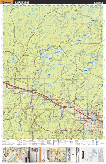
NEON75 Kapuskasing - Northeastern Ontario Topo
Backroad Mapbooks
This recreation topographic map for Kapuskasing highlights all the logging/resource roads, hunting areas, fishing lakes & streams, campsites, paddling routes for canoeing and kayaking, wildlife viewing areas, multi-use trails for hiking, biking, horseback riding, cross-country skiing and snowshoeing, motorized trails for ATVing and snowmobiling & more. Covering 3,040 km2 (1,170 mi2), this 1:85,000 scale map measures 48 x 63.5 km (30 x 39.5 mi), providing you with more topographic and recreational detail for the Meldrum Bay area than any other map on the market. New features include Crown land areas, countless new roads and trails plus additional recreational Points of Interest. Included on this map are Kapuskasing, Allan Lake, Zadi Lake, Opasatika River, Bear Tooth Lake, Val Rita Harty Park and more!
Page Size: 24 x 37 in (610 x 940 mm)
No search results