


MapSherpa Catalog
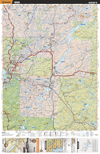
NEON36 Wawa - Northeastern Ontario Topo
Backroad Mapbooks
This recreation topographic map for Wawa highlights all the logging/resource roads, hunting areas, fishing lakes & streams, campsites, paddling routes for canoeing and kayaking, wildlife viewing areas, multi-use trails for hiking, biking, horseback riding, cross-country skiing and snowshoeing, motorized trails for ATVing and snowmobiling & more. Covering 3,040 km2 (1,170 mi2), this 1:85,000 scale map measures 48 x 63.5 km (30 x 39.5 mi), providing you with more topographic and recreational detail for the Meldrum Bay area than any other map on the market. New features include Crown land areas, countless new roads and trails plus additional recreational Points of Interest. Included on this map are Wawa, Manitowik Lake, Whitefish Lake, Anjigami Lake, Wawa Lake, Shikwamkwa River, Hawk lake, Michipicoten River, Sand Lake, Magpie River and more!
Page Size: 24 x 37 in (610 x 940 mm)
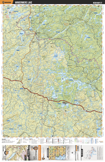
NEON37 Windermere Lake - Northeastern Ontario Topo
Backroad Mapbooks
This recreation topographic map for Windermere Lake highlights all the logging/resource roads, hunting areas, fishing lakes & streams, campsites, paddling routes for canoeing and kayaking, wildlife viewing areas, multi-use trails for hiking, biking, horseback riding, cross-country skiing and snowshoeing, motorized trails for ATVing and snowmobiling & more. Covering 3,040 km2 (1,170 mi2), this 1:85,000 scale map measures 48 x 63.5 km (30 x 39.5 mi), providing you with more topographic and recreational detail for the Meldrum Bay area than any other map on the market. New features include Crown land areas, countless new roads and trails plus additional recreational Points of Interest. Included on this map are Windermere Lake, Murray Lake, Dog Lake, Prairie Bee Lake, Goldie Lake, Chapleau Crown Game Reserve, Shikwamkwa Lake, Ogasiwi Lake, Jackpine River and more!
Page Size: 24 x 37 in (610 x 940 mm)
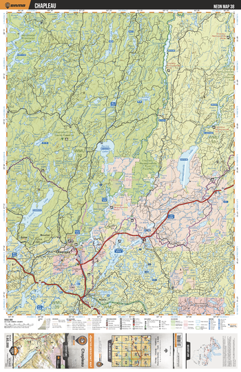
NEON38 Chapleau - Northeastern Ontario Topo
Backroad Mapbooks
This recreation topographic map for Chapleau highlights all the logging/resource roads, hunting areas, fishing lakes & streams, campsites, paddling routes for canoeing and kayaking, wildlife viewing areas, multi-use trails for hiking, biking, horseback riding, cross-country skiing and snowshoeing, motorized trails for ATVing and snowmobiling & more. Covering 3,040 km2 (1,170 mi2), this 1:85,000 scale map measures 48 x 63.5 km (30 x 39.5 mi), providing you with more topographic and recreational detail for the Meldrum Bay area than any other map on the market. New features include Crown land areas, countless new roads and trails plus additional recreational Points of Interest. Included on this map are Chapleau, Chapleau Crown Game Reserve, Racine Lake, Como Lake, Nemegosenda Lake, Nemagosenda River, Chapleau River, Borden Lake, Lipsett Lake, Missinaibi Prov Park and more!
Page Size: 24 x 37 in (610 x 940 mm)
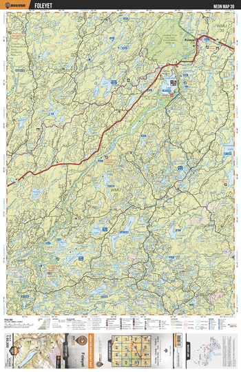
NEON39 Foleyet - Northeastern Ontario Topo
Backroad Mapbooks
This recreation topographic map for Foleyet highlights all the logging/resource roads, hunting areas, fishing lakes & streams, campsites, paddling routes for canoeing and kayaking, wildlife viewing areas, multi-use trails for hiking, biking, horseback riding, cross-country skiing and snowshoeing, motorized trails for ATVing and snowmobiling & more. Covering 3,040 km2 (1,170 mi2), this 1:85,000 scale map measures 48 x 63.5 km (30 x 39.5 mi), providing you with more topographic and recreational detail for the Meldrum Bay area than any other map on the market. New features include Crown land areas, countless new roads and trails plus additional recreational Points of Interest. Included on this map are Ivanhoe Lake, Rollo Lake, Ianhoe River, Hellyer Lake, Murdock Lake, Foleyet, Horwood Lake, Carty Lake, Denyes Lake, Raney Lake and more!
Page Size: 24 x 37 in (610 x 940 mm)
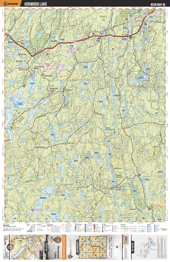
NEON40 Horwood Lake - Northeastern Ontario Topo
Backroad Mapbooks
This recreation topographic map for Horwood Lake highlights all the logging/resource roads, hunting areas, fishing lakes & streams, campsites, paddling routes for canoeing and kayaking, wildlife viewing areas, multi-use trails for hiking, biking, horseback riding, cross-country skiing and snowshoeing, motorized trails for ATVing and snowmobiling & more. Covering 3,040 km2 (1,170 mi2), this 1:85,000 scale map measures 48 x 63.5 km (30 x 39.5 mi), providing you with more topographic and recreational detail for the Meldrum Bay area than any other map on the market. New features include Crown land areas, countless new roads and trails plus additional recreational Points of Interest. Included on this map are Horwood Lake, Groundhog Lake, Rush Lake, Groundhog River, Hardiman Lake, Kenogaming Lake and more!
Page Size: 24 x 37 in (610 x 940 mm)
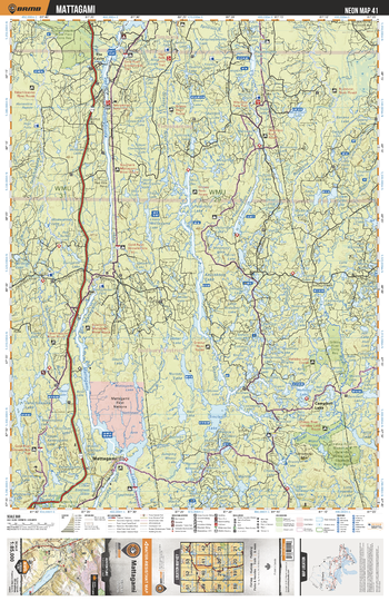
NEON41 Mattagami - Northeastern Ontario Topo
Backroad Mapbooks
This recreation topographic map for Mattagami highlights all the logging/resource roads, hunting areas, fishing lakes & streams, campsites, paddling routes for canoeing and kayaking, wildlife viewing areas, multi-use trails for hiking, biking, horseback riding, cross-country skiing and snowshoeing, motorized trails for ATVing and snowmobiling & more. Covering 3,040 km2 (1,170 mi2), this 1:85,000 scale map measures 48 x 63.5 km (30 x 39.5 mi), providing you with more topographic and recreational detail for the Meldrum Bay area than any other map on the market. New features include Crown land areas, countless new roads and trails plus additional recreational Points of Interest. Included on this map are Kapiskong Lake, Mattagami Lake, Mattagami River, Sinclair Lake, Kenogamiss Lake, Muskasenda Lake, Mountjoy River, Redstone River, Campbell Lake, Mattagami and more!
Page Size: 24 x 37 in (610 x 940 mm)
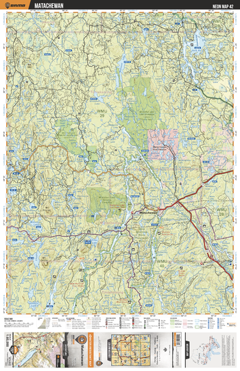
NEON42 Matachewan - Northeastern Ontario Topo
Backroad Mapbooks
This recreation topographic map for Matachewan highlights all the logging/resource roads, hunting areas, fishing lakes & streams, campsites, paddling routes for canoeing and kayaking, wildlife viewing areas, multi-use trails for hiking, biking, horseback riding, cross-country skiing and snowshoeing, motorized trails for ATVing and snowmobiling & more. Covering 3,040 km2 (1,170 mi2), this 1:85,000 scale map measures 48 x 63.5 km (30 x 39.5 mi), providing you with more topographic and recreational detail for the Meldrum Bay area than any other map on the market. New features include Crown land areas, countless new roads and trails plus additional recreational Points of Interest. Included on this map are West Montreal River, Matachewan, Radison Lake, Watabeag Lake, Montreal River, Duncan Lake, Lloyd Lake, Mistinkikon Lake, Whitefish Lake, Matachewan Lake and more!
Page Size: 24 x 37 in (610 x 940 mm)
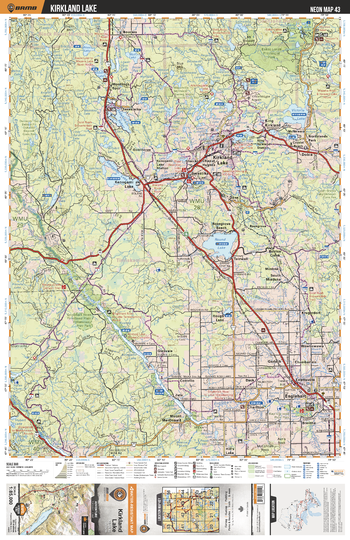
NEON43 Kirkland Lake - Northeastern Ontario Topo
Backroad Mapbooks
This recreation topographic map for Kirkland Lake highlights all the logging/resource roads, hunting areas, fishing lakes & streams, campsites, paddling routes for canoeing and kayaking, wildlife viewing areas, multi-use trails for hiking, biking, horseback riding, cross-country skiing and snowshoeing, motorized trails for ATVing and snowmobiling & more. Covering 3,040 km2 (1,170 mi2), this 1:85,000 scale map measures 48 x 63.5 km (30 x 39.5 mi), providing you with more topographic and recreational detail for the Meldrum Bay area than any other map on the market. New features include Crown land areas, countless new roads and trails plus additional recreational Points of Interest. Included on this map are Round Lake, Kenogami Lake, Kirkland Lake, Victoria Lake, Sesekinika Lake, Esker Lakes Prov Park, Englehart, Englehart River, Montreal River, Elk Lake and more!
Page Size: 24 x 37 in (610 x 940 mm)
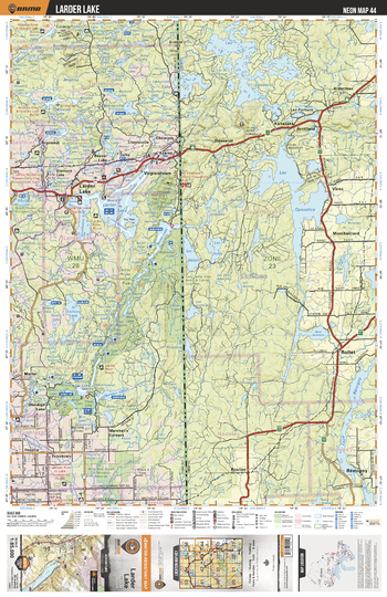
NEON44 Larder Lake - Northeastern Ontario Topo
Backroad Mapbooks
This recreation topographic map for Larder Lake highlights all the logging/resource roads, hunting areas, fishing lakes & streams, campsites, paddling routes for canoeing and kayaking, wildlife viewing areas, multi-use trails for hiking, biking, horseback riding, cross-country skiing and snowshoeing, motorized trails for ATVing and snowmobiling & more. Covering 3,040 km2 (1,170 mi2), this 1:85,000 scale map measures 48 x 63.5 km (30 x 39.5 mi), providing you with more topographic and recreational detail for the Meldrum Bay area than any other map on the market. New features include Crown land areas, countless new roads and trails plus additional recreational Points of Interest. Included on this map are Larder Lake, St Anthony Lake, Larder River, Blanche River, Raven Lake, Larder River Prov Park, Skeleton Lake, Bear Lake, Wendigo Lake and more!
Page Size: 24 x 37 in (610 x 940 mm)
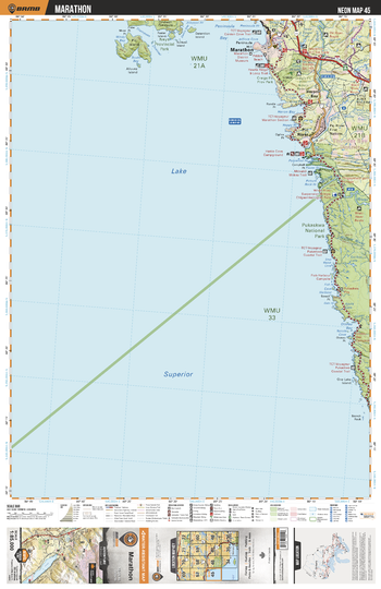
NEON45 Marathon - Northeastern Ontario Topo
Backroad Mapbooks
This recreation topographic map for Marathon highlights all the logging/resource roads, hunting areas, fishing lakes & streams, campsites, paddling routes for canoeing and kayaking, wildlife viewing areas, multi-use trails for hiking, biking, horseback riding, cross-country skiing and snowshoeing, motorized trails for ATVing and snowmobiling & more. Covering 3,040 km2 (1,170 mi2), this 1:85,000 scale map measures 48 x 63.5 km (30 x 39.5 mi), providing you with more topographic and recreational detail for the Meldrum Bay area than any other map on the market. New features include Crown land areas, countless new roads and trails plus additional recreational Points of Interest. Included on this map are Lake Superior, Marathon, Pukaskwa National Park, Heron Bay, Pic River, Black River, White River, Oiseau Bay, Craigs Pit Prov Park, Pic Island, Neys Prov Park and more!
Page Size: 24 x 37 in (610 x 940 mm)
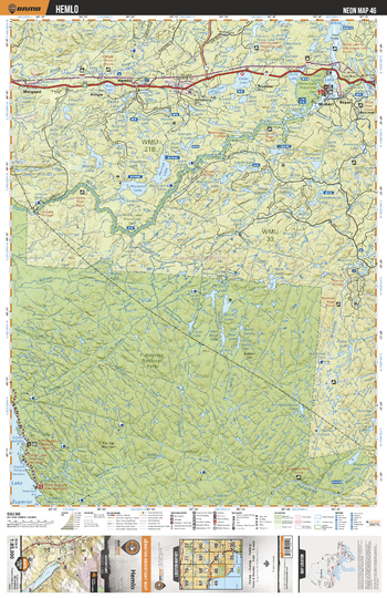
NEON46 Hemlo - Northeastern Ontario Topo
Backroad Mapbooks
This recreation topographic map for Hemlo highlights all the logging/resource roads, hunting areas, fishing lakes & streams, campsites, paddling routes for canoeing and kayaking, wildlife viewing areas, multi-use trails for hiking, biking, horseback riding, cross-country skiing and snowshoeing, motorized trails for ATVing and snowmobiling & more. Covering 3,040 km2 (1,170 mi2), this 1:85,000 scale map measures 48 x 63.5 km (30 x 39.5 mi), providing you with more topographic and recreational detail for the Meldrum Bay area than any other map on the market. New features include Crown land areas, countless new roads and trails plus additional recreational Points of Interest. Included on this map are White River, Pukaskwa National Park, Pukaskwa River, Cedar Lake, Herrick Lake, Hayward Lake, Mussy Lake, White Lake, Rous Lake, Hemlo and more!
Page Size: 24 x 37 in (610 x 940 mm)
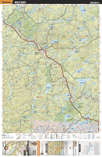
NEON47 White River - Northeastern Ontario Topo
Backroad Mapbooks
This recreation topographic map for White River highlights all the logging/resource roads, hunting areas, fishing lakes & streams, campsites, paddling routes for canoeing and kayaking, wildlife viewing areas, multi-use trails for hiking, biking, horseback riding, cross-country skiing and snowshoeing, motorized trails for ATVing and snowmobiling & more. Covering 3,040 km2 (1,170 mi2), this 1:85,000 scale map measures 48 x 63.5 km (30 x 39.5 mi), providing you with more topographic and recreational detail for the Meldrum Bay area than any other map on the market. New features include Crown land areas, countless new roads and trails plus additional recreational Points of Interest. Included on this map are White River, Negwazu Lake, Obatanga Lake, Knife Lake, Pokei Lake, Bremner, Bremner River, Tukanee Lake, Dayohessarah Lake, Kabenung Lake and more!
Page Size: 24 x 37 in (610 x 940 mm)
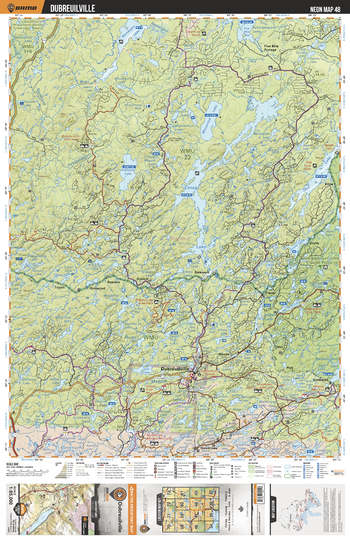
NEON48 Dubreuilville - Northeastern Ontario Topo
Backroad Mapbooks
This recreation topographic map for Dubreuilville highlights all the logging/resource roads, hunting areas, fishing lakes & streams, campsites, paddling routes for canoeing and kayaking, wildlife viewing areas, multi-use trails for hiking, biking, horseback riding, cross-country skiing and snowshoeing, motorized trails for ATVing and snowmobiling & more. Covering 3,040 km2 (1,170 mi2), this 1:85,000 scale map measures 48 x 63.5 km (30 x 39.5 mi), providing you with more topographic and recreational detail for the Meldrum Bay area than any other map on the market. New features include Crown land areas, countless new roads and trails plus additional recreational Points of Interest. Included on this map are Esnagi Lake, Dubreuilville, Mosambik Lake, Oba Lake, Magpie River, Anaharea Lake, Lola Lake, Nameigos Lake, Five Mile Portage, Honeymoon Falls and more!
Page Size: 24 x 37 in (610 x 940 mm)
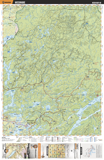
NEON49 Missanabie - Northeastern Ontario Topo
Backroad Mapbooks
This recreation topographic map for Missanabie highlights all the logging/resource roads, hunting areas, fishing lakes & streams, campsites, paddling routes for canoeing and kayaking, wildlife viewing areas, multi-use trails for hiking, biking, horseback riding, cross-country skiing and snowshoeing, motorized trails for ATVing and snowmobiling & more. Covering 3,040 km2 (1,170 mi2), this 1:85,000 scale map measures 48 x 63.5 km (30 x 39.5 mi), providing you with more topographic and recreational detail for the Meldrum Bay area than any other map on the market. New features include Crown land areas, countless new roads and trails plus additional recreational Points of Interest. Included on this map are Missinaibi Lake, Little Missinaibi River, Missanabie, Dog Lake, Wabatongushi Lake, Chapleau Crown Game Preserve, Mosher, Oba Lake, Rennie Lake, Easey Lake and more!
Page Size: 24 x 37 in (610 x 940 mm)
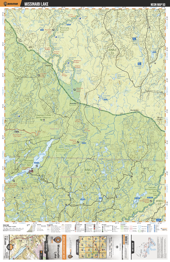
NEON50 Missinaibi Lake - Northeastern Ontario Topo
Backroad Mapbooks
This recreation topographic map for Missinaibi Lake highlights all the logging/resource roads, hunting areas, fishing lakes & streams, campsites, paddling routes for canoeing and kayaking, wildlife viewing areas, multi-use trails for hiking, biking, horseback riding, cross-country skiing and snowshoeing, motorized trails for ATVing and snowmobiling & more. Covering 3,040 km2 (1,170 mi2), this 1:85,000 scale map measures 48 x 63.5 km (30 x 39.5 mi), providing you with more topographic and recreational detail for the Meldrum Bay area than any other map on the market. New features include Crown land areas, countless new roads and trails plus additional recreational Points of Interest. Included on this map are Missanaibi Lake, Missinaibi River, Nottawa River, Greenhill River, Missinaibi Prov Park, Chapleau River, Chapleau-Nemegosenda River Prov Park, Dunrankin, Peterbell, Argolis and more!
Page Size: 24 x 37 in (610 x 940 mm)
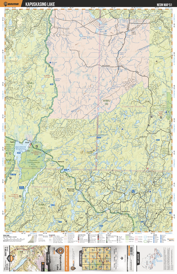
NEON51 Kapuskasing Lake - Northeastern Ontario Topo
Backroad Mapbooks
This recreation topographic map for Kapuskasing Lake highlights all the logging/resource roads, hunting areas, fishing lakes & streams, campsites, paddling routes for canoeing and kayaking, wildlife viewing areas, multi-use trails for hiking, biking, horseback riding, cross-country skiing and snowshoeing, motorized trails for ATVing and snowmobiling & more. Covering 3,040 km2 (1,170 mi2), this 1:85,000 scale map measures 48 x 63.5 km (30 x 39.5 mi), providing you with more topographic and recreational detail for the Meldrum Bay area than any other map on the market. New features include Crown land areas, countless new roads and trails plus additional recreational Points of Interest. Included on this map are Kapuskasing Lake, Kapuskasing River, Nemegosenda River, Chapleau-Nemegosenda River Prov Park, Ivanhoe River, Dunrankin River, Fryingpan Lake, Kyushk Lake, Mishionga Lake, Chapleau River and more!
Page Size: 24 x 37 in (610 x 940 mm)
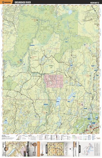
NEON52 Groundhog River - Northeastern Ontario Topo
Backroad Mapbooks
This recreation topographic map for Groundhog River highlights all the logging/resource roads, hunting areas, fishing lakes & streams, campsites, paddling routes for canoeing and kayaking, wildlife viewing areas, multi-use trails for hiking, biking, horseback riding, cross-country skiing and snowshoeing, motorized trails for ATVing and snowmobiling & more. Covering 3,040 km2 (1,170 mi2), this 1:85,000 scale map measures 48 x 63.5 km (30 x 39.5 mi), providing you with more topographic and recreational detail for the Meldrum Bay area than any other map on the market. New features include Crown land areas, countless new roads and trails plus additional recreational Points of Interest. Included on this map are Northern Claybelt Complex Forest Cons Reserve, Bromley Lake, Harriet Lake, Groundhog River, Kamiskotia River, Nat River, Ivanhoe River, Elf Lake, Manning Lake, Opishing Lake and more!
Page Size: 24 x 37 in (610 x 940 mm)
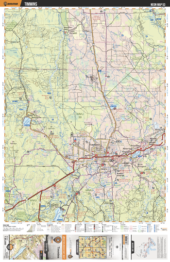
NEON53 Timmins - Northeastern Ontario Topo
Backroad Mapbooks
This recreation topographic map for Timmins highlights all the logging/resource roads, hunting areas, fishing lakes & streams, campsites, paddling routes for canoeing and kayaking, wildlife viewing areas, multi-use trails for hiking, biking, horseback riding, cross-country skiing and snowshoeing, motorized trails for ATVing and snowmobiling & more. Covering 3,040 km2 (1,170 mi2), this 1:85,000 scale map measures 48 x 63.5 km (30 x 39.5 mi), providing you with more topographic and recreational detail for the Meldrum Bay area than any other map on the market. New features include Crown land areas, countless new roads and trails plus additional recreational Points of Interest. Included on this map are Kamiskotia Lake, Porcupine Lake, Timmins, Kenogamissi Lake, Wawaitin Falls, Sturgeon Falls, Mettagami River, Redstone River, Grassy River, Porcupine River and more!
Page Size: 24 x 37 in (610 x 940 mm)
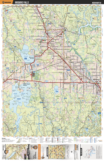
NEON54 Iroquois Falls - Northeastern Ontario Topo
Backroad Mapbooks
This recreation topographic map for Iroquois Falls highlights all the logging/resource roads, hunting areas, fishing lakes & streams, campsites, paddling routes for canoeing and kayaking, wildlife viewing areas, multi-use trails for hiking, biking, horseback riding, cross-country skiing and snowshoeing, motorized trails for ATVing and snowmobiling & more. Covering 3,040 km2 (1,170 mi2), this 1:85,000 scale map measures 48 x 63.5 km (30 x 39.5 mi), providing you with more topographic and recreational detail for the Meldrum Bay area than any other map on the market. New features include Crown land areas, countless new roads and trails plus additional recreational Points of Interest. Included on this map are Val Gagne, Iroquois Falls, Frederick House Lake, Nighthawk Lake, Moose Lake, Kettle Lakes Prov Park, Matheson, Abitibi River, Black River, Watabeag River and more!
Page Size: 24 x 37 in (610 x 940 mm)
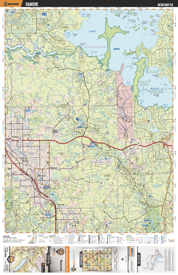
NEON55 Ramore - Northeastern Ontario Topo
Backroad Mapbooks
This recreation topographic map for Ramore highlights all the logging/resource roads, hunting areas, fishing lakes & streams, campsites, paddling routes for canoeing and kayaking, wildlife viewing areas, multi-use trails for hiking, biking, horseback riding, cross-country skiing and snowshoeing, motorized trails for ATVing and snowmobiling & more. Covering 3,040 km2 (1,170 mi2), this 1:85,000 scale map measures 48 x 63.5 km (30 x 39.5 mi), providing you with more topographic and recreational detail for the Meldrum Bay area than any other map on the market. New features include Crown land areas, countless new roads and trails plus additional recreational Points of Interest. Included on this map are Lake Abitibi, Abitibi-de Troyes Prov Park, Abitibi River, Ghost River, Ramore, Belleek, Esker Lakes Prov Park and more!
Page Size: 24 x 37 in (610 x 940 mm)
No search results