


MapSherpa Catalog
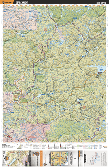
NEON16 Searchmont - Northeastern Ontario Topo
Backroad Mapbooks
This recreation topographic map for Searchmont highlights all the logging/resource roads, hunting areas, fishing lakes & streams, campsites, paddling routes for canoeing and kayaking, wildlife viewing areas, multi-use trails for hiking, biking, horseback riding, cross-country skiing and snowshoeing, motorized trails for ATVing and snowmobiling & more. Covering 3,040 km2 (1,170 mi2), this 1:85,000 scale map measures 48 x 63.5 km (30 x 39.5 mi), providing you with more topographic and recreational detail for the Meldrum Bay area than any other map on the market. New features include Crown land areas, countless new roads and trails plus additional recreational Points of Interest. Included on this map are Ranger Lake, Searchmont, Echo River Hardwoods Cons Reserve, Garden River, Goulais River, Goulais River Prov Park, Algoma Headwaters Prov Park, Morrison Lake, Garden Lake, Trout Lake and more!
Page Size: 24 x 37 in (610 x 940 mm)
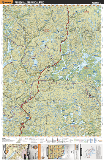
NEON17 Aubrey Falls Provincial Park - Northeastern Ontario Topo
Backroad Mapbooks
This recreation topographic map for Aubrey Falls Provincial Park highlights all the logging/resource roads, hunting areas, fishing lakes & streams, campsites, paddling routes for canoeing and kayaking, wildlife viewing areas, multi-use trails for hiking, biking, horseback riding, cross-country skiing and snowshoeing, motorized trails for ATVing and snowmobiling & more. Covering 3,040 km2 (1,170 mi2), this 1:85,000 scale map measures 48 x 63.5 km (30 x 39.5 mi), providing you with more topographic and recreational detail for the Meldrum Bay area than any other map on the market. New features include Crown land areas, countless new roads and trails plus additional recreational Points of Interest. Included on this map are Rocky Island Lake, Peshu Lake, Kirkpatrick Lake, Ranger Lake, Mississagi River Prov Park, Mississagi River, Aubinadong River Prov Park, Wenebegon River Prov Park, Aubrey Falls Prov Park, Aubrey Lake and more!
Page Size: 24 x 37 in (610 x 940 mm)
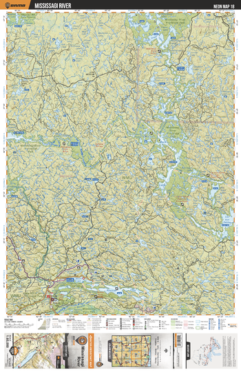
NEON18 Mississagi River - Northeastern Ontario Topo
Backroad Mapbooks
This recreation topographic map for Mississagi River highlights all the logging/resource roads, hunting areas, fishing lakes & streams, campsites, paddling routes for canoeing and kayaking, wildlife viewing areas, multi-use trails for hiking, biking, horseback riding, cross-country skiing and snowshoeing, motorized trails for ATVing and snowmobiling & more. Covering 3,040 km2 (1,170 mi2), this 1:85,000 scale map measures 48 x 63.5 km (30 x 39.5 mi), providing you with more topographic and recreational detail for the Meldrum Bay area than any other map on the market. New features include Crown land areas, countless new roads and trails plus additional recreational Points of Interest. Included on this map are Mississagi River, Mississagi River Prov Park, Rawhide Lake, Lac aux Sables, Bark Lake, Upper Green Lake, White Owl Lake and more!
Page Size: 24 x 37 in (610 x 940 mm)
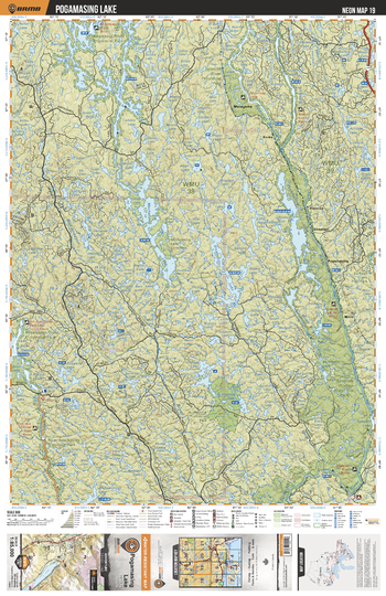
NEON19 Pogamasing Lake - Northeastern Ontario Topo
Backroad Mapbooks
This recreation topographic map for Pogamasing Lake highlights all the logging/resource roads, hunting areas, fishing lakes & streams, campsites, paddling routes for canoeing and kayaking, wildlife viewing areas, multi-use trails for hiking, biking, horseback riding, cross-country skiing and snowshoeing, motorized trails for ATVing and snowmobiling & more. Covering 3,040 km2 (1,170 mi2), this 1:85,000 scale map measures 48 x 63.5 km (30 x 39.5 mi), providing you with more topographic and recreational detail for the Meldrum Bay area than any other map on the market. New features include Crown land areas, countless new roads and trails plus additional recreational Points of Interest. Included on this map are Spanish River, Spanish River Prov Park, Mississagi River Prov Park, Mozhabong Lake, Sinamida Lake, Indian Lake, Ramsey Lake, Metagama, Pogamasing Lake and more!
Page Size: 24 x 37 in (610 x 940 mm)
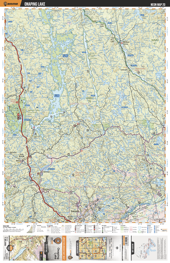
NEON20 Onaping Lake - Northeastern Ontario Topo
Backroad Mapbooks
This recreation topographic map for Onaping Lake highlights all the logging/resource roads, hunting areas, fishing lakes & streams, campsites, paddling routes for canoeing and kayaking, wildlife viewing areas, multi-use trails for hiking, biking, horseback riding, cross-country skiing and snowshoeing, motorized trails for ATVing and snowmobiling & more. Covering 3,040 km2 (1,170 mi2), this 1:85,000 scale map measures 48 x 63.5 km (30 x 39.5 mi), providing you with more topographic and recreational detail for the Meldrum Bay area than any other map on the market. New features include Crown land areas, countless new roads and trails plus additional recreational Points of Interest. Included on this map are Onaping Lake, McKees Camp, Vermilion River, Levack, Moose Lake, Venetian Lake, Onaping River, Geneva Lake, Nelson Lake, Halfway Lake Prov Park and more!
Page Size: 24 x 37 in (610 x 940 mm)
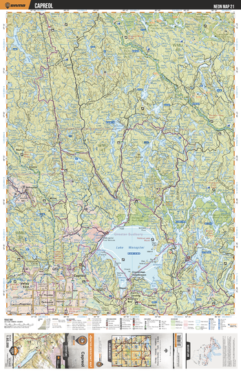
NEON21 Capreol - Northeastern Ontario Topo
Backroad Mapbooks
This recreation topographic map for Capreol highlights all the logging/resource roads, hunting areas, fishing lakes & streams, campsites, paddling routes for canoeing and kayaking, wildlife viewing areas, multi-use trails for hiking, biking, horseback riding, cross-country skiing and snowshoeing, motorized trails for ATVing and snowmobiling & more. Covering 3,040 km2 (1,170 mi2), this 1:85,000 scale map measures 48 x 63.5 km (30 x 39.5 mi), providing you with more topographic and recreational detail for the Meldrum Bay area than any other map on the market. New features include Crown land areas, countless new roads and trails plus additional recreational Points of Interest. Included on this map are Lake Wanapitei, Capreol, Ashigami Lake, Kukagami Lake, Wanapitei River, Sturgeon River, Chiniguchi Lake, Burwash Lake, Vermilion River, Sturgeon River Prov Park and more!
Page Size: 24 x 37 in (610 x 940 mm)
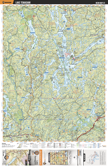
NEON22 Lake Temagami - Northeastern Ontario Topo
Backroad Mapbooks
This recreation topographic map for Lake Temagami highlights all the logging/resource roads, hunting areas, fishing lakes & streams, campsites, paddling routes for canoeing and kayaking, wildlife viewing areas, multi-use trails for hiking, biking, horseback riding, cross-country skiing and snowshoeing, motorized trails for ATVing and snowmobiling & more. Covering 3,040 km2 (1,170 mi2), this 1:85,000 scale map measures 48 x 63.5 km (30 x 39.5 mi), providing you with more topographic and recreational detail for the Meldrum Bay area than any other map on the market. New features include Crown land areas, countless new roads and trails plus additional recreational Points of Interest. Included on this map are Lake Temagami, Red Cedar Lake, Temagami River, Sturgeon River, Obabika River, Obabika Lake, Maskinonge Lake, Camp Wanapitei, Adanac, Wakimika Lake and more!
Page Size: 24 x 37 in (610 x 940 mm)
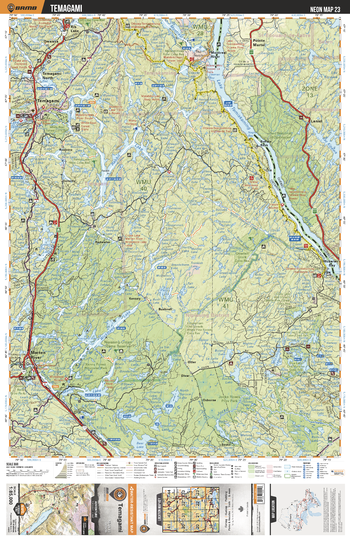
NEON23 Temagami - Northeastern Ontario Topo
Backroad Mapbooks
This recreation topographic map for Temagami highlights all the logging/resource roads, hunting areas, fishing lakes & streams, campsites, paddling routes for canoeing and kayaking, wildlife viewing areas, multi-use trails for hiking, biking, horseback riding, cross-country skiing and snowshoeing, motorized trails for ATVing and snowmobiling & more. Covering 3,040 km2 (1,170 mi2), this 1:85,000 scale map measures 48 x 63.5 km (30 x 39.5 mi), providing you with more topographic and recreational detail for the Meldrum Bay area than any other map on the market. New features include Crown land areas, countless new roads and trails plus additional recreational Points of Interest. Included on this map are Lake Temiskaming, Ottawa River, Rabbit Lake, Temagami, Jocko Rivers Prov Park, Wickstead Lake, Marten Lake, Jocko River, Marten River and more!
Page Size: 24 x 37 in (610 x 940 mm)
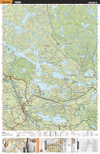
NEON24 Thorne - Northeastern Ontario Topo
Backroad Mapbooks
This recreation topographic map for Thorne highlights all the logging/resource roads, hunting areas, fishing lakes & streams, campsites, paddling routes for canoeing and kayaking, wildlife viewing areas, multi-use trails for hiking, biking, horseback riding, cross-country skiing and snowshoeing, motorized trails for ATVing and snowmobiling & more. Covering 3,040 km2 (1,170 mi2), this 1:85,000 scale map measures 48 x 63.5 km (30 x 39.5 mi), providing you with more topographic and recreational detail for the Meldrum Bay area than any other map on the market. New features include Crown land areas, countless new roads and trails plus additional recreational Points of Interest. Included on this map are Thorne, Wyse, Eldee, Ottawa River, Big McDougal Lake and more!
Page Size: 24 x 37 in (610 x 940 mm)
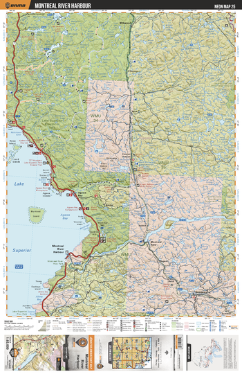
NEON25 Montreal River Harbour - Northeastern Ontario Topo
Backroad Mapbooks
This recreation topographic map for Montreal River Harbour highlights all the logging/resource roads, hunting areas, fishing lakes & streams, campsites, paddling routes for canoeing and kayaking, wildlife viewing areas, multi-use trails for hiking, biking, horseback riding, cross-country skiing and snowshoeing, motorized trails for ATVing and snowmobiling & more. Covering 3,040 km2 (1,170 mi2), this 1:85,000 scale map measures 48 x 63.5 km (30 x 39.5 mi), providing you with more topographic and recreational detail for the Meldrum Bay area than any other map on the market. New features include Crown land areas, countless new roads and trails plus additional recreational Points of Interest. Included on this map are Montreal River, Lake Superior, Agawa Bay, Montreal River Harbour, Lake Superior Prov Park, Batchewana River, Agawa River, Sand River, Baldhead River, Montreal River Prov Park and more!
Page Size: 24 x 37 in (610 x 940 mm)
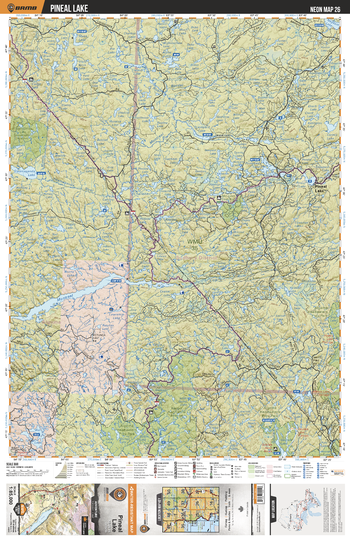
NEON26 Pineal Lake - Northeastern Ontario Topo
Backroad Mapbooks
This recreation topographic map for Pineal Lake highlights all the logging/resource roads, hunting areas, fishing lakes & streams, campsites, paddling routes for canoeing and kayaking, wildlife viewing areas, multi-use trails for hiking, biking, horseback riding, cross-country skiing and snowshoeing, motorized trails for ATVing and snowmobiling & more. Covering 3,040 km2 (1,170 mi2), this 1:85,000 scale map measures 48 x 63.5 km (30 x 39.5 mi), providing you with more topographic and recreational detail for the Meldrum Bay area than any other map on the market. New features include Crown land areas, countless new roads and trails plus additional recreational Points of Interest. Included on this map are Montreal River, Pineal Lake, Algoma Headwaters Prov Park, Tikamaganda Lake, Lineus Lake, Goulais River, Batchawana River and more!
Page Size: 24 x 37 in (610 x 940 mm)
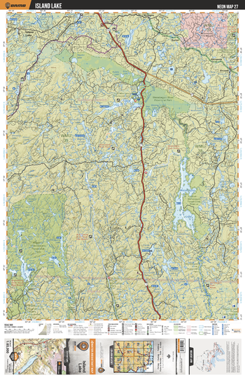
NEON27 Island Lake - Northeastern Ontario Topo
Backroad Mapbooks
This recreation topographic map for Island Lake highlights all the logging/resource roads, hunting areas, fishing lakes & streams, campsites, paddling routes for canoeing and kayaking, wildlife viewing areas, multi-use trails for hiking, biking, horseback riding, cross-country skiing and snowshoeing, motorized trails for ATVing and snowmobiling & more. Covering 3,040 km2 (1,170 mi2), this 1:85,000 scale map measures 48 x 63.5 km (30 x 39.5 mi), providing you with more topographic and recreational detail for the Meldrum Bay area than any other map on the market. New features include Crown land areas, countless new roads and trails plus additional recreational Points of Interest. Included on this map are Wenebegon Lake, Aubinadong River, Island Lake, Algoma Headwaters Prov Park, Wenebegon River, Five Mile Lake, Megisan Lake and more!
Page Size: 24 x 37 in (610 x 940 mm)
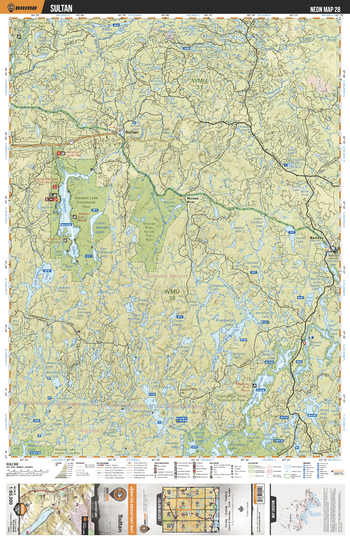
NEON28 Sultan - Northeastern Ontario Topo
Backroad Mapbooks
This recreation topographic map for Sultan highlights all the logging/resource roads, hunting areas, fishing lakes & streams, campsites, paddling routes for canoeing and kayaking, wildlife viewing areas, multi-use trails for hiking, biking, horseback riding, cross-country skiing and snowshoeing, motorized trails for ATVing and snowmobiling & more. Covering 3,040 km2 (1,170 mi2), this 1:85,000 scale map measures 48 x 63.5 km (30 x 39.5 mi), providing you with more topographic and recreational detail for the Meldrum Bay area than any other map on the market. New features include Crown land areas, countless new roads and trails plus additional recreational Points of Interest. Included on this map are Wakami Lake, Kebskwasheshi Lake, Woman River Forest Prov Park, Frechette Lake, Bardney Lake, Sultan, Ramsay, Ridout River, Woman River, Wakami River and more!
Page Size: 24 x 37 in (610 x 940 mm)
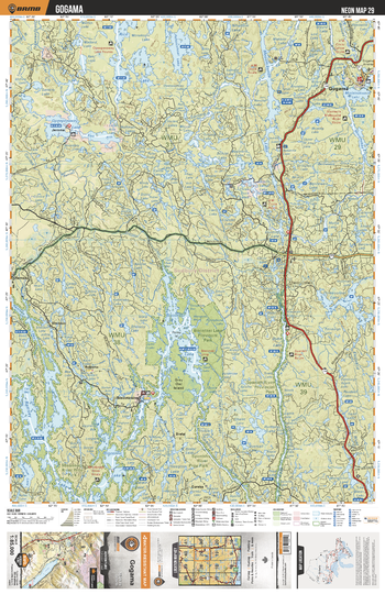
NEON29 Gogama - Northeastern Ontario Topo
Backroad Mapbooks
This recreation topographic map for Gogama highlights all the logging/resource roads, hunting areas, fishing lakes & streams, campsites, paddling routes for canoeing and kayaking, wildlife viewing areas, multi-use trails for hiking, biking, horseback riding, cross-country skiing and snowshoeing, motorized trails for ATVing and snowmobiling & more. Covering 3,040 km2 (1,170 mi2), this 1:85,000 scale map measures 48 x 63.5 km (30 x 39.5 mi), providing you with more topographic and recreational detail for the Meldrum Bay area than any other map on the market. New features include Crown land areas, countless new roads and trails plus additional recreational Points of Interest. Included on this map are Biscotasi Lake, Ramsey Lake, Opeepeesway Lake, Rice Lake, Pebonishawi Lake, Mesomikenda Lake, Gogama, Minisinakwa Lake, Threecorner Lake, East Spanish River and more!
Page Size: 24 x 37 in (610 x 940 mm)
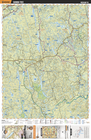
NEON30 Shining Tree - Northeastern Ontario Topo
Backroad Mapbooks
This recreation topographic map for Shining Tree highlights all the logging/resource roads, hunting areas, fishing lakes & streams, campsites, paddling routes for canoeing and kayaking, wildlife viewing areas, multi-use trails for hiking, biking, horseback riding, cross-country skiing and snowshoeing, motorized trails for ATVing and snowmobiling & more. Covering 3,040 km2 (1,170 mi2), this 1:85,000 scale map measures 48 x 63.5 km (30 x 39.5 mi), providing you with more topographic and recreational detail for the Meldrum Bay area than any other map on the market. New features include Crown land areas, countless new roads and trails plus additional recreational Points of Interest. Included on this map are Shining Tree, Morin Village, Mattagami Lake, Nabakwasi Lake, Wanapitei River, Opikinimika Lake, Opikinimika River, Westree, Okawakenda Lake, Donnegana Lake and more!
Page Size: 24 x 37 in (610 x 940 mm)
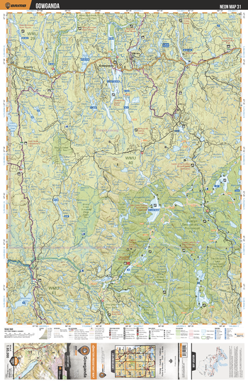
NEON31 Gowanda - Northeastern Ontario Topo
Backroad Mapbooks
This recreation topographic map for Gowanda highlights all the logging/resource roads, hunting areas, fishing lakes & streams, campsites, paddling routes for canoeing and kayaking, wildlife viewing areas, multi-use trails for hiking, biking, horseback riding, cross-country skiing and snowshoeing, motorized trails for ATVing and snowmobiling & more. Covering 3,040 km2 (1,170 mi2), this 1:85,000 scale map measures 48 x 63.5 km (30 x 39.5 mi), providing you with more topographic and recreational detail for the Meldrum Bay area than any other map on the market. New features include Crown land areas, countless new roads and trails plus additional recreational Points of Interest. Included on this map are Yorston River, Gowganda, Sturgeon River, Welcome Lake, Smoothwater Lake, Florence Lake, Lady Evelyn Smoothwater Prov Park, Lady Evelyn River, Montreal River, Gowganda Lake and more!
Page Size: 24 x 37 in (610 x 940 mm)
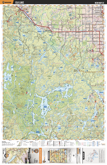
NEON32 Elk Lake - Northeastern Ontario Topo
Backroad Mapbooks
This recreation topographic map for Elk Lake highlights all the logging/resource roads, hunting areas, fishing lakes & streams, campsites, paddling routes for canoeing and kayaking, wildlife viewing areas, multi-use trails for hiking, biking, horseback riding, cross-country skiing and snowshoeing, motorized trails for ATVing and snowmobiling & more. Covering 3,040 km2 (1,170 mi2), this 1:85,000 scale map measures 48 x 63.5 km (30 x 39.5 mi), providing you with more topographic and recreational detail for the Meldrum Bay area than any other map on the market. New features include Crown land areas, countless new roads and trails plus additional recreational Points of Interest. Included on this map are Elk Lake, Mountain Lake, Montreal River, Makobe River, Makobe Lake, Lady Evelyn Smoothwater Prov park, Lady Evelyn Lake, Lady Evelyn River, Diamond Lake, Anima Nipissing Lake and more!
Page Size: 24 x 37 in (610 x 940 mm)
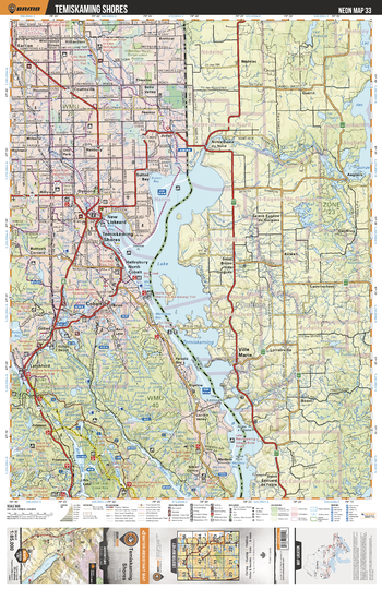
NEON33 Temiskaming Shores - Northeastern Ontario Topo
Backroad Mapbooks
This recreation topographic map for Temiskaming Shores highlights all the logging/resource roads, hunting areas, fishing lakes & streams, campsites, paddling routes for canoeing and kayaking, wildlife viewing areas, multi-use trails for hiking, biking, horseback riding, cross-country skiing and snowshoeing, motorized trails for ATVing and snowmobiling & more. Covering 3,040 km2 (1,170 mi2), this 1:85,000 scale map measures 48 x 63.5 km (30 x 39.5 mi), providing you with more topographic and recreational detail for the Meldrum Bay area than any other map on the market. New features include Crown land areas, countless new roads and trails plus additional recreational Points of Interest. Included on this map are Temiskaming Shores, Lake Temiskaming, Cobalt, Montreal River, Ottawa River, New Liskeard, Rib Lake and more!
Page Size: 24 x 37 in (610 x 940 mm)
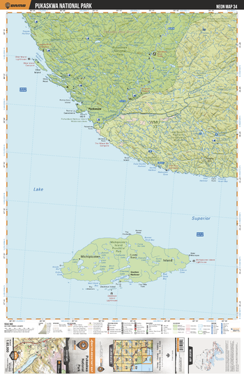
NEON34 Pukaskwa National Park - Northeastern Ontario Topo
Backroad Mapbooks
This recreation topographic map for Pukaskwa National Park highlights all the logging/resource roads, hunting areas, fishing lakes & streams, campsites, paddling routes for canoeing and kayaking, wildlife viewing areas, multi-use trails for hiking, biking, horseback riding, cross-country skiing and snowshoeing, motorized trails for ATVing and snowmobiling & more. Covering 3,040 km2 (1,170 mi2), this 1:85,000 scale map measures 48 x 63.5 km (30 x 39.5 mi), providing you with more topographic and recreational detail for the Meldrum Bay area than any other map on the market. New features include Crown land areas, countless new roads and trails plus additional recreational Points of Interest. Included on this map are Michipicoten Island Prov Park, Lake Superior, Pukaskwa River, Pukaskwa National Park, Puckasaw and more!
Page Size: 24 x 37 in (610 x 940 mm)
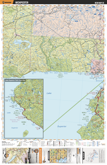
NEON35 Michipicoten - Northeastern Ontario Topo
Backroad Mapbooks
This recreation topographic map for Michipicoten highlights all the logging/resource roads, hunting areas, fishing lakes & streams, campsites, paddling routes for canoeing and kayaking, wildlife viewing areas, multi-use trails for hiking, biking, horseback riding, cross-country skiing and snowshoeing, motorized trails for ATVing and snowmobiling & more. Covering 3,040 km2 (1,170 mi2), this 1:85,000 scale map measures 48 x 63.5 km (30 x 39.5 mi), providing you with more topographic and recreational detail for the Meldrum Bay area than any other map on the market. New features include Crown land areas, countless new roads and trails plus additional recreational Points of Interest. Included on this map are Lake Superior, Lake Superior Prov Park, Mishibishu Lake, Mishi Lake, Brient, Dore Lake, Michipicoten, Old Woman River, Nimoosh Prov Park, Dog River and more!
Page Size: 24 x 37 in (610 x 940 mm)
No search results