


MapSherpa Catalog
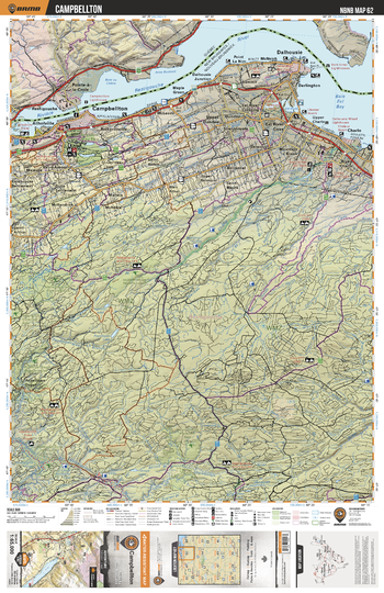
NBNB62 Campbellton - New Brunswick Topo
Backroad Mapbooks
This recreation topographic map for Campbellton highlights all the logging/resource roads, hunting areas, fishing lakes & streams, campsites, paddling routes for canoeing and kayaking, wildlife viewing areas, multi-use trails for hiking, biking, horseback riding, cross-country skiing and snowshoeing, motorized trails for ATVing and snowmobiling & more. Covering 1,950 km2 (750 mi2), this 1:65,000 scale map measures 38 x 51 km (23.5 x 32 mi), providing you with more topographic and recreational detail for the Grand Manan Island area than any other map on the market. New features include enhanced Crown land data and countless updates to roads, trails and recreational Points of Interest. This map includes Dalhousie, Campbellton, Charlo, Dundee, Balmoral, Eel River Cove, Eel Bay, Sugarloaf Mtn, Ristogouche River, Charlo River and more!
Page Size: 24 x 37 in (610 x 940 mm)
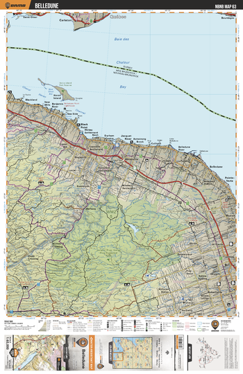
NBNB63 Belledune - New Brunswick Topo
Backroad Mapbooks
This recreation topographic map for Belledune highlights all the logging/resource roads, hunting areas, fishing lakes & streams, campsites, paddling routes for canoeing and kayaking, wildlife viewing areas, multi-use trails for hiking, biking, horseback riding, cross-country skiing and snowshoeing, motorized trails for ATVing and snowmobiling & more. Covering 1,950 km2 (750 mi2), this 1:65,000 scale map measures 38 x 51 km (23.5 x 32 mi), providing you with more topographic and recreational detail for the Grand Manan Island area than any other map on the market. New features include enhanced Crown land data and countless updates to roads, trails and recreational Points of Interest. This map includes Chaleur Bay, Belledune, Jacquet River Gorge Prov Protected Area, Antinouri Lake, Sunnyside, Jacquet River, Black Point, Heron Channel, Heron Island Park Reserve, Robertville and more!
Page Size: 24 x 37 in (610 x 940 mm)
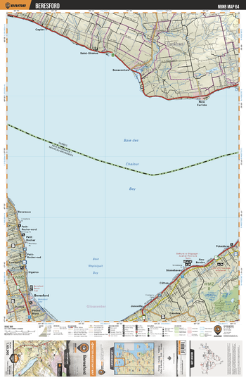
NBNB64 Beresford - New Brunswick Topo
Backroad Mapbooks
This recreation topographic map for Beresford highlights all the logging/resource roads, hunting areas, fishing lakes & streams, campsites, paddling routes for canoeing and kayaking, wildlife viewing areas, multi-use trails for hiking, biking, horseback riding, cross-country skiing and snowshoeing, motorized trails for ATVing and snowmobiling & more. Covering 1,950 km2 (750 mi2), this 1:65,000 scale map measures 38 x 51 km (23.5 x 32 mi), providing you with more topographic and recreational detail for the Grand Manan Island area than any other map on the market. New features include enhanced Crown land data and countless updates to roads, trails and recreational Points of Interest. This map includes Beresford, Nepisiguit Bay, Chaleur Bay, Pokeshaw, Clifton, Petit Rocher, Dunlop, Peters River, Stonehaven, Janeville and more!
Page Size: 24 x 37 in (610 x 940 mm)
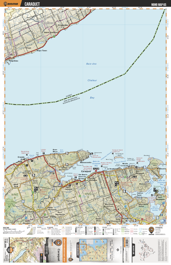
NBNB65 Caraquet - New Brunswick Topo
Backroad Mapbooks
This recreation topographic map for Caraquet highlights all the logging/resource roads, hunting areas, fishing lakes & streams, campsites, paddling routes for canoeing and kayaking, wildlife viewing areas, multi-use trails for hiking, biking, horseback riding, cross-country skiing and snowshoeing, motorized trails for ATVing and snowmobiling & more. Covering 1,950 km2 (750 mi2), this 1:65,000 scale map measures 38 x 51 km (23.5 x 32 mi), providing you with more topographic and recreational detail for the Grand Manan Island area than any other map on the market. New features include enhanced Crown land data and countless updates to roads, trails and recreational Points of Interest. This map includes Caraquet, Shippegan Bay, Morais, Evangeline, Bertrand, Grande Anse, Dugas, Maisonnette, Burnsville, Theriault and more!
Page Size: 24 x 37 in (610 x 940 mm)
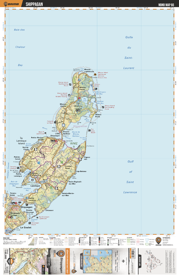
NBNB66 Shippagan - New Brunswick Topo
Backroad Mapbooks
This recreation topographic map for Shippagan highlights all the logging/resource roads, hunting areas, fishing lakes & streams, campsites, paddling routes for canoeing and kayaking, wildlife viewing areas, multi-use trails for hiking, biking, horseback riding, cross-country skiing and snowshoeing, motorized trails for ATVing and snowmobiling & more. Covering 1,950 km2 (750 mi2), this 1:65,000 scale map measures 38 x 51 km (23.5 x 32 mi), providing you with more topographic and recreational detail for the Grand Manan Island area than any other map on the market. New features include enhanced Crown land data and countless updates to roads, trails and recreational Points of Interest. This map includes Lameque, Shippagan, Le Goulet, Pigeon Hill, Miscou Harbour, Lameque Island, Miscou Island, Big Lake, Wilson Point, Chiasson and more!
Page Size: 24 x 37 in (610 x 940 mm)
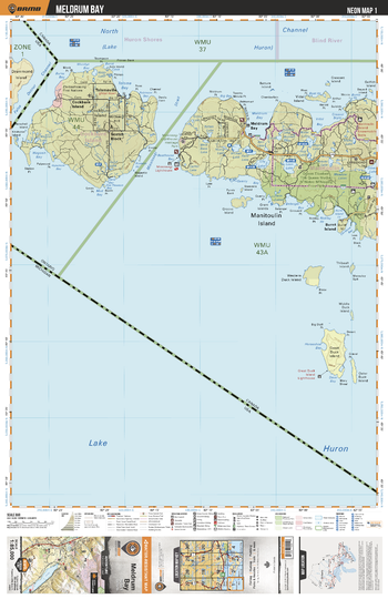
NEON01 Meldrum Bay - Northeastern Ontario Topo
Backroad Mapbooks
This recreation topographic map for Meldrum Bay highlights all the logging/resource roads, hunting areas, fishing lakes & streams, campsites, paddling routes for canoeing and kayaking, wildlife viewing areas, multi-use trails for hiking, biking, horseback riding, cross-country skiing and snowshoeing, motorized trails for ATVing and snowmobiling & more. Covering 3,040 km2 (1,170 mi2), this 1:85,000 scale map measures 48 x 63.5 km (30 x 39.5 mi), providing you with more topographic and recreational detail for the Meldrum Bay area than any other map on the market. New features include Crown land areas, countless new roads and trails plus additional recreational Points of Interest. Included on this map are Burnt Island, Cockburn Island, Great Duck Island, Lake Huron, Manitoulin Island, Scotch Block, Tolsmaville and more!
Page Size: 24 x 37 in (610 x 940 mm)
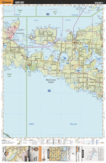
NEON02 Gore Bay - Northeastern Ontario Topo
Backroad Mapbooks
This recreation topographic map for Gore Bay highlights all the logging/resource roads, hunting areas, fishing lakes & streams, campsites, paddling routes for canoeing and kayaking, wildlife viewing areas, multi-use trails for hiking, biking, horseback riding, cross-country skiing and snowshoeing, motorized trails for ATVing and snowmobiling & more. Covering 3,040 km2 (1,170 mi2), this 1:85,000 scale map measures 48 x 63.5 km (30 x 39.5 mi), providing you with more topographic and recreational detail for the Meldrum Bay area than any other map on the market. New features include Crown land areas, countless new roads and trails plus additional recreational Points of Interest. Included on this map are Manitoulin Island, Bayfield Sound, Barrie Island, Gore Bay, Silver Water, Lake Kagawong, Spring Bay, Lake Wolsey and more!
Page Size: 24 x 37 in (610 x 940 mm)
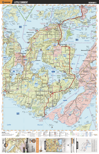
NEON03 Little Current - Northeastern Ontario Topo
Backroad Mapbooks
This recreation topographic map for Little Current highlights all the logging/resource roads, hunting areas, fishing lakes & streams, campsites, paddling routes for canoeing and kayaking, wildlife viewing areas, multi-use trails for hiking, biking, horseback riding, cross-country skiing and snowshoeing, motorized trails for ATVing and snowmobiling & more. Covering 3,040 km2 (1,170 mi2), this 1:85,000 scale map measures 48 x 63.5 km (30 x 39.5 mi), providing you with more topographic and recreational detail for the Meldrum Bay area than any other map on the market. New features include Crown land areas, countless new roads and trails plus additional recreational Points of Interest. Included on this map are M'Chigneeg, Manitowaning, Little Current, Lake Manitou, South Bay, Manitowaning Bay, Mindemoya Lake, Mudge Bay, Manitoulin Island and more!
Page Size: 24 x 37 in (610 x 940 mm)
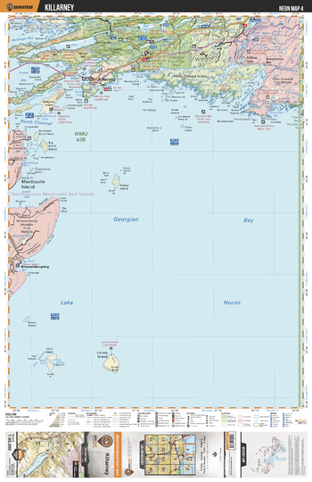
NEON04 Killarney - Northeastern Ontario Topo
Backroad Mapbooks
This recreation topographic map for Killarney highlights all the logging/resource roads, hunting areas, fishing lakes & streams, campsites, paddling routes for canoeing and kayaking, wildlife viewing areas, multi-use trails for hiking, biking, horseback riding, cross-country skiing and snowshoeing, motorized trails for ATVing and snowmobiling & more. Covering 3,040 km2 (1,170 mi2), this 1:85,000 scale map measures 48 x 63.5 km (30 x 39.5 mi), providing you with more topographic and recreational detail for the Meldrum Bay area than any other map on the market. New features include Crown land areas, countless new roads and trails plus additional recreational Points of Interest. Included on this map are Collins Inlet, Killarney, Wikwemikongsing, Beaverstone Bay, Philip Edward Island, Badgeley Island, Frazer Bay, Baie Fine, Killarney Prov Park and more!
Page Size: 24 x 37 in (610 x 940 mm)
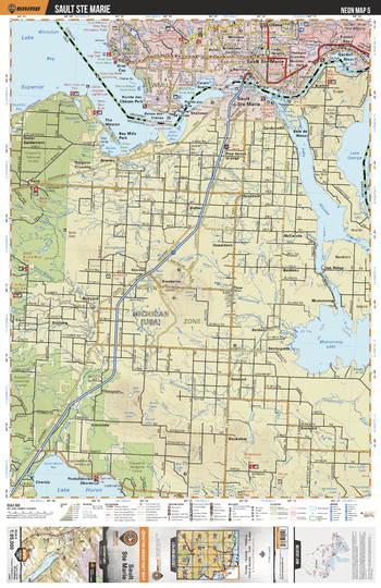
NEON05 Sault Ste Marie - Northeastern Ontario Topo
Backroad Mapbooks
This recreation topographic map for Sault Ste Marie highlights all the logging/resource roads, hunting areas, fishing lakes & streams, campsites, paddling routes for canoeing and kayaking, wildlife viewing areas, multi-use trails for hiking, biking, horseback riding, cross-country skiing and snowshoeing, motorized trails for ATVing and snowmobiling & more. Covering 3,040 km2 (1,170 mi2), this 1:85,000 scale map measures 48 x 63.5 km (30 x 39.5 mi), providing you with more topographic and recreational detail for the Meldrum Bay area than any other map on the market. New features include Crown land areas, countless new roads and trails plus additional recreational Points of Interest. Included on this map are Sault Ste Marie, French Bay, Garden River, Gros Cap, Odena, St Marys River, Whitefish Bay and more!
Page Size: 24 x 37 in (610 x 940 mm)
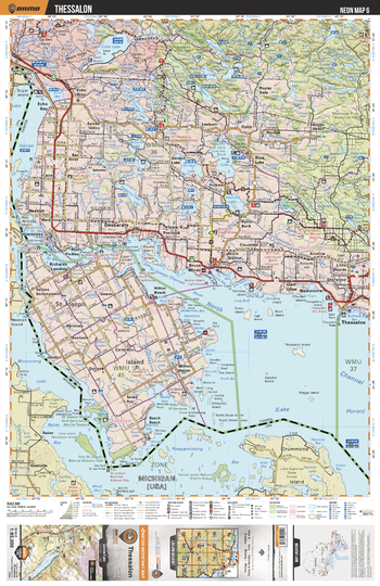
NEON06 Thessalon - Northeastern Ontario Topo
Backroad Mapbooks
This recreation topographic map for Thessalon highlights all the logging/resource roads, hunting areas, fishing lakes & streams, campsites, paddling routes for canoeing and kayaking, wildlife viewing areas, multi-use trails for hiking, biking, horseback riding, cross-country skiing and snowshoeing, motorized trails for ATVing and snowmobiling & more. Covering 3,040 km2 (1,170 mi2), this 1:85,000 scale map measures 48 x 63.5 km (30 x 39.5 mi), providing you with more topographic and recreational detail for the Meldrum Bay area than any other map on the market. New features include Crown land areas, countless new roads and trails plus additional recreational Points of Interest. Included on this map are Thessalon, St Joseph Island, Richards Landing, St Marys River, Desbarats, Rock Lake, Echo Lake, Echo Bay, Mississagi River Provincial Park, Ottertail Lake and more!
Page Size: 24 x 37 in (610 x 940 mm)
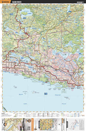
NEON07 Blind River - Northeastern Ontario Topo
Backroad Mapbooks
This recreation topographic map for Blind River highlights all the logging/resource roads, hunting areas, fishing lakes & streams, campsites, paddling routes for canoeing and kayaking, wildlife viewing areas, multi-use trails for hiking, biking, horseback riding, cross-country skiing and snowshoeing, motorized trails for ATVing and snowmobiling & more. Covering 3,040 km2 (1,170 mi2), this 1:85,000 scale map measures 48 x 63.5 km (30 x 39.5 mi), providing you with more topographic and recreational detail for the Meldrum Bay area than any other map on the market. New features include Crown land areas, countless new roads and trails plus additional recreational Points of Interest. Included on this map are Blind River, Day Mills, Wakomata Lake, Mississagi River Prov Park, Basswood Lake, Chiblow Lake, Matinenda Lake, Little White River, Blind River Prov Park, Bright Lake and more!
Page Size: 24 x 37 in (610 x 940 mm)
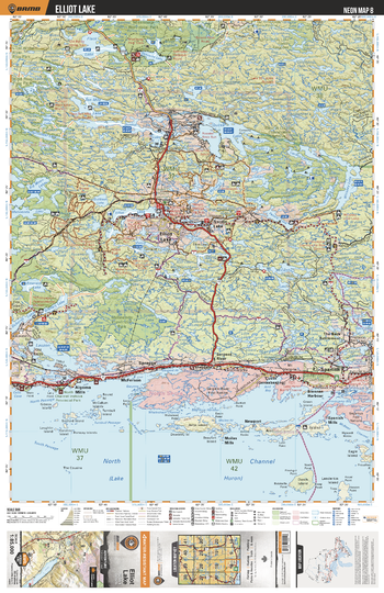
NEON08 Elliot Lake - Northeastern Ontario Topo
Backroad Mapbooks
This recreation topographic map for Elliot Lake highlights all the logging/resource roads, hunting areas, fishing lakes & streams, campsites, paddling routes for canoeing and kayaking, wildlife viewing areas, multi-use trails for hiking, biking, horseback riding, cross-country skiing and snowshoeing, motorized trails for ATVing and snowmobiling & more. Covering 3,040 km2 (1,170 mi2), this 1:85,000 scale map measures 48 x 63.5 km (30 x 39.5 mi), providing you with more topographic and recreational detail for the Meldrum Bay area than any other map on the market. New features include Crown land areas, countless new roads and trails plus additional recreational Points of Interest. Included on this map are Elliot Lake, Quirke Lake, Ten Mile Lake, Flack Lake, Spanish, Mississagi Prov Park, Nordic Lake, Dunlop Lake, Serpent River and more!
Page Size: 24 x 37 in (610 x 940 mm)
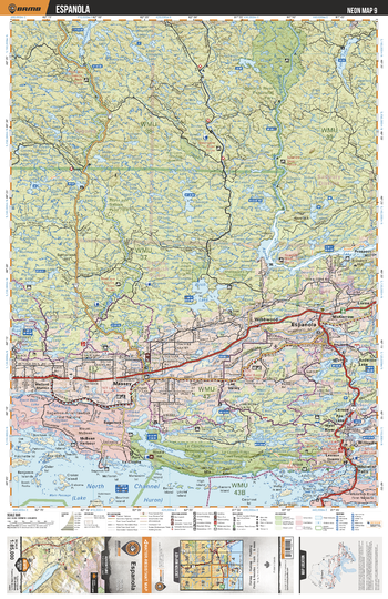
NEON09 Espanola - Northeastern Ontario Topo
Backroad Mapbooks
This recreation topographic map for Espanola highlights all the logging/resource roads, hunting areas, fishing lakes & streams, campsites, paddling routes for canoeing and kayaking, wildlife viewing areas, multi-use trails for hiking, biking, horseback riding, cross-country skiing and snowshoeing, motorized trails for ATVing and snowmobiling & more. Covering 3,040 km2 (1,170 mi2), this 1:85,000 scale map measures 48 x 63.5 km (30 x 39.5 mi), providing you with more topographic and recreational detail for the Meldrum Bay area than any other map on the market. New features include Crown land areas, countless new roads and trails plus additional recreational Points of Interest. Included on this map are Spanish River Prov Park, Agnew Lake, Espanola, La Cloche Prov Park, Spanish River, River aux Sables Prov Park, Birch Lake, La Cloche Lake, Fox Lake and more!
Page Size: 24 x 37 in (610 x 940 mm)
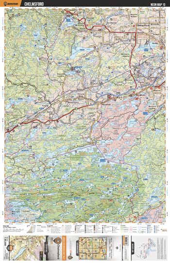
NEON10 Chelmsford - Northeastern Ontario Topo
Backroad Mapbooks
This recreation topographic map for Chelmsford highlights all the logging/resource roads, hunting areas, fishing lakes & streams, campsites, paddling routes for canoeing and kayaking, wildlife viewing areas, multi-use trails for hiking, biking, horseback riding, cross-country skiing and snowshoeing, motorized trails for ATVing and snowmobiling & more. Covering 3,040 km2 (1,170 mi2), this 1:85,000 scale map measures 48 x 63.5 km (30 x 39.5 mi), providing you with more topographic and recreational detail for the Meldrum Bay area than any other map on the market. New features include Crown land areas, countless new roads and trails plus additional recreational Points of Interest. Included on this map are Killarney Prov Park, Chelmsford, Whitewater Lake, Windy Lake, Vermilion Lake, Fairbank Lake, Round Lake, Lake Panache, Whitefish and more!
Page Size: 24 x 37 in (610 x 940 mm)
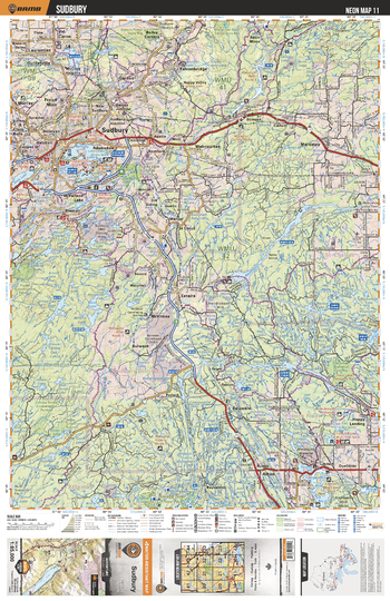
NEON11 Sudbury - Northeastern Ontario Topo
Backroad Mapbooks
This recreation topographic map for Sudbury highlights all the logging/resource roads, hunting areas, fishing lakes & streams, campsites, paddling routes for canoeing and kayaking, wildlife viewing areas, multi-use trails for hiking, biking, horseback riding, cross-country skiing and snowshoeing, motorized trails for ATVing and snowmobiling & more. Covering 3,040 km2 (1,170 mi2), this 1:85,000 scale map measures 48 x 63.5 km (30 x 39.5 mi), providing you with more topographic and recreational detail for the Meldrum Bay area than any other map on the market. New features include Crown land areas, countless new roads and trails plus additional recreational Points of Interest. Included on this map are Sudbury, Wanapitei River, Nepewassi Lake, Murdoch River, Eighteen Mile Bay, Ramsey Lake, Whitson Lake, Kelly Lake and more!
Page Size: 24 x 37 in (610 x 940 mm)
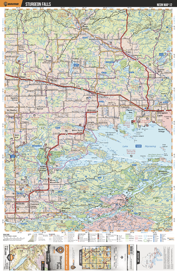
NEON12 Sturgeon Falls - Northeastern Ontario Topo
Backroad Mapbooks
This recreation topographic map for Sturgeon Falls highlights all the logging/resource roads, hunting areas, fishing lakes & streams, campsites, paddling routes for canoeing and kayaking, wildlife viewing areas, multi-use trails for hiking, biking, horseback riding, cross-country skiing and snowshoeing, motorized trails for ATVing and snowmobiling & more. Covering 3,040 km2 (1,170 mi2), this 1:85,000 scale map measures 48 x 63.5 km (30 x 39.5 mi), providing you with more topographic and recreational detail for the Meldrum Bay area than any other map on the market. New features include Crown land areas, countless new roads and trails plus additional recreational Points of Interest. Included on this map are Lake Nipissing, Sturgeon Falls, Cache Bay, Sturgeon River, Frence River, French River Prov Park, Tomiko Lake and more!
Page Size: 24 x 37 in (610 x 940 mm)
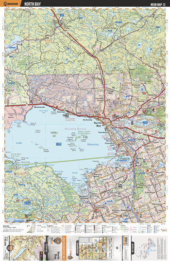
NEON13 North Bay - Northeastern Ontario Topo
Backroad Mapbooks
This recreation topographic map for North Bay highlights all the logging/resource roads, hunting areas, fishing lakes & streams, campsites, paddling routes for canoeing and kayaking, wildlife viewing areas, multi-use trails for hiking, biking, horseback riding, cross-country skiing and snowshoeing, motorized trails for ATVing and snowmobiling & more. Covering 3,040 km2 (1,170 mi2), this 1:85,000 scale map measures 48 x 63.5 km (30 x 39.5 mi), providing you with more topographic and recreational detail for the Meldrum Bay area than any other map on the market. New features include Crown land areas, countless new roads and trails plus additional recreational Points of Interest. Included on this map are North Bay, Lake Nipissing, Restoule Prov Park, Widdifield Forest Prov Park, Tomiko Lake, Callander Bay, Trout Lake and more!
Page Size: 24 x 37 in (610 x 940 mm)
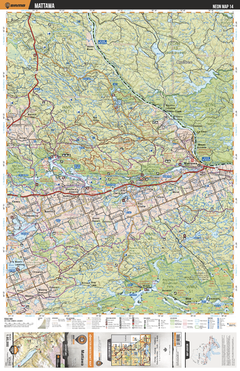
NEON14 Mattawa - Northeastern Ontario Topo
Backroad Mapbooks
This recreation topographic map for Mattawa highlights all the logging/resource roads, hunting areas, fishing lakes & streams, campsites, paddling routes for canoeing and kayaking, wildlife viewing areas, multi-use trails for hiking, biking, horseback riding, cross-country skiing and snowshoeing, motorized trails for ATVing and snowmobiling & more. Covering 3,040 km2 (1,170 mi2), this 1:85,000 scale map measures 48 x 63.5 km (30 x 39.5 mi), providing you with more topographic and recreational detail for the Meldrum Bay area than any other map on the market. New features include Crown land areas, countless new roads and trails plus additional recreational Points of Interest. Included on this map are Jocko River Prov Park, Algonquin Prov Park, Lake Talon, Mattawa, Lake Nosbonsing, Wasi Lake, Kioshkokwi Lakes, Mattawa River, Jocko River, Ottawa River and more!
Page Size: 24 x 37 in (610 x 940 mm)
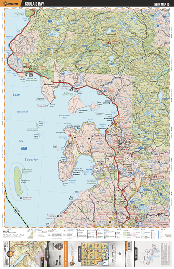
NEON15 Goulais Bay - Northeastern Ontario Topo
Backroad Mapbooks
This recreation topographic map for Goulais Bay highlights all the logging/resource roads, hunting areas, fishing lakes & streams, campsites, paddling routes for canoeing and kayaking, wildlife viewing areas, multi-use trails for hiking, biking, horseback riding, cross-country skiing and snowshoeing, motorized trails for ATVing and snowmobiling & more. Covering 3,040 km2 (1,170 mi2), this 1:85,000 scale map measures 48 x 63.5 km (30 x 39.5 mi), providing you with more topographic and recreational detail for the Meldrum Bay area than any other map on the market. New features include Crown land areas, countless new roads and trails plus additional recreational Points of Interest. Included on this map are Lake Superior, Batchawana Bay, Pancake Bay Prov Park, Batchawana Prov Park, Goulais Bay, Achigan Lake, Pancake Lake, Sandy Islands and more!
Page Size: 24 x 37 in (610 x 940 mm)
No search results