


MapSherpa Catalog
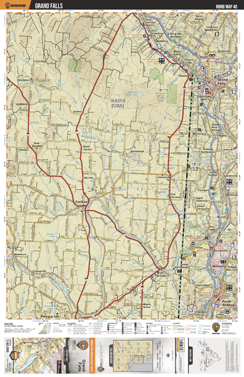
NBNB40 Grand Falls - New Brunswick Topo
Backroad Mapbooks
This recreation topographic map for Grand Falls highlights all the logging/resource roads, hunting areas, fishing lakes & streams, campsites, paddling routes for canoeing and kayaking, wildlife viewing areas, multi-use trails for hiking, biking, horseback riding, cross-country skiing and snowshoeing, motorized trails for ATVing and snowmobiling & more. Covering 1,950 km2 (750 mi2), this 1:65,000 scale map measures 38 x 51 km (23.5 x 32 mi), providing you with more topographic and recreational detail for the Grand Manan Island area than any other map on the market. New features include enhanced Crown land data and countless updates to roads, trails and recreational Points of Interest. This map includes Grand Falls, Maliseet, Pert-Andover, Saint John River, Aroostook River, Carlingford, Medford, McCluskey, St Andre, Bellefleur and more!
Page Size: 24 x 37 in (610 x 940 mm)
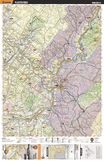
NBNB41 Plaster Rock - New Brunswick Topo
Backroad Mapbooks
This recreation topographic map for Plaster Rock highlights all the logging/resource roads, hunting areas, fishing lakes & streams, campsites, paddling routes for canoeing and kayaking, wildlife viewing areas, multi-use trails for hiking, biking, horseback riding, cross-country skiing and snowshoeing, motorized trails for ATVing and snowmobiling & more. Covering 1,950 km2 (750 mi2), this 1:65,000 scale map measures 38 x 51 km (23.5 x 32 mi), providing you with more topographic and recreational detail for the Grand Manan Island area than any other map on the market. New features include enhanced Crown land data and countless updates to roads, trails and recreational Points of Interest. This map includes Plaster Rock, Plaster Rock-Renous Provincial Game Area, Tobique River, Oxbow, Blue Mtn Bend, Longley, Rowena, Drummond, Red Rapids, Salmon River and more!
Page Size: 24 x 37 in (610 x 940 mm)
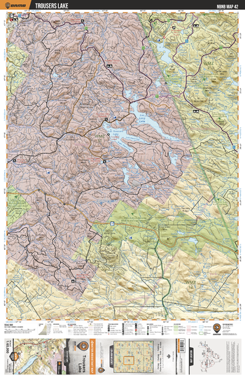
NBNB42 Trousers Lake - New Brunswick Topo
Backroad Mapbooks
This recreation topographic map for Trousers Lake highlights all the logging/resource roads, hunting areas, fishing lakes & streams, campsites, paddling routes for canoeing and kayaking, wildlife viewing areas, multi-use trails for hiking, biking, horseback riding, cross-country skiing and snowshoeing, motorized trails for ATVing and snowmobiling & more. Covering 1,950 km2 (750 mi2), this 1:65,000 scale map measures 38 x 51 km (23.5 x 32 mi), providing you with more topographic and recreational detail for the Grand Manan Island area than any other map on the market. New features include enhanced Crown land data and countless updates to roads, trails and recreational Points of Interest. This map includes Long Lake, Trousers Lake, Serpentine Lake, Island Lake, Gulquac Lake, Moose Lake, Tuadook River, Plaster Rock-Renous Provincial Game Area, Britt Brook Lake, Blind Lake and more!
Page Size: 24 x 37 in (610 x 940 mm)
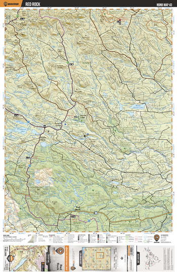
NBNB43 Red Rock - New Brunswick Topo
Backroad Mapbooks
This recreation topographic map for Red Rock highlights all the logging/resource roads, hunting areas, fishing lakes & streams, campsites, paddling routes for canoeing and kayaking, wildlife viewing areas, multi-use trails for hiking, biking, horseback riding, cross-country skiing and snowshoeing, motorized trails for ATVing and snowmobiling & more. Covering 1,950 km2 (750 mi2), this 1:65,000 scale map measures 38 x 51 km (23.5 x 32 mi), providing you with more topographic and recreational detail for the Grand Manan Island area than any other map on the market. New features include enhanced Crown land data and countless updates to roads, trails and recreational Points of Interest. This map includes Plaster Rock-Renous Provincial Game Area, Kennedy Lakes Prov Protected Area, Red Rock, Loggie Lodge, Pratt's Camp, Tuadook Lake, Mullin Stream Lake, Kennedy Lakes, Renous River, Ramsay Lodge and more!
Page Size: 24 x 37 in (610 x 940 mm)
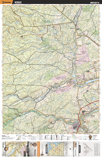
NBNB44 Renous - New Brunswick Topo
Backroad Mapbooks
This recreation topographic map for Renous highlights all the logging/resource roads, hunting areas, fishing lakes & streams, campsites, paddling routes for canoeing and kayaking, wildlife viewing areas, multi-use trails for hiking, biking, horseback riding, cross-country skiing and snowshoeing, motorized trails for ATVing and snowmobiling & more. Covering 1,950 km2 (750 mi2), this 1:65,000 scale map measures 38 x 51 km (23.5 x 32 mi), providing you with more topographic and recreational detail for the Grand Manan Island area than any other map on the market. New features include enhanced Crown land data and countless updates to roads, trails and recreational Points of Interest. This map includes Renous River, Southwest Miramichi River, Northwest Miramichi River, Renous, Dungarvon River, Exmoor, Whitney, Big Hole, Wayerton, Halcombe and more!
Page Size: 24 x 37 in (610 x 940 mm)
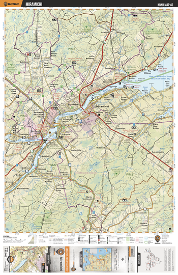
NBNB45 Miramichi - New Brunswick Topo
Backroad Mapbooks
This recreation topographic map for Miramichi highlights all the logging/resource roads, hunting areas, fishing lakes & streams, campsites, paddling routes for canoeing and kayaking, wildlife viewing areas, multi-use trails for hiking, biking, horseback riding, cross-country skiing and snowshoeing, motorized trails for ATVing and snowmobiling & more. Covering 1,950 km2 (750 mi2), this 1:65,000 scale map measures 38 x 51 km (23.5 x 32 mi), providing you with more topographic and recreational detail for the Grand Manan Island area than any other map on the market. New features include enhanced Crown land data and countless updates to roads, trails and recreational Points of Interest. This map includes Miramichi, Miramichi River, Napan Bay, Bellefond, Bartibog, Barryville, Chelmsford, Redmondville, Big Cove, Barnaby River and more!
Page Size: 24 x 37 in (610 x 940 mm)
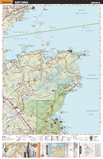
NBNB46 Burnt Church - New Brunswick Topo
Backroad Mapbooks
This recreation topographic map for Burnt Church highlights all the logging/resource roads, hunting areas, fishing lakes & streams, campsites, paddling routes for canoeing and kayaking, wildlife viewing areas, multi-use trails for hiking, biking, horseback riding, cross-country skiing and snowshoeing, motorized trails for ATVing and snowmobiling & more. Covering 1,950 km2 (750 mi2), this 1:65,000 scale map measures 38 x 51 km (23.5 x 32 mi), providing you with more topographic and recreational detail for the Grand Manan Island area than any other map on the market. New features include enhanced Crown land data and countless updates to roads, trails and recreational Points of Interest. This map includes Kouchibouguac National Park, St Margarets, Miramichi, Burnt Church, Miramichi Bay, Kouchibouguac River, Kouchibouguac Bay, Point Sapin Centre, Black River, Baie Sainte Anne and more!
Page Size: 24 x 37 in (610 x 940 mm)
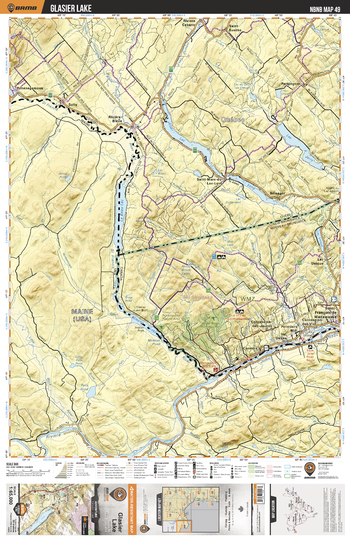
NBNB49 Glasier Lake - New Brunswick Topo
Backroad Mapbooks
This recreation topographic map for Glasier Lake highlights all the logging/resource roads, hunting areas, fishing lakes & streams, campsites, paddling routes for canoeing and kayaking, wildlife viewing areas, multi-use trails for hiking, biking, horseback riding, cross-country skiing and snowshoeing, motorized trails for ATVing and snowmobiling & more. Covering 1,950 km2 (750 mi2), this 1:65,000 scale map measures 38 x 51 km (23.5 x 32 mi), providing you with more topographic and recreational detail for the Grand Manan Island area than any other map on the market. New features include enhanced Crown land data and countless updates to roads, trails and recreational Points of Interest. This map includes Saint John River, Lac Long, Lac Jerry, Lac Unique, Saint Francois de Madawaska, Concession des Viel, Pelletiers Mill, Val Oakes, Concession des Jaunes, Connors, Glasier Lake and more!
Page Size: 24 x 37 in (610 x 940 mm)
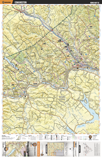
NBNB50 Edmundston - New Brunswick Topo
Backroad Mapbooks
This recreation topographic map for Edmundston highlights all the logging/resource roads, hunting areas, fishing lakes & streams, campsites, paddling routes for canoeing and kayaking, wildlife viewing areas, multi-use trails for hiking, biking, horseback riding, cross-country skiing and snowshoeing, motorized trails for ATVing and snowmobiling & more. Covering 1,950 km2 (750 mi2), this 1:65,000 scale map measures 38 x 51 km (23.5 x 32 mi), providing you with more topographic and recreational detail for the Grand Manan Island area than any other map on the market. New features include enhanced Crown land data and countless updates to roads, trails and recreational Points of Interest. This map includes Edmunston, Fort Kent, Saint John River, Saint Jacques, Lac Baker, Frenchville, Ennemond, Iroquois River, Baker Brook, Ciquart and more!
Page Size: 24 x 37 in (610 x 940 mm)
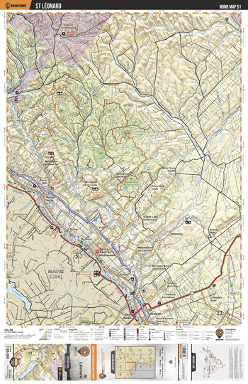
NBNB51 St Léonard - New Brunswick Topo
Backroad Mapbooks
This recreation topographic map for St Léonard highlights all the logging/resource roads, hunting areas, fishing lakes & streams, campsites, paddling routes for canoeing and kayaking, wildlife viewing areas, multi-use trails for hiking, biking, horseback riding, cross-country skiing and snowshoeing, motorized trails for ATVing and snowmobiling & more. Covering 1,950 km2 (750 mi2), this 1:65,000 scale map measures 38 x 51 km (23.5 x 32 mi), providing you with more topographic and recreational detail for the Grand Manan Island area than any other map on the market. New features include enhanced Crown land data and countless updates to roads, trails and recreational Points of Interest. This map includes St Leonard, Saint John River, Sainte Anne de Madawaska, Riviere Verte, Grande River, Green River, McCoy Brook, Quisibis, Miller Line Cache, Sirois and more!
Page Size: 24 x 37 in (610 x 940 mm)
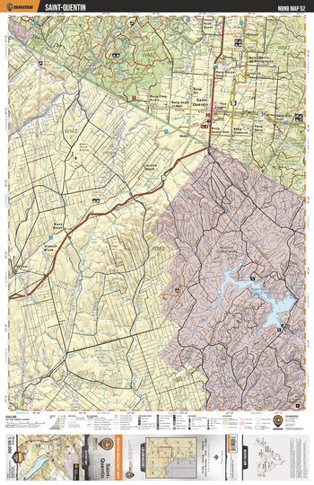
NBNB52 Saint Quentin - New Brunswick Topo
Backroad Mapbooks
This recreation topographic map for Saint Quentin highlights all the logging/resource roads, hunting areas, fishing lakes & streams, campsites, paddling routes for canoeing and kayaking, wildlife viewing areas, multi-use trails for hiking, biking, horseback riding, cross-country skiing and snowshoeing, motorized trails for ATVing and snowmobiling & more. Covering 1,950 km2 (750 mi2), this 1:65,000 scale map measures 38 x 51 km (23.5 x 32 mi), providing you with more topographic and recreational detail for the Grand Manan Island area than any other map on the market. New features include enhanced Crown land data and countless updates to roads, trails and recreational Points of Interest. This map includes Saint Quentin, Sisson Branch Reservoir, Limerick, Veneer, Little Main Restigouche River, Thibault, Hazen, Jardine Brook, Black Brook, Violette Brook and more!
Page Size: 24 x 37 in (610 x 940 mm)
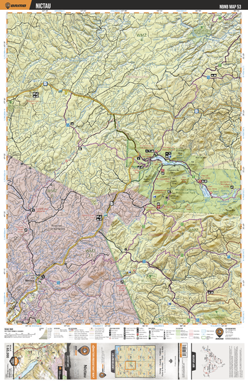
NBNB53 Nictau - New Brunswick Topo
Backroad Mapbooks
This recreation topographic map for Nictau highlights all the logging/resource roads, hunting areas, fishing lakes & streams, campsites, paddling routes for canoeing and kayaking, wildlife viewing areas, multi-use trails for hiking, biking, horseback riding, cross-country skiing and snowshoeing, motorized trails for ATVing and snowmobiling & more. Covering 1,950 km2 (750 mi2), this 1:65,000 scale map measures 38 x 51 km (23.5 x 32 mi), providing you with more topographic and recreational detail for the Grand Manan Island area than any other map on the market. New features include enhanced Crown land data and countless updates to roads, trails and recreational Points of Interest. This map includes Mount Carleton Prov Park, Bathurst Lake, Nictau Lake, Nepisiguit Lakes, Mamozekel River, Little Tobique River, Nictau, Northwest Upsalquitch River, Mt Head, Teneriffe Lake and more!
Page Size: 24 x 37 in (610 x 940 mm)
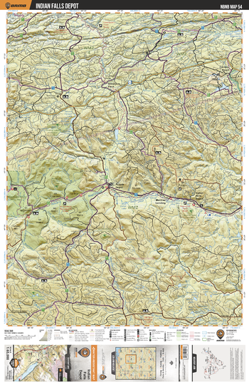
NBNB54 Indian Falls Depot - New Brunswick Topo
Backroad Mapbooks
This recreation topographic map for Indian Falls Depot highlights all the logging/resource roads, hunting areas, fishing lakes & streams, campsites, paddling routes for canoeing and kayaking, wildlife viewing areas, multi-use trails for hiking, biking, horseback riding, cross-country skiing and snowshoeing, motorized trails for ATVing and snowmobiling & more. Covering 1,950 km2 (750 mi2), this 1:65,000 scale map measures 38 x 51 km (23.5 x 32 mi), providing you with more topographic and recreational detail for the Grand Manan Island area than any other map on the market. New features include enhanced Crown land data and countless updates to roads, trails and recreational Points of Interest. This map includes New Brunswick Highlands Protected Area, Mount Carleton Prov Park, Nepisiguit River, Upsalquitch Lake, Caribou Depot, Mathias Landing, Indian Falls Depot, Popple Depot, Northwest Miramichi River, Simpsons Field and more!
Page Size: 24 x 37 in (610 x 940 mm)
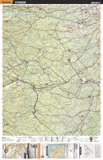
NBNB55 Tetagouche - New Brunswick Topo
Backroad Mapbooks
This recreation topographic map for Tetagouche highlights all the logging/resource roads, hunting areas, fishing lakes & streams, campsites, paddling routes for canoeing and kayaking, wildlife viewing areas, multi-use trails for hiking, biking, horseback riding, cross-country skiing and snowshoeing, motorized trails for ATVing and snowmobiling & more. Covering 1,950 km2 (750 mi2), this 1:65,000 scale map measures 38 x 51 km (23.5 x 32 mi), providing you with more topographic and recreational detail for the Grand Manan Island area than any other map on the market. New features include enhanced Crown land data and countless updates to roads, trails and recreational Points of Interest. This map includes Nepisiguit River, Heath Steele, Brunswick Mines, Bathurst Mines, Tetagouche, Millstream River, Rio Grande, Portage River, Pabineau River and more!
Page Size: 24 x 37 in (610 x 940 mm)
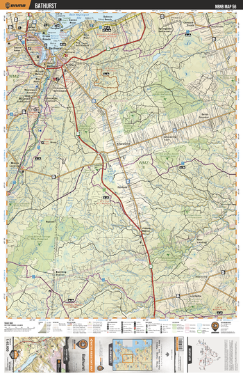
NBNB56 Bathurst - New Brunswick Topo
Backroad Mapbooks
This recreation topographic map for Bathurst highlights all the logging/resource roads, hunting areas, fishing lakes & streams, campsites, paddling routes for canoeing and kayaking, wildlife viewing areas, multi-use trails for hiking, biking, horseback riding, cross-country skiing and snowshoeing, motorized trails for ATVing and snowmobiling & more. Covering 1,950 km2 (750 mi2), this 1:65,000 scale map measures 38 x 51 km (23.5 x 32 mi), providing you with more topographic and recreational detail for the Grand Manan Island area than any other map on the market. New features include enhanced Crown land data and countless updates to roads, trails and recreational Points of Interest. This map includes Bathurst, Big Tracadie River Wildlife Management Area, Nepisiguit River, Allardville, Nepisiguit Bay, Salmon Beach, Rocheville, Daulnay, Allainville, Bear Landing and more!
Page Size: 24 x 37 in (610 x 940 mm)
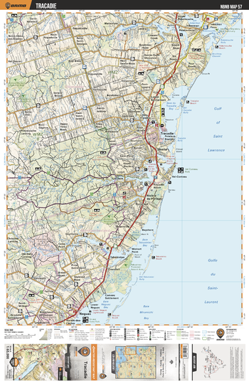
NBNB57 Tracadie - New Brunswick Topo
Backroad Mapbooks
This recreation topographic map for Tracadie highlights all the logging/resource roads, hunting areas, fishing lakes & streams, campsites, paddling routes for canoeing and kayaking, wildlife viewing areas, multi-use trails for hiking, biking, horseback riding, cross-country skiing and snowshoeing, motorized trails for ATVing and snowmobiling & more. Covering 1,950 km2 (750 mi2), this 1:65,000 scale map measures 38 x 51 km (23.5 x 32 mi), providing you with more topographic and recreational detail for the Grand Manan Island area than any other map on the market. New features include enhanced Crown land data and countless updates to roads, trails and recreational Points of Interest. This map includes Tracadie, Sheila, Inkerman, Tracadie River, Neguac, Tabusintac River, Pokemouche River, Gaythorne, Spruce Brook, Gaspereau and more!
Page Size: 24 x 37 in (610 x 940 mm)
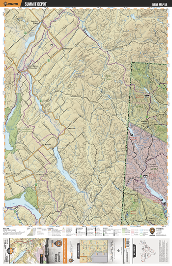
NBNB58 Summit Depot - New Brunswick Topo
Backroad Mapbooks
This recreation topographic map for Summit Depot highlights all the logging/resource roads, hunting areas, fishing lakes & streams, campsites, paddling routes for canoeing and kayaking, wildlife viewing areas, multi-use trails for hiking, biking, horseback riding, cross-country skiing and snowshoeing, motorized trails for ATVing and snowmobiling & more. Covering 1,950 km2 (750 mi2), this 1:65,000 scale map measures 38 x 51 km (23.5 x 32 mi), providing you with more topographic and recreational detail for the Grand Manan Island area than any other map on the market. New features include enhanced Crown land data and countless updates to roads, trails and recreational Points of Interest. This map includes First Lake, Summit Depot, Rimouski River, Third Lake, Twin Lakes, Second Lake, Halfway Depot, Mud Lake, Wild Goose Lake and more!
Page Size: 24 x 37 in (610 x 940 mm)
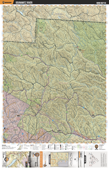
NBNB59 Gounamitz River - New Brunswick Topo
Backroad Mapbooks
This recreation topographic map for Gounamitz River highlights all the logging/resource roads, hunting areas, fishing lakes & streams, campsites, paddling routes for canoeing and kayaking, wildlife viewing areas, multi-use trails for hiking, biking, horseback riding, cross-country skiing and snowshoeing, motorized trails for ATVing and snowmobiling & more. Covering 1,950 km2 (750 mi2), this 1:65,000 scale map measures 38 x 51 km (23.5 x 32 mi), providing you with more topographic and recreational detail for the Grand Manan Island area than any other map on the market. New features include enhanced Crown land data and countless updates to roads, trails and recreational Points of Interest. This map includes South Kedgwick Protected Area, Kedgwick River, Gounamitz River, Clearwater Brook, Eighteen Mile Gulch and more!
Page Size: 24 x 37 in (610 x 940 mm)
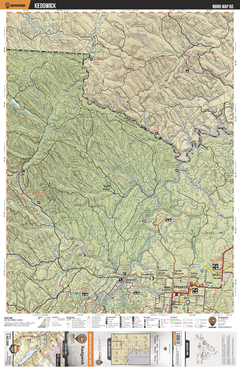
NBNB60 Kedgwick - New Brunswick Topo
Backroad Mapbooks
This recreation topographic map for Kedgwick highlights all the logging/resource roads, hunting areas, fishing lakes & streams, campsites, paddling routes for canoeing and kayaking, wildlife viewing areas, multi-use trails for hiking, biking, horseback riding, cross-country skiing and snowshoeing, motorized trails for ATVing and snowmobiling & more. Covering 1,950 km2 (750 mi2), this 1:65,000 scale map measures 38 x 51 km (23.5 x 32 mi), providing you with more topographic and recreational detail for the Grand Manan Island area than any other map on the market. New features include enhanced Crown land data and countless updates to roads, trails and recreational Points of Interest. This map includes Kedgwick, Whites Brook, Restigouche River, Patapedia River, Kedgwick River, Eightmile Lake, Tracy Depot, McDougall Lake, States Lake and more!
Page Size: 24 x 37 in (610 x 940 mm)
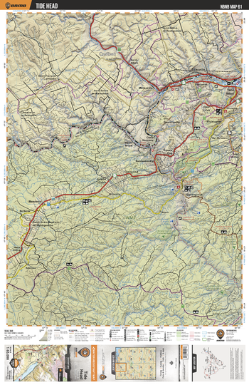
NBNB61 Tide Head - New Brunswick Topo
Backroad Mapbooks
This recreation topographic map for Tide Head highlights all the logging/resource roads, hunting areas, fishing lakes & streams, campsites, paddling routes for canoeing and kayaking, wildlife viewing areas, multi-use trails for hiking, biking, horseback riding, cross-country skiing and snowshoeing, motorized trails for ATVing and snowmobiling & more. Covering 1,950 km2 (750 mi2), this 1:65,000 scale map measures 38 x 51 km (23.5 x 32 mi), providing you with more topographic and recreational detail for the Grand Manan Island area than any other map on the market. New features include enhanced Crown land data and countless updates to roads, trails and recreational Points of Interest. This map includes Ristigouche River, Glen Levit, Tide Head, Upsalquitch, Glenwood, Menneval, Adams Gulch, Camp Harmony, Saint Arthur, Upsalquitch River and more!
Page Size: 24 x 37 in (610 x 940 mm)
No search results