


MapSherpa Catalog
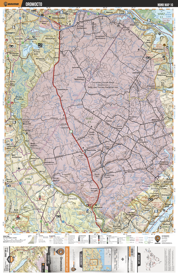
NBNB10 Oromocto - New Brunswick Topo
Backroad Mapbooks
This recreation topographic map for Oromocto highlights all the logging/resource roads, hunting areas, fishing lakes & streams, campsites, paddling routes for canoeing and kayaking, wildlife viewing areas, multi-use trails for hiking, biking, horseback riding, cross-country skiing and snowshoeing, motorized trails for ATVing and snowmobiling & more. Covering 1,950 km2 (750 mi2), this 1:65,000 scale map measures 38 x 51 km (23.5 x 32 mi), providing you with more topographic and recreational detail for the Grand Manan Island area than any other map on the market. New features include enhanced Crown land data and countless updates to roads, trails and recreational Points of Interest. This map includes Canadian Forces Base Gagetown, Oromocto, Saint John River, Gagetown, Browns Flats, Clones, Geary, French Lake, Oromocto River, Enniskillen and more!
Page Size: 24 x 37 in (610 x 940 mm)
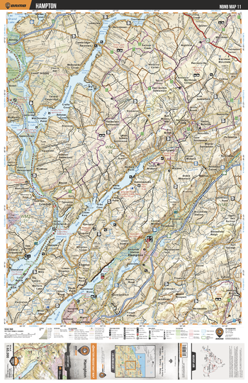
NBNB11 Hampton - New Brunswick Topo
Backroad Mapbooks
This recreation topographic map for Hampton highlights all the logging/resource roads, hunting areas, fishing lakes & streams, campsites, paddling routes for canoeing and kayaking, wildlife viewing areas, multi-use trails for hiking, biking, horseback riding, cross-country skiing and snowshoeing, motorized trails for ATVing and snowmobiling & more. Covering 1,950 km2 (750 mi2), this 1:65,000 scale map measures 38 x 51 km (23.5 x 32 mi), providing you with more topographic and recreational detail for the Grand Manan Island area than any other map on the market. New features include enhanced Crown land data and countless updates to roads, trails and recreational Points of Interest. This map includes Washademoak Lake, Urquhart, Hampton, Kennebecasis River, Darlings Lake, Belleisle Bay, Long Reach, Saint John River, Cambridge Narrows, Evandale and more!
Page Size: 24 x 37 in (610 x 940 mm)
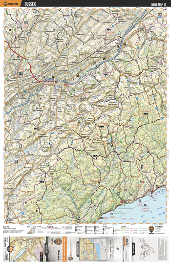
NBNB12 Sussex - New Brunswick Topo
Backroad Mapbooks
This recreation topographic map for Sussex highlights all the logging/resource roads, hunting areas, fishing lakes & streams, campsites, paddling routes for canoeing and kayaking, wildlife viewing areas, multi-use trails for hiking, biking, horseback riding, cross-country skiing and snowshoeing, motorized trails for ATVing and snowmobiling & more. Covering 1,950 km2 (750 mi2), this 1:65,000 scale map measures 38 x 51 km (23.5 x 32 mi), providing you with more topographic and recreational detail for the Grand Manan Island area than any other map on the market. New features include enhanced Crown land data and countless updates to roads, trails and recreational Points of Interest. This map includes Sussex, Lindys, Five Points, Snider Mountain, Berwick, Chambers Settlement, Kennebecasis River, Little Salmon River, Cassidy Lake, Picadilly and more!
Page Size: 24 x 37 in (610 x 940 mm)
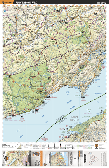
NBNB13 Fundy National Park - New Brunswick Topo
Backroad Mapbooks
This recreation topographic map for Fundy National Park highlights all the logging/resource roads, hunting areas, fishing lakes & streams, campsites, paddling routes for canoeing and kayaking, wildlife viewing areas, multi-use trails for hiking, biking, horseback riding, cross-country skiing and snowshoeing, motorized trails for ATVing and snowmobiling & more. Covering 1,950 km2 (750 mi2), this 1:65,000 scale map measures 38 x 51 km (23.5 x 32 mi), providing you with more topographic and recreational detail for the Grand Manan Island area than any other map on the market. New features include enhanced Crown land data and countless updates to roads, trails and recreational Points of Interest. This map includes Fundy National Park, Rocher Bay, Chignecto Bay, Harvey Bank, Shepody River, Gowland Mountain, Elgin, Rosevale, Mapleton, Caledonia Gorge Protected Area and more!
Page Size: 24 x 37 in (610 x 940 mm)
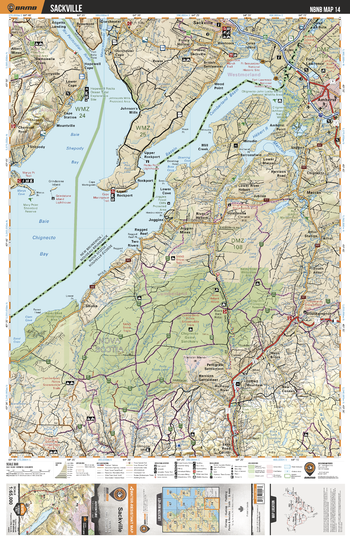
NBNB14 Sackville - New Brunswick Topo
Backroad Mapbooks
This recreation topographic map for Sackville highlights all the logging/resource roads, hunting areas, fishing lakes & streams, campsites, paddling routes for canoeing and kayaking, wildlife viewing areas, multi-use trails for hiking, biking, horseback riding, cross-country skiing and snowshoeing, motorized trails for ATVing and snowmobiling & more. Covering 1,950 km2 (750 mi2), this 1:65,000 scale map measures 38 x 51 km (23.5 x 32 mi), providing you with more topographic and recreational detail for the Grand Manan Island area than any other map on the market. New features include enhanced Crown land data and countless updates to roads, trails and recreational Points of Interest. This map includes Petitcodiac River, Cumberland Basin, Sackville, Evans, Rockport, Shepody, Curryville, Albert Mines, Dorchester, Wood Point and more!
Page Size: 24 x 37 in (610 x 940 mm)
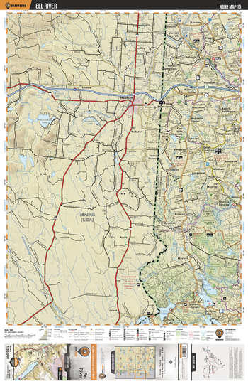
NBNB15 Eel River - New Brunswick Topo
Backroad Mapbooks
This recreation topographic map for Eel River highlights all the logging/resource roads, hunting areas, fishing lakes & streams, campsites, paddling routes for canoeing and kayaking, wildlife viewing areas, multi-use trails for hiking, biking, horseback riding, cross-country skiing and snowshoeing, motorized trails for ATVing and snowmobiling & more. Covering 1,950 km2 (750 mi2), this 1:65,000 scale map measures 38 x 51 km (23.5 x 32 mi), providing you with more topographic and recreational detail for the Grand Manan Island area than any other map on the market. New features include enhanced Crown land data and countless updates to roads, trails and recreational Points of Interest. This map includes First Eel Lake, North Lake, Eel River Lake, Maxwell, Benton, Wickham, Elmwood, Plymouth, Lindsay, Meduxnekeag River and more!
Page Size: 24 x 37 in (610 x 940 mm)
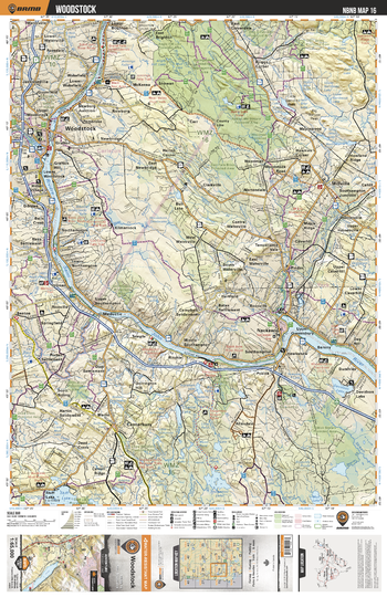
NBNB16 Woodstock - New Brunswick Topo
Backroad Mapbooks
This recreation topographic map for Woodstock highlights all the logging/resource roads, hunting areas, fishing lakes & streams, campsites, paddling routes for canoeing and kayaking, wildlife viewing areas, multi-use trails for hiking, biking, horseback riding, cross-country skiing and snowshoeing, motorized trails for ATVing and snowmobiling & more. Covering 1,950 km2 (750 mi2), this 1:65,000 scale map measures 38 x 51 km (23.5 x 32 mi), providing you with more topographic and recreational detail for the Grand Manan Island area than any other map on the market. New features include enhanced Crown land data and countless updates to roads, trails and recreational Points of Interest. This map includes Saint John River, Skiff Lake, Canterbury, Nackawic, Millville, Woodstock, Becaguimec Provincial Game Area, Davidson Lake, Big Lake, Bull Lake and more!
Page Size: 24 x 37 in (610 x 940 mm)
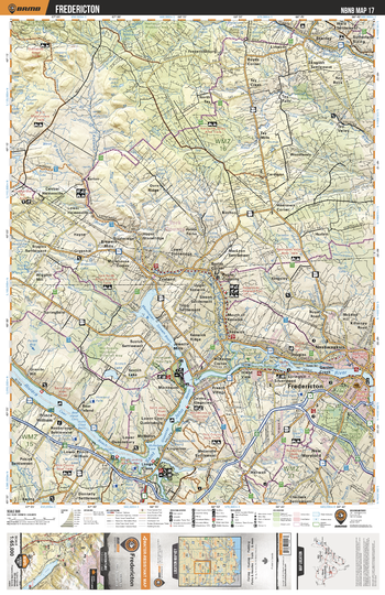
NBNB17 Fredericton - New Brunswick Topo
Backroad Mapbooks
This recreation topographic map for Fredericton highlights all the logging/resource roads, hunting areas, fishing lakes & streams, campsites, paddling routes for canoeing and kayaking, wildlife viewing areas, multi-use trails for hiking, biking, horseback riding, cross-country skiing and snowshoeing, motorized trails for ATVing and snowmobiling & more. Covering 1,950 km2 (750 mi2), this 1:65,000 scale map measures 38 x 51 km (23.5 x 32 mi), providing you with more topographic and recreational detail for the Grand Manan Island area than any other map on the market. New features include enhanced Crown land data and countless updates to roads, trails and recreational Points of Interest. This map includes Saint John River, Fredericton, New Maryland, McNallys, Prince William, Tay Valley, Greenhill, Stanley, Mactaquac Stream Basin, Longs Creek and more!
Page Size: 24 x 37 in (610 x 940 mm)
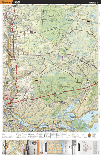
NBNB18 Devon - New Brunswick Topo
Backroad Mapbooks
This recreation topographic map for Devon highlights all the logging/resource roads, hunting areas, fishing lakes & streams, campsites, paddling routes for canoeing and kayaking, wildlife viewing areas, multi-use trails for hiking, biking, horseback riding, cross-country skiing and snowshoeing, motorized trails for ATVing and snowmobiling & more. Covering 1,950 km2 (750 mi2), this 1:65,000 scale map measures 38 x 51 km (23.5 x 32 mi), providing you with more topographic and recreational detail for the Grand Manan Island area than any other map on the market. New features include enhanced Crown land data and countless updates to roads, trails and recreational Points of Interest. This map includes Maquapit Lake, French Lake, Saint John River, Fredericton, Devon, Glencoe, Indian Lake, Killarney Lake Park, Burpee Wildlife Protected Area, Bantalor Provincial Wildlife Area and more!
Page Size: 24 x 37 in (610 x 940 mm)
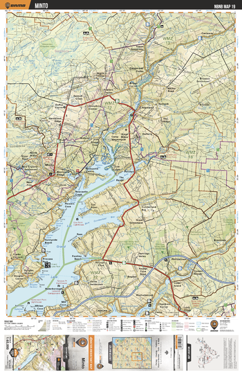
NBNB19 Minto - New Brunswick Topo
Backroad Mapbooks
This recreation topographic map for Minto highlights all the logging/resource roads, hunting areas, fishing lakes & streams, campsites, paddling routes for canoeing and kayaking, wildlife viewing areas, multi-use trails for hiking, biking, horseback riding, cross-country skiing and snowshoeing, motorized trails for ATVing and snowmobiling & more. Covering 1,950 km2 (750 mi2), this 1:65,000 scale map measures 38 x 51 km (23.5 x 32 mi), providing you with more topographic and recreational detail for the Grand Manan Island area than any other map on the market. New features include enhanced Crown land data and countless updates to roads, trails and recreational Points of Interest. This map includes Grand Lake, Canaan River, Douglas Harbour, Minto, Gaspereau Forks, Salmon River, Gaspereau River, Phillipstown, Canaan Rapids, Chipman and more!
Page Size: 24 x 37 in (610 x 940 mm)
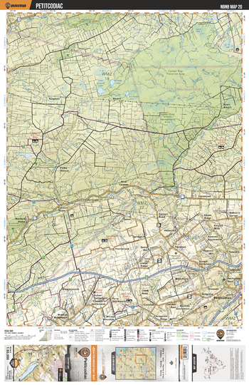
NBNB20 Petitcodiac - New Brunswick Topo
Backroad Mapbooks
This recreation topographic map for Petitcodiac highlights all the logging/resource roads, hunting areas, fishing lakes & streams, campsites, paddling routes for canoeing and kayaking, wildlife viewing areas, multi-use trails for hiking, biking, horseback riding, cross-country skiing and snowshoeing, motorized trails for ATVing and snowmobiling & more. Covering 1,950 km2 (750 mi2), this 1:65,000 scale map measures 38 x 51 km (23.5 x 32 mi), providing you with more topographic and recreational detail for the Grand Manan Island area than any other map on the market. New features include enhanced Crown land data and countless updates to roads, trails and recreational Points of Interest. This map includes Canaan Bog Provincial Protected Area, Canaan River Wildlife Area, Petitcodiac, Canaan River, Pangburn, Harewood, Alward, Dingleycooch, Cranberry Lake, Stream Lake and more!
Page Size: 24 x 37 in (610 x 940 mm)
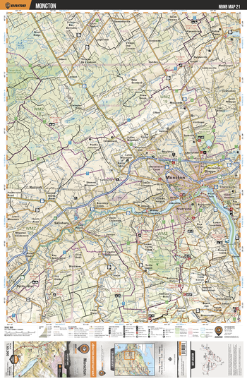
NBNB21 Moncton - New Brunswick Topo
Backroad Mapbooks
This recreation topographic map for Moncton highlights all the logging/resource roads, hunting areas, fishing lakes & streams, campsites, paddling routes for canoeing and kayaking, wildlife viewing areas, multi-use trails for hiking, biking, horseback riding, cross-country skiing and snowshoeing, motorized trails for ATVing and snowmobiling & more. Covering 1,950 km2 (750 mi2), this 1:65,000 scale map measures 38 x 51 km (23.5 x 32 mi), providing you with more topographic and recreational detail for the Grand Manan Island area than any other map on the market. New features include enhanced Crown land data and countless updates to roads, trails and recreational Points of Interest. This map includes Moncton, Petitcodiac River, Riverview, Dieppe, Notre-Dame, Salisbury, Irishtown, Baltimore Station, Boundary Creek, Berryton and more!
Page Size: 24 x 37 in (610 x 940 mm)
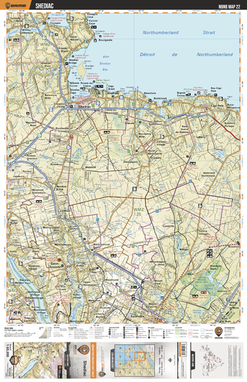
NBNB22 Shediac - New Brunswick Topo
Backroad Mapbooks
This recreation topographic map for Shediac highlights all the logging/resource roads, hunting areas, fishing lakes & streams, campsites, paddling routes for canoeing and kayaking, wildlife viewing areas, multi-use trails for hiking, biking, horseback riding, cross-country skiing and snowshoeing, motorized trails for ATVing and snowmobiling & more. Covering 1,950 km2 (750 mi2), this 1:65,000 scale map measures 38 x 51 km (23.5 x 32 mi), providing you with more topographic and recreational detail for the Grand Manan Island area than any other map on the market. New features include enhanced Crown land data and countless updates to roads, trails and recreational Points of Interest. This map includes Shediac, Whites Settlement, Bourgeois, Cap-Pele, Saint Joseph, Jolicure Lakes, Tintamarre Nat Wildlife Area, Sackville, Robichaud, Cocagne and more!
Page Size: 24 x 37 in (610 x 940 mm)
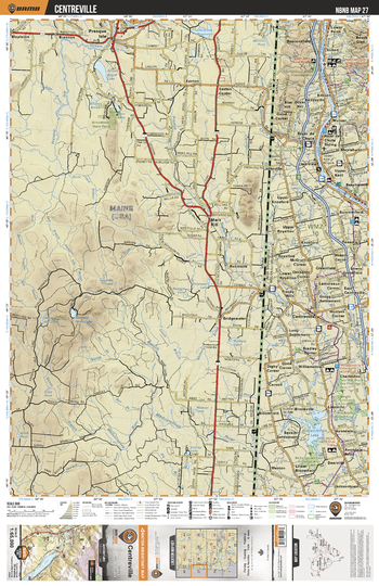
NBNB27 Centreville - New Brunswick Topo
Backroad Mapbooks
This recreation topographic map for Centreville highlights all the logging/resource roads, hunting areas, fishing lakes & streams, campsites, paddling routes for canoeing and kayaking, wildlife viewing areas, multi-use trails for hiking, biking, horseback riding, cross-country skiing and snowshoeing, motorized trails for ATVing and snowmobiling & more. Covering 1,950 km2 (750 mi2), this 1:65,000 scale map measures 38 x 51 km (23.5 x 32 mi), providing you with more topographic and recreational detail for the Grand Manan Island area than any other map on the market. New features include enhanced Crown land data and countless updates to roads, trails and recreational Points of Interest. This map includes Saint John River, Williamstown Lake, Kilburn, River de Chute, Clearview, Beechwood, Summerfield, Greenfield, Centreville, Lakeville and more!
Page Size: 24 x 37 in (610 x 940 mm)
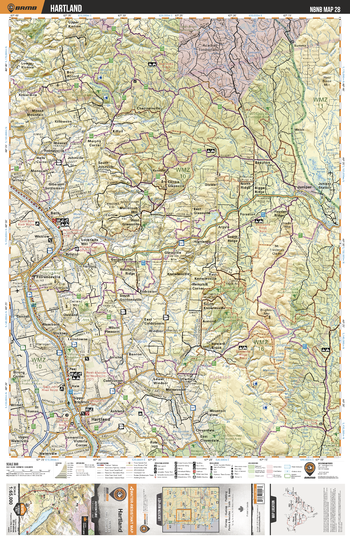
NBNB28 Hartland - New Brunswick Topo
Backroad Mapbooks
This recreation topographic map for Hartland highlights all the logging/resource roads, hunting areas, fishing lakes & streams, campsites, paddling routes for canoeing and kayaking, wildlife viewing areas, multi-use trails for hiking, biking, horseback riding, cross-country skiing and snowshoeing, motorized trails for ATVing and snowmobiling & more. Covering 1,950 km2 (750 mi2), this 1:65,000 scale map measures 38 x 51 km (23.5 x 32 mi), providing you with more topographic and recreational detail for the Grand Manan Island area than any other map on the market. New features include enhanced Crown land data and countless updates to roads, trails and recreational Points of Interest. This map includes Hartland, Florenceville, Wicklow, Juniper, Knowlesville, Saint John River, Nashwaak River, Bristol, Bath, Stickney and more!
Page Size: 24 x 37 in (610 x 940 mm)
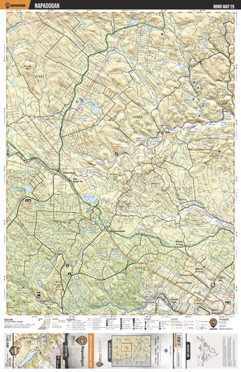
NBNB29 Napadogan - New Brunswick Topo
Backroad Mapbooks
This recreation topographic map for Napadogan highlights all the logging/resource roads, hunting areas, fishing lakes & streams, campsites, paddling routes for canoeing and kayaking, wildlife viewing areas, multi-use trails for hiking, biking, horseback riding, cross-country skiing and snowshoeing, motorized trails for ATVing and snowmobiling & more. Covering 1,950 km2 (750 mi2), this 1:65,000 scale map measures 38 x 51 km (23.5 x 32 mi), providing you with more topographic and recreational detail for the Grand Manan Island area than any other map on the market. New features include enhanced Crown land data and countless updates to roads, trails and recreational Points of Interest. This map includes Napadogan, Maple Grove, Currieburg, Miramichi Lake, McKiel Lake, Nashwaak Lake, Southwest Miramichi River, Green Hill, Cross Creek, Beaver Brook Lake and more!
Page Size: 24 x 37 in (610 x 940 mm)
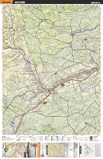
NBNB30 Boiestown - New Brunswick Topo
Backroad Mapbooks
This recreation topographic map for Boiestown highlights all the logging/resource roads, hunting areas, fishing lakes & streams, campsites, paddling routes for canoeing and kayaking, wildlife viewing areas, multi-use trails for hiking, biking, horseback riding, cross-country skiing and snowshoeing, motorized trails for ATVing and snowmobiling & more. Covering 1,950 km2 (750 mi2), this 1:65,000 scale map measures 38 x 51 km (23.5 x 32 mi), providing you with more topographic and recreational detail for the Grand Manan Island area than any other map on the market. New features include enhanced Crown land data and countless updates to roads, trails and recreational Points of Interest. This map includes Southwest Miramichi River, Boiestown, McGivney, Bettsburg, Holtville, Dungarvon River, Dugarvon Lake, Big Hole Brook, Sisters Mtn, Ludlow and more!
Page Size: 24 x 37 in (610 x 940 mm)
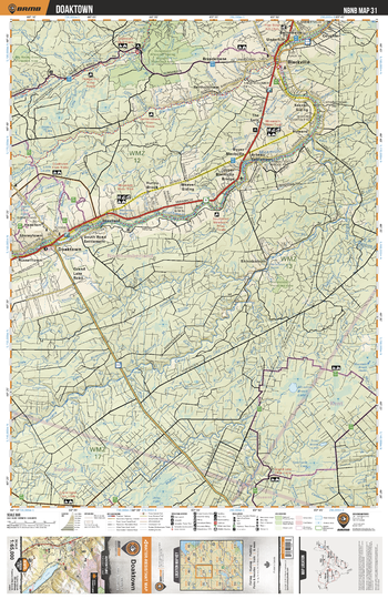
NBNB31 Doaktown - New Brunswick Topo
Backroad Mapbooks
This recreation topographic map for Doaktown highlights all the logging/resource roads, hunting areas, fishing lakes & streams, campsites, paddling routes for canoeing and kayaking, wildlife viewing areas, multi-use trails for hiking, biking, horseback riding, cross-country skiing and snowshoeing, motorized trails for ATVing and snowmobiling & more. Covering 1,950 km2 (750 mi2), this 1:65,000 scale map measures 38 x 51 km (23.5 x 32 mi), providing you with more topographic and recreational detail for the Grand Manan Island area than any other map on the market. New features include enhanced Crown land data and countless updates to roads, trails and recreational Points of Interest. This map includes Southwest Miramichi River, Cains River, Doaktown, Blackville, Blissfield, Shinnickburn, Gaspereau River, Coughlan, Bartholomew River, Meadow Brook Lake and more!
Page Size: 24 x 37 in (610 x 940 mm)
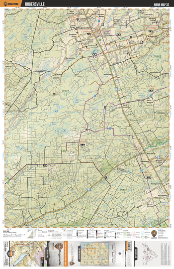
NBNB32 Rogersville - New Brunswick Topo
Backroad Mapbooks
This recreation topographic map for Rogersville highlights all the logging/resource roads, hunting areas, fishing lakes & streams, campsites, paddling routes for canoeing and kayaking, wildlife viewing areas, multi-use trails for hiking, biking, horseback riding, cross-country skiing and snowshoeing, motorized trails for ATVing and snowmobiling & more. Covering 1,950 km2 (750 mi2), this 1:65,000 scale map measures 38 x 51 km (23.5 x 32 mi), providing you with more topographic and recreational detail for the Grand Manan Island area than any other map on the market. New features include enhanced Crown land data and countless updates to roads, trails and recreational Points of Interest. This map includes Rogersville, Collette, Vautour, Noinville, Harcourt, Mortimer, Adamsville, Salmon River, Kouchibouguac River, Acadieville and more!
Page Size: 24 x 37 in (610 x 940 mm)
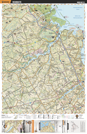
NBNB33 Richibucto - New Brunswick Topo
Backroad Mapbooks
This recreation topographic map for Richibucto highlights all the logging/resource roads, hunting areas, fishing lakes & streams, campsites, paddling routes for canoeing and kayaking, wildlife viewing areas, multi-use trails for hiking, biking, horseback riding, cross-country skiing and snowshoeing, motorized trails for ATVing and snowmobiling & more. Covering 1,950 km2 (750 mi2), this 1:65,000 scale map measures 38 x 51 km (23.5 x 32 mi), providing you with more topographic and recreational detail for the Grand Manan Island area than any other map on the market. New features include enhanced Crown land data and countless updates to roads, trails and recreational Points of Interest. This map includes Kouchibouguac National Park, Richibucto, Rexton, Richibucto River, Buctouche River, Buctouche, Saint-Antoine, St Nicholas River, Kouchibouguacis River, Big Cove and more!
Page Size: 24 x 37 in (610 x 940 mm)
No search results