


MapSherpa Catalog
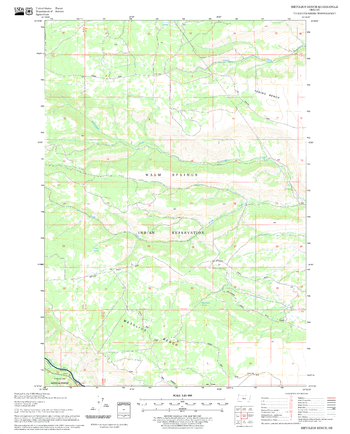
Metolius Bench Quadrangle, Oregon
United States Forest Service
United States Department of Agriculture Forestry Service topographical map of Metolius Bench, Deschutes National Forest, Oregon.
Page Size: 21.75 x 27 in (552 x 686 mm)
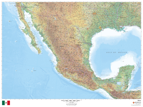
Mexico
MapSherpa
This beautiful map shows physical and political features for Mexico and surrounding areas. Relief shading and the use of different colours by height above sea level are both informative and attractive.
Page Size: 48 x 36 in (1219 x 914 mm)
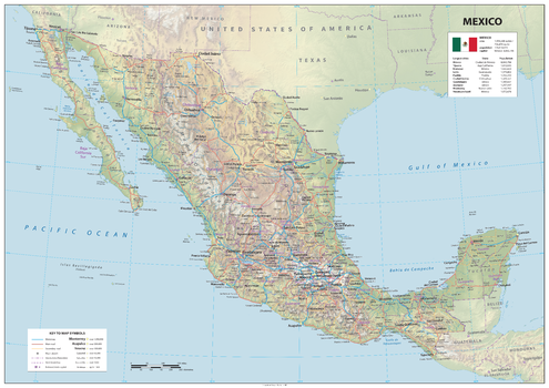
Mexico
Sparrow Maps
A physical map of Mexico showing relief features on land with administrative districts, capital cities, roads and airports. The national flag is shown with the country's area and population with population figures for largest cities. A great map to give a comprehensive view of the country.
Page Size: 47 x 33.25 in (1189 x 841 mm)
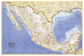
Mexico - Published 1973
National Geographic
This map of Mexico is a classic example of National Geographic cartography, demonstrating crisp clarity and detail. Published in May 1973 to accompany the article "Mexico, the City That Founded a Nation" and an additional map of Central America.
Page Size: 34.25 x 23 in (867 x 581 mm)
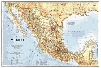
Mexico - Published 1994
National Geographic
This attractive Mexico map features national parks and striking ocean bathymetry. Published in September 1994, this map accompanied a traveler's map of Mexico and the article "The Sonoran Desert: Anything But Empty."
Page Size: 30.25 x 20.5 in (763 x 514 mm)
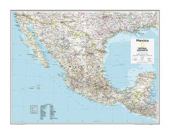
Mexico - Atlas of the World, 10th Edition
National Geographic
Page Size: 28 x 22 in (711 x 559 mm)
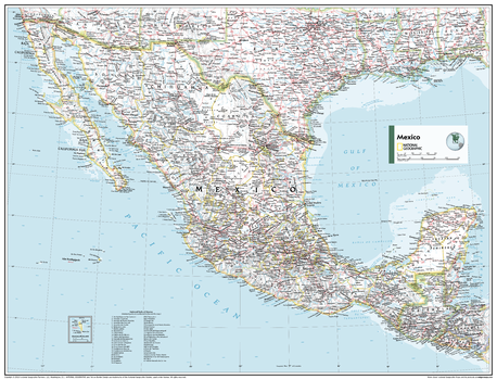
Mexico - Atlas of the World, 11th Edition
National Geographic
This Mexico map of physical and political features can fit in any space. Showcasing the country and surrounding regions in stunning detail with state-of-the-art cartographic techniques delivering accuracy and exceptional quality, the innovative and engaging design makes the content easily accessible and user-friendly.
Ideal for classrooms with an emphasis on teaching geography or environmental themes. The inclusion of physical features gives your students a genuine feel for how our world appears.
This map uses a bright, easy to read color palette featuring blue oceans and stunning shaded relief that has been featured on National Geographic wall maps for over 75 years. It is drawn in the Albers Conic Equal-Area projection, which uses two standard parallels between which distortion is minimized, however scale and shape is not preserved.
Names of geographic features are carefully placed on the map to maintain legibility, and an inset of Guadalupe Island is included.
This map is found in National Geographic's 11th Edition World Atlas and is now available as a stand alone product.
Page Size: 31.5 x 24 in (798 x 610 mm)
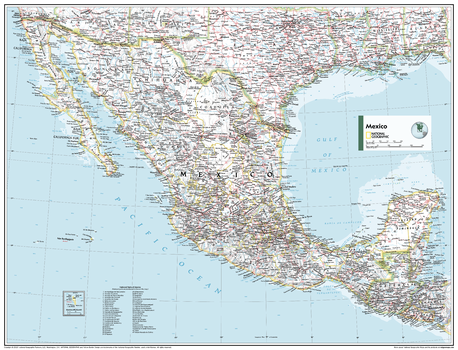
Mexico - Atlas of the World, 11th Edition - Compact
National Geographic
This Mexico map of physical and political features can fit in any space. Showcasing the country and surrounding regions in stunning detail with state-of-the-art cartographic techniques delivering accuracy and exceptional quality, the innovative and engaging design makes the content easily accessible and user-friendly.
Ideal for classrooms with an emphasis on teaching geography or environmental themes. The inclusion of physical features gives your students a genuine feel for how our world appears.
This map uses a bright, easy to read color palette featuring blue oceans and stunning shaded relief that has been featured on National Geographic wall maps for over 75 years. It is drawn in the Albers Conic Equal-Area projection, which uses two standard parallels between which distortion is minimized, however scale and shape is not preserved.
Names of geographic features are carefully placed on the map to maintain legibility, and an inset of Guadalupe Island is included.
This map is found in National Geographic's 11th Edition World Atlas and is now available as a stand alone product.
Page Size: 21.5 x 16.25 in (540 x 413 mm)
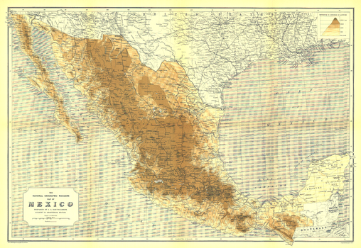
Mexico - Published 1911
National Geographic
National Geographic's first map of Mexico, this fine work was created by Scottish cartographer and geographer John George Bartholomew. Produced in May 1911, this map accompanied the article "Our Neighbor, Mexico" and features altitude shading to bring Mexico's geography to life.
Page Size: 25.25 x 17.5 in (638 x 439 mm)
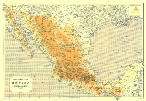
Mexico - Published 1914
National Geographic
Published in May 1914, only three years after National Geographic's first map of Mexico, this work shows the transportation changes taking place. An ambitious railroad project was underway on the gulf coast, while similar railroad expansions were taking place in other regions. This map appeared with three articles on Mexico including "Mexico and Mexicans."
Page Size: 25 x 17.5 in (635 x 440 mm)
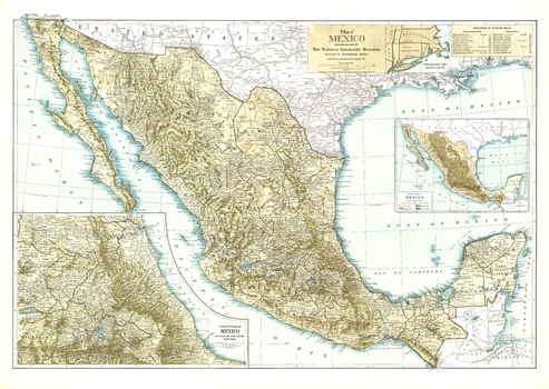
Mexico - Published 1916
National Geographic
Distinctive in its muted earth tones, this attractive map of Mexico, published in July 1916, features a physical map of the country as well as an inset of the central portion at twice the scale of the main map. A wonderful collector's item or companion map to the Mexico maps of 1911 and 1914.
Page Size: 30 x 21.5 in (761 x 540 mm)
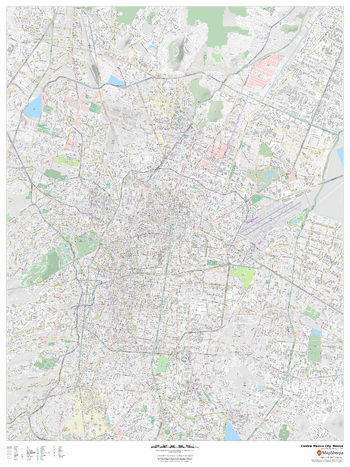
Mexico City, Mexico Inner Metro
MapSherpa
This detailed street map of central Mexico City, Mexico shows the full road and rail networks, points of interest, and land use across the city. Useful for businesses operating in the city, or as consumer memorabilia of the city.
Page Size: 36 x 48 in (914 x 1219 mm)
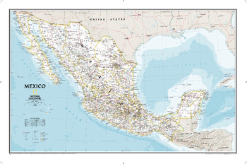
Mexico Classic
National Geographic
National Geographic's wall map of Mexico is one of the largest and most detailed maps of the country. The signature Classic style design uses a bright, easy-to-read color palette. This map features thousands of place names, accurate political boundaries, national parks including Cumbres de Monterrey National Park, biosphere reserves including El Vizcaino Biosphere Reserve, archeological sites including the ruins of the Yucatan Peninsula, and major infrastructure networks such as roads, canals, ferry routes, and railroads. Mexico's diverse terrain is detailed through accurate shaded relief, coastal bathymetry, and symbolism for water features and other land forms. Elevations of major peaks are expressed in both feet and meters, and depth soundings are expressed in fathoms.
Page Size: 34.5 x 22.75 in (876 x 575 mm)
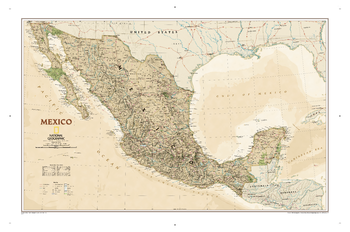
Mexico Executive
National Geographic
National Geographic's Executive style wall map of Mexico is one of the largest and most detailed maps of the country. It features thousands of place names, accurate political boundaries, national parks including Cumbres de Monterrey National Park, biosphere reserves including El Vizcaino Biosphere Reserve, archeological sites including the ruins of the Yucatan Peninsula, and major infrastructure networks such as highways, roads, canals, ferry routes, railroads, oil fields and airports. Mexico's diverse terrain is detailed with accurate shaded relief including areas of sand, intermittent and dry lakes, swamps, lava fields and coastal bathymetry. The map is rendered in an antique-inspired color palette, making it as stunning as it is informative.
Page Size: 34.5 x 22.75 in (876 x 575 mm)
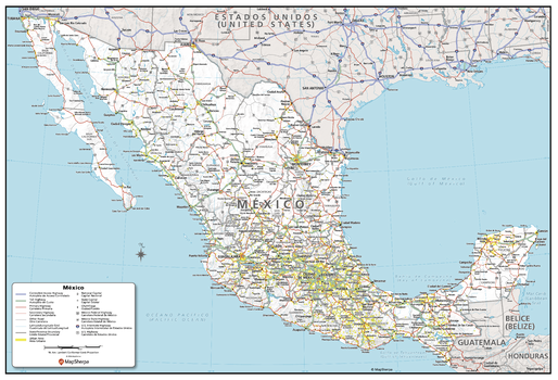
Mexico Political Wall Map - Compact
MapSherpa
Created specifically for MapSherpa, this Mexico Political Map shows the entire country and surrounding regions in great detail. The bright background gives great contrast to the thousands of labels, including City Names, Capitals, State/Federal Highways, and many more. The boundaries of each state/province are accurately shown, with their Urban Areas clearly marked in Yellow, which adds an extra layer of interesting information to the map. With multiple sizes available, this is the perfect reference map for home, office, or school use.
Page Size: 23.5 x 16 in (597 x 406 mm)
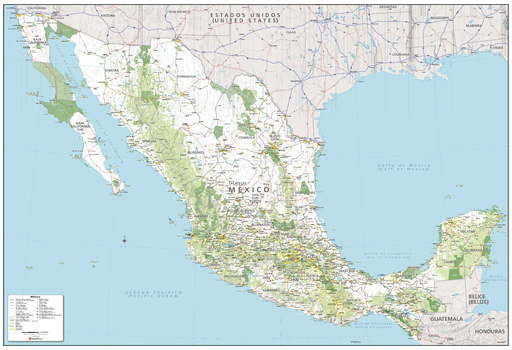
Mexico Political Wall Map - Extra Large
MapSherpa
Created specifically for MapSherpa, this Mexico Political Map shows the entire country and surrounding regions in great detail. The bright background gives great contrast to the thousands of labels, including City Names, Capitals, State/Federal Highways, and many more. The boundaries of each state/province are accurately shown, with their Urban Areas clearly marked in Yellow, which adds an extra layer of interesting information to the map. With multiple sizes available, this is the perfect reference map for home, office, or school use.
Page Size: 60 x 41 in (1524 x 1041 mm)
Mexico Political Wall Map - Large
MapSherpa
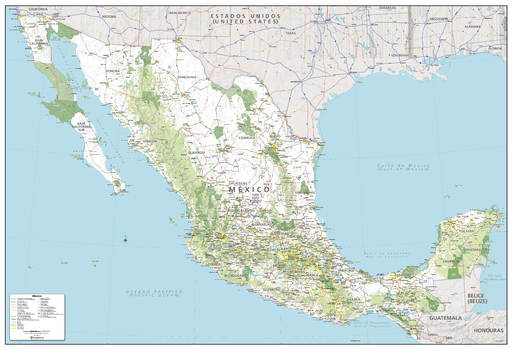
Created specifically for MapSherpa, this Mexico Political Map shows the entire country and surrounding regions in great detail. The bright background gives great contrast to the thousands of labels, including City Names, Capitals, State/Federal Highways, and many more. The boundaries of each state/province are accurately shown, with their Urban Areas clearly marked in Yellow, which adds an extra layer of interesting information to the map. With multiple sizes available, this is the perfect reference map for home, office, or school use.
Page Size: 48 x 32.75 in (1219 x 832 mm)
Mexico Political Wall Map - Poster
MapSherpa
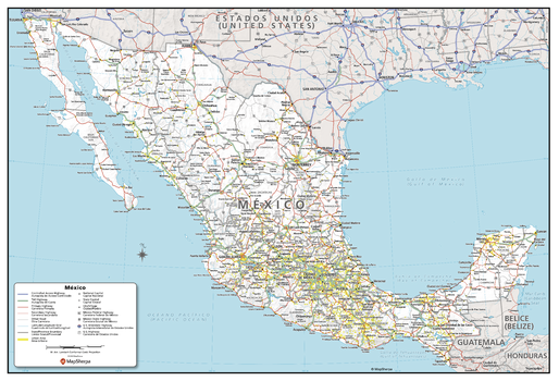
Created specifically for MapSherpa, this Mexico Political Map shows the entire country and surrounding regions in great detail. The bright background gives great contrast to the thousands of labels, including City Names, Capitals, State/Federal Highways, and many more. The boundaries of each state/province are accurately shown, with their Urban Areas clearly marked in Yellow, which adds an extra layer of interesting information to the map. With multiple sizes available, this is the perfect reference map for home, office, or school use.
Page Size: 36 x 24.5 in (914 x 622 mm)
Mexico Tequila Map - A3
Inspirit Cartographics
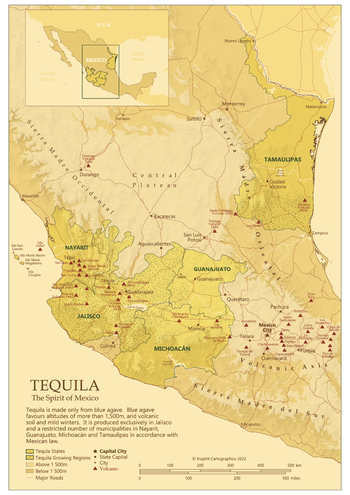
A map of the different Mexican regions which have the right conditions to grow blue agave, the only fruit that can be used to make tequila
Page Size: 11.75 x 16.75 in (297 x 420 mm)

Mexico Tequila Map - A4
Inspirit Cartographics
A map of the different Mexican regions which have the right conditions to grow blue agave, the only fruit that can be used to make tequila
Page Size: 8.5 x 11.75 in (210 x 297 mm)
No search results