


MapSherpa Catalog
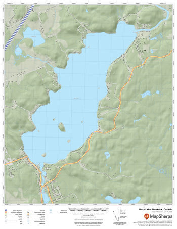
Mary Lake, Muskoka, Ontario
MapSherpa
A cartographically beautiful map of Mary Lake, Muskoka, Ontario ideal for showing off cottages, resorts, lakes and other favourite places.
Page Size: 17 x 22 in (432 x 559 mm)
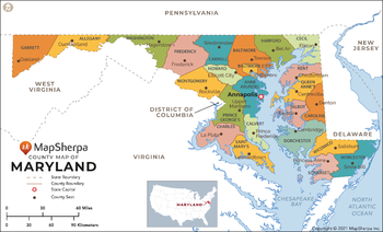
Maryland Counties Map - Extra Large
MapSherpa
This map has been created exclusively for MapSherpa, and designed for reference or business use. Clear and clean colors & fonts matched with cartographic research makes this map of Maryland Counties Map easily readable and useful. The map shows the 64 counties of Maryland and their borders across the Old Line State.
Page Size: 60 x 36.5 in (1524 x 925 mm)
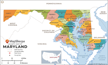
Maryland Counties Map - Large
MapSherpa
This map has been created exclusively for MapSherpa, and designed for reference or business use. Clear and clean colors & fonts matched with cartographic research makes this map of Maryland Counties Map easily readable and useful. The map shows the 64 counties of Maryland and their borders across the Old Line State.
Page Size: 48 x 29.25 in (1219 x 740 mm)
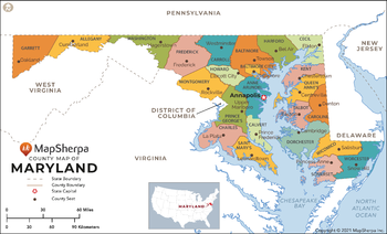
Maryland Counties Map - Standard
MapSherpa
This map has been created exclusively for MapSherpa, and designed for reference or business use. Clear and clean colors & fonts matched with cartographic research makes this map of Maryland Counties Map easily readable and useful. The map shows the 64 counties of Maryland and their borders across the Old Line State.
Page Size: 36 x 22 in (914 x 555 mm)
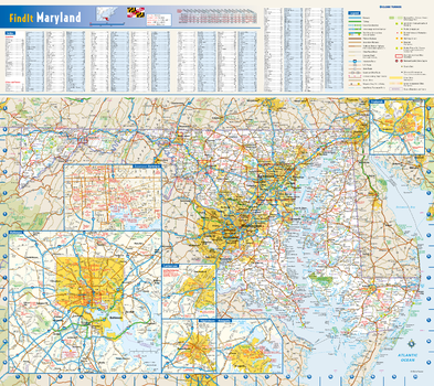
Maryland State Wall Map
Globe Turner
This colorful, easy-to-read state map of Maryland identifies all major thoroughfares, secondary roads, freeway interchanges, rest areas, distance markers, landmarks, recreational areas, and more. Shaded relief on the state map provides a three-dimensional sense of Maryland's topography. Detailed city inset maps of Annapolis, Baltimore, Cumberland, Frederick, and Hagerstown are based on the latest street information from our cartographic experts. County and city indices make it simple to locate even the smallest town.
Page Size: 20.75 x 18.5 in (524 x 467 mm)
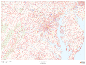
Maryland ZIP Code Map
MapSherpa
This map of Maryland shows ZIP codes overlaid on a road map. Base map features include municipality and county boundaries, major road network features, and state and national parks and conservation areas.
Page Size: 48 x 36 in (1219 x 914 mm)
Maryland ZIP Code Map with Counties - Extra Large
MapSherpa
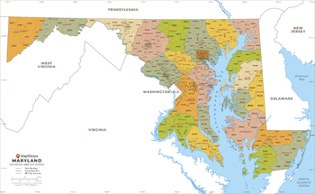
This map has been created exclusively for MapSherpa, and designed for business or reference use. Clear and clean colors & fonts matched with cartographic research makes this Maryland Zip Code Map with Counties easily readable and useful. The map shows the 24 counties of Maryland and the borders of the 467 zip codes across the Old Line State.
Page Size: 60 x 37 in (1524 x 935 mm)
Maryland ZIP Code Map with Counties - Large
MapSherpa
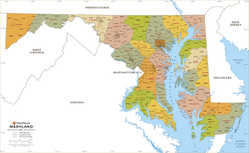
This map has been created exclusively for MapSherpa, and designed for business or reference use. Clear and clean colors & fonts matched with cartographic research makes this Maryland Zip Code Map with Counties easily readable and useful. The map shows the 24 counties of Maryland and the borders of the 467 zip codes across the Old Line State.
Page Size: 48 x 29.5 in (1219 x 748 mm)
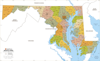
Maryland ZIP Code Map with Counties - Standard
MapSherpa
This map has been created exclusively for MapSherpa, and designed for business or reference use. Clear and clean colors & fonts matched with cartographic research makes this Maryland Zip Code Map with Counties easily readable and useful. The map shows the 24 counties of Maryland and the borders of the 467 zip codes across the Old Line State.
Page Size: 36 x 22.25 in (914 x 561 mm)
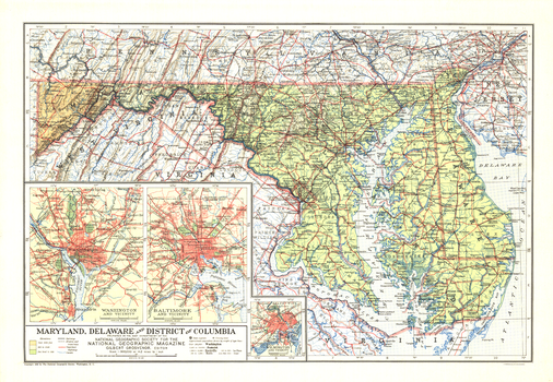
Maryland, Delaware and District of Columbia - Published 1927
National Geographic
Published in February 1927, the Maryland, Delaware and District of Columbia map contains detailed insets of the cities of Baltimore, Wilmington, and Washington. The weight of type used for names gives a clue to the population of the cities at the time.
Page Size: 19.75 x 13.5 in (496 x 343 mm)
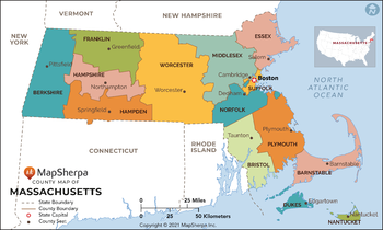
Massachusetts Counties Map - Extra Large
MapSherpa
This map has been created exclusively for MapSherpa, and designed for reference or business use. Clear and clean colors & fonts matched with cartographic research makes this map of Massachusetts Counties Map easily readable and useful. The map shows the 14 counties of Massachusetts and their borders across the Bay State.
Page Size: 60 x 36 in (1524 x 913 mm)
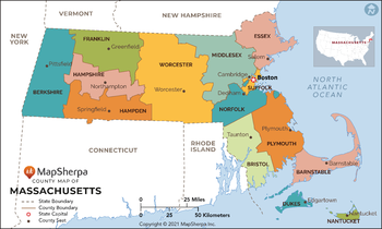
Massachusetts Counties Map - Large
MapSherpa
This map has been created exclusively for MapSherpa, and designed for reference or business use. Clear and clean colors & fonts matched with cartographic research makes this map of Massachusetts Counties Map easily readable and useful. The map shows the 14 counties of Massachusetts and their borders across the Bay State.
Page Size: 48 x 29 in (1219 x 731 mm)
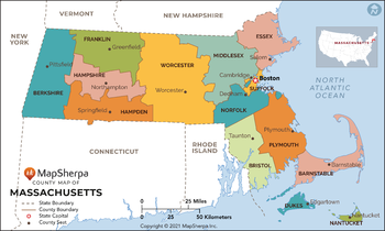
Massachusetts Counties Map - Standard
MapSherpa
This map has been created exclusively for MapSherpa, and designed for reference or business use. Clear and clean colors & fonts matched with cartographic research makes this map of Massachusetts Counties Map easily readable and useful. The map shows the 14 counties of Massachusetts and their borders across the Bay State.
Page Size: 36 x 21.75 in (914 x 548 mm)
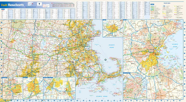
Massachusetts State Wall Map
Globe Turner
This colorful, easy-to-read state map of Massachusetts identifies all major thoroughfares, secondary roads, freeway interchanges, rest areas, distance markers, landmarks, recreational areas, and more. Shaded relief on the state map provides a three-dimensional sense of Massachusetts' topography. Detailed inset maps of Boston, Lowell, New Bedford/Fall River, Springfield and Worcester are based on the latest street information from our cartographic experts. County and city indices make it simple to locate even the smallest town.
Page Size: 30.5 x 16.75 in (775 x 425 mm)
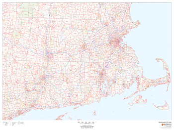
Massachusetts ZIP Code Map
MapSherpa
This map of Massachusetts shows ZIP code areas overlaid on a road map. Ideal for planning of deliveries, home services, sales territories, real estate and much more. Base map features include all roads with major roads and highways labelled, municipality and county boundaries, neighborhood names, railways, and high level land use such as parks and recreation areas
Page Size: 48 x 36 in (1219 x 914 mm)
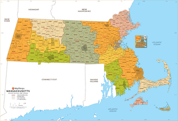
Massachusetts ZIP Code Map with Counties - Extra Large
MapSherpa
This map has been created exclusively for MapSherpa, and designed for business or reference use. Clear and clean colors & fonts matched with cartographic research makes this Massachusetts Zip Code Map with Counties easily readable and useful. The map shows the 14 counties of Massachusetts and the borders of the 536 zip codes across the Bay State.
Page Size: 60 x 40.75 in (1524 x 1033 mm)
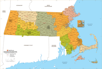
Massachusetts ZIP Code Map with Counties - Large
MapSherpa
This map has been created exclusively for MapSherpa, and designed for business or reference use. Clear and clean colors & fonts matched with cartographic research makes this Massachusetts Zip Code Map with Counties easily readable and useful. The map shows the 14 counties of Massachusetts and the borders of the 536 zip codes across the Bay State.
Page Size: 48 x 32.75 in (1219 x 827 mm)
Massachusetts ZIP Code Map with Counties - Standard
MapSherpa
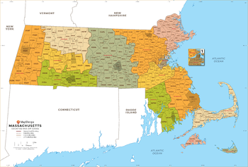
This map has been created exclusively for MapSherpa, and designed for business or reference use. Clear and clean colors & fonts matched with cartographic research makes this Massachusetts Zip Code Map with Counties easily readable and useful. The map shows the 14 counties of Massachusetts and the borders of the 536 zip codes across the Bay State.
Page Size: 36 x 24.5 in (914 x 620 mm)
Masten Butte Quadrangle, Oregon
United States Forest Service
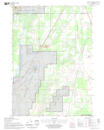
United States Department of Agriculture Forestry Service topographical map of Masten Butte, Deschutes National Forest, Oregon.
Page Size: 21.75 x 27 in (552 x 686 mm)
MasterMap B&W 1:1250
MapSherpa
The most detailed and comprehensive map data-set of Great Britain from the Ordnance Survey. Mapping data is updated quarterly so maps are always current. Maps are suitable for Planning applications and Land Registry purposes. Maps can be created in black and white at a fixed scale of 1:1,250.
No search results