


MapSherpa Catalog
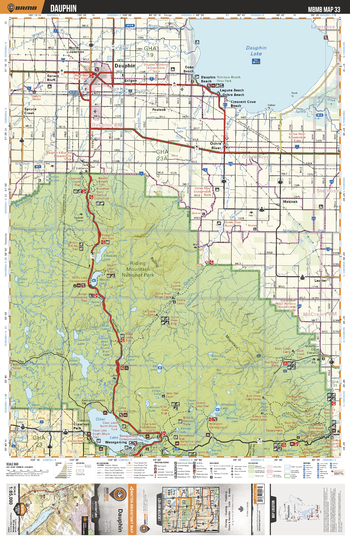
MBMB33 Dauphin - Manitoba Backroad Mapbook Topo
Backroad Mapbooks
This recreation topographic map for Dauphin highlights all the logging/resource roads, hunting areas, fishing lakes & streams, campsites, paddling routes for canoeing and kayaking, wildlife viewing areas, multi-use trails for hiking, biking, horseback riding, cross-country skiing and snowshoeing, motorized trails for ATVing and snowmobiling & more. Covering 3,040 km2 (1,175 mi2), this 1:85,000 scale map measures 50 x 63.5 km (30 x 39.5 mi), providing you with more topographic and recreational detail for the Melita area than any other map on the market. New features include Crown land areas and labeled fish species, plus countless new trails, roads and recreational Points of Interest. Included in this map are Dauphin Lake, Dauphin, Riding Mountain National Park, Clear Lake, Edwards Lake, Moon Lake, Shoal Lake, Whirlpool Lake, Bead Lakes, Wasagaming and more.
Page Size: 24 x 37 in (610 x 940 mm)
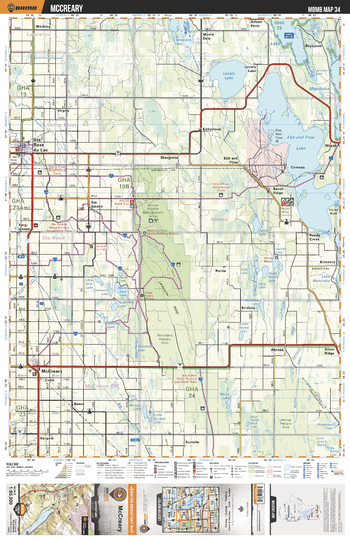
MBMB34 McCreary - Manitoba Backroad Mapbook Topo
Backroad Mapbooks
This recreation topographic map for McCreary highlights all the logging/resource roads, hunting areas, fishing lakes & streams, campsites, paddling routes for canoeing and kayaking, wildlife viewing areas, multi-use trails for hiking, biking, horseback riding, cross-country skiing and snowshoeing, motorized trails for ATVing and snowmobiling & more. Covering 3,040 km2 (1,175 mi2), this 1:85,000 scale map measures 50 x 63.5 km (30 x 39.5 mi), providing you with more topographic and recreational detail for the Melita area than any other map on the market. New features include Crown land areas and labeled fish species, plus countless new trails, roads and recreational Points of Interest. Included in this map are Ste Rose du Lac, McCreary, Ebb and Flow Lake, Lonely Lake, Lake Manitoba, Alonsa Wildlife Management Area, Beaver Dam Lake, Comeau, Jarvies Lake, Pedro Lake and more.
Page Size: 24 x 37 in (610 x 940 mm)
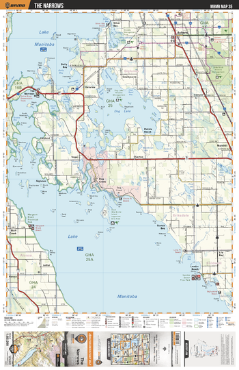
MBMB35 The Narrows - Manitoba Backroad Mapbook Topo
Backroad Mapbooks
This recreation topographic map for The Narrows highlights all the logging/resource roads, hunting areas, fishing lakes & streams, campsites, paddling routes for canoeing and kayaking, wildlife viewing areas, multi-use trails for hiking, biking, horseback riding, cross-country skiing and snowshoeing, motorized trails for ATVing and snowmobiling & more. Covering 3,040 km2 (1,175 mi2), this 1:85,000 scale map measures 50 x 63.5 km (30 x 39.5 mi), providing you with more topographic and recreational detail for the Melita area than any other map on the market. New features include Crown land areas and labeled fish species, plus countless new trails, roads and recreational Points of Interest. Included in this map are Lake Manitoba, Dog Lake, Ashern, The Narrows, Dog Creek, Lundar Beach, Pebble Beach, Silver Bay, Little Birch Wildlife Management Area, Moosehorn Lakes and more.
Page Size: 24 x 37 in (610 x 940 mm)
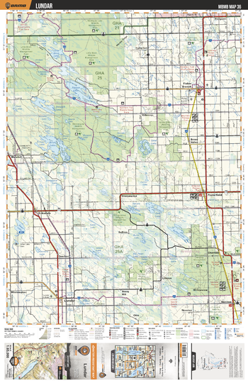
MBMB36 Lundar - Manitoba Backroad Mapbook Topo
Backroad Mapbooks
This recreation topographic map for Lundar highlights all the logging/resource roads, hunting areas, fishing lakes & streams, campsites, paddling routes for canoeing and kayaking, wildlife viewing areas, multi-use trails for hiking, biking, horseback riding, cross-country skiing and snowshoeing, motorized trails for ATVing and snowmobiling & more. Covering 3,040 km2 (1,175 mi2), this 1:85,000 scale map measures 50 x 63.5 km (30 x 39.5 mi), providing you with more topographic and recreational detail for the Melita area than any other map on the market. New features include Crown land areas and labeled fish species, plus countless new trails, roads and recreational Points of Interest. Included in this map are Mantagao Lake Wildlife Management Area, Little Birch Wildlife Management Area, Birch Lake, Stewart Lake, Kilkenny, Little Birch Lake, Lundar, Sleeve Lake, Broad Valley, Narcisse and more.
Page Size: 24 x 37 in (610 x 940 mm)
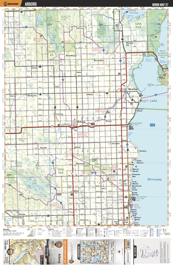
MBMB37 Arborg - Manitoba Backroad Mapbook Topo
Backroad Mapbooks
This recreation topographic map for Arborg highlights all the logging/resource roads, hunting areas, fishing lakes & streams, campsites, paddling routes for canoeing and kayaking, wildlife viewing areas, multi-use trails for hiking, biking, horseback riding, cross-country skiing and snowshoeing, motorized trails for ATVing and snowmobiling & more. Covering 3,040 km2 (1,175 mi2), this 1:85,000 scale map measures 50 x 63.5 km (30 x 39.5 mi), providing you with more topographic and recreational detail for the Melita area than any other map on the market. New features include Crown land areas and labeled fish species, plus countless new trails, roads and recreational Points of Interest. Included in this map are Lake Winnipeg, Fish Lake, Arborg, Riverton, Hecla/Grindstone Prov Park, Lee Lake, Washow Bay, Icelandic River, Camp Morton, Spruce Sands and more.
Page Size: 24 x 37 in (610 x 940 mm)
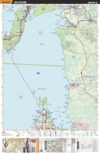
MBMB38 Hecla Island - Manitoba Backroad Mapbook Topo
Backroad Mapbooks
This recreation topographic map for Hecla Island highlights all the logging/resource roads, hunting areas, fishing lakes & streams, campsites, paddling routes for canoeing and kayaking, wildlife viewing areas, multi-use trails for hiking, biking, horseback riding, cross-country skiing and snowshoeing, motorized trails for ATVing and snowmobiling & more. Covering 3,040 km2 (1,175 mi2), this 1:85,000 scale map measures 50 x 63.5 km (30 x 39.5 mi), providing you with more topographic and recreational detail for the Melita area than any other map on the market. New features include Crown land areas and labeled fish species, plus countless new trails, roads and recreational Points of Interest. Included in this map are Lake Winipeg, Hecla/Grindstone Prov Park, Hecla Island, Black Island, Gull Harbour, Manigotagan River, O'Hanly, Elk Island, Traverse Bay, Manigotagan River Prov Park, and more.
Page Size: 24 x 37 in (610 x 940 mm)
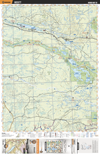
MBMB39 Bissett - Manitoba Backroad Mapbook Topo
Backroad Mapbooks
This recreation topographic map for Bissett highlights all the logging/resource roads, hunting areas, fishing lakes & streams, campsites, paddling routes for canoeing and kayaking, wildlife viewing areas, multi-use trails for hiking, biking, horseback riding, cross-country skiing and snowshoeing, motorized trails for ATVing and snowmobiling & more. Covering 3,040 km2 (1,175 mi2), this 1:85,000 scale map measures 50 x 63.5 km (30 x 39.5 mi), providing you with more topographic and recreational detail for the Melita area than any other map on the market. New features include Crown land areas and labeled fish species, plus countless new trails, roads and recreational Points of Interest. Included in this map are Nopoming Prov Park, Manigotagan River, Manigotagan Lake, Quesnel Lake, Clearwater Lakes, Turtle Lake, Wanipigow Lake, Rice Lake, Black River, Shoe Lake and more.
Page Size: 24 x 37 in (610 x 940 mm)
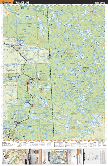
MBMB40 Wallace Lake - Manitoba Backroad Mapbook Topo
Backroad Mapbooks
This recreation topographic map for Wallace Lake highlights all the logging/resource roads, hunting areas, fishing lakes & streams, campsites, paddling routes for canoeing and kayaking, wildlife viewing areas, multi-use trails for hiking, biking, horseback riding, cross-country skiing and snowshoeing, motorized trails for ATVing and snowmobiling & more. Covering 3,040 km2 (1,175 mi2), this 1:85,000 scale map measures 50 x 63.5 km (30 x 39.5 mi), providing you with more topographic and recreational detail for the Melita area than any other map on the market. New features include Crown land areas and labeled fish species, plus countless new trails, roads and recreational Points of Interest. Included in this map are Atikaki Prov Park, Nopoming Prov Park, Garner Lake, Long Lake, Wallace Lake, Obukowin Lake, Black Lake, Tooth Lake, Flintstone Lake, Beresford Lake and more.
Page Size: 24 x 37 in (610 x 940 mm)
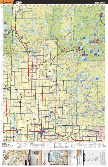
MBMB41 Roblin - Manitoba Backroad Mapbook Topo
Backroad Mapbooks
This recreation topographic map for Roblin highlights all the logging/resource roads, hunting areas, fishing lakes & streams, campsites, paddling routes for canoeing and kayaking, wildlife viewing areas, multi-use trails for hiking, biking, horseback riding, cross-country skiing and snowshoeing, motorized trails for ATVing and snowmobiling & more. Covering 3,040 km2 (1,175 mi2), this 1:85,000 scale map measures 50 x 63.5 km (30 x 39.5 mi), providing you with more topographic and recreational detail for the Melita area than any other map on the market. New features include Crown land areas and labeled fish species, plus countless new trails, roads and recreational Points of Interest. Included in this map are Duck Mountain Prov Park, Roblin, Lake of the Prairies, Childs Lake, San Clara, Shell River, Laurie Lake, Mossberry Lake, Spray Lake, Boggy Creek and more.
Page Size: 24 x 37 in (610 x 940 mm)
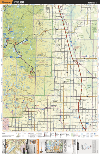
MBMB42 Ethelbert - Manitoba Backroad Mapbook Topo
Backroad Mapbooks
This recreation topographic map for Ethelbert highlights all the logging/resource roads, hunting areas, fishing lakes & streams, campsites, paddling routes for canoeing and kayaking, wildlife viewing areas, multi-use trails for hiking, biking, horseback riding, cross-country skiing and snowshoeing, motorized trails for ATVing and snowmobiling & more. Covering 3,040 km2 (1,175 mi2), this 1:85,000 scale map measures 50 x 63.5 km (30 x 39.5 mi), providing you with more topographic and recreational detail for the Melita area than any other map on the market. New features include Crown land areas and labeled fish species, plus countless new trails, roads and recreational Points of Interest. Included in this map are Duck Mountain Prov Park, Mink Creek, Garland, Ethelbert, Singush Lake, Valley River, West Blue Lake, East Blue Lake, Trembowle, Vimy Ridge and more.
Page Size: 24 x 37 in (610 x 940 mm)
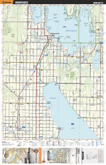
MBMB43 Winnipegosis - Manitoba Backroad Mapbook Topo
Backroad Mapbooks
This recreation topographic map for Winnipegosis highlights all the logging/resource roads, hunting areas, fishing lakes & streams, campsites, paddling routes for canoeing and kayaking, wildlife viewing areas, multi-use trails for hiking, biking, horseback riding, cross-country skiing and snowshoeing, motorized trails for ATVing and snowmobiling & more. Covering 3,040 km2 (1,175 mi2), this 1:85,000 scale map measures 50 x 63.5 km (30 x 39.5 mi), providing you with more topographic and recreational detail for the Melita area than any other map on the market. New features include Crown land areas and labeled fish species, plus countless new trails, roads and recreational Points of Interest. Included in this map are Dauphin Lake, Lake Winnipegosis, Spence Lake, Winnipegosis, Sagemace Bay, Salt Point, Sifton Beach, Fork River, Mossy River, Valley River and more.
Page Size: 24 x 37 in (610 x 940 mm)
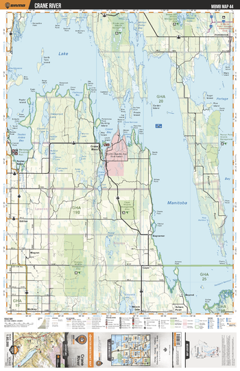
MBMB44 Crane River - Manitoba Backroad Mapbook Topo
Backroad Mapbooks
This recreation topographic map for Crane River highlights all the logging/resource roads, hunting areas, fishing lakes & streams, campsites, paddling routes for canoeing and kayaking, wildlife viewing areas, multi-use trails for hiking, biking, horseback riding, cross-country skiing and snowshoeing, motorized trails for ATVing and snowmobiling & more. Covering 3,040 km2 (1,175 mi2), this 1:85,000 scale map measures 50 x 63.5 km (30 x 39.5 mi), providing you with more topographic and recreational detail for the Melita area than any other map on the market. New features include Crown land areas and labeled fish species, plus countless new trails, roads and recreational Points of Interest. Included in this map are Lake Manitoba, Portage Bay, Toutes Aides Bay, Manipogo Provincial Park, Prime Lake, Bayend, Peonan Point, Basket Lake, Million Dollar Bay, Crane River and more.
Page Size: 24 x 37 in (610 x 940 mm)
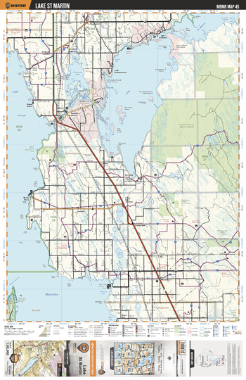
MBMB45 Lake St Martin - Manitoba Backroad Mapbook Topo
Backroad Mapbooks
This recreation topographic map for Lake St Martin highlights all the logging/resource roads, hunting areas, fishing lakes & streams, campsites, paddling routes for canoeing and kayaking, wildlife viewing areas, multi-use trails for hiking, biking, horseback riding, cross-country skiing and snowshoeing, motorized trails for ATVing and snowmobiling & more. Covering 3,040 km2 (1,175 mi2), this 1:85,000 scale map measures 50 x 63.5 km (30 x 39.5 mi), providing you with more topographic and recreational detail for the Melita area than any other map on the market. New features include Crown land areas and labeled fish species, plus countless new trails, roads and recreational Points of Interest. Included in this map are Lake St Martin, Lake Manitoba, Branching River, Pineimuta Lake, Fairford, Little Saskatchewan, Steep Rock, Gypsumville, Banana Lakes, The Three Lakes and more.
Page Size: 24 x 37 in (610 x 940 mm)
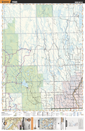
MBMB46 Peguis - Manitoba Backroad Mapbook Topo
Backroad Mapbooks
This recreation topographic map for Peguis highlights all the logging/resource roads, hunting areas, fishing lakes & streams, campsites, paddling routes for canoeing and kayaking, wildlife viewing areas, multi-use trails for hiking, biking, horseback riding, cross-country skiing and snowshoeing, motorized trails for ATVing and snowmobiling & more. Covering 3,040 km2 (1,175 mi2), this 1:85,000 scale map measures 50 x 63.5 km (30 x 39.5 mi), providing you with more topographic and recreational detail for the Melita area than any other map on the market. New features include Crown land areas and labeled fish species, plus countless new trails, roads and recreational Points of Interest. Included in this map are Mantagao Lake, Mantagao River, Peguis, Harwill, Red Rose, Hodgson, Lake St David, Crooked Black Lake, Lake Fifty One, High Rock Lake and more.
Page Size: 24 x 37 in (610 x 940 mm)
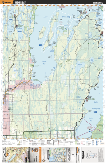
MBMB47 Fisher Bay - Manitoba Backroad Mapbook Topo
Backroad Mapbooks
This recreation topographic map for Fisher Bay highlights all the logging/resource roads, hunting areas, fishing lakes & streams, campsites, paddling routes for canoeing and kayaking, wildlife viewing areas, multi-use trails for hiking, biking, horseback riding, cross-country skiing and snowshoeing, motorized trails for ATVing and snowmobiling & more. Covering 3,040 km2 (1,175 mi2), this 1:85,000 scale map measures 50 x 63.5 km (30 x 39.5 mi), providing you with more topographic and recreational detail for the Melita area than any other map on the market. New features include Crown land areas and labeled fish species, plus countless new trails, roads and recreational Points of Interest. Included in this map are Lake Winnipeg, Fisher Bay, Moose Lake, Matheson Island, Lake St George, Lake St Andrew, Lake St Peter, Koostatak, Goldeye Lake, Beaver Creek and more.
Page Size: 24 x 37 in (610 x 940 mm)
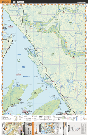
MBMB48 Gull Harbour - Manitoba Backroad Mapbook Topo
Backroad Mapbooks
This recreation topographic map for Gull Harbour highlights all the logging/resource roads, hunting areas, fishing lakes & streams, campsites, paddling routes for canoeing and kayaking, wildlife viewing areas, multi-use trails for hiking, biking, horseback riding, cross-country skiing and snowshoeing, motorized trails for ATVing and snowmobiling & more. Covering 3,040 km2 (1,175 mi2), this 1:85,000 scale map measures 50 x 63.5 km (30 x 39.5 mi), providing you with more topographic and recreational detail for the Melita area than any other map on the market. New features include Crown land areas and labeled fish species, plus countless new trails, roads and recreational Points of Interest. Included in this map are Lake Winnipeg, Deer Island, Black Island, Blacks Point, Leyond River, Loon Bay, Atikakai Prov Park, Bloodvein River, Shallow Lake, Rice River and more.
Page Size: 24 x 37 in (610 x 940 mm)
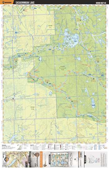
MBMB49 Sasaginnigak Lake - Manitoba Backroad Mapbook Topo
Backroad Mapbooks
This recreation topographic map for Sasaginnigak Lake highlights all the logging/resource roads, hunting areas, fishing lakes & streams, campsites, paddling routes for canoeing and kayaking, wildlife viewing areas, multi-use trails for hiking, biking, horseback riding, cross-country skiing and snowshoeing, motorized trails for ATVing and snowmobiling & more. Covering 3,040 km2 (1,175 mi2), this 1:85,000 scale map measures 50 x 63.5 km (30 x 39.5 mi), providing you with more topographic and recreational detail for the Melita area than any other map on the market. New features include Crown land areas and labeled fish species, plus countless new trails, roads and recreational Points of Interest. Included in this map are Sasaginnigak Lake, Bloodvein River, Gammon River, English Lake, Atikaki Provincial Park ,Rice River, Kautunigan Lake and more.
Page Size: 24 x 37 in (610 x 940 mm)
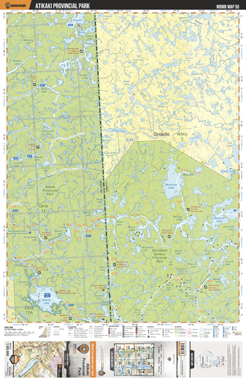
MBMB50 Atikaki Provincial Park - Manitoba Backroad Mapbook Topo
Backroad Mapbooks
This recreation topographic map for Atikaki Provincial Park highlights all the logging/resource roads, hunting areas, fishing lakes & streams, campsites, paddling routes for canoeing and kayaking, wildlife viewing areas, multi-use trails for hiking, biking, horseback riding, cross-country skiing and snowshoeing, motorized trails for ATVing and snowmobiling & more. Covering 3,040 km2 (1,175 mi2), this 1:85,000 scale map measures 50 x 63.5 km (30 x 39.5 mi), providing you with more topographic and recreational detail for the Melita area than any other map on the market. New features include Crown land areas and labeled fish species, plus countless new trails, roads and recreational Points of Interest. Included in this map are Atikaki Provincial Park, Musclow Lake, Aikens Lake, Bloodvein River, Woodland Caribou Provincial Park, Gammon River and more.
Page Size: 24 x 37 in (610 x 940 mm)
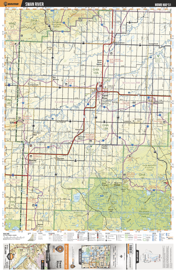
MBMB51 Swan River - Manitoba Backroad Mapbook Topo
Backroad Mapbooks
This recreation topographic map for Swan River highlights all the logging/resource roads, hunting areas, fishing lakes & streams, campsites, paddling routes for canoeing and kayaking, wildlife viewing areas, multi-use trails for hiking, biking, horseback riding, cross-country skiing and snowshoeing, motorized trails for ATVing and snowmobiling & more. Covering 3,040 km2 (1,175 mi2), this 1:85,000 scale map measures 50 x 63.5 km (30 x 39.5 mi), providing you with more topographic and recreational detail for the Melita area than any other map on the market. New features include Crown land areas and labeled fish species, plus countless new trails, roads and recreational Points of Interest. Included in this map are Duck Mountain Prov Park, Benito, Swan River, Bowsman, Minitonas, Sarah Lake, Woody River, Roaring Rive, Durban, Craigsford and more.
Page Size: 24 x 37 in (610 x 940 mm)
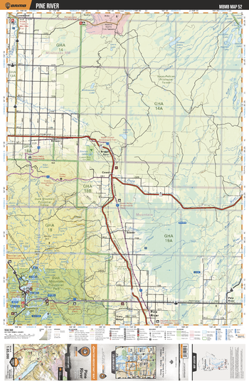
MBMB52 Pine River - Manitoba Backroad Mapbook Topo
Backroad Mapbooks
This recreation topographic map for Pine River highlights all the logging/resource roads, hunting areas, fishing lakes & streams, campsites, paddling routes for canoeing and kayaking, wildlife viewing areas, multi-use trails for hiking, biking, horseback riding, cross-country skiing and snowshoeing, motorized trails for ATVing and snowmobiling & more. Covering 3,040 km2 (1,175 mi2), this 1:85,000 scale map measures 50 x 63.5 km (30 x 39.5 mi), providing you with more topographic and recreational detail for the Melita area than any other map on the market. New features include Crown land areas and labeled fish species, plus countless new trails, roads and recreational Points of Interest. Included in this map are Duck Mountain Prov Park, Pine River, Briggs Spur, Kettle Hills, Pelican River, Spence Lake, Sinclair River, Duck River, Sclater River, Springwater Prov Park and more.
Page Size: 24 x 37 in (610 x 940 mm)
No search results