


MapSherpa Catalog
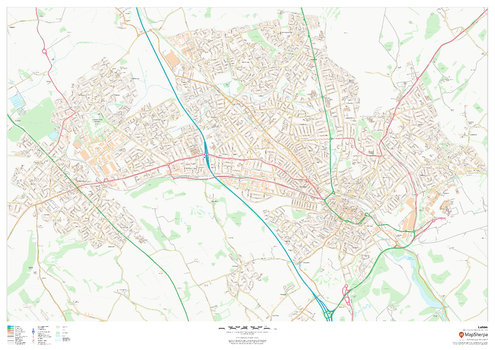
Luton
MapSherpa
This map of Luton shows detailed street level information including extensive street labelling. Ideal for planning of deliveries, home services, sales territories, real estate and much more.
Page Size: 47 x 33.25 in (1189 x 841 mm)
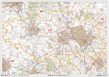
Luton - LU - Postcode Wall Map
XYZ Maps
The Luton Postcode Sector Wall Map shows detailed postcode sector boundaries (LU1 1, LU1 2) on a comprehensive background and is perfect for determining postcode boundaries for sales areas, planning mailshots and also an excellent reference for logistics. This wall map covers the whole of the LU Postcode Area.
Page Size: 47 x 33.25 in (1189 x 841 mm)
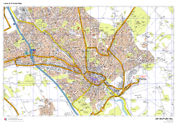
Luton A-Z Street Map
A-Z Maps
This up-to-date A-Z street map covers Luton, including the town centre together with the surrounding districts of Bury Park, Farley Hill, Leagrave, Lewsey, Marsh Farm and Stopsley.
Page Size: 33.25 x 23.5 in (841 x 594 mm)

Lviv Tourist Map - Latynka
Kartographia
This map of Lviv is intended to be easy to read, as is useful for foreign tourists. Residential quarters with numbers of corner houses, airport, railway stations, bus terminals, diplomatic missions, museums, theaters, cinemas, monuments, churches, hotels, hospitals, forests, parks, cemeteries, public gardens, limits of city council and city districts are shown on the map. The city center is shown in an inset map at a scale of 1:12,000.
Place names on the map are written in the Ukrainian Latin alphabet (Latynka). The map legend is in English, Polish and German. A table shows the translation of Ukrainian Romanized letters into English, Polish and German.
Page Size: 27 x 33.25 in (680 x 840 mm)

Lvivska oblast Wall Map - Ukrainian
Kartographia
This Ukrainian-language wall map features important architectural sites, monuments, cultural and entertainment establishments, reserves, national parks, wildlife areas, nature monuments and tourist centers of the Lviv region. Also included is a place name distance index, photographs and descriptions of notable features, and a description of the tour circuit ZolotapidkovaLvivshchyny / Golden horseshoe of the Lviv region.
Page Size: 26.5 x 27.75 in (670 x 704 mm)
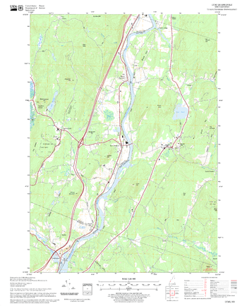
Lyme Quadrangle, New Hampshire-Vermont
United States Forest Service
United States Forestry Service topographical map of Lyme, New Hampshire-Vermont
Page Size: 21.75 x 27 in (552 x 686 mm)
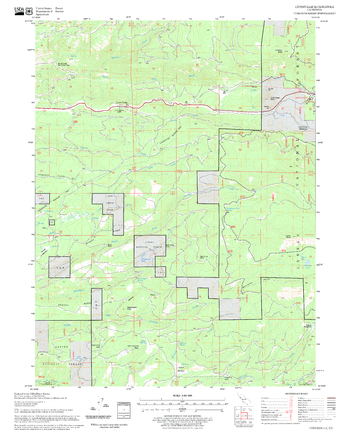
Lyonsville Quadrangle, California
United States Forest Service
United States Department of Agriculture Forestry Service topographical map of Lyonsville, Lassen National Forest, California.
Page Size: 21.75 x 27 in (552 x 686 mm)
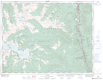
Lytton - 92 I/4 - British Columbia
Natural Resources Canada
Canadian topographic map of Lytton, British Columbia. NTS sheet 092I04 Edition 3.
Page Size: 32.5 x 25.5 in (822 x 642 mm)
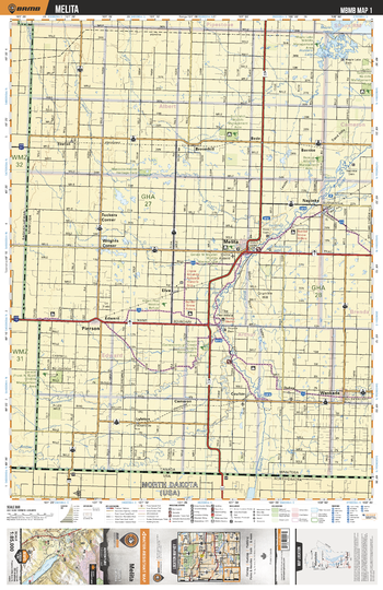
MBMB01 Melita - Manitoba Backroad Mapbook Topo
Backroad Mapbooks
This recreation topographic map for Melita highlights all the logging/resource roads, hunting areas, fishing lakes & streams, campsites, paddling routes for canoeing and kayaking, wildlife viewing areas, multi-use trails for hiking, biking, horseback riding, cross-country skiing and snowshoeing, motorized trails for ATVing and snowmobiling & more. Covering 3,040 km2 (1,175 mi2), this 1:85,000 scale map measures 50 x 63.5 km (30 x 39.5 mi), providing you with more topographic and recreational detail for the Melita area than any other map on the market. New features include Crown land areas and labeled fish species, plus countless new trails, roads and recreational Points of Interest. Included in this map are Bede, Broomhill, Cameron, Coulter, Dainy, Elva, Lyleton, Melita, Napinka, Pierson, Tucker’s Corner, Wrights Corner and Waskida, plus the Broomhill Wildlife Management Area, Hunters Lake, Lauder Sandhills Wildlife Management Area, Pierson Creek Wildlife Management Area and the Souris River.
Page Size: 24 x 37 in (610 x 940 mm)
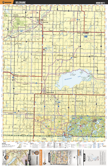
MBMB02 Deloraine - Manitoba Backroad Mapbook Topo
Backroad Mapbooks
This recreation topographic map for Deloraine highlights all the logging/resource roads, hunting areas, fishing lakes & streams, campsites, paddling routes for canoeing and kayaking, wildlife viewing areas, multi-use trails for hiking, biking, horseback riding, cross-country skiing and snowshoeing, motorized trails for ATVing and snowmobiling & more. Covering 3,040 km2 (1,175 mi2), this 1:85,000 scale map measures 50 x 63.5 km (30 x 39.5 mi), providing you with more topographic and recreational detail for the Melita area than any other map on the market. New features include Crown land areas and labeled fish species, plus countless new trails, roads and recreational Points of Interest. Included in this map are Whitewater Lake, Deloraine, Turtle Mountain Prov Park, Max Lake, Sharpe Lake, Hartney, Elgin, Chain Lakes, Souris River, Lauder Sandhills Wildlife Management Area and more.
Page Size: 24 x 37 in (610 x 940 mm)
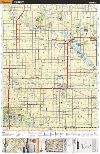
MBMB03 Killarney - Manitoba Backroad Mapbook Topo
Backroad Mapbooks
This recreation topographic map for Killarney highlights all the logging/resource roads, hunting areas, fishing lakes & streams, campsites, paddling routes for canoeing and kayaking, wildlife viewing areas, multi-use trails for hiking, biking, horseback riding, cross-country skiing and snowshoeing, motorized trails for ATVing and snowmobiling & more. Covering 3,040 km2 (1,175 mi2), this 1:85,000 scale map measures 50 x 63.5 km (30 x 39.5 mi), providing you with more topographic and recreational detail for the Melita area than any other map on the market. New features include Crown land areas and labeled fish species, plus countless new trails, roads and recreational Points of Interest. Included in this map are Killarney, Boissevain, Souris River, Pelican Lake, Ninette, Belmont, Turtle Mountain Prov Park, Souris River, Bone Lake, Noble Lake and more.
Page Size: 24 x 37 in (610 x 940 mm)
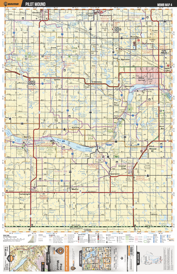
MBMB04 Pilot Mound - Manitoba Backroad Mapbook Topo
Backroad Mapbooks
This recreation topographic map for Pilot Mound highlights all the logging/resource roads, hunting areas, fishing lakes & streams, campsites, paddling routes for canoeing and kayaking, wildlife viewing areas, multi-use trails for hiking, biking, horseback riding, cross-country skiing and snowshoeing, motorized trails for ATVing and snowmobiling & more. Covering 3,040 km2 (1,175 mi2), this 1:85,000 scale map measures 50 x 63.5 km (30 x 39.5 mi), providing you with more topographic and recreational detail for the Melita area than any other map on the market. New features include Crown land areas and labeled fish species, plus countless new trails, roads and recreational Points of Interest. Included in this map are Rock Lake, Swan Lake, Crystal Mound, Pilot Mound, Cypress River, Cartwright, Pembina River, Glenboro, Indian Springs, Lake Louise and more.
Page Size: 24 x 37 in (610 x 940 mm)
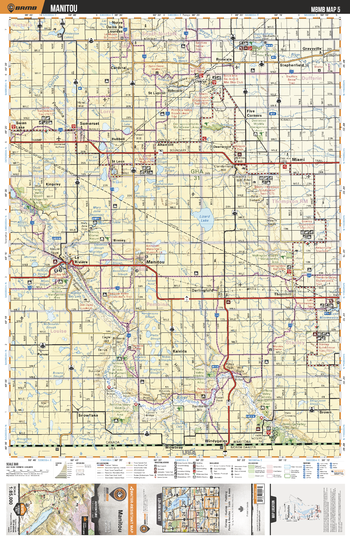
MBMB05 Manitou - Manitoba Backroad Mapbook Topo
Backroad Mapbooks
This recreation topographic map for Manitou highlights all the logging/resource roads, hunting areas, fishing lakes & streams, campsites, paddling routes for canoeing and kayaking, wildlife viewing areas, multi-use trails for hiking, biking, horseback riding, cross-country skiing and snowshoeing, motorized trails for ATVing and snowmobiling & more. Covering 3,040 km2 (1,175 mi2), this 1:85,000 scale map measures 50 x 63.5 km (30 x 39.5 mi), providing you with more topographic and recreational detail for the Melita area than any other map on the market. New features include Crown land areas and labeled fish species, plus countless new trails, roads and recreational Points of Interest. Included in this map are Lizard Lake, Manitou, La Riviere, Pembina River, Lake Minnewasta, Somerset, Five Corners, Pinkerton Lakes, Stephenfield Lake, Boyne River and more.
Page Size: 24 x 37 in (610 x 940 mm)
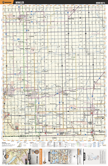
MBMB06 Winkler - Manitoba Backroad Mapbook Topo
Backroad Mapbooks
This recreation topographic map for Winkler highlights all the logging/resource roads, hunting areas, fishing lakes & streams, campsites, paddling routes for canoeing and kayaking, wildlife viewing areas, multi-use trails for hiking, biking, horseback riding, cross-country skiing and snowshoeing, motorized trails for ATVing and snowmobiling & more. Covering 3,040 km2 (1,175 mi2), this 1:85,000 scale map measures 50 x 63.5 km (30 x 39.5 mi), providing you with more topographic and recreational detail for the Melita area than any other map on the market. New features include Crown land areas and labeled fish species, plus countless new trails, roads and recreational Points of Interest. Included in this map are Winkler, Morden, Haskett, Gretna, Altona, Plum Coulee, Roland, Carman, Boyne River, Tobacco Creek and more.
Page Size: 24 x 37 in (610 x 940 mm)
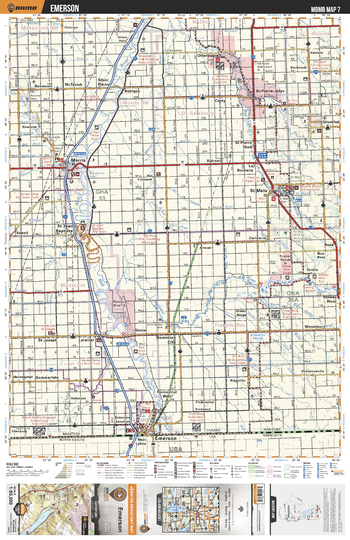
MBMB07 Emerson - Manitoba Backroad Mapbook Topo
Backroad Mapbooks
This recreation topographic map for Emerson highlights all the logging/resource roads, hunting areas, fishing lakes & streams, campsites, paddling routes for canoeing and kayaking, wildlife viewing areas, multi-use trails for hiking, biking, horseback riding, cross-country skiing and snowshoeing, motorized trails for ATVing and snowmobiling & more. Covering 3,040 km2 (1,175 mi2), this 1:85,000 scale map measures 50 x 63.5 km (30 x 39.5 mi), providing you with more topographic and recreational detail for the Melita area than any other map on the market. New features include Crown land areas and labeled fish species, plus countless new trails, roads and recreational Points of Interest. Included in this map are Emerson, St Malo, St Pierre Jolys, Morris, Grunthal, Roseau River, Kirkpatrick Swamp, Red River, St Jean Baptiste, Otterburn and more.
Page Size: 24 x 37 in (610 x 940 mm)
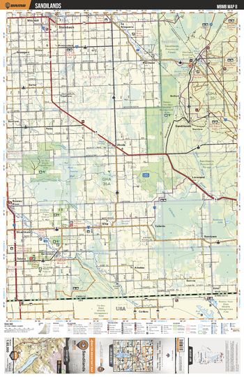
MBMB08 Sandilands - Manitoba Backroad Mapbook Topo
Backroad Mapbooks
This recreation topographic map for Sandilands highlights all the logging/resource roads, hunting areas, fishing lakes & streams, campsites, paddling routes for canoeing and kayaking, wildlife viewing areas, multi-use trails for hiking, biking, horseback riding, cross-country skiing and snowshoeing, motorized trails for ATVing and snowmobiling & more. Covering 3,040 km2 (1,175 mi2), this 1:85,000 scale map measures 50 x 63.5 km (30 x 39.5 mi), providing you with more topographic and recreational detail for the Melita area than any other map on the market. New features include Crown land areas and labeled fish species, plus countless new trails, roads and recreational Points of Interest. Included in this map are Sandilands, Rat River, Stuartburn, Marchand Prov Park, Roseau River, Caliento Bog, Sundown Lake, Steinbach, Mitchell, Vita and more.
Page Size: 24 x 37 in (610 x 940 mm)
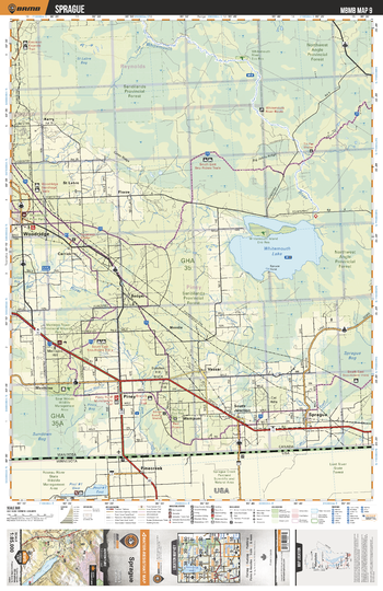
MBMB09 Sprague - Manitoba Backroad Mapbook Topo
Backroad Mapbooks
This recreation topographic map for Sprague highlights all the logging/resource roads, hunting areas, fishing lakes & streams, campsites, paddling routes for canoeing and kayaking, wildlife viewing areas, multi-use trails for hiking, biking, horseback riding, cross-country skiing and snowshoeing, motorized trails for ATVing and snowmobiling & more. Covering 3,040 km2 (1,175 mi2), this 1:85,000 scale map measures 50 x 63.5 km (30 x 39.5 mi), providing you with more topographic and recreational detail for the Melita area than any other map on the market. New features include Crown land areas and labeled fish species, plus countless new trails, roads and recreational Points of Interest. Included in this map are Whitemouth Lake, Sandilands Prov Forest, Woodridge, Vassar, Sprague, Whitemouth River, Spur Woods Wildlife Management Area, Wampum, Rat River, Sprague Bog and more.
Page Size: 24 x 37 in (610 x 940 mm)
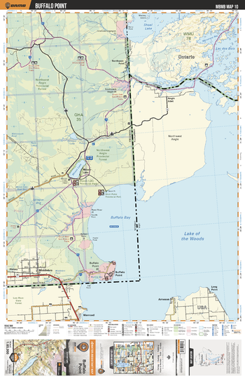
MBMB10 Buffalo Point - Manitoba Backroad Mapbook Topo
Backroad Mapbooks
This recreation topographic map for Buffalo Point highlights all the logging/resource roads, hunting areas, fishing lakes & streams, campsites, paddling routes for canoeing and kayaking, wildlife viewing areas, multi-use trails for hiking, biking, horseback riding, cross-country skiing and snowshoeing, motorized trails for ATVing and snowmobiling & more. Covering 3,040 km2 (1,175 mi2), this 1:85,000 scale map measures 50 x 63.5 km (30 x 39.5 mi), providing you with more topographic and recreational detail for the Melita area than any other map on the market. New features include Crown land areas and labeled fish species, plus countless new trails, roads and recreational Points of Interest. Included in this map are Buffalo Bay, Buffalo Point, Middlebro, Moose Lake, Northwest Point, Sandilands Prov Forest, Reed River, Sprague Bog, Birch Point Prov Park, Sprague Lake and more.
Page Size: 24 x 37 in (610 x 940 mm)
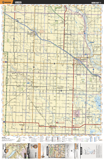
MBMB11 Virden - Manitoba Backroad Mapbook Topo
Backroad Mapbooks
This recreation topographic map for Virden highlights all the logging/resource roads, hunting areas, fishing lakes & streams, campsites, paddling routes for canoeing and kayaking, wildlife viewing areas, multi-use trails for hiking, biking, horseback riding, cross-country skiing and snowshoeing, motorized trails for ATVing and snowmobiling & more. Covering 3,040 km2 (1,175 mi2), this 1:85,000 scale map measures 50 x 63.5 km (30 x 39.5 mi), providing you with more topographic and recreational detail for the Melita area than any other map on the market. New features include Crown land areas and labeled fish species, plus countless new trails, roads and recreational Points of Interest. Included in this map are Virden, Pipestone, Reston, Elkhorn, Kirkella, Assiniboine River, Pipestone Creek, Oak Lake Reserve, Routledge, Two Creeks and more.
Page Size: 24 x 37 in (610 x 940 mm)
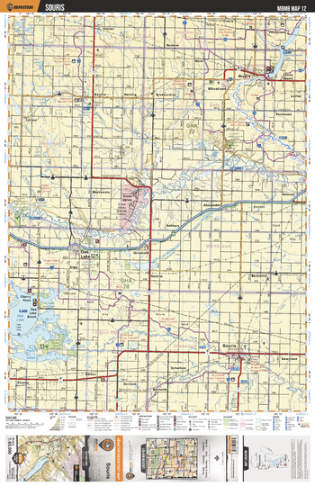
MBMB12 Souris - Manitoba Backroad Mapbook Topo
Backroad Mapbooks
This recreation topographic map for Souris highlights all the logging/resource roads, hunting areas, fishing lakes & streams, campsites, paddling routes for canoeing and kayaking, wildlife viewing areas, multi-use trails for hiking, biking, horseback riding, cross-country skiing and snowshoeing, motorized trails for ATVing and snowmobiling & more. Covering 3,040 km2 (1,175 mi2), this 1:85,000 scale map measures 50 x 63.5 km (30 x 39.5 mi), providing you with more topographic and recreational detail for the Melita area than any other map on the market. New features include Crown land areas and labeled fish species, plus countless new trails, roads and recreational Points of Interest. Included in this map are Souris, Rivers, Wheatland, Oak Lake, Denbow, Sioux Valley, Lake Wahtopanah, Little Saskatchewan River, Assiniboine River, Souris River and more.
Page Size: 24 x 37 in (610 x 940 mm)
No search results