top of page
UK Political Postcode District Wall Map (D8)
XYZ Maps
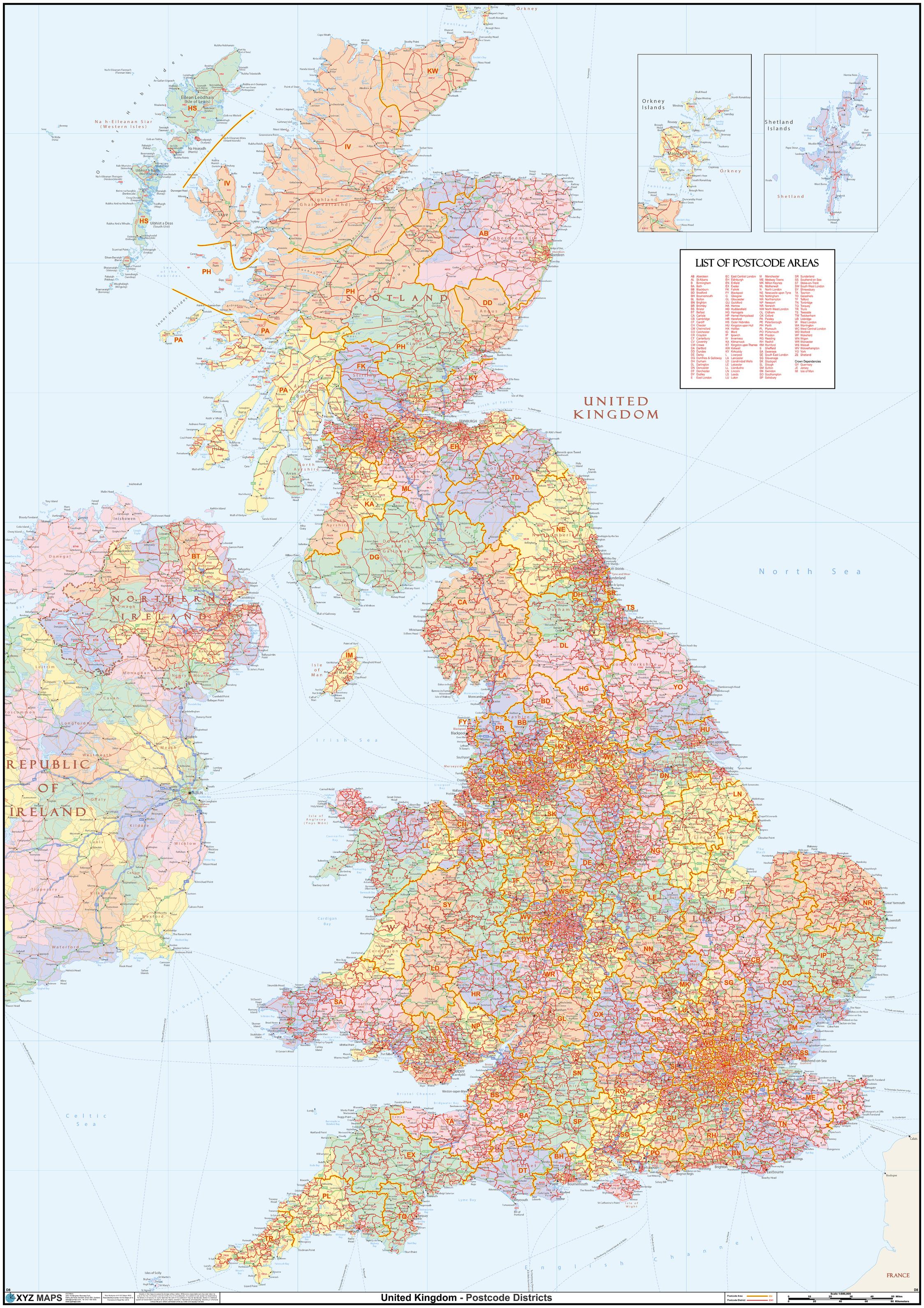
This huge UK Political Postcode District Wall Map is 2A in size (1189mm x 1682mm, 4ft x 6ft). We believe it is the only single wall map to cover the United Kingdom at postcode district level. The map features a political map base showing the counties and unitary authorities in pastel colours.
Page Size: 47 x 66.25 in (1189 x 1682 mm)
Buy this map on MapTrove.ca
bottom of page