top of page
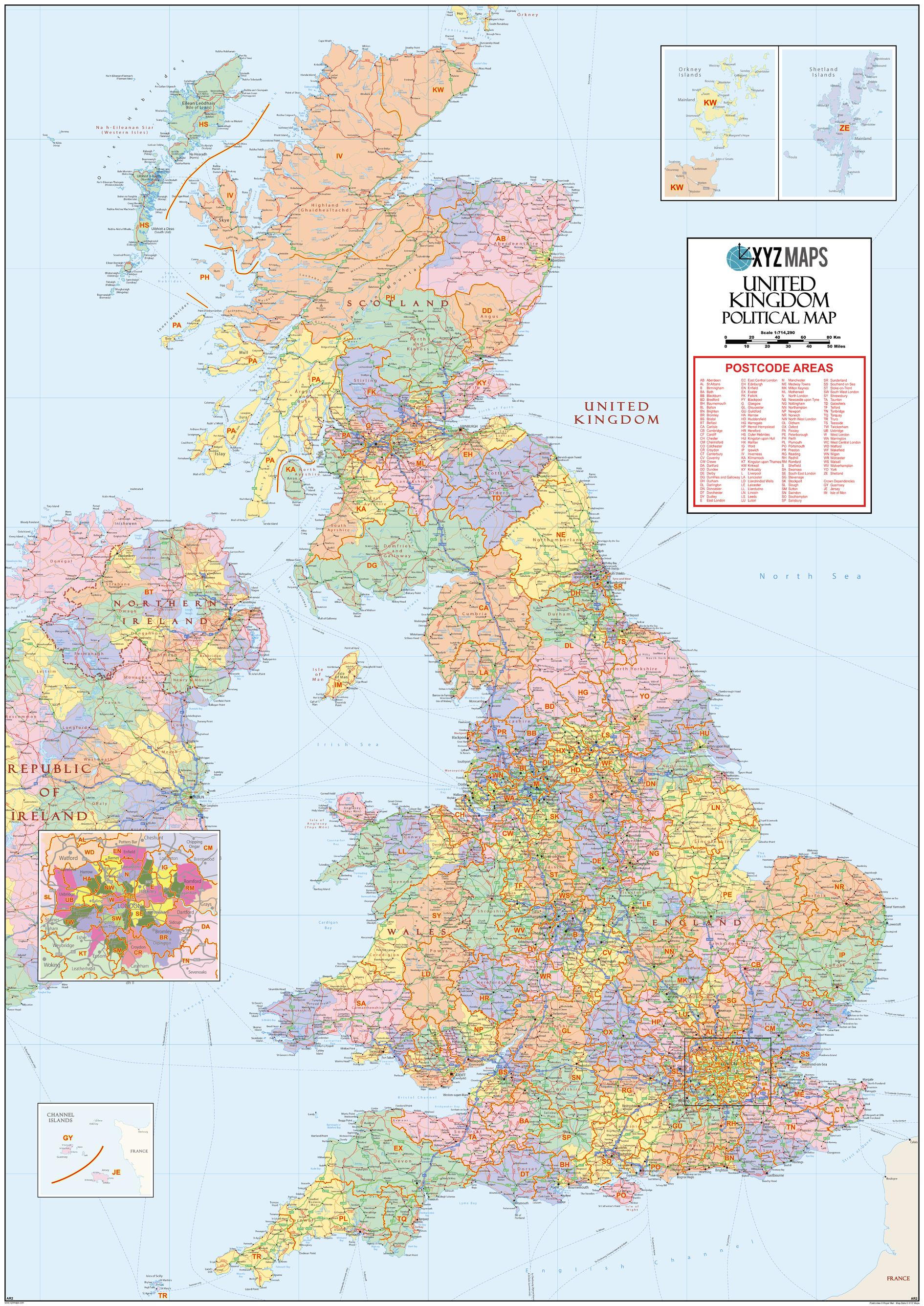
UK Political Postcode Area Large Wall Map (A2)
XYZ Maps
The UK Political Postcode Area Large Wall Map clearly shows the 124 postcode area boundaries on a comprehensive background and is perfect for determining national postcode boundaries, national planning, logistics or as a national reference guide.
Page Size: 39.5 x 55.75 in (1000 x 1414 mm)
Buy this map on MapTrove.ca
bottom of page