United States Department of Agriculture Forest Service
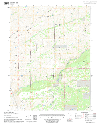
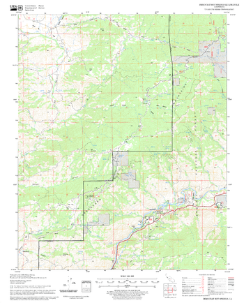
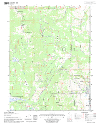
Deer Creek Flat Quadrangle, California
United States Department of Agriculture Forestry Service topographical map of Deer Creek Flat, Lassen National Forest, California.
Page Size: 21.75 x 27 in (552 x 686 mm)
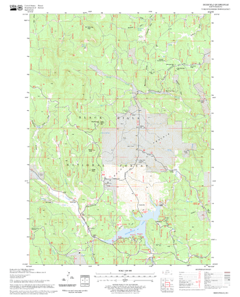
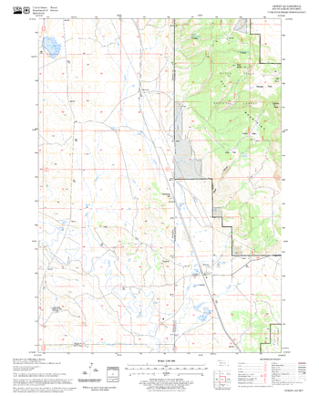
Deerfield Quadrangle, South Dakota
United States Department of Agriculture Forestry Service topographical map of Deerfield, Black Hills National Forest, South Dakota.
Page Size: 21.75 x 27 in (552 x 686 mm)
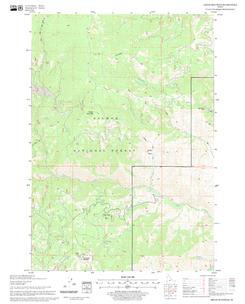
Degan Mountain Quadrangle, Idaho
United States Department of Agriculture Forestry Service topographical map of Degan Mountain, Salmon-Chalis National Forest, Idaho.
Page Size: 21.75 x 27 in (552 x 686 mm)
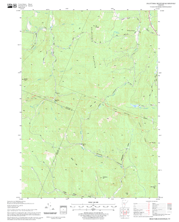
Delectable Mountain Quadrangle, New Hampshire-Vermont
United States Forestry Service topographical map of Delectable Mountain, New Hampshire-Vermont
Page Size: 21.75 x 27 in (552 x 686 mm)
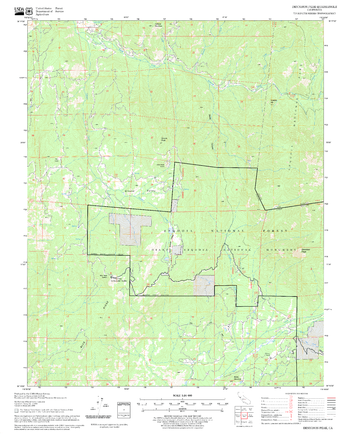
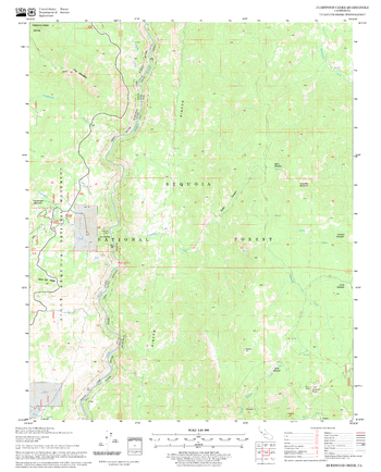
Democrat Hot Springs Quadrangle, California
United States Department of Agriculture Forestry Service topographical map of Democrat Hot Springs, Sequoia National Forest, California.
Page Size: 21.75 x 27 in (552 x 686 mm)
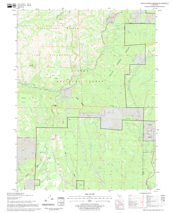
Dennison Peak Quadrangle, California
United States Department of Agriculture Forestry Service topographical map of Dennison Peak, Sequoia National Forest, California.
Page Size: 21.75 x 27 in (552 x 686 mm)
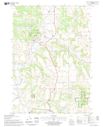
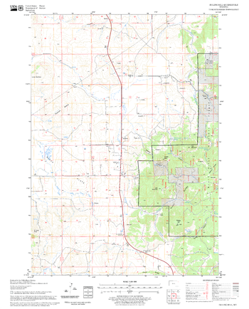
Devils Parade Ground Quadrangle, California
United States Department of Agriculture Forestry Service topographical map of Devils Parade Ground, Lassen National Forest, California.
Page Size: 21.75 x 27 in (552 x 686 mm)
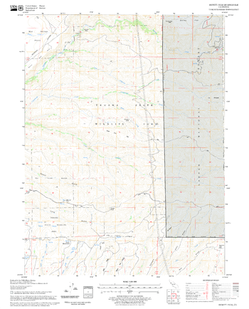
Devils Tower Quadrangle, South Dakota
United States Department of Agriculture Forestry Service topographical map of Devils Tower, Black Hills National Forest, South Dakota.
Page Size: 21.75 x 27 in (552 x 686 mm)
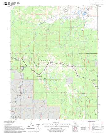
Dewey Quadrangle, South Dakota
United States Department of Agriculture Forestry Service topographical map of Dewey, Black Hills National Forest, South Dakota.
Page Size: 21.75 x 27 in (552 x 686 mm)
Dewitt Peak Quadrangle, California
United States Department of Agriculture Forestry Service topographical map of Dewitt Peak, Lassen National Forest, California.
Page Size: 21.75 x 27 in (552 x 686 mm)
Diamond Mountain Quadrangle, California
United States Department of Agriculture Forestry Service topographical map of Diamond Mountain, Lassen National Forest, California.
Page Size: 21.75 x 27 in (552 x 686 mm)
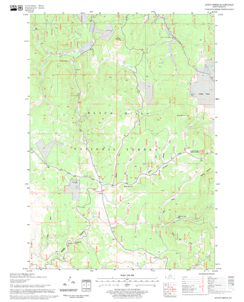
Ditch Creek Quadrangle, South Dakota
United States Department of Agriculture Forestry Service topographical map of Ditch Creek, Black Hills National Forest, South Dakota.
Page Size: 21.75 x 27 in (552 x 686 mm)
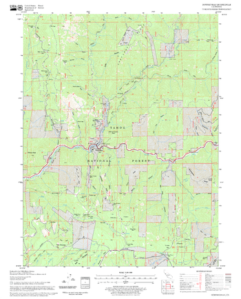
Dog Valley Quadrangle, California
United States Department of Agriculture Forestry Service topographical map of Dog Valley, Tahoe National Forest, California.
Page Size: 21.75 x 27 in (552 x 686 mm)
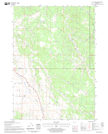
Downieville Quadrangle, California
United States Department of Agriculture Forestry Service topographical map of Downieville, Tahoe National Forest, California.
Page Size: 21.75 x 27 in (552 x 686 mm)
Dry Draw Quadrangle, South Dakota
United States Department of Agriculture Forestry Service topographical map of Dry Draw, Black Hills National Forest, South Dakota.
Page Size: 21.75 x 27 in (552 x 686 mm)
Duck Creek Point Quadrangle, Idaho
United States Department of Agriculture Forestry Service topographical map of Duck Creek Point, Salmon-Chalis National Forest, Idaho.
Page Size: 21.75 x 27 in (552 x 686 mm)
Duling Hill Quadrangle, South Dakota
United States Department of Agriculture Forestry Service topographical map of Duling Hill, Black Hills National Forest, South Dakota.
Page Size: 21.75 x 27 in (552 x 686 mm)
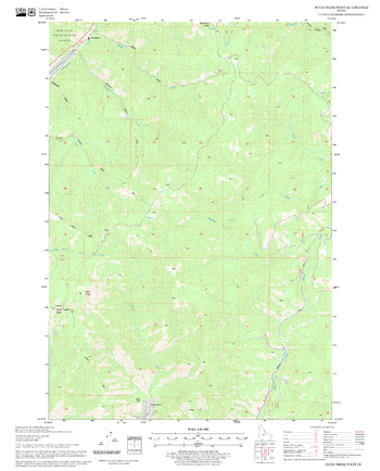
Duncan Peak Quadrangle, California
United States Department of Agriculture Forestry Service topographical map of Duncan Peak, Tahoe National Forest, California.
Page Size: 21.75 x 27 in (552 x 686 mm)
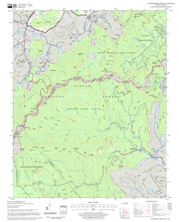
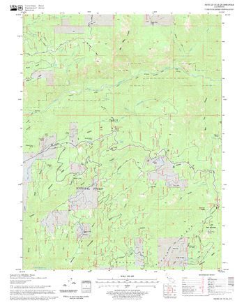
Dunsmore Mountain Quadrangle, North Carolina
United States Department of Agriculture Forestry Service topographical map of Dunsmore Mountain, Pisgah National Forest, North Carolina.
Page Size: 21.75 x 27 in (552 x 686 mm)
Durrwood Creek Quadrangle, California
United States Department of Agriculture Forestry Service topographical map of Durrwood Creek, Sequoia National Forest, California.
Page Size: 21.75 x 27 in (552 x 686 mm)