United States Department of Agriculture Forest Service
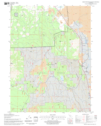
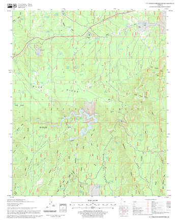
Burney Mountain East Quadrangle, California
United States Department of Agriculture Forestry Service topographical map of Burney Mountain East, Lassen National Forest, California.
Page Size: 21.75 x 27 in (552 x 686 mm)
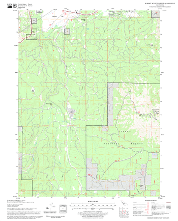
Burney Mountain West Quadrangle, California
United States Department of Agriculture Forestry Service topographical map of Burney Mountain West, Lassen National Forest, California.
Page Size: 21.75 x 27 in (552 x 686 mm)
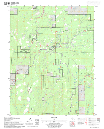
Butte Meadows Quadrangle, California
United States Department of Agriculture Forestry Service topographical map of Butte Meadows, Lassen National Forest, California.
Page Size: 21.75 x 27 in (552 x 686 mm)
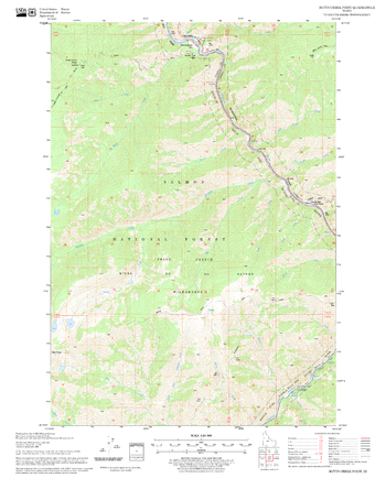
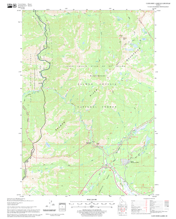
Butts Creek Point Quadrangle, Idaho
United States Department of Agriculture Forestry Service topographical map of Butts Creek Point, Salmon-Chalis National Forest, Idaho.
Page Size: 21.75 x 27 in (552 x 686 mm)
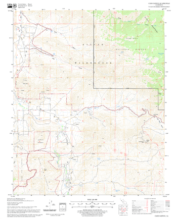
C C Craigin Reservoir Quadrangle, Arizona
United States Department of Agriculture Forestry Service topographical map of C C Craigin Reservoir, Coconino National Forest, Arizona.
Page Size: 21.75 x 27 in (552 x 686 mm)
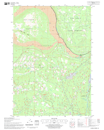
Cabin Lake Quadrangle, Oregon
United States Department of Agriculture Forestry Service topographical map of Cabin Lake, Deschutes National Forest, Oregon.
Page Size: 21.75 x 27 in (552 x 686 mm)
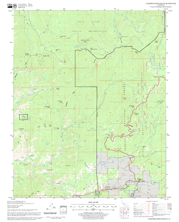
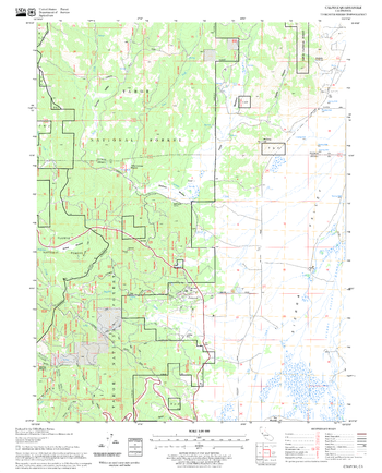
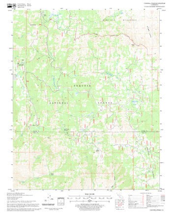
California Hot Springs Quadrangle, California
United States Department of Agriculture Forestry Service topographical map of California Hot Springs, Sequoia National Forest, California.
Page Size: 21.75 x 27 in (552 x 686 mm)
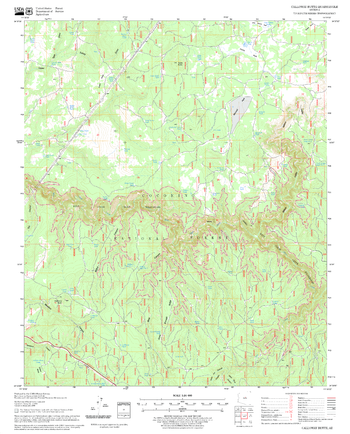
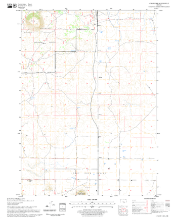
Calloway Butte Quadrangle, Arizona
United States Department of Agriculture Forestry Service topographical map of Calloway Butte, Coconino National Forest, Arizona.
Page Size: 21.75 x 27 in (552 x 686 mm)
Calpine Quadrangle, California
United States Department of Agriculture Forestry Service topographical map of Calpine, Tahoe National Forest, California.
Page Size: 21.75 x 27 in (552 x 686 mm)
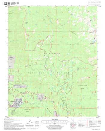
Camp Nelson Quadrangle, California
United States Department of Agriculture Forestry Service topographical map of Camp Nelson, Sequoia National Forest, California.
Page Size: 21.75 x 27 in (552 x 686 mm)
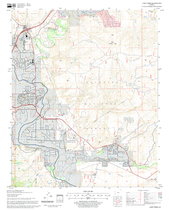
Camp Verde Quadrangle, Arizona
United States Department of Agriculture Forestry Service topographical map of Camp Verde, Coconino National Forest, Arizona.
Page Size: 21.75 x 27 in (552 x 686 mm)
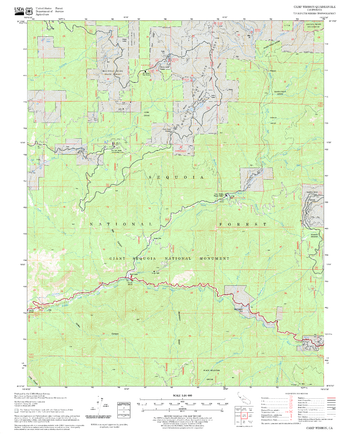
Camp Wishon Quadrangle, California
United States Department of Agriculture Forestry Service topographical map of Camp Wishon, Sequoia National Forest, California.
Page Size: 21.75 x 27 in (552 x 686 mm)
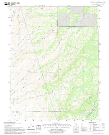
Campbell Mound Quadrangle, California
United States Department of Agriculture Forestry Service topographical map of Campbell Mound, Lassen National Forest, California.
Page Size: 21.75 x 27 in (552 x 686 mm)
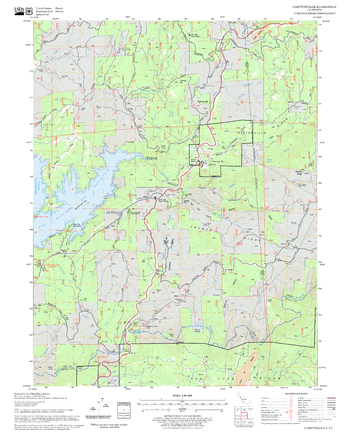
Camptonville Quadrangle, California
United States Department of Agriculture Forestry Service topographical map of Camptonville, Tahoe National Forest, California.
Page Size: 21.75 x 27 in (552 x 686 mm)
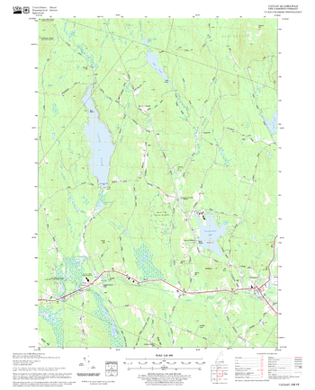
Canaan Quadrangle, New Hampshire-Vermont
United States Forestry Service topographical map of Canaan, New Hampshire-Vermont
Page Size: 21.75 x 27 in (552 x 686 mm)
Candle Creek Quadrangle, Oregon
United States Department of Agriculture Forestry Service topographical map of Candle Creek, Deschutes National Forest, Oregon.
Page Size: 21.75 x 27 in (552 x 686 mm)
Cane Canyon Quadrangle, California
United States Department of Agriculture Forestry Service topographical map of Cane Canyon, Sequoia National Forest, California.
Page Size: 21.75 x 27 in (552 x 686 mm)
Cannell Peak Quadrangle, California
United States Department of Agriculture Forestry Service topographical map of Cannell Peak, Sequoia National Forest, California.
Page Size: 21.75 x 27 in (552 x 686 mm)
Canyondam Quadrangle, California
United States Department of Agriculture Forestry Service topographical map of Canyondam, Lassen National Forest, California.
Page Size: 21.75 x 27 in (552 x 686 mm)
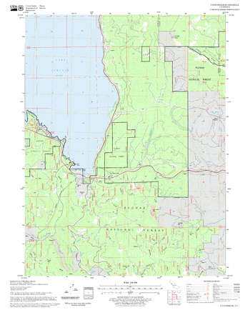
Cape Horn Lakes Quadrangle, Idaho
United States Department of Agriculture Forestry Service topographical map of Cape Horn Lakes, Salmon-Chalis National Forest, Idaho.
Page Size: 21.75 x 27 in (552 x 686 mm)