United States Department of Agriculture Forest Service
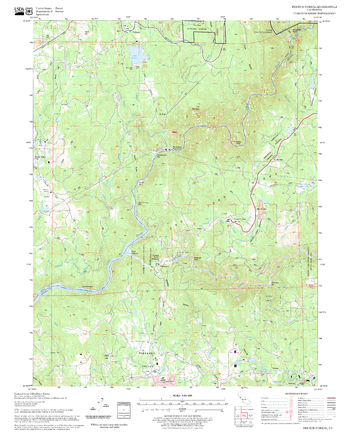
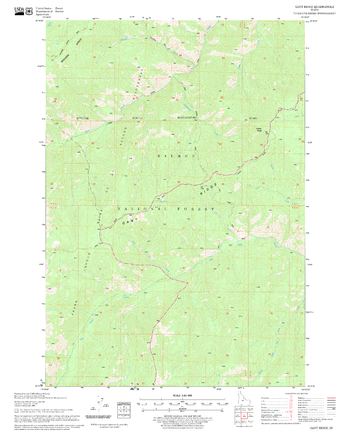
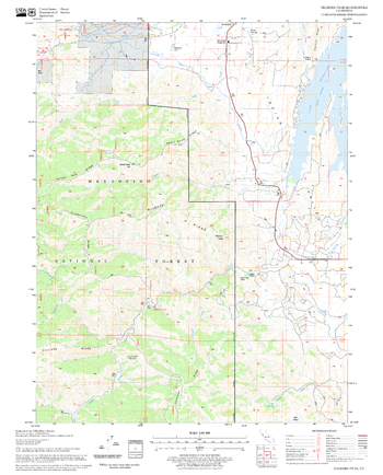
French Corral Quadrangle, California
United States Department of Agriculture Forestry Service topographical map of French Corral, Tahoe National Forest, California.
Page Size: 21.75 x 27 in (552 x 686 mm)
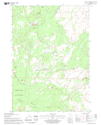
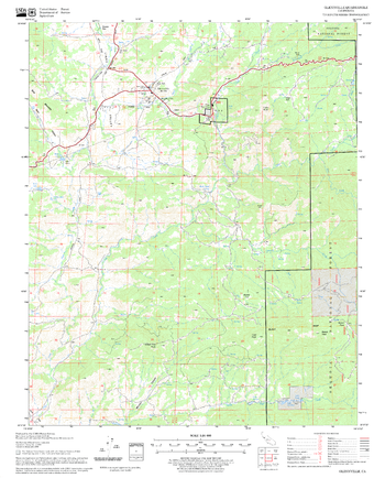
Fuzztail Butte Quadrangle, Oregon
United States Department of Agriculture Forestry Service topographical map of Fuzztail Butte, Deschutes National Forest, Oregon.
Page Size: 21.75 x 27 in (552 x 686 mm)
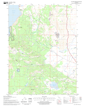
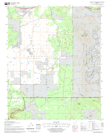
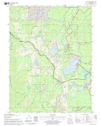
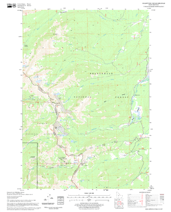
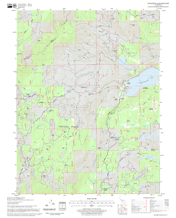
Gallatin Peak Quadrangle, California
United States Department of Agriculture Forestry Service topographical map of Gallatin Peak, Lassen National Forest, California.
Page Size: 21.75 x 27 in (552 x 686 mm)
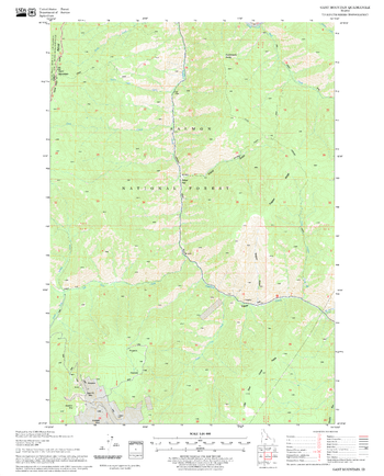
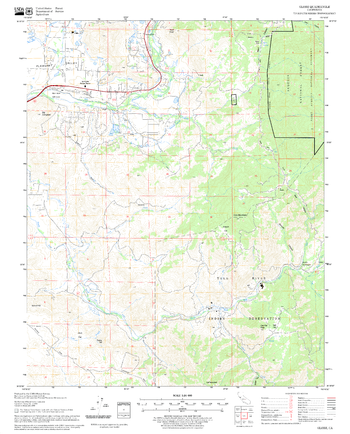
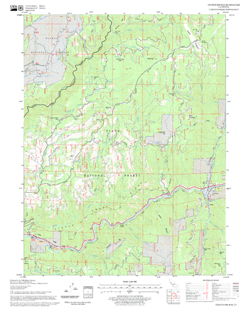
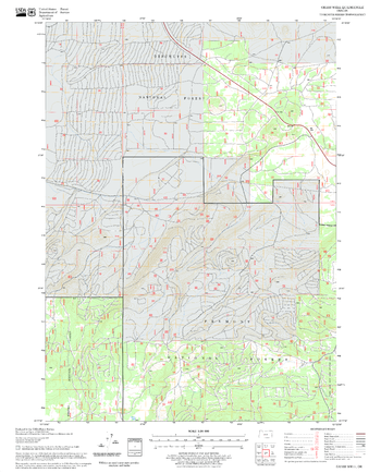
Gant Mountain Quadrangle, Idaho
United States Department of Agriculture Forestry Service topographical map of Gant Mountain, Salmon-Chalis National Forest, Idaho.
Page Size: 21.75 x 27 in (552 x 686 mm)
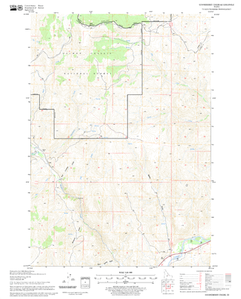
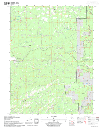
Gant Ridge Quadrangle, Idaho
United States Department of Agriculture Forestry Service topographical map of Gant Ridge, Salmon-Chalis National Forest, Idaho.
Page Size: 21.75 x 27 in (552 x 686 mm)
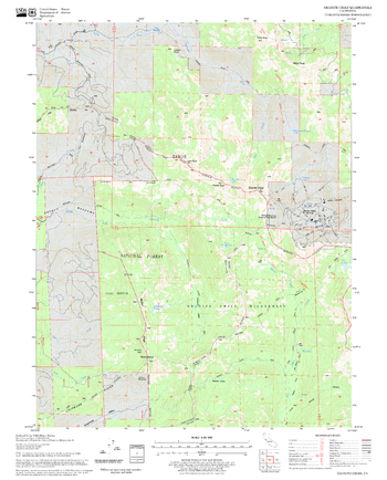
Garland Prairie Quadrangle, Arizona
United States Department of Agriculture Forestry Service topographical map of Garland Prairie, Coconino National Forest, Arizona.
Page Size: 21.75 x 27 in (552 x 686 mm)
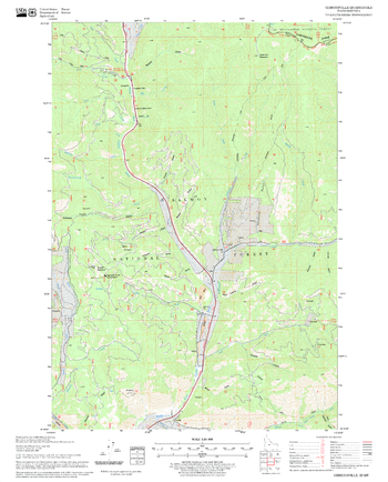
Gibbonsville Quadrangle, Idaho
United States Department of Agriculture Forestry Service topographical map of Gibbonsville, Salmon-Chalis National Forest, Idaho.
Page Size: 21.75 x 27 in (552 x 686 mm)
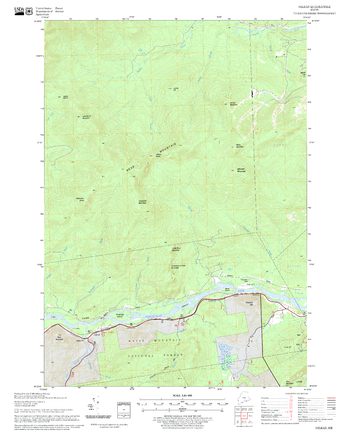
Gilead Quadrangle, New Hampshire-Vermont
United States Department of Agriculture Forestry Service topographical map of Gilead, White Mountains National Forest, New Hampshire-Vermont.
Page Size: 21.75 x 27 in (552 x 686 mm)
Gilmore Peak Quadrangle, California
United States Department of Agriculture Forestry Service topographical map of Gilmore Peak, Mendocino National Forest, California.
Page Size: 21.75 x 27 in (552 x 686 mm)
Glennville Quadrangle, California
United States Department of Agriculture Forestry Service topographical map of Glennville, Sequoia National Forest, California.
Page Size: 21.75 x 27 in (552 x 686 mm)
Globe Quadrangle, California
United States Department of Agriculture Forestry Service topographical map of Globe, Sequoia National Forest, California.
Page Size: 21.75 x 27 in (552 x 686 mm)
Gold Lake Quadrangle, California
United States Department of Agriculture Forestry Service topographical map of Gold Lake, Tahoe National Forest, California.
Page Size: 21.75 x 27 in (552 x 686 mm)
Goldstone Pass Quadrangle, Idaho
United States Department of Agriculture Forestry Service topographical map of Goldstone Pass, Salmon-Chalis National Forest, Idaho.
Page Size: 21.75 x 27 in (552 x 686 mm)
Goodyears Bar Quadrangle, California
United States Department of Agriculture Forestry Service topographical map of Goodyears Bar, Tahoe National Forest, California.
Page Size: 21.75 x 27 in (552 x 686 mm)
Gooseberry Creek Quadrangle, Idaho
United States Department of Agriculture Forestry Service topographical map of Gooseberry Creek, Salmon-Chalis National Forest, Idaho.
Page Size: 21.75 x 27 in (552 x 686 mm)
Granite Chief Quadrangle, California
United States Department of Agriculture Forestry Service topographical map of Granite Chief, Tahoe National Forest, California.
Page Size: 21.75 x 27 in (552 x 686 mm)
Graniteville Quadrangle, California
United States Department of Agriculture Forestry Service topographical map of Graniteville, Tahoe National Forest, California.
Page Size: 21.75 x 27 in (552 x 686 mm)
Grass Well Quadrangle, Oregon
United States Department of Agriculture Forestry Service topographical map of Grass Well, Deschutes National Forest, Oregon.
Page Size: 21.75 x 27 in (552 x 686 mm)
Grays Peak Quadrangle, California
United States Department of Agriculture Forestry Service topographical map of Grays Peak, Lassen National Forest, California.
Page Size: 21.75 x 27 in (552 x 686 mm)
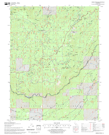
Greek Store Quadrangle, California
United States Department of Agriculture Forestry Service topographical map of Greek Store, Tahoe National Forest, California.
Page Size: 21.75 x 27 in (552 x 686 mm)