United States Department of Agriculture Forest Service
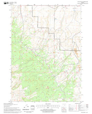
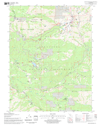
Evans Well Quadrangle, Oregon
United States Department of Agriculture Forestry Service topographical map of Evans Well, Deschutes National Forest, Oregon.
Page Size: 21.75 x 27 in (552 x 686 mm)
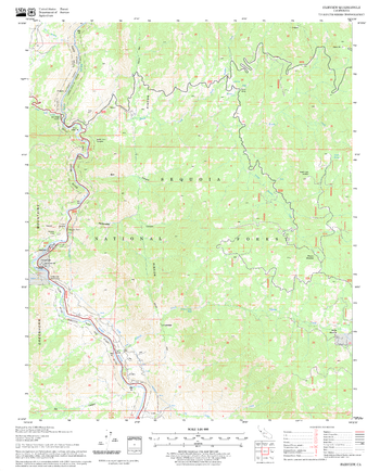
Fairview Quadrangle, California
United States Department of Agriculture Forestry Service topographical map of Fairview, Sequoia National Forest, California.
Page Size: 21.75 x 27 in (552 x 686 mm)
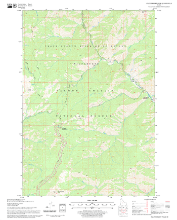
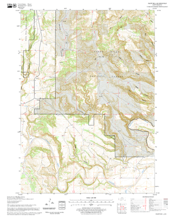
Falconberry Peak Quadrangle, Idaho
United States Department of Agriculture Forestry Service topographical map of Falconberry Peak, Salmon-Chalis National Forest, Idaho.
Page Size: 21.75 x 27 in (552 x 686 mm)
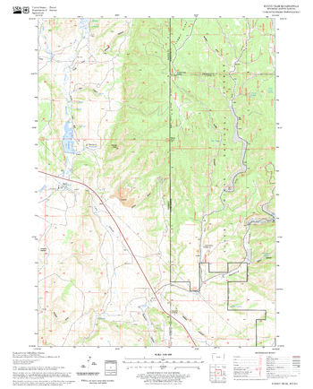
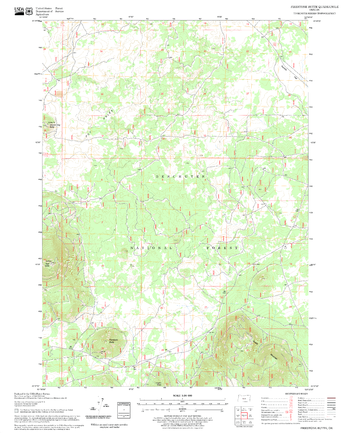
Fanny Peak Quadrangle, South Dakota
United States Department of Agriculture Forestry Service topographical map of Fanny Peak, Black Hills National Forest, South Dakota.
Page Size: 21.75 x 27 in (552 x 686 mm)
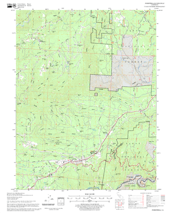
Felkner Hill Quadrangle, California
United States Department of Agriculture Forestry Service topographical map of Felkner Hill, Mendocino National Forest, California.
Page Size: 21.75 x 27 in (552 x 686 mm)
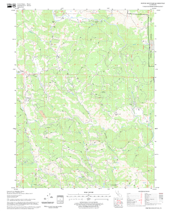
Finley Butte Quadrangle, California
United States Department of Agriculture Forestry Service topographical map of Finley Butte, Lassen National Forest, California.
Page Size: 21.75 x 27 in (552 x 686 mm)
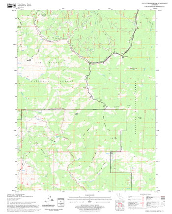
Finley Butte Quadrangle, Oregon
United States Department of Agriculture Forestry Service topographical map of Finley Butte, Deschutes National Forest, Oregon.
Page Size: 21.75 x 27 in (552 x 686 mm)
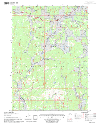
Firestone Butte Quadrangle, Oregon
United States Department of Agriculture Forestry Service topographical map of Firestone Butte, Deschutes National Forest, Oregon.
Page Size: 21.75 x 27 in (552 x 686 mm)
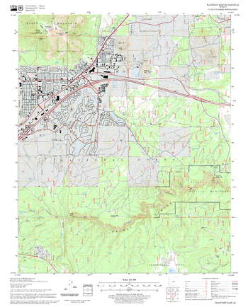
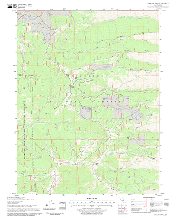
Flagstaff East Quadrangle, Arizona
United States Department of Agriculture Forestry Service topographical map of Flagstaff East, Coconino National Forest, Arizona.
Page Size: 21.75 x 27 in (552 x 686 mm)
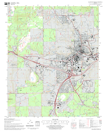
Flagstaff West Quadrangle, Arizona
United States Department of Agriculture Forestry Service topographical map of Flagstaff West, Coconino National Forest, Arizona.
Page Size: 21.75 x 27 in (552 x 686 mm)
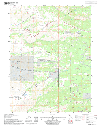
Flint Hill Quadrangle, South Dakota
United States Department of Agriculture Forestry Service topographical map of Flint Hill, Black Hills National Forest, South Dakota.
Page Size: 21.75 x 27 in (552 x 686 mm)
Fly Creek Quadrangle, Oregon
United States Department of Agriculture Forestry Service topographical map of Fly Creek, Deschutes National Forest, Oregon.
Page Size: 21.75 x 27 in (552 x 686 mm)
Foresthill Quadrangle, California
United States Department of Agriculture Forestry Service topographical map of Foresthill, Tahoe National Forest, California.
Page Size: 21.75 x 27 in (552 x 686 mm)
Foster Mountain Quadrangle, California
United States Department of Agriculture Forestry Service topographical map of Foster Mountain, Mendocino National Forest, California.
Page Size: 21.75 x 27 in (552 x 686 mm)
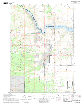
Four Corners Rock Quadrangle, California
United States Department of Agriculture Forestry Service topographical map of Four Corners Rock, Mendocino National Forest, California.
Page Size: 21.75 x 27 in (552 x 686 mm)
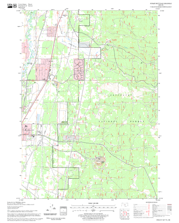
Fourmile Quadrangle, South Dakota
United States Department of Agriculture Forestry Service topographical map of Fourmile, Black Hills National Forest, South Dakota.
Page Size: 21.75 x 27 in (552 x 686 mm)
Fouts Springs Quadrangle, California
United States Department of Agriculture Forestry Service topographical map of Fouts Springs, Mendocino National Forest, California.
Page Size: 21.75 x 27 in (552 x 686 mm)
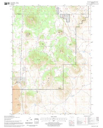
Fox Butte Quadrangle, Oregon
United States Department of Agriculture Forestry Service topographical map of Fox Butte, Deschutes National Forest, Oregon.
Page Size: 21.75 x 27 in (552 x 686 mm)
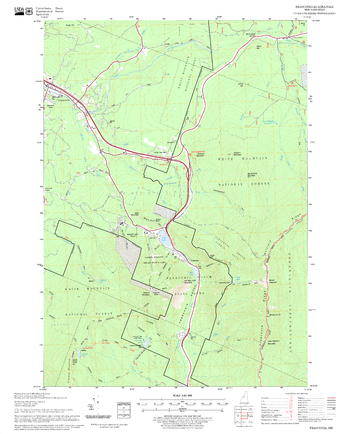
Franconia Quadrangle, New Hampshire-Vermont
United States Forestry Service topographical map of Franconia, New Hampshire-Vermont
Page Size: 21.75 x 27 in (552 x 686 mm)
Fredonyer Pass Quadrangle, California
United States Department of Agriculture Forestry Service topographical map of Fredonyer Pass, Lassen National Forest, California.
Page Size: 21.75 x 27 in (552 x 686 mm)