The Times Map of New Guinea and Solomon Islands - Compact
The Times
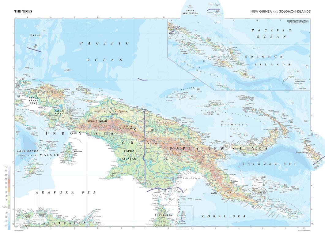
This map of New Guinea and the Solomon Islands is a benchmark of cartographic excellence, taken from the industry leading Times Comprehensive Atlas of the World. The second-largest island in the world, this map shows the two halves of the island: the Western region of Papua New Guinea and the Eastern region forming part of Indonesia. The capitals of both regions: Port Moresby and Jayapura, are easily identifiable, as are extra features including mountain ranges and additional islands. The Solomon Islands are also shown in detail, with the added sea level and water depth markers making it easy to understand the data being presented. Carefully curated to ensure coherence and attractiveness, each element of this map has been thoughtfully selected to provide a clear and engaging visual guide to New Guinea and the Solomon Islands.
Page Size: 22.25 x 16.25 in (561 x 410 mm)
Buy this map on MapTrove.ca