Stanfords
Stanford's Library Map of London Sheet 10 Colour (1862)
This map covering Victorian London during a period of rapid expansion and improvement is from a fascinating series of reproductions from our Edward Stanford Cartographic Collection archive. Stanford’s Library Map is one of the great maps of London. It shows the city at a key time of the development of the metropolis and the impact of the railway. Our founder, Edward Stanford took the Ordnance Survey 12 inch to a mile sheets of their Skeleton Survey (showing outline and elevation only) for the Metropolitan Commissioners of Sewers, and despatched his own surveyors to complete immense quantity of detail for which this map is notable. Originally at a scale of 1:10560 a 14x16”map in a series of 24 which included surrounding areas. This map is extremely detailed, naming streets and marking major buildings. It has been subtly coloured so that green areas, water and main roads and water are distinguished. The map coverage is of central London and extends out to Marylebone and Knightsbridge to the west showing some of Hyde Park. The northern point includes Bloomsbury and the British Museum. It extends down to Victoria Station and Lambeth Bridge and shows a small portion of Lambeth and Waterloo south of the river.
Page Size: 14.25 x 17.25 in (362 x 438 mm)
Stanford's Library Map of London Sheet 11 Black and White (1862)
The Stanford’s Library Map of London (Sheet 11) is from a fascinating series of reproductions from our Edward Stanford Cartographic Collection archive.
Page Size: 14.75 x 17.75 in (370 x 450 mm)
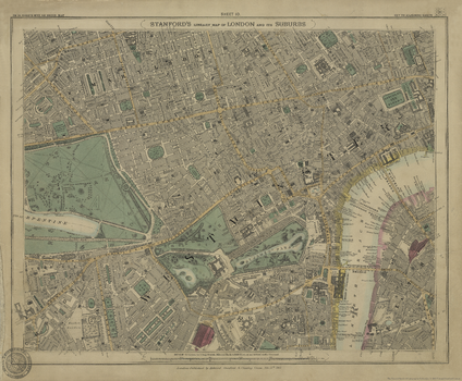
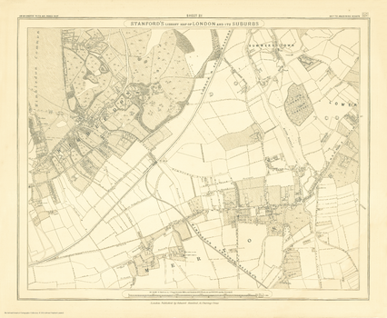
Stanford's Library Map of London Sheet 12 Black and White (1862)
The Stanford’s Library Map of London (Sheet 12) is from a fascinating series of reproductions from our Edward Stanford Cartographic Collection archive.
Page Size: 14.75 x 17.75 in (370 x 450 mm)
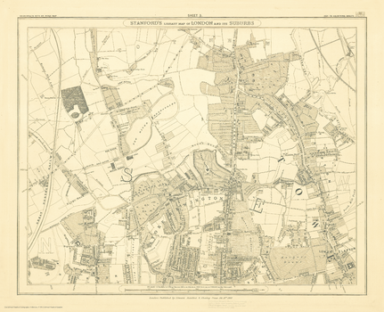
Stanford's Library Map of London Sheet 13 Black and White (1862)
The Stanford’s Library Map of London (Sheet 13) is from a fascinating series of reproductions from our Edward Stanford Cartographic Collection archive.
Page Size: 14.75 x 17.75 in (370 x 450 mm)
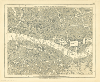
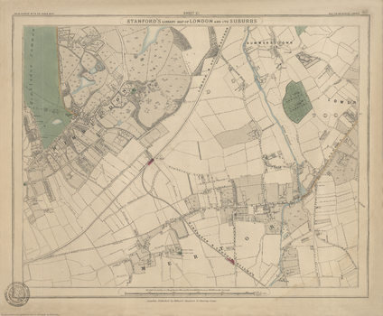
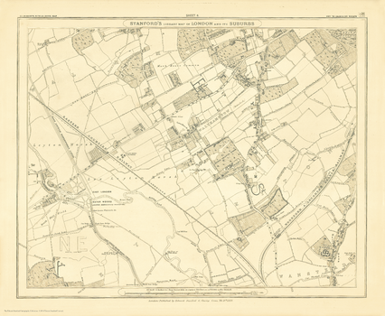
Stanford's Library Map of London Sheet 14 Black and White (1862)
The Stanford’s Library Map of London (Sheet 14) is from a fascinating series of reproductions from our Edward Stanford Cartographic Collection archive.
Page Size: 14.75 x 17.75 in (370 x 450 mm)
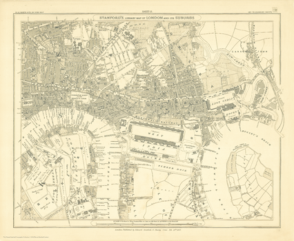
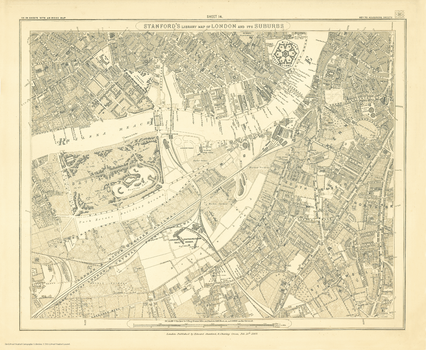
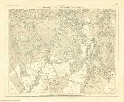
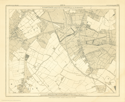
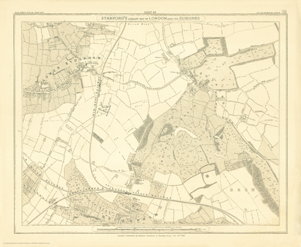
Stanford's Library Map of London Sheet 15 Black and White (1862)
The Stanford’s Library Map of London (Sheet 15) is from a fascinating series of reproductions from our Edward Stanford Cartographic Collection archive.
Page Size: 14.75 x 17.75 in (370 x 450 mm)
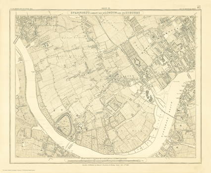
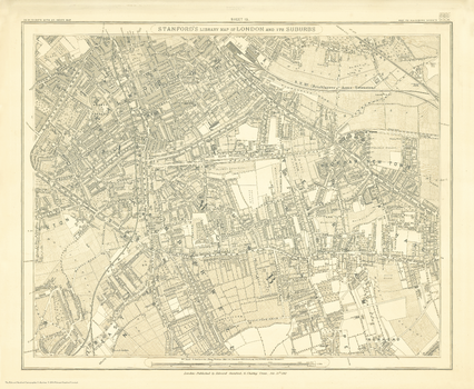
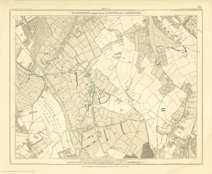
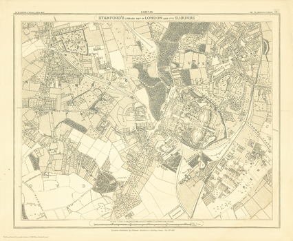
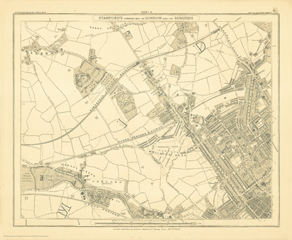
Stanford's Library Map of London Sheet 16 Black and White (1862)
The Stanford’s Library Map of London (Sheet 16) is from a fascinating series of reproductions from our Edward Stanford Cartographic Collection archive.
Page Size: 14.75 x 17.75 in (370 x 450 mm)
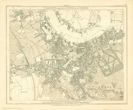
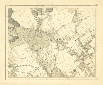
Stanford's Library Map of London Sheet 17 Black and White (1862)
The Stanford’s Library Map of London (Sheet 17) is from a fascinating series of reproductions from our Edward Stanford Cartographic Collection archive.
Page Size: 14.75 x 17.75 in (370 x 450 mm)
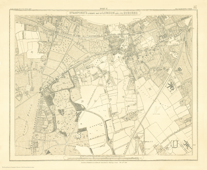
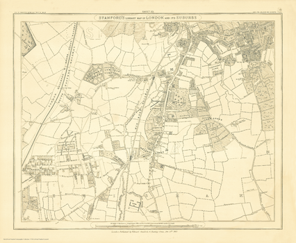
Stanford's Library Map of London Sheet 18 Black and White (1862)
The Stanford’s Library Map of London (Sheet 18) is from a fascinating series of reproductions from our Edward Stanford Cartographic Collection archive.
Page Size: 14.75 x 17.75 in (370 x 450 mm)
Stanford's Library Map of London Sheet 19 Black and White (1862)
The Stanford’s Library Map of London (Sheet 19) is from a fascinating series of reproductions from our Edward Stanford Cartographic Collection archive.
Page Size: 14.75 x 17.75 in (370 x 450 mm)
Stanford's Library Map of London Sheet 2 Black and White (1862)
The Stanford’s Library Map of London (Sheet 2) is from a fascinating series of reproductions from our Edward Stanford Cartographic Collection archive.
Page Size: 15 x 18 in (375 x 454 mm)
Stanford's Library Map of London Sheet 20 Black and White (1862)
The Stanford’s Library Map of London (Sheet 20) is from a fascinating series of reproductions from our Edward Stanford Cartographic Collection archive.
Page Size: 14.75 x 17.75 in (370 x 450 mm)
Stanford's Library Map of London Sheet 21 Black and White (1862)
The Stanford’s Library Map of London (Sheet 21) is from a fascinating series of reproductions from our Edward Stanford Cartographic Collection archive.
Page Size: 14.75 x 17.75 in (370 x 450 mm)
Stanford's Library Map of London Sheet 21 Colour (1862)
The Stanford’s Library Map of London (Sheet 21) is from a fascinating series of reproductions from our Edward Stanford Cartographic Collection archive.
Page Size: 15 x 18 in (375 x 455 mm)
Stanford's Library Map of London Sheet 22 Black and White (1862)
The Stanford’s Library Map of London (Sheet 22) is from a fascinating series of reproductions from our Edward Stanford Cartographic Collection archive.
Page Size: 14.75 x 17.75 in (370 x 450 mm)
Stanford's Library Map of London Sheet 23 Black and White (1862)
The Stanford’s Library Map of London (Sheet 23) is from a fascinating series of reproductions from our Edward Stanford Cartographic Collection archive.
Page Size: 14.75 x 17.75 in (370 x 450 mm)
Stanford's Library Map of London Sheet 24 Black and White (1862)
The Stanford’s Library Map of London (Sheet 24) is from a fascinating series of reproductions from our Edward Stanford Cartographic Collection archive.
Page Size: 14.75 x 17.75 in (370 x 450 mm)
Stanford's Library Map of London Sheet 3 Black and White (1862)
The Stanford’s Library Map of London (Sheet 3) is from a fascinating series of reproductions from our Edward Stanford Cartographic Collection archive.
Page Size: 14.75 x 18 in (370 x 455 mm)
Stanford's Library Map of London Sheet 4 Black and White (1862)
The Stanford’s Library Map of London (Sheet 4) is from a fascinating series of reproductions from our Edward Stanford Cartographic Collection archive.
Page Size: 14.75 x 17.75 in (370 x 450 mm)
Stanford's Library Map of London Sheet 5 Black and White (1862)
The Stanford’s Library Map of London (Sheet 5) is from a fascinating series of reproductions from our Edward Stanford Cartographic Collection archive.
Page Size: 14.75 x 17.75 in (370 x 450 mm)