Stanford's New Map of Kabul (1880)
Stanfords
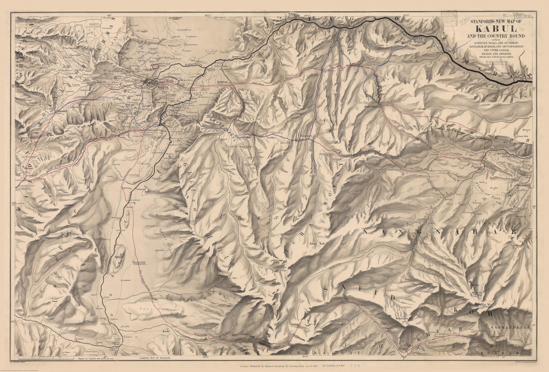
The Stanford’s New Map of Kabul is from a fascinating series of reproductions from our Edward Stanford Cartographic Collection archive. This map was published by Stanfords in January 1880 and says ‘Stanford’s New Map of Kabul and the country round as far as Kohistan, Tagao, and Lughman: Gandamak, Kurram, and Shutargardan; The Upper Logar; Maidan and Argandi; with the sites of all the recent conflicts.’ The whole map is tonal except for a few red and blue lines. One of which indicates the route of Lieutenant Vincent Eyre and the other captives. Another shows General Roberts’ advance. This is a beautiful historic map with lots of regions fascinatingly still marked as ‘unexplored’.
Page Size: 27 x 40 in (685 x 1010 mm)
Buy this map on MapTrove.ca