top of page


Ukraine
Sparrow Maps
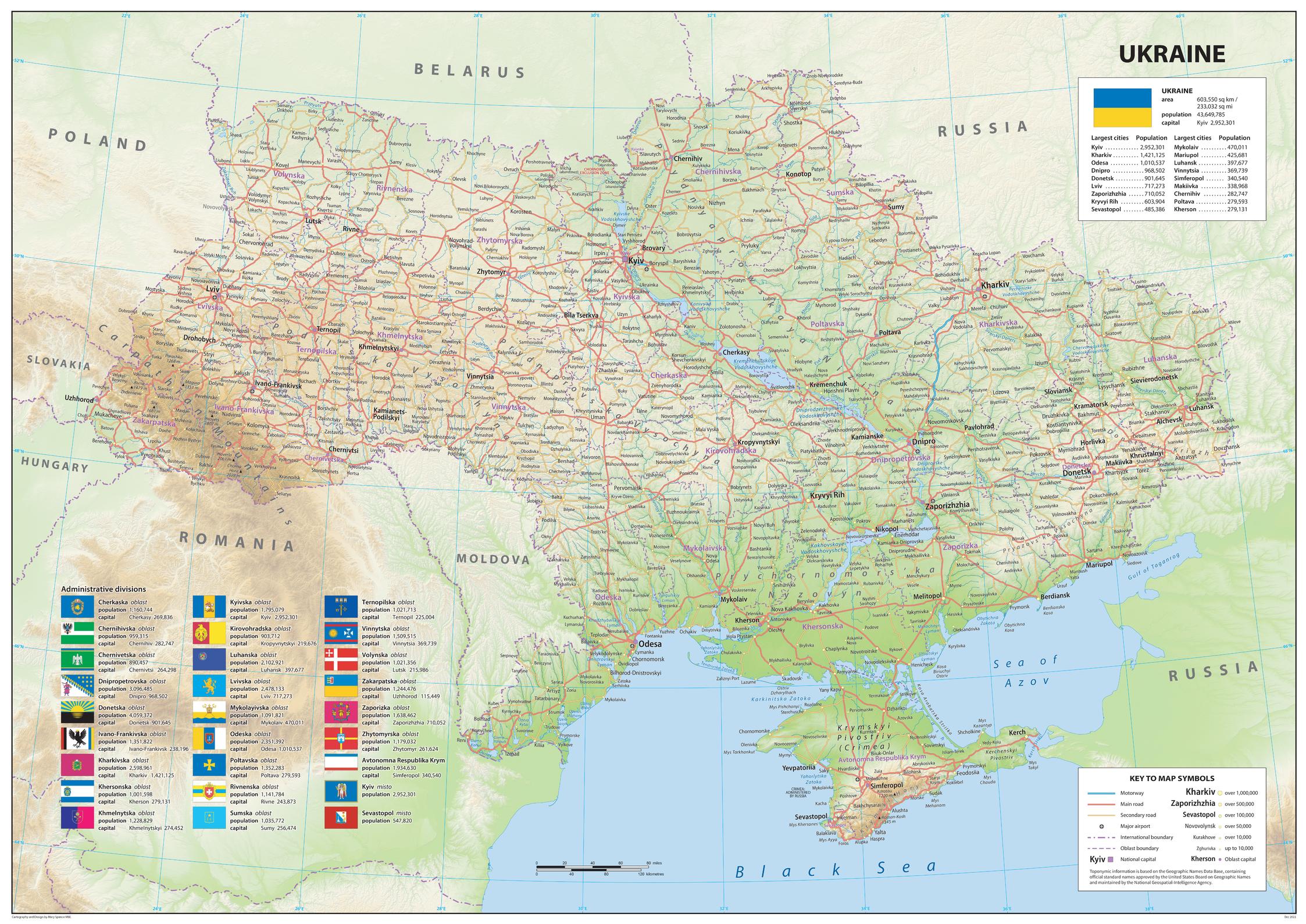
A detailed physical map showing relief features on land with administrative districts, capital cities,
roads and airports. An information panel gives details of the administrative divisions with flags and population statistics. The Chernobyl Exclusion Zone is marked with its abandoned settlements. The national flag is shown with the country's area and population with population figures for largest cities. The map represents the situation on the ground before the Russian invasion in 2022. A great map to give a comprehensive view of the region at that time.
Page Size: 47 x 33.25 in (1189 x 841 mm)
Buy this map on MapTrove.ca
bottom of page