top of page


Making the United States – from colonization to independent country
Sparrow Maps
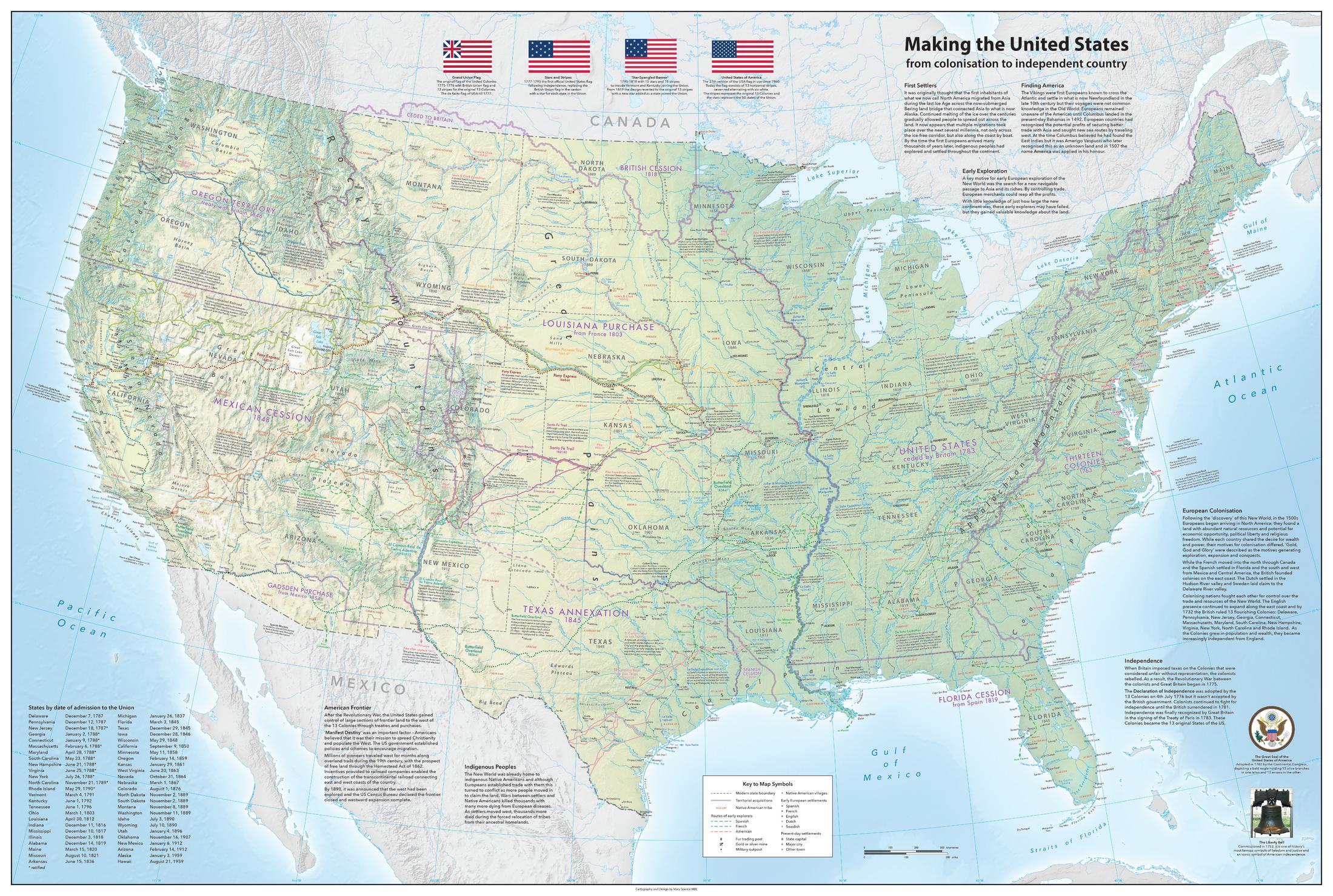
A map illustrating the exploration and growth of the United States.
Based on a physical map of the Contiguous USA with present-day state boundaries and settlements, the map shows territorial acquisitions and the dates each state joined the Union, routes of early explorers and early European settlements, trails of westward expansion and native American tribes and villages, annotated with notes. Historical texts around the map, table of states by date of admission to the Union and illustrations of significant flags, Great Seal of USA and The Liberty Bell. An amazing compilation of the growing discovery and knowledge of the country's geography.
Page Size: 46 x 31 in (1163 x 782 mm)
Buy this map on MapTrove.ca
bottom of page