top of page


Israel
Sparrow Maps
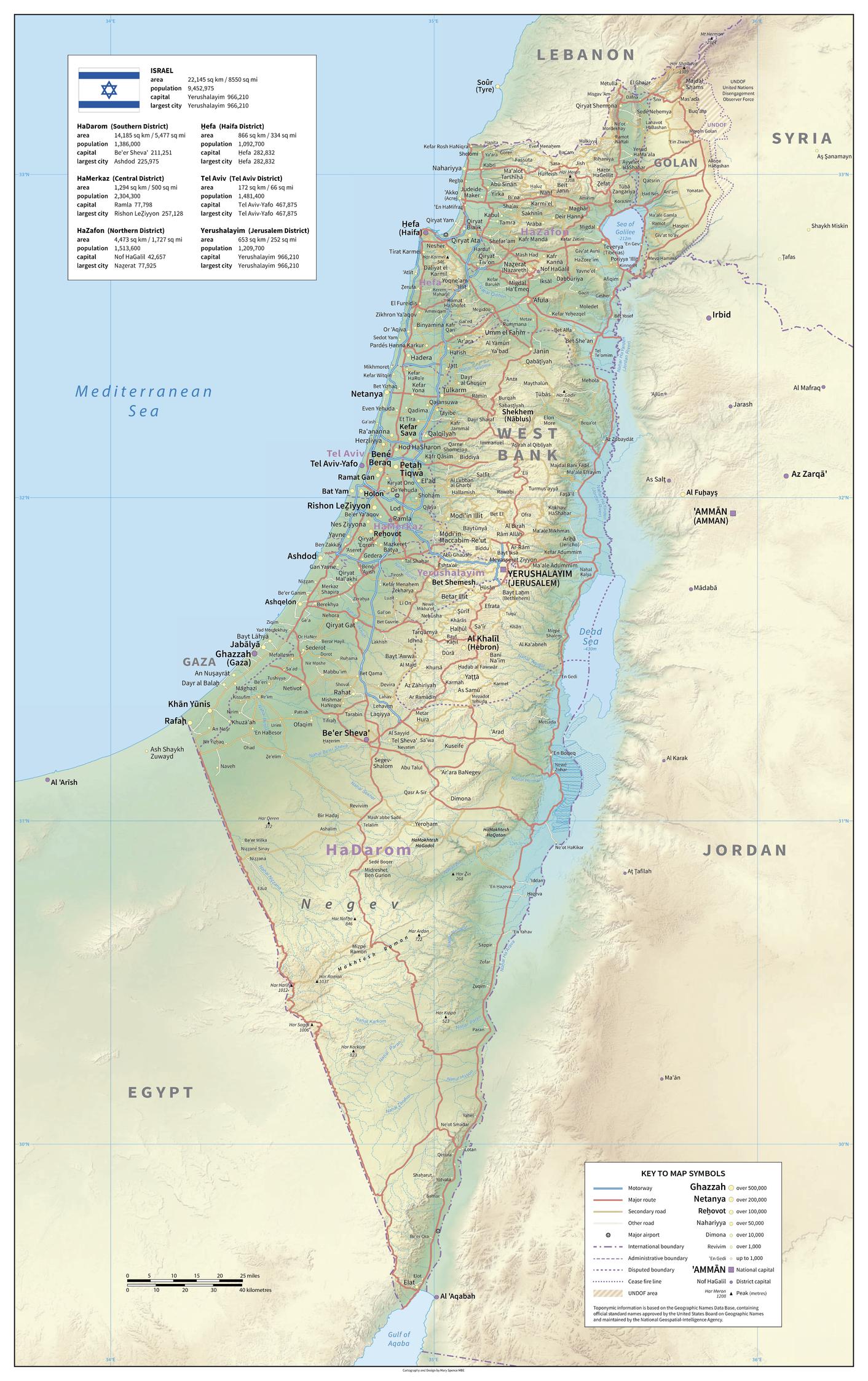
A detailed physical map of Israel showing land relief, administrative divisions, roads, cities and
airports. The map shows the de facto depiction of Gaza, West Bank and the UNDOF region in
the north. Names are in the local form with conventional equivalents for major features. A table of area and population data for the districts is included with the national flag. A useful base map to help locate the areas of conflict in the country.
Page Size: 29.5 x 47 in (747 x 1189 mm)
Buy this map on MapTrove.ca
bottom of page