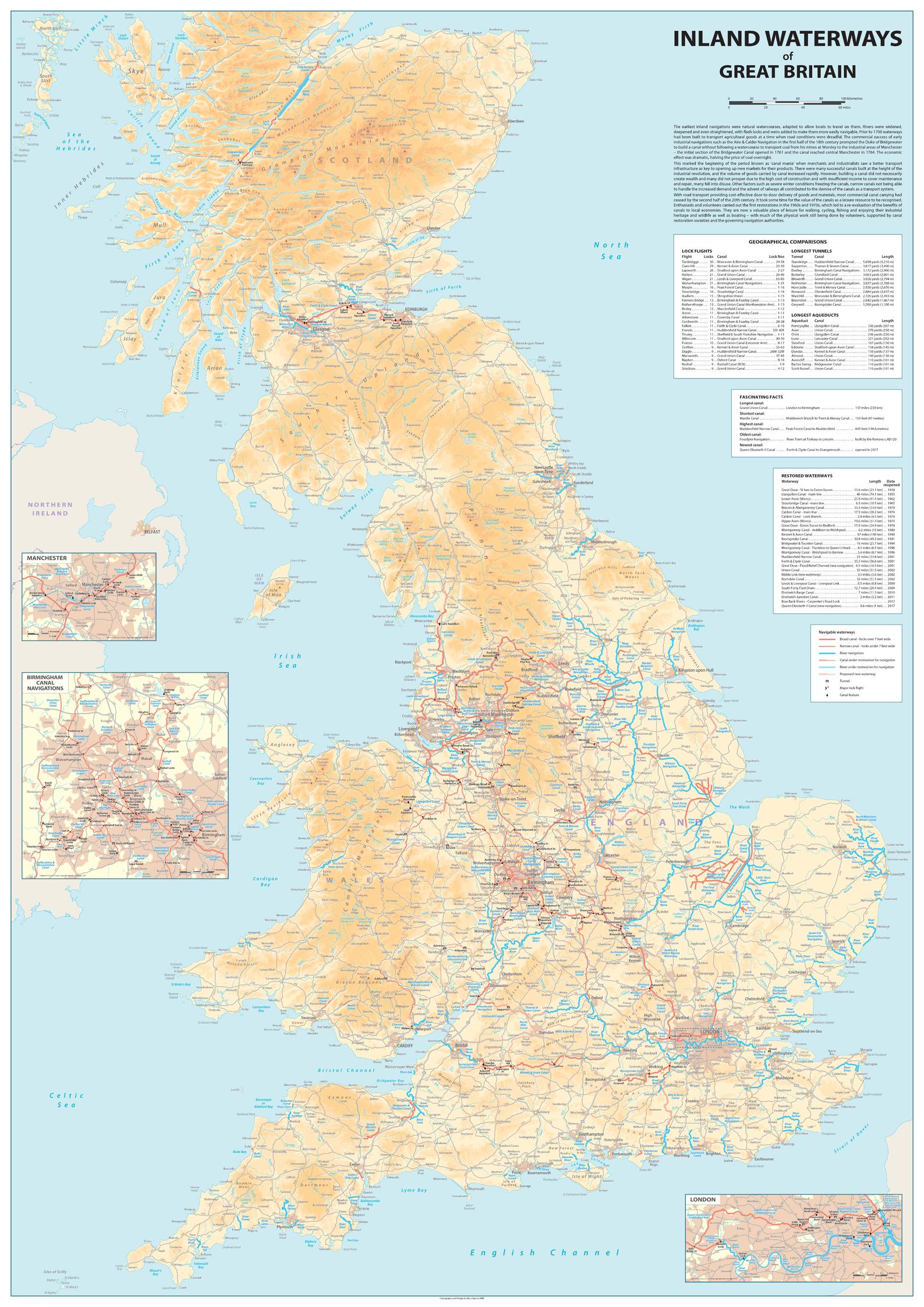
Inland Waterways of Great Britain
Sparrow Maps
A detailed map of the inland waterways on a muted physical base with roads and settlements. River navigations and broad and narrow canals are highlighted together with waterways under restoration. Major tunnels, lock flights and other canal features are marked. Insets of London, Manchester and Birmingham in greater detail. A text explains the growth and significance of the canal system from its original industrial use to the present day tourist resource. A table of geographical comparisons of lock flights, longest tunnels and longest aqueducts. Fascinating facts about longest and shortest, the highest and oldest and newest canals. A list of restored waterways gives the dates they reopened. An invaluable introduction to the waterways system and an ideal route planner.
Page Size: 33.25 x 47 in (840 x 1188 mm)
Buy this map on MapTrove.ca