Oxford Cartographers
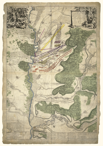
Blenheim Battle map 1704
Map of the Battle of Blenheim, 13 August 1704
Page Size: 16.75 x 23.5 in (420 x 594 mm)
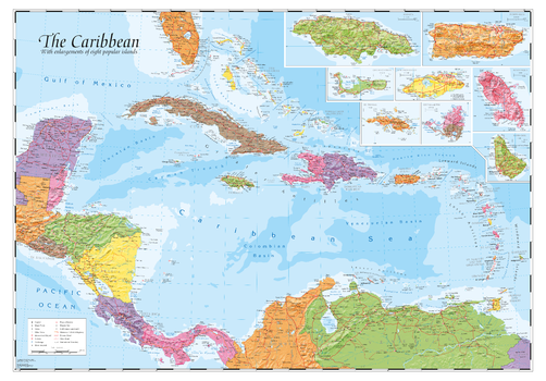
Caribbean and main islands
The Caribbean with hill-shading and inset maps of 8 popular islands
Page Size: 39.5 x 27.25 in (1000 x 690 mm)
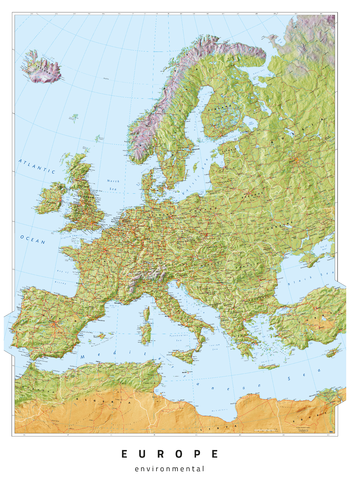
Europe Environmental
Europe map, with environmental colours (vegetation/desert/ice)
Page Size: 23.5 x 33.25 in (594 x 841 mm)
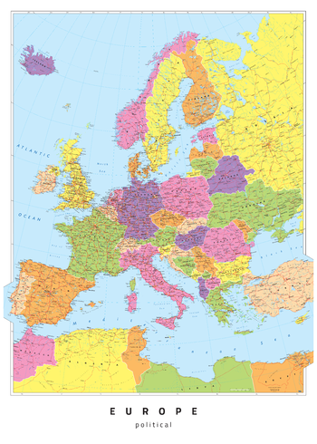
Europe Political
Europe map, politically coloured
Page Size: 23.5 x 33.25 in (594 x 841 mm)
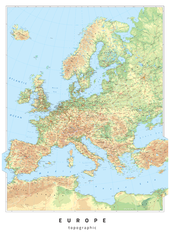
Europe Topographic
Europe map, with coloured land height layers
Page Size: 23.5 x 33.25 in (594 x 841 mm)
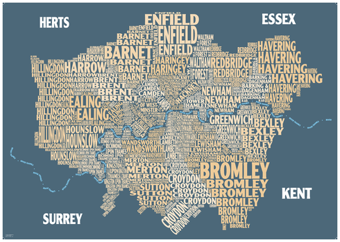
Graphic Map London - boroughs, beige background
Colourful design-led map using text to show London Boroughs
Page Size: 33.25 x 23.5 in (841 x 594 mm)
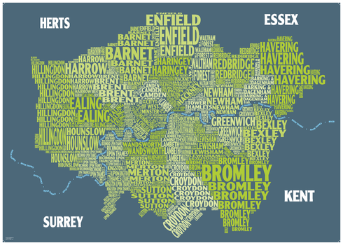
Graphic Map London - boroughs, green background
Colourful design-led map using text to show London Boroughs
Page Size: 33.25 x 23.5 in (841 x 594 mm)
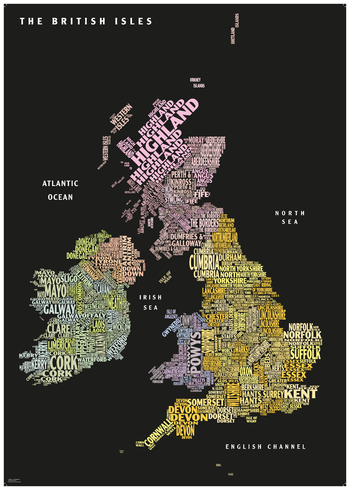
Graphic Map UK - counties, black background
Colourful design-led map using text to show countries and counties
Page Size: 23.5 x 33.25 in (594 x 841 mm)
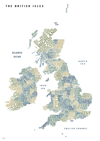
Graphic Map UK - counties, white background
Colourful design-led map using text to show countries and counties
Page Size: 23.5 x 33.25 in (594 x 841 mm)
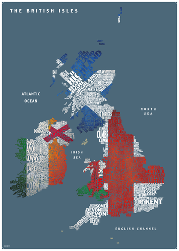
Graphic Map UK - flags
Colourful design-led map using text to show countries and counties
Page Size: 23.5 x 33.25 in (594 x 841 mm)
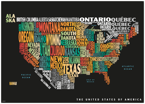
Graphic Map USA - colours, black background
Colourful design-led map using text to show the states of the USA
Page Size: 33.25 x 23.5 in (841 x 594 mm)
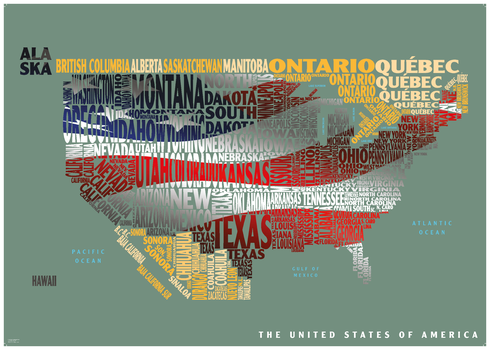
Graphic Map USA - flag
Colourful design-led map using text to show the states of the USA
Page Size: 33.25 x 23.5 in (841 x 594 mm)
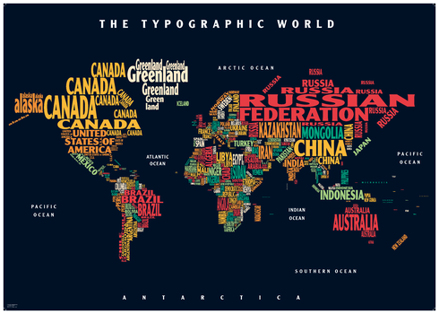
Graphic Map World - colours, black background
Colourful map using text to show the countries of the World
Page Size: 33.25 x 23.5 in (841 x 594 mm)
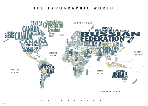
Graphic Map World - colours, white background
Colourful map using text to show the countries of the World
Page Size: 33.25 x 23.5 in (841 x 594 mm)
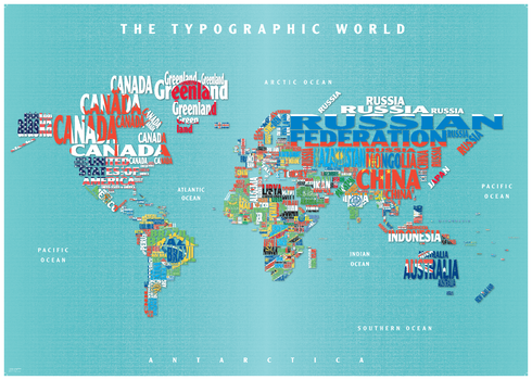
Graphic Map World - flags
Colourful map using text to show the countries of the World
Page Size: 34.25 x 24.5 in (864 x 617 mm)
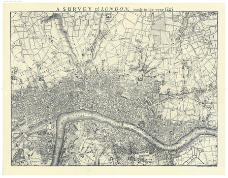
London 1745
Map of London (black & white) showing the extent of the city in 1745
ISBN 9780946405190
Page Size: 27.75 x 21.5 in (700 x 540 mm)
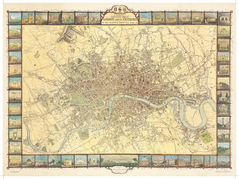
London Tallis 1851
Map of London in colour showing the extent of the city in 1851
ISBN 9780946405206
Page Size: 30 x 22.25 in (760 x 565 mm)
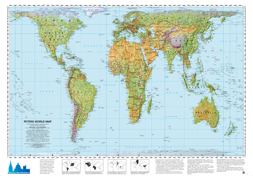
Peters Projection World Environmental
World map, with environmental colours (vegetation/desert/ice), on the Peters Projection
Page Size: 34 x 24.25 in (863 x 613 mm)
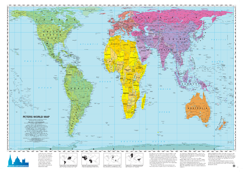
Peters Projection World political
World map, politically coloured, on the Peters Projection
Page Size: 34 x 24.25 in (863 x 613 mm)
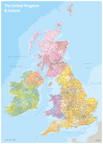
UK & Ireland Political
UK & Ireland map with coloured counties
Page Size: 23.5 x 33.25 in (594 x 841 mm)