top of page
Relief Map of Canada Wall Map - Atlas of Canada
Natural Resources Canada
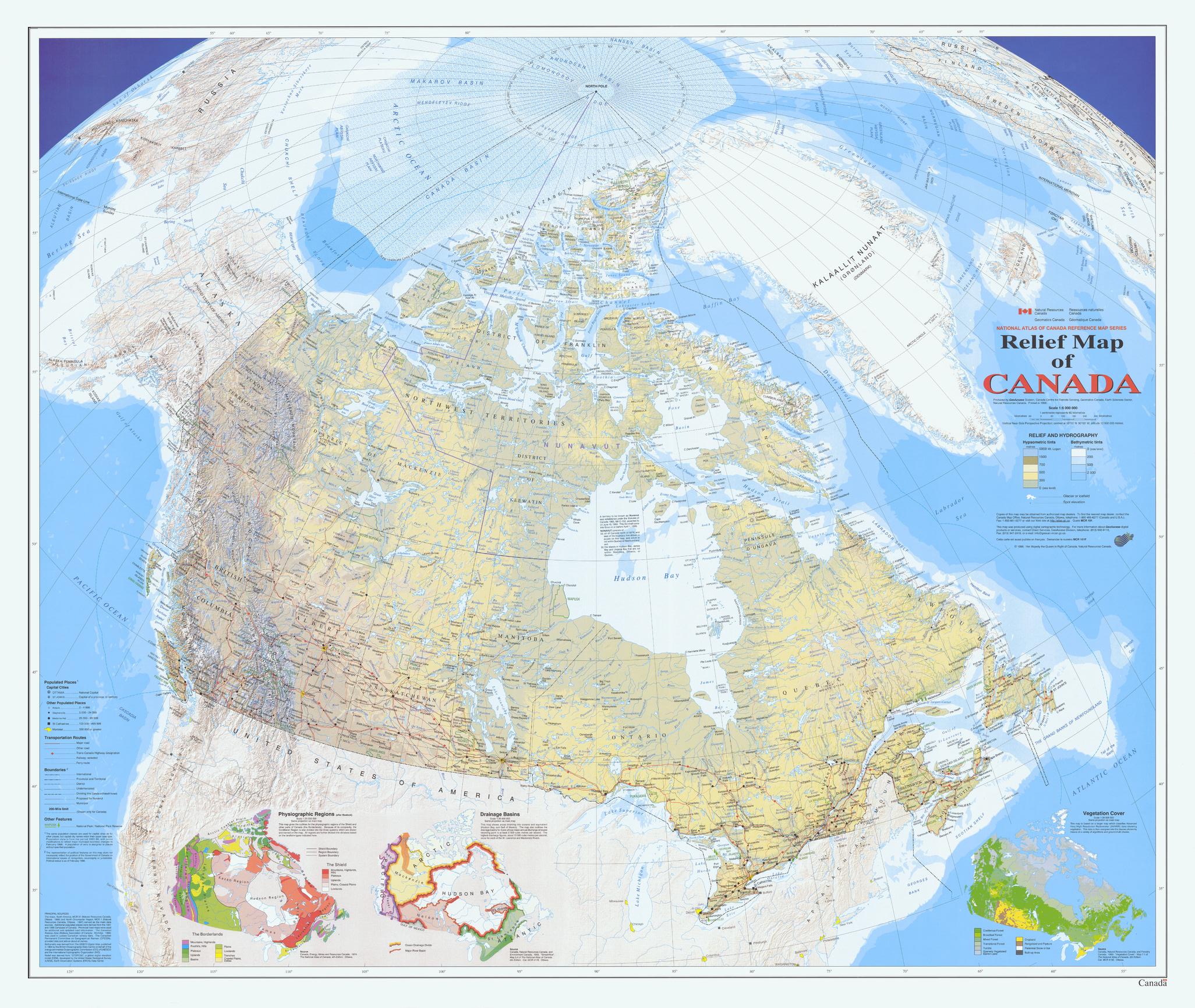
This map uses the Vertical Near-Side Perspective Projection. The map's main feature is showing Canada with very-detailed digital shaded relief. All official Canadian, provincial, and surrounding international boundaries are shown, including the proposed boundary for the new territory of Nunavut (which came into existence in 1999). There are three small maps of Canada shown on this map sheet, all at scale 1:35 000 000. One shows the major physiographic regions; the second shows major drainage basins, and the third map shows classes of vegetation cover. All data on the map is current to the mid to late 1990's.
Page Size: 42.75 x 36.25 in (1086 x 917 mm)
Buy this map on MapTrove.ca or MapTrove.com
bottom of page