Limits of forest trees (1906)
Natural Resources Canada
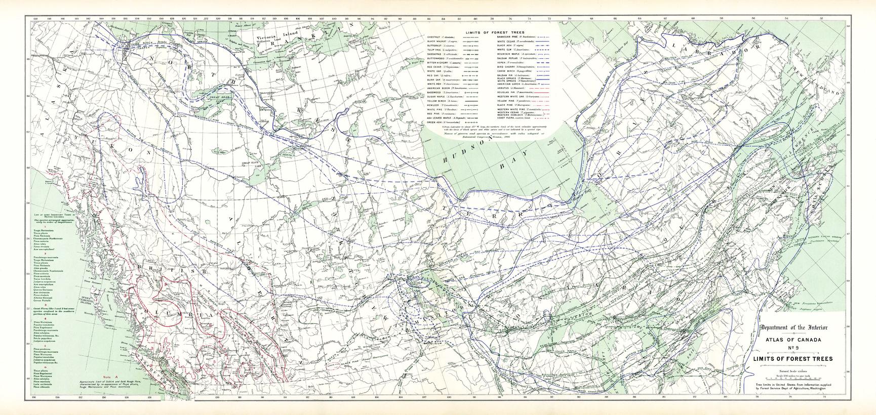
Contained within the 1st Edition (1906) of the Atlas of Canada is a map that shows the northern limits of approximately 40 different tree species in Canada, including an extension into the Northern U.S. Using green lines the map displays the northern limits of the principal trees found within the Southern Forest. Blue lines indicate the northern, and in a few incidences the southern, limits of the principal trees found within the Northern Forest. Red lines show the limits of the trees within the Cordilleran Forest. For this map, and the Atlas of Canada Forests map, the line of division between the Northern and Southern Forests has been taken as the northern limit of red and white pine. These trees are assigned to the Northern Forest, including those whose limit is south of the pine tree limits within the Southern Forest. The map also includes, rivers, major bodies of water, and a few tree types labeled in specific locations.
Page Size: 36.25 x 17.25 in (915 x 434 mm)
Buy this map on MapTrove.ca or MapTrove.com