top of page
2010 Olympic sites / Sites olympiques 2010
Natural Resources Canada
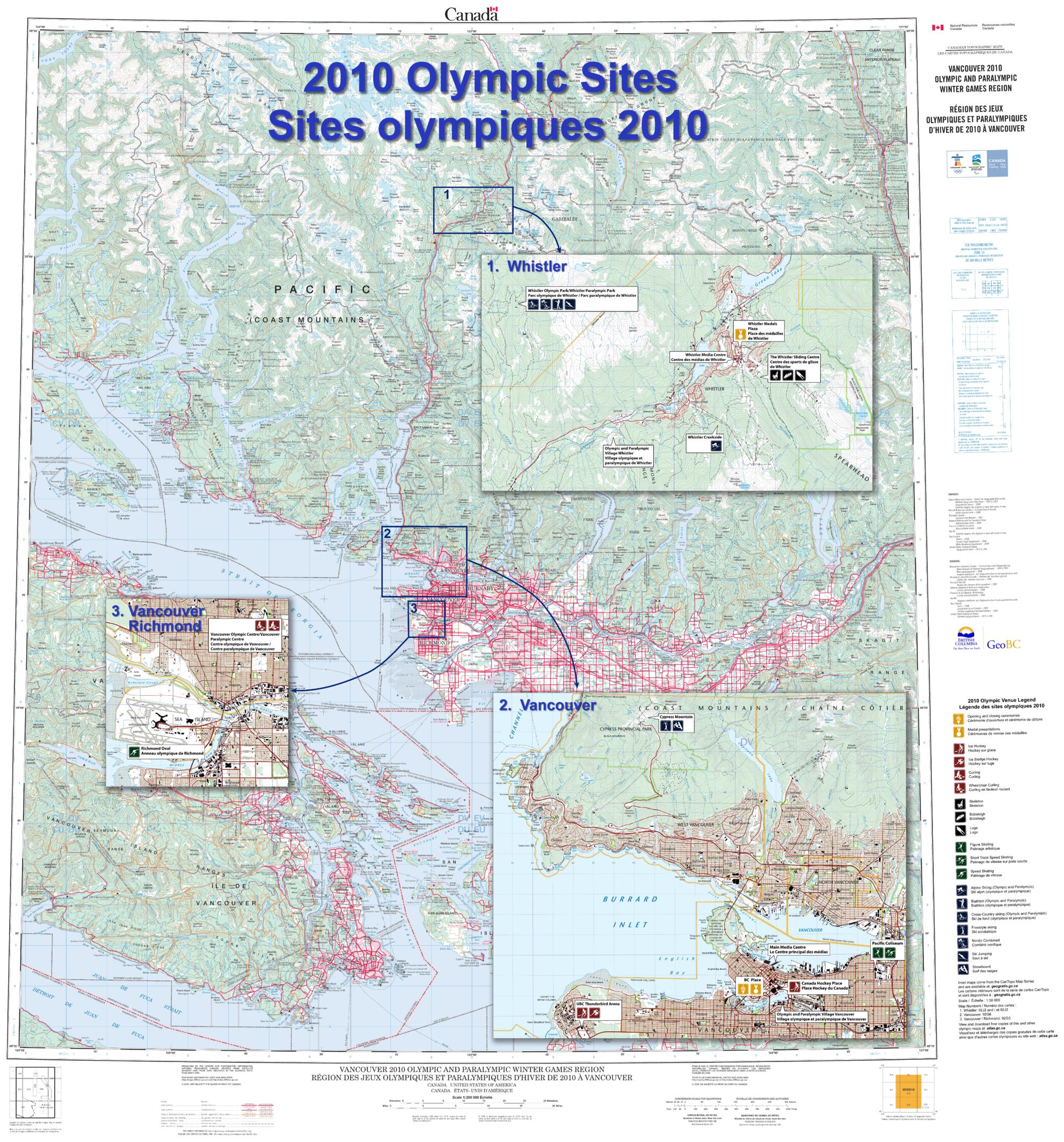
Contained within the Atlas of Canada Poster Map Series, is a large-format Olympics Sites wall map (42 inches by 45 inches) featuring a 1:250 000 scale topographic base map extending from the southern tip of Vancouver Island north to Pemberton and east to Abbotsford, British Columbia. It contains inset maps, at 1:50 000 scale of Vancouver and Whistler, from the new CanTopo map series to show these areas in greater detail. Additional thematic information has been added to these insets to highlight the location of the Olympics and Paralympics sites (for example ski runs, athletes' village, hockey arena).
Page Size: 41.5 x 44.5 in (1049 x 1125 mm)
Buy this map on MapTrove.ca or MapTrove.com
bottom of page