


National Geographic

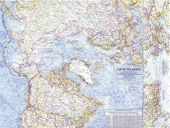
Top of the World - Published 1965
In the mid 1960s, the USSR and US were in the midst of a cold war, in which each nation was acutely aware of its proximity to the other. This map offers a truly unique view that features the Arctic Polar Region at its center, as well as the "Early Warning Lines" for the United States in case of imminent nuclear attack from the USSR. Published in November of 1965.
Page Size: 25 x 19 in (631 x 478 mm)
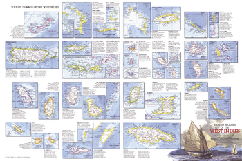
Tourist Islands of the West Indies - Published 1981
Featuring maps and information on over thirty islands in the Caribbean, the Tourist Islands of the West Indies map is half of a two-map set highlighting the unique tourist destinations to be found in the region. Published in National Geographic Magazine in February 1981, it accompanied the West Indies and Central America map.
Page Size: 33.75 x 22.5 in (855 x 571 mm)
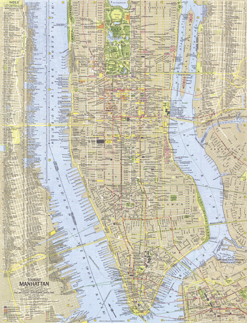
Tourist Manhattan - Published 1964
Published two years before construction began on the World Trade Center, this map provides a detailed look at Manhattan, the commercial, financial, and cultural center of New York City. Includes a complete index, making it easy to find the many points of interest that the island borough has to offer. Published in July 1964 as part of a two–map set with "Greater New York."
Page Size: 15.25 x 20 in (385 x 504 mm)
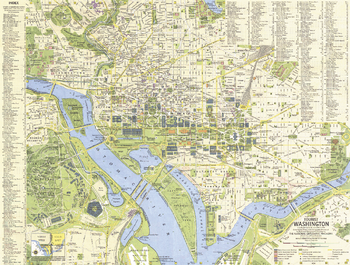
Tourist Washington - Published 1964
Explore the national capital of the United States. Published in December 1964, this map and its companion "Suburban Washington" make up the two-piece set that accompanied the article "Washington: The City Freedom Built."
Page Size: 20 x 15.25 in (507 x 383 mm)
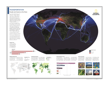
Transportation: People and Goods on the Move - Atlas of the World, 10th Edition
Global Transportation Systems; Comparing Travel; Shipping the World's Goods; Measuring Road Networks; Charting International Tourism; Recession and Growth
Page Size: 28 x 22 in (711 x 559 mm)
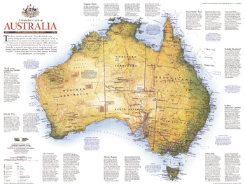
Travelers Look At Australia - Published 1988
National Geographic celebrated Australia's bicentennial with an entire issue devoted to the continent. This informative map details the country's history, climate, and tourist activities. Published in February 1988 as a companion to the map "Australia's Continental Odyssey."
Page Size: 27 x 20.5 in (685 x 516 mm)
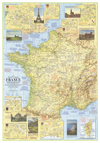
Travelers Map of France - Published 1971
This travel map of France features an abundance of historical notes and inset maps of major cities. Published in June 1971 to accompany the article "The Louvre, France's Palace of the Arts."
Page Size: 23 x 32.75 in (580 x 828 mm)
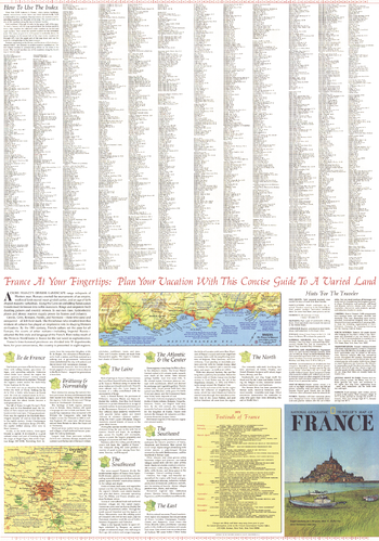
Travelers Map of France Theme - Published 1971
Published in June 1971, A Traveler's Map of France contains a wealth of information about each region as well as helpful hints about clothing, dining, currency, sightseeing, transportation, camping, and more. Half of a two-map set, this map also includes a list of the various festivals and events held in France each year.
Page Size: 23 x 32.75 in (580 x 828 mm)
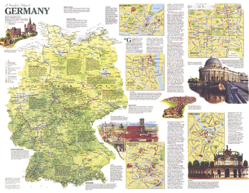
Travelers Map of Germany - Published 1991
This map of Germany contains a wealth of historical facts, insets of major cities, and special information on traveling the country's scenic roadways. Published in September 1991 as half of a two–map set with the map "Germany", and as a companion to the article "The Morning After: Germany Reunited".
Page Size: 26.25 x 20.25 in (661 x 511 mm)
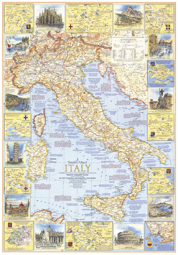
Travelers Map of Italy - Published 1970
This travel map of Italy features an abundance of historical information, tourist sites, and inset maps of eleven cities. Attractive illustrations of various places of interest border the main map. Published in June 1970.
Page Size: 23 x 32.75 in (579 x 829 mm)
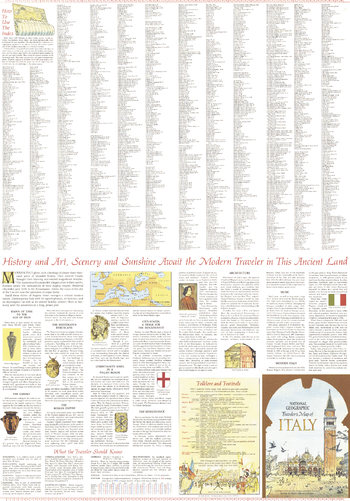
Travelers Map of Italy Theme - Published 1970
Published in June 1970, A Traveler's Map of Italy contains a wealth of information about the history of the country as well as helpful hints about clothing, currency, shopping, transportation, and more. Half of a two-map set, this map also includes a list of the seasonal festivals and events held in Italy each year.
Page Size: 23 x 32.75 in (579 x 829 mm)
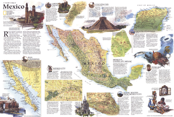
Travelers Map of Mexico - Published 1994
The centerpiece of this informative traveler's map is a striking physical map of Mexico. Published in September 1994, this map accompanied a full-page physical and political map of Mexico and the article "The Sonoran Desert: Anything But Empty."
Page Size: 30 x 20.25 in (762 x 513 mm)
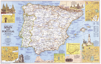
Travelers Map of Spain and Portugal - Published 1984
This map of Spain and Portugal features an abundance of historical notes and sites of interest including the tomb and pilgrimage route of St. James. Includes inset maps of Barcelona, Lisbon, and Madrid. Published in October 1984.
Page Size: 36 x 22.75 in (912 x 576 mm)
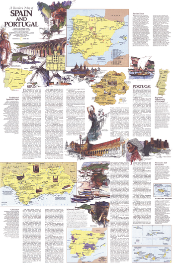
Travelers Map of Spain and Portugal Theme - Published 1984
Published in October 1984, this half of the two-map set entitled A Traveler's Map of Spain and Portugal contains a wealth of information on the history and culture of the region. This map contains tour routes, a map of the Iberian wine country, information about the handicrafts of Spain and Portugal, and more.
Page Size: 22.75 x 35 in (575 x 887 mm)
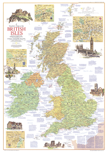
Travelers Map of the British Isles - Published 1974
This map of the British Isles contains an abundance of information on a variety of tourist sites and activities. Published in April 1974 to accompany the article "The England of Charles Dickens."
Page Size: 23 x 32.75 in (578 x 829 mm)
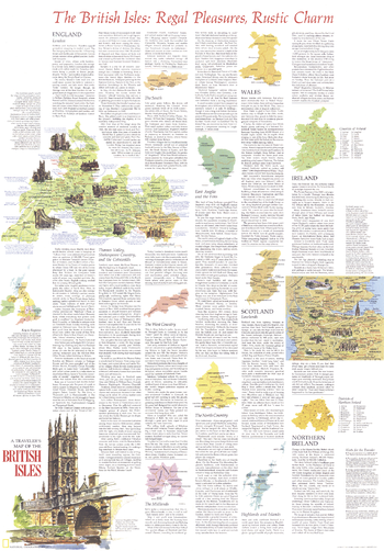
Travelers Map of the British Isles Theme - Published 1974
Half of a two-map set, this map of the British Isles provides a large quantity of information about the various regions in England, Wales, Scotland, Ireland, and Northern Ireland, and the wonderful tourist activities and historical sites in each. Published in April 1974 with the article "The England of Charles Dickens," this map is a must-have for those traveling to the United Kingdom or Ireland.
Page Size: 23 x 32.75 in (578 x 829 mm)
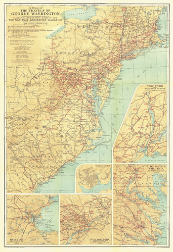
Travels of George Washington - Published 1932
The map of the Travels of George Washington was published in January 1932 in cooperation with the United States Commission for the Celebration of the Two Hundredth Anniversary of the Birth of George Washington. Inset maps of major colonial cities including Boston, New York, and Philadelphia as well as Washington's Mount Vernon home and the Tidewater Virginia area add great detail to this unique historic map.
Page Size: 20 x 29 in (505 x 735 mm)
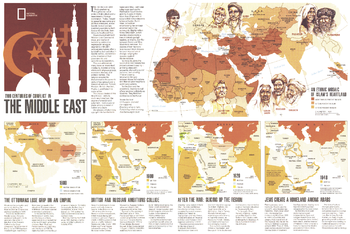
Two Centuries of Conflict in the Middle East - Published 1980
This informative map supplements the "Mideast in Turmoil" map and the article "Saudi Arabia: The Kingdom and Its Power" which were all published in the September 1980 issue of National Geographic. Four maps highlight the historical conflicts of the region while the largest section of this piece is devoted to showing the percentage of muslims amongst the various ethnicities of the region.
Page Size: 20.75 x 14 in (525 x 350 mm)
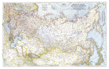
Union of Soviet Socialist Republics 1938-1944 - Published 1944
This World War II era map of the Union of Soviet Socialist Republics was published in December 1944, at the beginning of the Battle of the Bulge. International boundaries according to Russian treaties and claims as of October 1, 1944 are shown on this map, and boundaries as of January 1, 1938, before Germany invaded Poland, are noted in red.
Page Size: 40.5 x 25.75 in (1027 x 654 mm)
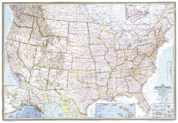
United States - Published 1968
This stunning United States map is a historical gem, capturing a snapshot of the country as the Interstate system expanded at a torrid pace. It features beautiful cartography, combining many layers of information into an integrated whole that is as artistic as it is informative. Published in February 1968 as an update to the July 1961 US map.
Page Size: 42.5 x 29.5 in (1078 x 748 mm)