


National Geographic

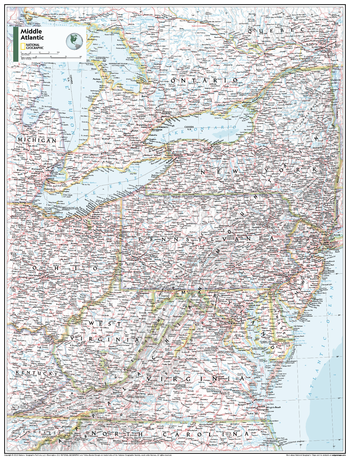
Middle Atlantic U.S. - Atlas of the World, 11th Edition - Compact
This Mid-Atlantic USA map of physical and political features can fit in any space. Showcasing the region in stunning detail with state-of-the-art cartographic techniques delivering accuracy and exceptional quality, the innovative and engaging design makes the content easily accessible and user-friendly.
Ideal for classrooms with an emphasis on teaching geography or environmental themes. The inclusion of physical features gives your students a genuine feel for how our world appears.
This map uses a bright, easy to read color palette featuring blue oceans and stunning shaded relief that has been featured on National Geographic wall maps for over 75 years. It is drawn in the Albers Conic Equal-Area projection, which uses two standard parallels between which distortion is minimized, however scale and shape are not preserved.
This map is found in National Geographic's 11th Edition World Atlas and is now available as a stand alone product.
Page Size: 16.25 x 21.5 in (413 x 540 mm)
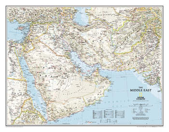
Middle East
This wall map covers a broad geographic area ranging from northern Africa through the Middle East to the western edge of China and India. Includes complete coverage of Afghanistan, Pakistan, Tajikistan, Iran, Iraq, Kuwait, Syria, Israel, Jordan, Lebanon, Saudi Arabia, Qatar, Bahrain, United Arab Emirates, Yemen, Oman, Cyprus, and Eritrea. Also includes parts of India, China, Kyrgyzstan, Uzbekistan, Turkmenistan, Azerbaijan, Armenia, Turkey, Egypt, Sudan, Ethiopia, and Djibouti.<br><br>Features thousands of place names, accurate political boundaries, archeological sites, and major infrastructure networks such as roads, canals, ferry routes, airports, and railroads. The region's diverse terrain is detailed through accurate shaded relief, coastal bathymetry, and symbolism for water features and other land forms. Elevations of major peaks and depth soundings are expressed in meters.
Page Size: 30.5 x 23.75 in (770 x 600 mm)
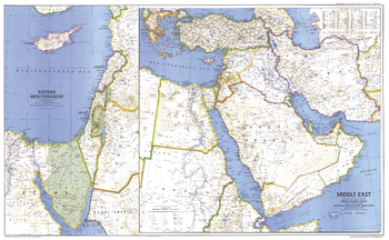
Middle East - Published 1978
When this map of the Middle East was created, Israel had occupied the West Bank, Sinai Peninsula, and Golan Heights for over a decade. Six months later, after signing the Israel-Egypt Peace Treaty, Israel withdrew from the Sinai Peninsula and evacuated the settlements it had established there during the 1970s. Published in September 1978 as a companion to the historical map "Early Civilizations in the Middle East."
Page Size: 37 x 23 in (937 x 578 mm)
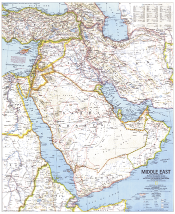
Middle East - Published 1991
This detailed map of the Middle East shows a variety of geographical features, including ruins, oil field, and extensive transportation networks. Published in February 1991, during the Gulf War, as a companion to the map "The Middle East: States in Turmoil."
Page Size: 20.25 x 24.75 in (512 x 627 mm)
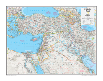
Middle East - Atlas of the World, 10th Edition
Syria, Turkey
Page Size: 28 x 22 in (711 x 559 mm)
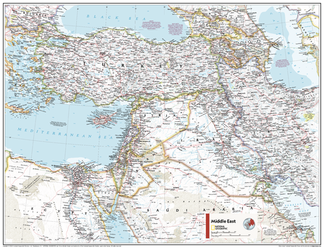
Middle East - Atlas of the World, 11th Edition
This Middle East map of physical and political features can fit in any space. Showcasing the region in stunning detail with state-of-the-art cartographic techniques delivering accuracy and exceptional quality, the innovative and engaging design makes the content easily accessible and user-friendly.
Ideal for classrooms with an emphasis on teaching geography or environmental themes. The inclusion of physical features gives your students a genuine feel for how our world appears.
This map uses a bright, easy to read color palette featuring blue oceans and stunning shaded relief that has been featured on National Geographic wall maps for over 75 years. It is drawn in Conic projection, in which an area of the earth is projected onto a cone whose vertex is usually above one of the poles, then unrolled onto a flat surface.
This map is found in National Geographic's 11th Edition World Atlas and is now available as a stand alone product.
Page Size: 31.5 x 24 in (798 x 610 mm)
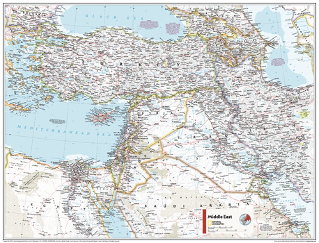
Middle East - Atlas of the World, 11th Edition - Compact
This Middle East map of physical and political features can fit in any space. Showcasing the region in stunning detail with state-of-the-art cartographic techniques delivering accuracy and exceptional quality, the innovative and engaging design makes the content easily accessible and user-friendly.
Ideal for classrooms with an emphasis on teaching geography or environmental themes. The inclusion of physical features gives your students a genuine feel for how our world appears.
This map uses a bright, easy to read color palette featuring blue oceans and stunning shaded relief that has been featured on National Geographic wall maps for over 75 years. It is drawn in Conic projection, in which an area of the earth is projected onto a cone whose vertex is usually above one of the poles, then unrolled onto a flat surface.
This map is found in National Geographic's 11th Edition World Atlas and is now available as a stand alone product.
Page Size: 21.5 x 16.25 in (540 x 413 mm)
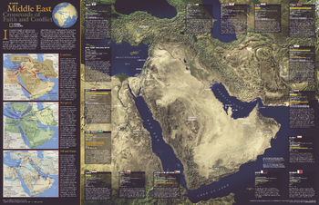
Middle East, Crossroads of Faith and Conflict - Published 2002
Its human struggles as torturous as its landscape, the Middle East has become, as in ancient times, a nexus of bitter conflict. This enlightening map contains information about each country as well as detail about the conflicts, religions, and resources which figure into the atmosphere of tension in the region. Published in October 2002 as half of a two–map set with "Heart of the Middle East."
Page Size: 31.25 x 20.25 in (791 x 511 mm)
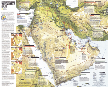
Middle East, States in Turmoil - Published 1991
This informative map of the Middle East highlights each country's military facilities, population, troops, oil reserves, gross national product, and more. An overview of the Gulf War is included. Published in February 1991 as a supplement to the map "The Middle East."
Page Size: 24.75 x 20.25 in (629 x 510 mm)
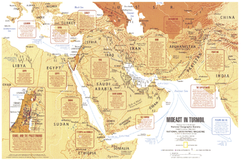
Mideast in Turmoil - Published 1980
This map summarizes the social and economic turmoil in the Middle East during the early 1980's, including the Soviet occupation of Afghanistan, war in Ethiopia, and conflict between Israel and the Palestinians. Published in September 1980 as a companion to the "Two Centuries of Conflict in the Middle East" map and the article "Saudi Arabia: The Kingdom and Its Power."
Page Size: 20.75 x 14 in (525 x 350 mm)
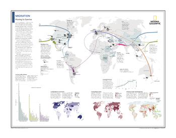
Migration: Moving to Survive - Atlas of the World, 10th Edition
Migrating to Cities; Counting Conflict Refugees; Locating Migrant Concentrations; Charting Remittances; Tracking Migrant Dollars; Predicting Climate-Induced Migrations
Page Size: 28 x 22 in (711 x 559 mm)
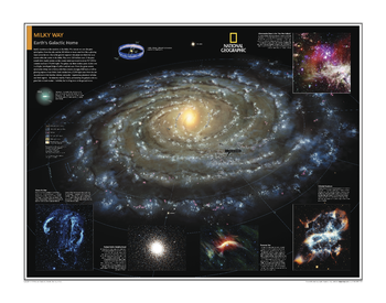
Milky Way: Earth's Galactic Home - Atlas of the World, 10th Edition
null
Page Size: 28 x 22 in (711 x 559 mm)
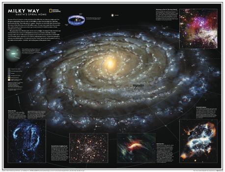
Milky Way: Earth's Spiral Home - Atlas of the World, 11th Edition
Home galaxy of Earth, the Milky Way is a spiral-shaped system of a few hundred billion stars. Bright regions of recently formed stars highlight its arms, while older stars explode or expel the outer layers as planetary nebulae, then fade away and die. A thick swarm of orange and red stars marks the galactic bulge, encapsulating the star-packed galactic center. At its core may lie a black hole, and the scale is staggering: Light from a star at one edge of the galaxy takes about 100,000 years to reach the opposite side.
Explore the Milky Way with this gorgeous computer-generated image. Showing the entire galaxy in one perspective of a 3D model, this map incorporates the positions of hundreds of thousands of stars and nebulae. It shows Earth's location near the Orion Arm, and includes additional photographs, descriptions, and locations of fascinating and stunning phenomena throughout the galaxy.
Star clusters, interstellar gas and dust, nebulae, young stars, molecular clouds, and galactic bursts are all depicted on this map in vivid blasts of color against the darkness of space. Read about phenomena like the eerie "ghosts of a star," whose tendrils can be seen with binoculars from Earth.
This map makes an essential companion to Solar System: The Sun's Neighborhood, and its size makes it perfect for a gallery wall.
This map is found in National Geographic's 11th Edition World Atlas and is now available as a stand alone product.
Page Size: 31.5 x 24 in (798 x 610 mm)
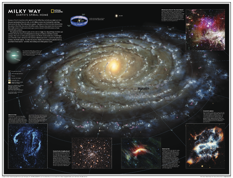
Milky Way: Earth's Spiral Home - Atlas of the World, 11th Edition - Compact
Home galaxy of Earth, the Milky Way is a spiral-shaped system of a few hundred billion stars. Bright regions of recently formed stars highlight its arms, while older stars explode or expel the outer layers as planetary nebulae, then fade away and die. A thick swarm of orange and red stars marks the galactic bulge, encapsulating the star-packed galactic center. At its core may lie a black hole, and the scale is staggering: Light from a star at one edge of the galaxy takes about 100,000 years to reach the opposite side.
Explore the Milky Way with this gorgeous computer-generated image. Showing the entire galaxy in one perspective of a 3D model, this map incorporates the positions of hundreds of thousands of stars and nebulae. It shows Earth's location near the Orion Arm, and includes additional photographs, descriptions, and locations of fascinating and stunning phenomena throughout the galaxy.
Star clusters, interstellar gas and dust, nebulae, young stars, molecular clouds, and galactic bursts are all depicted on this map in vivid blasts of color against the darkness of space. Read about phenomena like the eerie "ghosts of a star," whose tendrils can be seen with binoculars from Earth.
This map makes an essential companion to Solar System: The Sun's Neighborhood, and its size makes it perfect for a gallery wall.
This map is found in National Geographic's 11th Edition World Atlas and is now available as a stand alone product.
Page Size: 21.5 x 16.25 in (540 x 413 mm)
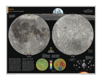
Moon - Atlas of the World, 10th Edition
null
Page Size: 28 x 22 in (711 x 559 mm)
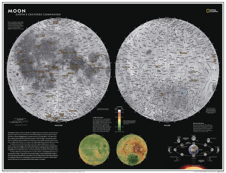
Moon - Atlas of the World, 11th Edition
Throughout human existence, the moon's enigmatic face and monthly waxing and waning have inspired intense fascination. Part of the mystique for ancient cultures might have lain in its unchanging aspect as it traversed the celestial sphere. The same lunar face permanently looks down on Earth because of "tidal locking." In 2013, NASA announced that its GRAIL mission had solved the gravitational mystery - but what other mysteries lurk on the far side of the moon?
The surface of Earth's closest neighbor in the solar system has been mapped since antiquity, but never with the fidelity that NASA's Lunar Reconnaisance Orbiter has provided. Thousands of photos from the spacecraft were stitched together into a mosaic of the surface.
This dual-hemisphere map of the moon, drawn in Lambert Azimuthal Equal-Area projection, makes this desolate landscape both familiar and far too alien. Thousands of craters are identified on both the near and far sides, offering readers a glimpse of the side of the moon that never sees the face of the Earth. A separate hemispheric elevation map and the phases of the moon provide further detail into this celestial body so long revered by humans.
This map makes an essential companion to Solar System: The Sun's Neighborhood, and its size makes it perfect for a gallery wall
This map is found in National Geographic's 11th Edition World Atlas and is now available as a stand alone product.
Page Size: 31.5 x 24 in (798 x 610 mm)
Moon - Atlas of the World, 11th Edition - Compact
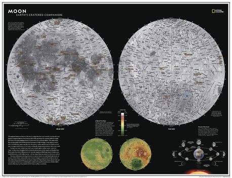
Throughout human existence, the moon's enigmatic face and monthly waxing and waning have inspired intense fascination. Part of the mystique for ancient cultures might have lain in its unchanging aspect as it traversed the celestial sphere. The same lunar face permanently looks down on Earth because of "tidal locking." In 2013, NASA announced that its GRAIL mission had solved the gravitational mystery - but what other mysteries lurk on the far side of the moon?
The surface of Earth's closest neighbor in the solar system has been mapped since antiquity, but never with the fidelity that NASA's Lunar Reconnaisance Orbiter has provided. Thousands of photos from the spacecraft were stitched together into a mosaic of the surface.
This dual-hemisphere map of the moon, drawn in Lambert Azimuthal Equal-Area projection, makes this desolate landscape both familiar and far too alien. Thousands of craters are identified on both the near and far sides, offering readers a glimpse of the side of the moon that never sees the face of the Earth. A separate hemispheric elevation map and the phases of the moon provide further detail into this celestial body so long revered by humans.
This map makes an essential companion to Solar System: The Sun's Neighborhood, and its size makes it perfect for a gallery wall
This map is found in National Geographic's 11th Edition World Atlas and is now available as a stand alone product.
Page Size: 21.5 x 16.25 in (540 x 413 mm)
Mount Everest - Published 1988
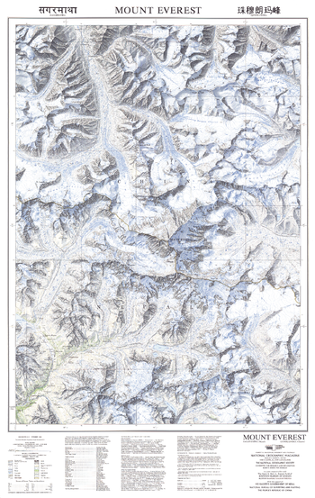
This beautiful map of Mount Everest and the surrounding region was published in November 1988 with three articles on Mount Everest including "Roof of the World." Featuring soft, colored shading and technical information about the making of the map.
Page Size: 22.75 x 36 in (575 x 909 mm)
Mount Everest 50th Anniversary: Side 1
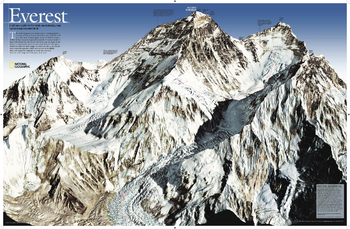
As seen in the May 2003 issue of NATIONAL GEOGRAPHIC, this map celebrates the 50th anniversary of Sir Edmund Hillary's ascent to the summit of Mt. Everest. A view of the mountain This side features a digital rendering of Mount Everest created from infrared images taken by the space shuttle combined with stereo photographs taken from a jet aircraft.
Page Size: 31.75 x 20.75 in (805 x 526 mm)
Mount Everest 50th Anniversary: Side 2
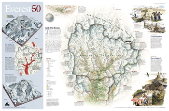
As seen in the May 2003 issue of NATIONAL GEOGRAPHIC, this map celebrates the 50th anniversary of Sir Edmund Hillary's ascent to the summit of Mt. Everest. Routes, cultures, and map The reverse side shows a map of Sagarmatha National Park and surrounding areas. Inset maps and informative sidebars describe the Sherpas, special locations in the area, the growth in visitors to the region, and the routes taken by famous Everest expeditions.
Page Size: 31.5 x 20.5 in (795 x 515 mm)