


National Geographic

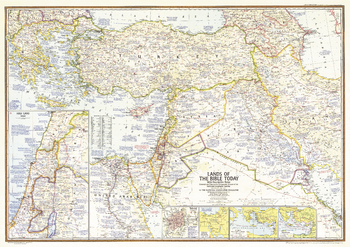
Lands of the Bible Today - Published 1967
This map of the "Lands of the Bible" outlines the territory occupied by Israel in June of 1967 during the Six Days' War between Israel and neighboring Arab countries. Contains a large quantity of ancient historical information as well as details of significant events of the time. Published in December 1967 to accompany three articles, including "Eyewitness to War in the Holy Land."
Page Size: 41 x 29 in (1041 x 735 mm)
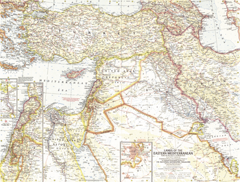
Lands of the Eastern Mediterranean - Published 1959
This map of the Lands of the Eastern Mediterranean features detailed inset maps of Lebanon and Israel, and the Suez Canal. There is also a map of Jerusalem and the surrounding area with religious sites noted. Published in January 1959 with the article "Station Wagon Odyssey: Baghdad to Istanbul."
Page Size: 25 x 19 in (633 x 478 mm)
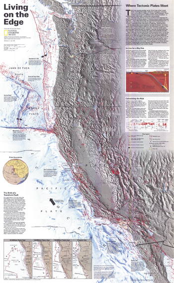
Living on the Edge - Published 1995
There is no escaping geology on the West Coast of the United States. Earthquakes continually shake California, while volcanoes loom over northern California, Oregon, and Washington. Each of these hazards marks a different kind of tectonic plate boundary - transform faults to the south, subduction zones up north. This map shows the western United States along with all of its known major fault lines and zones.
Page Size: 22.25 x 36 in (563 x 914 mm)
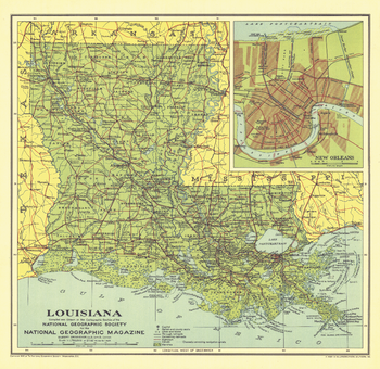
Louisiana - Published 1930
Land of bayous, plantations, Cajuns, and jazz, Louisiana is one of the most unique states in the union. National Geographic highlighted the state in April 1930 with the Louisiana map and the article "Louisiana, Land of Perpetual Romance."
Page Size: 13.25 x 13 in (337 x 327 mm)
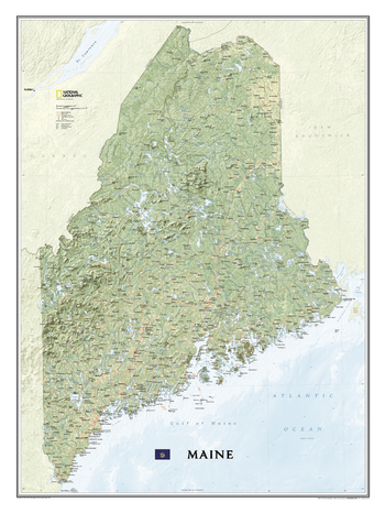
Maine
Maine State Wall Map, part of National Geographic's growing series of State Wall Maps. Map depicts Maine's diverse terrain and vegetation and ocean bathymetry. Contains hundreds of place names and precise locations of cities, major roadways and railways, airports, federal and state protected lands, mountain ranges and prominent peaks, marine sanctuaries, military installations, major lakes, rivers and reservoirs, and other geographic features.
Page Size: 30.25 x 40.5 in (768 x 1028 mm)
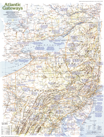
Making of America, Atlantic Gateways - Published 1983
From the early settlements of European colonists to the great cities of New York, Philadelphia, and Washington, D.C., the Atlantic Gateways region of the United States has a tremendous historical and modern day presence. This educational map explores this vital region, focusing on the central states along the eastern seaboard. Published in March 1983 as part of the "Making of America" series.
Page Size: 20.5 x 27 in (519 x 683 mm)
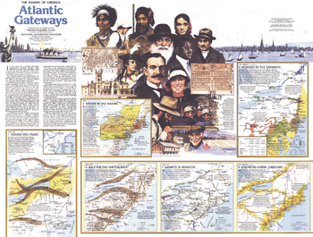
Making of America, Atlantic Gateways Theme - Published 1983
Part of the "Making of America" series, this map of the Atlantic Gateways is Side Two of a two-map set. Published in March 1983, this work features an abundance of historical information about the central region of the eastern seaboard including New York, Pennsylvania, New Jersey, Maryland, Rhode Island, northern Virginia, and southern Massachusetts.
Page Size: 27 x 20.5 in (685 x 518 mm)
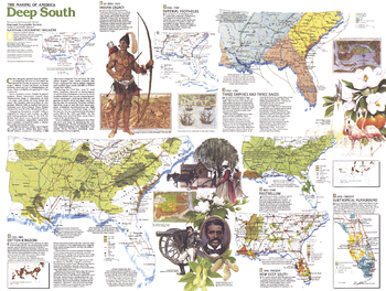
Making of America, Deep South Theme - Published 1983
Part of the "Making of America" series, the Deep South map is half of a two-map set published in August 1984. With nine unique maps profiling the history of the region, this work provides an abundance of information on the cultures who settled the region, its dark history of slavery, phases of its economic growth, and more.
Page Size: 27.25 x 20.5 in (687 x 518 mm)
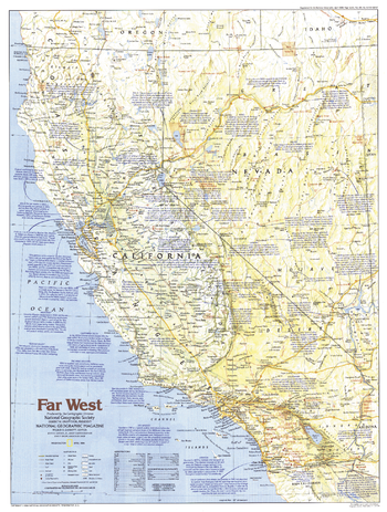
Making of America, Far West - Published 1984
This map of the Far West region of the United States focuses on California and Nevada, detailing the history, geography, and tourist sites to be found in both the "Golden State" and "Silver State." Published in April 1984 as part of the "Making of America" series.
Page Size: 20.5 x 27.25 in (520 x 687 mm)
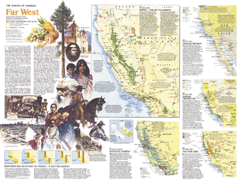
Making of America, Far West Theme - Published 1984
The Far West map of April 1984 is half of a two-map set in the "Making of America" series. Focusing on California and Nevada, this map provides a wealth of historical information about the region including the early days of Indians and Spanish settlements, the discovery of gold and silver, and the establishment of the agricultural and film industries.
Page Size: 27.25 x 20.5 in (688 x 518 mm)
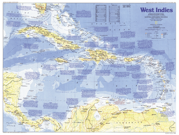
Making of America, West Indies - Published 1987
Explore the culturally diverse and historically rich islands of the Caribbean with this map of the West Indies. Published in November 1987 as part of the "Making of America" series, this map accompanied two articles, "Searching for Columbus's Lost Colony: La Navidad" and "Haiti - Against All Odds."
Page Size: 27.25 x 20.5 in (687 x 519 mm)
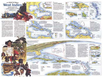
Making of America, West Indies Theme - Published 1987
A region of contrasts, the islands of the West Indies are both tropical paradise and lands marred by a dark history of slavery, greed, and suffering. Part of the "Making of America" series, this work represents Side Two of a two-map set published in November 1987 and features an abundance of historical information about this culturally diverse region. Two articles, "Searching for Columbus's Lost Colony: La Navidad" and "Haiti - Against All Odds," accompanied the two maps.
Page Size: 27.25 x 20.5 in (687 x 519 mm)
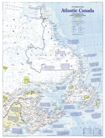
Making of Canada, Atlantic Canada - Published 1993
Explore the eastern-most points in North America and a land of rich and diverse culture and pristine environment with this map of Canada's Atlantic provinces. Published in October 1993 as part of the "Making of Canada" series.
Page Size: 20.5 x 27 in (519 x 683 mm)
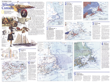
Making of Canada, Atlantic Canada Theme - Published 1993
Published in October 1993 as half of a two-map set, this map of Atlantic Canada is part of the "Making of Canada" series. With a collection of maps detailing periods of the region's exploration and settlement as well as information about its dwindling fishing industry and burgeoning tourism industry, this work provides a wonderful historical overview as well as a compelling look at the changing face of Atlantic Canada.
Page Size: 27 x 20.5 in (685 x 519 mm)
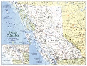
Making of Canada, British Columbia - Published 1992
A land of rugged mountains and spectacular forests, Canada's British Columbia province is a land of plentiful natural resources and vibrant native cultures. This map is noteworthy for its inclusion of the wealth of national and provincial parks and Indian reserves throughout the region. Published in April 1992 as part of the "Making of Canada" series.
Page Size: 27 x 20.5 in (685 x 518 mm)
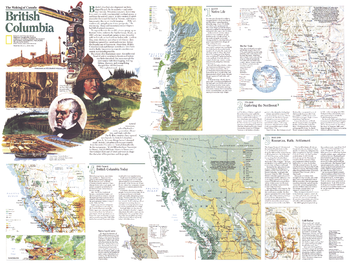
Making of Canada, British Columbia Theme - Published 1992
Published in April 1992 as half of a two-map set, this map of British Columbia is part of the "Making of Canada" series. With a collection of maps detailing periods of the province's exploration and settlement, this work provides a wonderful historical overview as well as a compelling look at the wonders of present-day British Columbia.
Page Size: 27 x 20.5 in (685 x 518 mm)
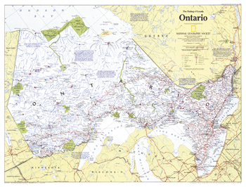
Making of Canada, Ontario - Published 1996
This map of Canada's Ontario province contains a wealth of information. The richest, most populous, and most urban province, Ontario is also a land of uninhabited wilderness and vast mineral wealth. Published in June 1996 as part of the "Making of Canada" series.
Page Size: 27.25 x 20.75 in (688 x 523 mm)
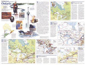
Making of Canada, Ontario Theme - Published 1996
The richest, most populous, and most urban province in Canada, Ontario contains both vibrant cities and uninhabited boreal forests and tundra. Part of the "Making of Canada" series, this map of the province is Side One of a two-map set published in June 1996 which accompanied an article on Toronto.
Page Size: 27.25 x 20.75 in (688 x 523 mm)
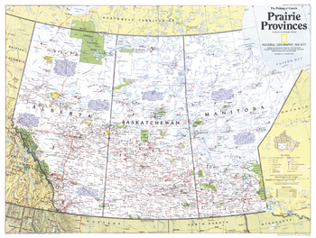
Making of Canada, Prairie Provinces - Published 1994
A land of sweeping prairies and abundant wildlife, Alberta, Saskatchewan and Manitoba make up Canada's agricultural heartland and Prairie Provinces. Published in December 1994 as part of the "Making of Canada" series, this map accompanied the article "Canada's Highway of Steel."
Page Size: 27 x 20.5 in (686 x 518 mm)
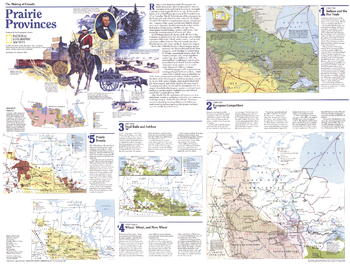
Making of Canada, Prairie Provinces Theme - Published 1994
Published in December 1994 as half of a two-map set, this map of the Prairie Provinces is part of the "Making of Canada" series. With a collection of maps detailing periods of the province's exploration and settlement, this work provides a wonderful historical overview as well as an informative look at present-day Alberta, Saskatchewan, and Manitoba.
Page Size: 27 x 20.5 in (686 x 518 mm)