


National Geographic

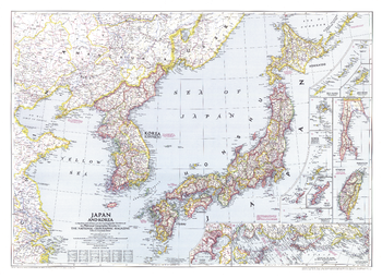
Japan and Korea - Published 1945
World War II had just ended when this map of Japan and Korea was published in December 1945. With the end of the war came the end of Japan's 35-year occupation of Korea. With detailed inset maps of many islands in the region, as well as a map of Tokyo, this map also contains historical notes such as the site of the Japanese surrender.
Page Size: 37.5 x 27.5 in (953 x 695 mm)
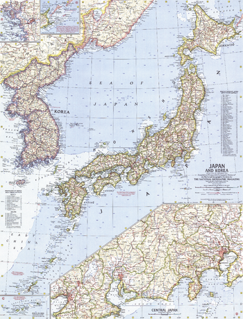
Japan and Korea - Published 1960
This map of Japan and Korea provides great detail of the region including inset maps of the Ryukyu Islands and U.S.S.R. administered islands. It also features prefectures of Japan and provinces of Korea with their capitals. Published in December 1960.
Page Size: 19 x 25 in (480 x 630 mm)
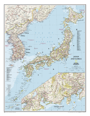
Japan and Korea - Published 2011
This map of Japan and Korea, which conforms to National Geographic's demanding standards of accuracy and cartographic detail, shows political boundaries, major roads, cities and towns, airports, islands, and other geographic details. An inset provides a more detailed map of central Japan including Tokyo, Yokohama, Nagoya, Osaka, and surrounding cities.
Page Size: 23.75 x 30.75 in (600 x 775 mm)
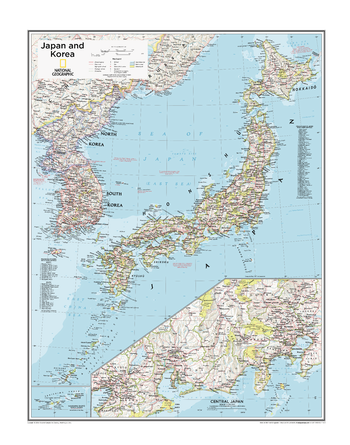
Japan and Korea - Atlas of the World, 10th Edition
null
Page Size: 22 x 28 in (559 x 711 mm)
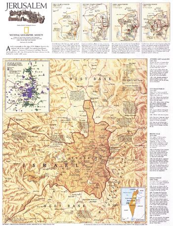
Jerusalem - Published 1996
This thorough portrait of Jerusalem contains a brief history of the city, a historical timeline, maps of the various periods, and a modern look at this enigmatic holy place. Published in April 1996, this map accompanied the "Jerusalem: The Old City" map and the article "The Three Faces of Jerusalem."
Page Size: 15.5 x 20.5 in (394 x 514 mm)
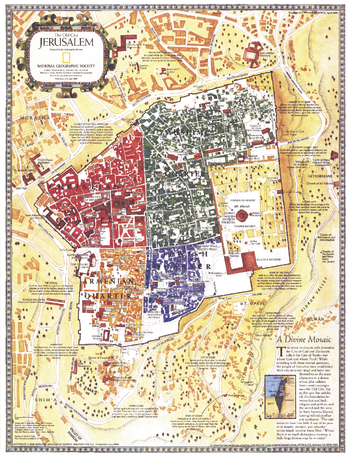
Jerusalem, the Old City - Published 1996
This map of Old City Jerusalem features the city's many historical sites. The Christian, Armenian, Muslim, and Jewish quarters are shown in distinct colors, and there are notes describing the most significant sacred sites in the old walled city and beyond. Published in April 1996, this map accompanied the"Jerusalem" map and the article "The Three Faces of Jerusalem."
Page Size: 15.5 x 20.5 in (394 x 515 mm)
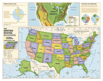
Kids Beginners USA Education: Grades K-3
Beginners USA Education map of the United States for grades K-3. National Geographic's graded-series of maps are the first to address the unique needs of K-12 students as they advance their understanding of our World.<br>Unlike other classroom poster maps, the world maps use the Winkel-Triple projection, which provides the best combination of size, shape, and distance giving the student the best visual representation of the Earth's surface in two dimensions. This solves the effect seen on other maps where Greenland appears larger than South America.<br><br>Our Beginner Series, grades K-3, contains an easy to read maps of the World and United States.
Page Size: 51.75 x 40.75 in (1310 x 1031 mm)
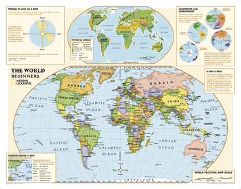
Kids Beginners World Education: Grades K-3
Beginners USA Education map of the world for grades K-3. National Geographic's graded-series of maps are the first to address the unique needs of K-12 students as they advance their understanding of our World.<br>Unlike other classroom poster maps, the world maps use the Winkel-Triple projection, which provides the best combination of size, shape, and distance giving the student the best visual representation of the Earth's surface in two dimensions. This solves the effect seen on other maps where Greenland appears larger than South America.<br><br>Our Beginner Series, grades K-3, contains an easy to read maps of the World and United States.
Page Size: 51.75 x 40.75 in (1310 x 1031 mm)
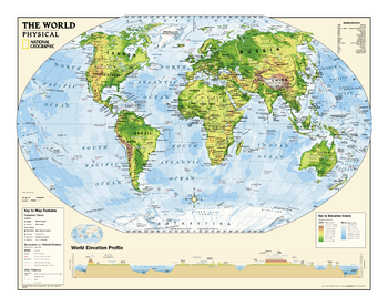
Kids Physical World Education: Grades 4-12
Physical map of the world for grades 4-12. National Geographic's graded-series of maps are the first to address the unique needs of K-12 students as they advance their understanding of our World.<br>Unlike other classroom poster maps, the world maps use the Winkel-Triple projection, which provides the best combination of size, shape, and distance giving the student the best visual representation of the Earth's surface in two dimensions. This solves the effect seen on other maps where Greenland appears larger than South America.<br><br>Our Physical Series, grades 6-12, helps advancing students understand the World's diverse landforms, Oceans, and terrain.
Page Size: 51.25 x 40.25 in (1298 x 1018 mm)
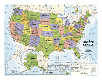
Kids Political USA Education: Grades 4-12
Political map of the United States for grades 4-12. National Geographic's graded-series of maps are the first to address the unique needs of K-12 students as they advance their understanding of our World.<br>Unlike other classroom poster maps, the world maps use the Winkel-Triple projection, which provides the best combination of size, shape, and distance giving the student the best visual representation of the Earth's surface in two dimensions. This solves the effect seen on other maps where Greenland appears larger than South America.<br><br>Our Political Series, grades 4-12, has up-to-date World and U.S. maps, increasing the detail of information for the teacher and student to utilize.
Page Size: 51.75 x 40.75 in (1310 x 1031 mm)
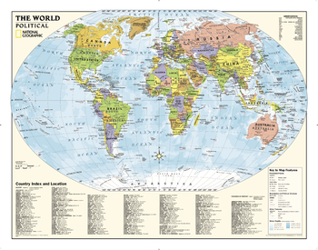
Kids Political World Education: Grades 4-12
Political map of the world for grades 4-12. National Geographic's graded-series of maps are the first to address the unique needs of K-12 students as they advance their understanding of our World.<br>Unlike other classroom poster maps, the world maps use the Winkel-Triple projection, which provides the best combination of size, shape, and distance giving the student the best visual representation of the Earth's surface in two dimensions. This solves the effect seen on other maps where Greenland appears larger than South America.<br><br>Our Political Series, grades 4-12, has up-to-date World and U.S. maps, increasing the detail of information for the teacher and student to utilize.
Page Size: 51.75 x 40.75 in (1310 x 1031 mm)

Kirin Harbin Vladivostok - Published 1905
The Trans-Siberian Railway, completed in 1903, is a network of railways connecting the Russian Far East and the Sea of Japan with Moscow. It is the longest railway in the world with branch lines to China through Mongolia and Manchuria. This beautifully rendered antique map of the region from Vladivostok to Kirin and Harbin was published by National Geographic in June of 1905.
Page Size: 46 x 20 in (1166 x 506 mm)
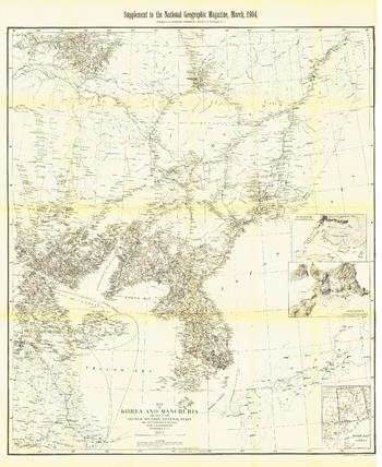
Korea and Manchuria - Published 1904
This historic black and white map of Korea and Manchuria contains exceptionally detailed inset maps of Port Arthur and Vladivostok. Published in March 1904 with the article "Russian Development of Manchuria," this intricate cartographic work is a fine addition to any map collection.
Page Size: 35 x 43 in (889 x 1086 mm)
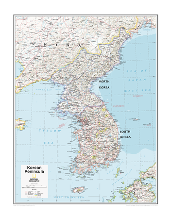
Korean Peninsula - Atlas of the World, 10th Edition
North Korea, South Korea
Page Size: 22 x 28 in (559 x 711 mm)
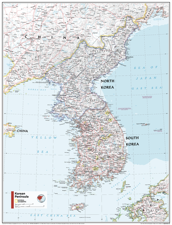
Korean Peninsula - Atlas of the World, 11th Edition
This Korean Peninsula map of physical and political features can fit in any space. Showcasing the region in stunning detail with state-of-the-art cartographic techniques delivering accuracy and exceptional quality, the innovative and engaging design makes the content easily accessible and user-friendly.
Ideal for classrooms with an emphasis on teaching geography or environmental themes. The inclusion of physical features gives your students a genuine feel for how our world appears.
This map uses a bright, easy to read color palette featuring blue oceans and stunning shaded relief that has been featured on National Geographic wall maps for over 75 years. It is drawn in Polyconic projection, where the parallels are all non-concentric circular arcs except for the equator, which is straight. Insets of central Japan and Ryukyu Islands and lists of administrative regions of both nations add detail to this map.
This map is found in National Geographic's 11th Edition World Atlas and is now available as a stand alone product.
Page Size: 24 x 31.5 in (610 x 798 mm)
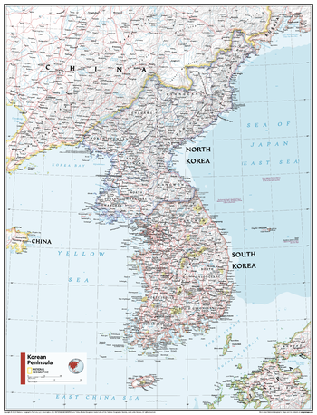
Korean Peninsula - Atlas of the World, 11th Edition - Compact
This Korean Peninsula map of physical and political features can fit in any space. Showcasing the region in stunning detail with state-of-the-art cartographic techniques delivering accuracy and exceptional quality, the innovative and engaging design makes the content easily accessible and user-friendly.
Ideal for classrooms with an emphasis on teaching geography or environmental themes. The inclusion of physical features gives your students a genuine feel for how our world appears.
This map uses a bright, easy to read color palette featuring blue oceans and stunning shaded relief that has been featured on National Geographic wall maps for over 75 years. It is drawn in Polyconic projection, where the parallels are all non-concentric circular arcs except for the equator, which is straight. Insets of central Japan and Ryukyu Islands and lists of administrative regions of both nations add detail to this map.
This map is found in National Geographic's 11th Edition World Atlas and is now available as a stand alone product.
Page Size: 16.25 x 21.5 in (413 x 540 mm)
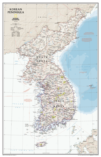
Korean Peninsula Classic
Amid increasingly combative rhetoric from Pyongyang, North Korea, do you know where its underground nuclear test site or missile launch centers are located? Are you aware that the South Korean government has begun a program to move its federal offices and personnel from Seoul to a new location? National Geographic's new Korean Peninsula map provides this and much more information about this conflicted peninsula.<br><br>National Geographic Maps' Korean Peninsula wall map is one of the most authoritative maps of the Koreas. The peninsula's rugged terrain is expertly depicted in shaded relief, including the elevation of prominent mountains and ocean depths in meters. This new edition clearly portrays both countries and uses the latest system for transcribing South Korean place-names from the Korean alphabet. In great detail, it delineates the latest administrative divisions of both countries along with the July 27, 1953 Military Demarcation Line—the historic demarcation line between the two Koreas. The map also portrays the transportation grid of both countries, including South Korea's high-speed passenger railway network.<br><br>The Korean Peninsula map measures 23" x 36" and is scaled at 1,357,000.
Page Size: 23.25 x 36 in (588 x 909 mm)

Land of the Maya - Published 1989
This map features national parks and other preserved areas where one can explore the remains of the great Mayan civilization, plus an abundance of historical notes about Mayan cities and their locations. Published in October 1989 as half of a two–map set with "The Ancient Maya World".
Page Size: 20.25 x 27 in (514 x 686 mm)
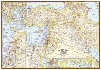
Lands of the Bible 1967 Map - Published 2012
This unique map was created in 1967 for the National Geographic Magazine and has been reprinted in its original format. Filled with reference information, the map includes insets of: The Holy Land, Walled city of Jerusalem, Traditional route of the Exodus, St. Paul's four great journeys, and The Crusades.
Page Size: 38.75 x 27.25 in (983 x 689 mm)
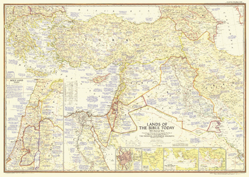
Lands of the Bible Today - Published 1956
This map of the Holy Land features attractive cartography and copious historical. It also reveals the locations of the Seven Wonders of the Ancient World, and contains references to Bible passages alongside relevant place names. Published in December 1956 with the article "Jerusalem to Rome in the Path of St. Paul." A fine companion to the maps of 1938 and 1946.
Page Size: 41 x 29 in (1039 x 735 mm)