


National Geographic

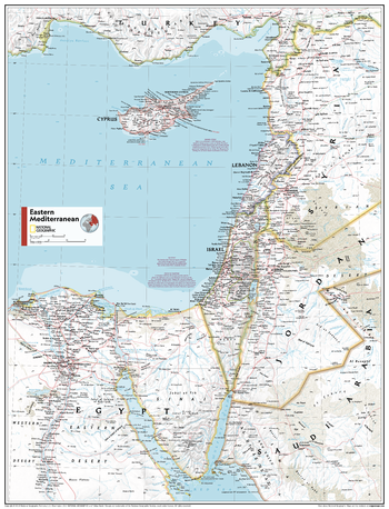
Eastern Mediterranean - Atlas of the World, 11th Edition
This Eastern Mediterranean area map of physical and political features can fit in any space. Showcasing the region in stunning detail with state-of-the-art cartographic techniques delivering accuracy and exceptional quality, the innovative and engaging design makes the content easily accessible and user-friendly.
Ideal for classrooms with an emphasis on teaching geography or environmental themes. The inclusion of physical features gives your students a genuine feel for how our world appears.
This map uses a bright, easy to read color palette featuring blue oceans and stunning shaded relief that has been featured on National Geographic wall maps for over 75 years.
Names of geographic features are carefully placed on the map to maintain legibility.
This map is found in National Geographic's 11th Edition World Atlas and is now available as a stand alone product.
Page Size: 24 x 31.5 in (610 x 798 mm)
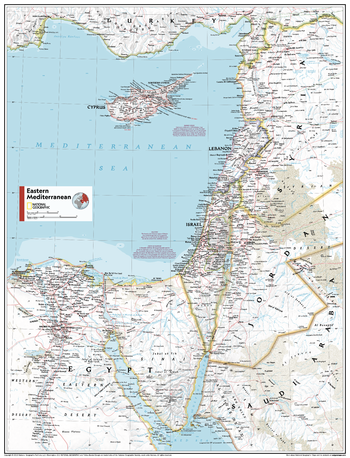
Eastern Mediterranean - Atlas of the World, 11th Edition - Compact
This Eastern Mediterranean area map of physical and political features can fit in any space. Showcasing the region in stunning detail with state-of-the-art cartographic techniques delivering accuracy and exceptional quality, the innovative and engaging design makes the content easily accessible and user-friendly.
Ideal for classrooms with an emphasis on teaching geography or environmental themes. The inclusion of physical features gives your students a genuine feel for how our world appears.
This map uses a bright, easy to read color palette featuring blue oceans and stunning shaded relief that has been featured on National Geographic wall maps for over 75 years.
Names of geographic features are carefully placed on the map to maintain legibility.
This map is found in National Geographic's 11th Edition World Atlas and is now available as a stand alone product.
Page Size: 16.25 x 21.5 in (413 x 540 mm)
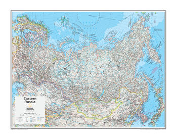
Eastern Russia - Atlas of the World, 10th Edition
null
Page Size: 28 x 22 in (711 x 559 mm)
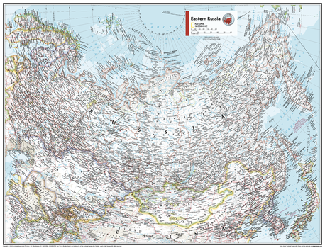
Eastern Russia - Atlas of the World, 11th Edition
This Eastern Russia area map of physical and political features can fit in any space. Showcasing the region in stunning detail with state-of-the-art cartographic techniques delivering accuracy and exceptional quality, the innovative and engaging design makes the content easily accessible and user-friendly.
Ideal for classrooms with an emphasis on teaching geography or environmental themes. The inclusion of physical features gives your students a genuine feel for how our world appears.
This map uses a bright, easy to read color palette featuring blue oceans and stunning shaded relief that has been featured on National Geographic wall maps for over 75 years. Drawn in the Two-Point Equidistant Projection, this map ensures that all points are at proportionally correct distances from two points chosen by the cartographer.
Names of geographic features are carefully placed on the map to maintain legibility.
This map is found in National Geographic's 11th Edition World Atlas and is now available as a stand alone product.
Page Size: 31.5 x 24 in (798 x 610 mm)
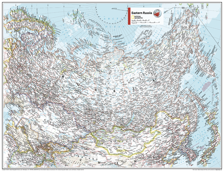
Eastern Russia - Atlas of the World, 11th Edition - Compact
This Eastern Russia area map of physical and political features can fit in any space. Showcasing the region in stunning detail with state-of-the-art cartographic techniques delivering accuracy and exceptional quality, the innovative and engaging design makes the content easily accessible and user-friendly.
Ideal for classrooms with an emphasis on teaching geography or environmental themes. The inclusion of physical features gives your students a genuine feel for how our world appears.
This map uses a bright, easy to read color palette featuring blue oceans and stunning shaded relief that has been featured on National Geographic wall maps for over 75 years. Drawn in the Two-Point Equidistant Projection, this map ensures that all points are at proportionally correct distances from two points chosen by the cartographer.
Names of geographic features are carefully placed on the map to maintain legibility.
This map is found in National Geographic's 11th Edition World Atlas and is now available as a stand alone product.
Page Size: 21.5 x 16.25 in (540 x 413 mm)
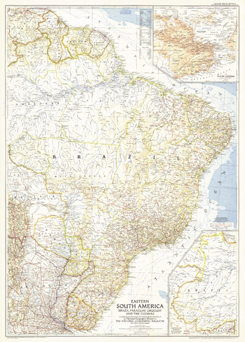
Eastern South America - Published 1955
This map of Eastern South America map features an inset of Rio de Janeiro. Published in March 1955 with two articles on the region including "Spectacular Rio de Janeiro" and "Life Among the Wai Wai Indians." A fine companion to the map of 1958 Southern South America.
Page Size: 29 x 40.5 in (735 x 1026 mm)
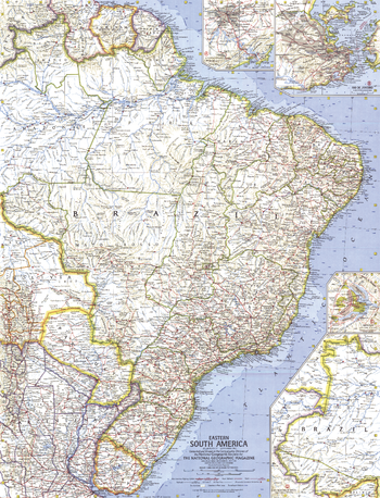
Eastern South America - Published 1962
This map of the Eastern part of South America features inset maps of the cities of Brasilia, Rio de Janeiro, and Sao Paulo. Published in September 1962 with the article "Brazil, Oba!" A fine companion to the 1964 map of Northwestern South America.
Page Size: 19 x 25 in (481 x 630 mm)
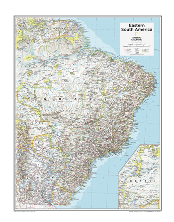
Eastern South America - Atlas of the World, 10th Edition
Brazil, French Guiana (France), Paraguay, Suriname
Page Size: 22 x 28 in (559 x 711 mm)
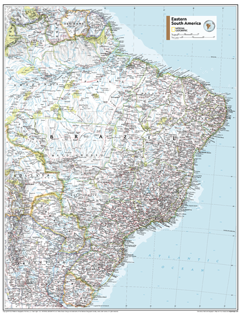
Eastern South America - Atlas of the World, 11th Edition
This Eastern South America map of physical and political features can fit in any space. Showcasing the region in stunning detail with state-of-the-art cartographic techniques delivering accuracy and exceptional quality, the innovative and engaging design makes the content easily accessible and user-friendly.
Ideal for classrooms with an emphasis on teaching geography or environmental themes. The inclusion of physical features gives your students a genuine feel for how our world appears.
This map uses a bright, easy to read color palette featuring blue oceans and stunning shaded relief that has been featured on National Geographic wall maps for over 75 years. Drawn in the Azimuthal Equidistant projection, this map ensures that all points on the map are at proportionally correct distances from the center point.
Names of geographic features are carefully placed on the map to maintain legibility.
This map is found in National Geographic's 11th Edition World Atlas and is now available as a stand alone product.
Page Size: 24 x 31.5 in (610 x 798 mm)
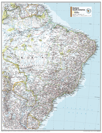
Eastern South America - Atlas of the World, 11th Edition - Compact
This Eastern South America map of physical and political features can fit in any space. Showcasing the region in stunning detail with state-of-the-art cartographic techniques delivering accuracy and exceptional quality, the innovative and engaging design makes the content easily accessible and user-friendly.
Ideal for classrooms with an emphasis on teaching geography or environmental themes. The inclusion of physical features gives your students a genuine feel for how our world appears.
This map uses a bright, easy to read color palette featuring blue oceans and stunning shaded relief that has been featured on National Geographic wall maps for over 75 years. Drawn in the Azimuthal Equidistant projection, this map ensures that all points on the map are at proportionally correct distances from the center point.
Names of geographic features are carefully placed on the map to maintain legibility.
This map is found in National Geographic's 11th Edition World Atlas and is now available as a stand alone product.
Page Size: 16.25 x 21.5 in (413 x 540 mm)
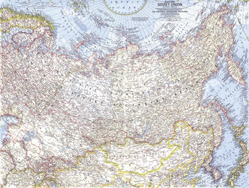
Eastern Soviet Union - Published 1967
This map of the eastern portion of the Soviet Union features many physical and political details, including the country's boundaries in 1938 and the northern limits of wooded country. Published in March 1967 with the article "Siberia: Russia's Frozen Frontier."
Page Size: 25 x 19 in (631 x 478 mm)
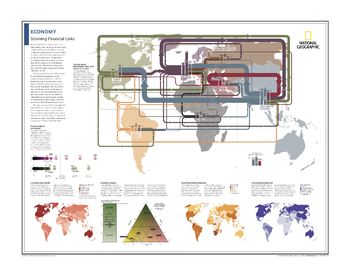
Economy: Straining Financial Links - Atlas of the World, 10th Edition
Tracking World Merchandise Trade, 2012; Charting Imports and Exports; Locating Global Wealth; Economic Engines; Identifying Wealth Disparities; Calculating External Debt
Page Size: 28 x 22 in (711 x 559 mm)
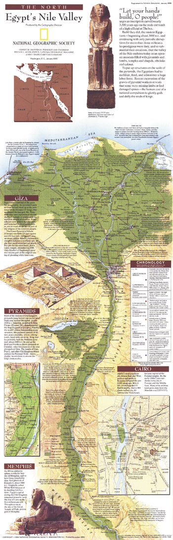
Egypts Nile Valley North - Published 1995
Explore the wonder and mysteries of the northern Nile Valley with this fascinating and educational map. Both a modern map of the rich Nile Valley and a guide through Egypt's magnificent past, this vibrant work features a chronological legend indicating the period best represented by each site. Published in January 1995, this map accompanied the "Egypt's Nile Valley South" map and the article "Age of the Pyramids: Egypt's Old Kingdom."
Page Size: 10 x 31.25 in (254 x 793 mm)
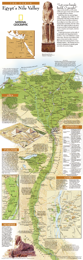
Egypts Nile Valley North - Published 2005
Explore the wonder and mysteries of the northern Nile Valley with this educational map. A map of the rich Nile Valley and a guide through Egypt's magnificent past, this vibrant work features a chronological legend indicating the period best represented by each site. A must have for anyone interested in archaeology or history.
Page Size: 10 x 31.25 in (254 x 794 mm)
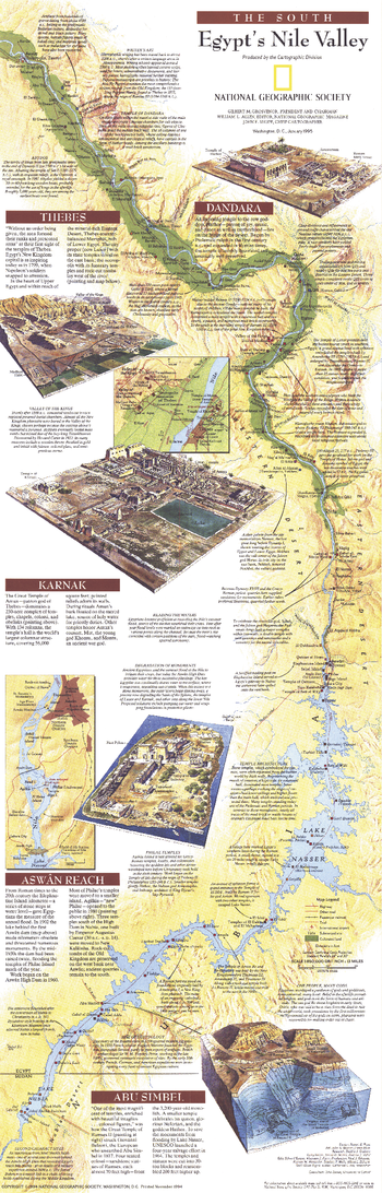
Egypts Nile Valley South - Published 1995
Explore the wonder and mysteries of the southern Nile Valley with this fascinating and educational map. Both a modern map and a guide through Egypt's magnificent past, this vibrant work features considerable details about archaeological sites and early Egyptian civilization. Published in January 1995, this map accompanied the "Egypt's Nile Valley North" map and the article "Age of the Pyramids: Egypt's Old Kingdom."
Page Size: 10 x 31.25 in (254 x 793 mm)
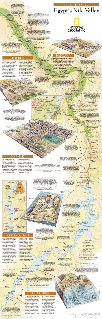
Egypts Nile Valley South - Published 2005
This map of the southern Nile Valley is your guide through Egypt's magnificent past, this vibrant work features a chronological legend indicating the period best represented by each site. A must have for anyone interested in archaeology or history.
Page Size: 10.25 x 31.25 in (254 x 794 mm)
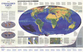
Endangered Earth - Published 1988
This amazing map introduces the issues and challenges surrounding our Endangered Earth as we navigate a historical transition between a world inherited and one profoundly different -- a global biosphere whose vital functions we have altered. Published in December 1988, on the 100th anniversary of the National Geographic Society.
Page Size: 46 x 29.25 in (1166 x 737 mm)
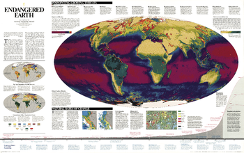
Endangered Earth - Published 1997
We are in a historical transition between a world inherited and one that is profoundly different a global biosphere whose vital functions we have altered. Burgeoning human numbers have placed unprecedented demands on farmland, forests, and other resources, changing the continents green skins of vegetation, as well as the interactions between atmosphere, land, oceans, and living organisms that sustain life on earth. This map shows these interactions and pinpoints growing threats. A wonderful resource for learning more about the delicate balance between development and natural regeneration of the planet.
Page Size: 46.25 x 29 in (1171 x 736 mm)
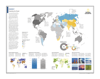
Energy: Powering the Planet - Atlas of the World, 10th Edition
Mapping Energy Sources; Balancing Consumption and Production; Identifying Global Final Energy Consumption; Renewables as a Share of Total Energy Consumption; Growth in Renewable Energy; Toward a Cleaner Energy Supply
Page Size: 28 x 22 in (711 x 559 mm)
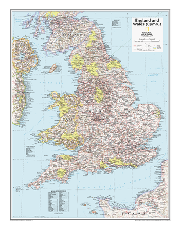
England and Wales (Cymru) - Atlas of the World, 10th Edition
null
Page Size: 21 x 27 in (533 x 686 mm)