


National Geographic

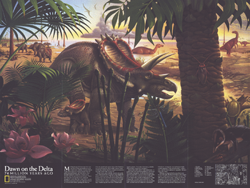
Dawn on the Delta - Published 1993
Published in January 1993, the "Dawn on the Delta: 74 Million Years Ago" poster is a stunning illustration of dinosaurs indiginous to North America. A companion to the "North America in the Age of the Dinosaurs" map, this beautiful depiction of an ancient landscape is a must-have for those fascinated by these enigmatic creatures.
Page Size: 27 x 20.25 in (683 x 513 mm)
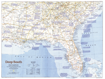
Deep South - Published 1983
Explore the Deep South region of the United States with this informative map, featuring historical notes, fine geographical detail, and a variety of tourist sites. Published in August 1983 as part of the "Making of America" series.
Page Size: 27.25 x 20.5 in (687 x 518 mm)
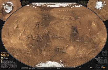
Destination Mars
See Mars as it really looks, from the heights of Olympus Mons (nearly 70,000 feet above the surface), to ancient canyons, to Hellas Planitia, the lowest point on Mars, where a meteorite punched a hole in the surface 1,300 miles wide and five miles deep. Destination Mars was created for National Geographic with over 1,000 images taken by the Mars Orbiter Camera, and merged with 330 million elevation points to create the sharpest view yet of Mars and its spectacular terrain.
Page Size: 31.25 x 20.25 in (794 x 514 mm)
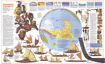
Discoverers of the Pacific - Published 1974
The Discoverers of the Pacific map was published in December 1974 as half of a two-map set with the Islands of the Pacific map and the article "The Coming of the Polynesians." An educational work, this map contains an abundance of information about Pacific Islanders, their shipbuilding techniques, types of canoes, and how they navigated using the stars, birds, and other natural data.
Page Size: 37 x 22.75 in (940 x 573 mm)
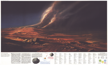
Dusty Face of Mars - Published 1973
This map contains the complete index for "The Red Planet Mars" map, published in February 1973 along with two articles on the planet: "Journey to Mars" and "The Search for Life on Mars." In addition to the index, this map features a breathtaking illustration of martian landscape and information on the satellites of Mars.
Page Size: 38 x 23 in (962 x 580 mm)
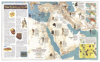
Early Civilizations in the Middle East - Published 1978
This fascinating map features a thorough overview of the history of the Middle East region and the civilizations who called it home. Includes illustrations of artifacts. Published in September 1978 as a companion to the "Middle East" political map.
Page Size: 37 x 22.75 in (937 x 578 mm)
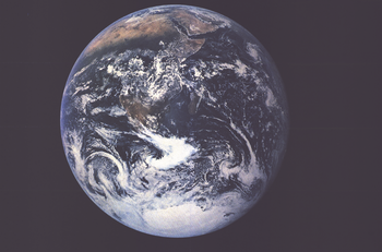
Earth From Space - Published 1973
Astronaut Harrison H. Schmitt captured this image from 25,000 miles above the Earth aboard Apollo 17 in December, 1972. This classic map accompanied four articles on Space exploration. The perfect complement to our "Teammates in Mankind's Greatest Adventure" poster.
Page Size: 34 x 22.5 in (860 x 568 mm)
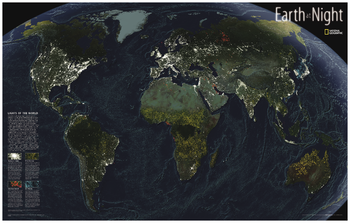
Earth at Night
This intriguing map reveals in stunning detail the pulsating lights of the Earth at night. See where populations are most and least concentrated. The rare view is a composite image made by three satellites on cloud-free nights over a one-year period. In addition to showing lighted areas of the Earth, this map also features where fires rage and natural gas burn-off and night fishing locations.
Page Size: 35.25 x 22.25 in (891 x 564 mm)
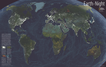
Earth at Night - Published 2004
While the Earth sleeps, lights pulsates across its surface in a lively dance visible from the vantage of space. This magnificent composite of satellite images from cloud-free nights gathered over a one year period. One look reveals the obvious: Rich, developed regions like the United States, Europe, and Japan glow with gaudy abandon, using energy disproportionate to their populations. Over the next few decades, many scientists expect a growth of lights in developing countries. But some anticipate seeing fewer lights in the wealthiest nations, where advances in lighting technology could save energy and better contain light emissions. Published in November 2004, this map represents half of a two-map set with a political map of the world.
Page Size: 35.25 x 22.25 in (890 x 562 mm)
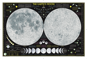
Earth's Moon
This National Geographic classic shows the mystery of bird migration and the incredible journeys that birds undertake in the Americas each year. 67 types of birds that migrate are shown on a map of the Americas that is overlaid with pathways that show migration routes from nesting grounds to wintering areas. Full-color bird paintings by noted illustrator Arthur Singer show each of the 67 species, making it easy to identify birds as they fly their amazing journeys.
Page Size: 43.25 x 29.25 in (1094 x 739 mm)
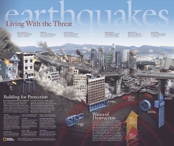
Earthquakes, Living With the Threat - Published 2006
Published in April 2006 as half of a two-piece set with "Danger Zones: Earthquake Risk, A Global View," this remarkable poster demonstrates the damage done to buildings, highways, high-rises, and other structures within a city when plates shift. It also reveals how strict construction standards and new innovations help hold things together when earthquakes strike.
Page Size: 24 x 20.25 in (609 x 512 mm)
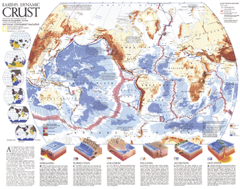
Earths Dynamic Crust - Published 1985
Explore the forces behind the shaping of our planet. This fascinating map explains the various forms of tectonic activity such as hot spots, accretion, subduction, and spreading. It also shows the locations of volcanoes and earthquakes of 6.0 magnitude or greater that occurred during 1975-1985. Published in August 1985 as half of a two–map set with "The Shaping of a Continent: North America's Active West", and as a companion to the article "Our Restless Planet Earth."
Page Size: 22.75 x 18 in (575 x 454 mm)
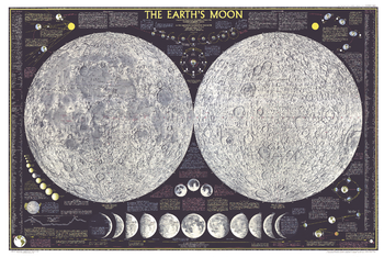
Earths Moon - Published 1969
Explore the moon in striking detail with this educational map published in February 1969. Featuring detailed illustrations of both the near and far sides of the moon, this map also contains an abundance of illustrations and information about the moon including its physical properties and features, phases, eclipses, orbital paths, and the Apollo mission.
Page Size: 42 x 28 in (1065 x 711 mm)
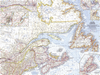
Eastern Canada - Published 1967
Explore the multitude of harbors, bays, inlets, and rivers to be found in Newfoundland, Labrador, Quebec, and the Maritime provinces with this compelling map of Eastern Canada. Includes wonderful detail of the region with inset maps of the provincial capitals, as well as maps of Cape Breton Island and the St. Lawrence Seaway. Published in May 1967, makes a fine companion to the maps of Central Canada (1963) and Western Canada (1966).
Page Size: 25 x 19 in (632 x 478 mm)
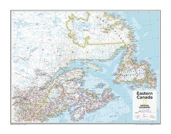
Eastern Canada - Atlas of the World, 10th Edition
null
Page Size: 28 x 22 in (711 x 559 mm)
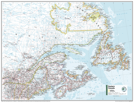
Eastern Canada - Atlas of the World, 11th Edition
This Eastern Canada map of physical and political features can fit in any space. Showcasing the region in stunning detail with state-of-the-art cartographic techniques delivering accuracy and exceptional quality, the innovative and engaging design makes the content easily accessible and user-friendly.
Ideal for classrooms with an emphasis on teaching geography or environmental themes. The inclusion of physical features to this map gives your students a genuine feel for how our world appears.
This map uses a bright, easy to read color palette featuring blue oceans and stunning shaded relief that has been featured on National Geographic wall maps for over 75 years. It is drawn in the Albers Conic Equal-Area projection, which uses two standard parallels between which distortion is minimized, however scale and shape are not preserved.
Names of geographic features are carefully placed on the map to maintain legibility, and the contrasts between Canada's populated and unpopulated areas are on brilliant display.
This map is found in National Geographic's 11th Edition World Atlas and is now available as a stand alone product.
Page Size: 31.5 x 24 in (798 x 610 mm)
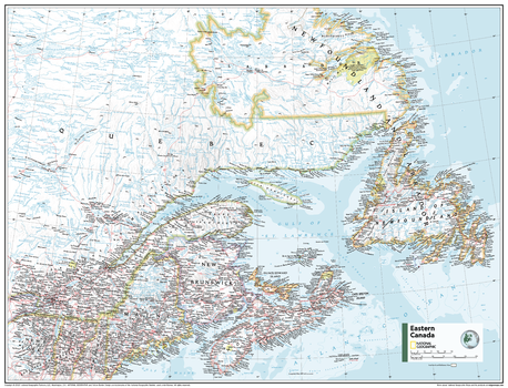
Eastern Canada - Atlas of the World, 11th Edition - Compact
This Eastern Canada map of physical and political features can fit in any space. Showcasing the region in stunning detail with state-of-the-art cartographic techniques delivering accuracy and exceptional quality, the innovative and engaging design makes the content easily accessible and user-friendly.
Ideal for classrooms with an emphasis on teaching geography or environmental themes. The inclusion of physical features to this map gives your students a genuine feel for how our world appears.
This map uses a bright, easy to read color palette featuring blue oceans and stunning shaded relief that has been featured on National Geographic wall maps for over 75 years. It is drawn in the Albers Conic Equal-Area projection, which uses two standard parallels between which distortion is minimized, however scale and shape are not preserved.
Names of geographic features are carefully placed on the map to maintain legibility, and the contrasts between Canada's populated and unpopulated areas are on brilliant display.
This map is found in National Geographic's 11th Edition World Atlas and is now available as a stand alone product.
Page Size: 21.5 x 16.25 in (540 x 413 mm)
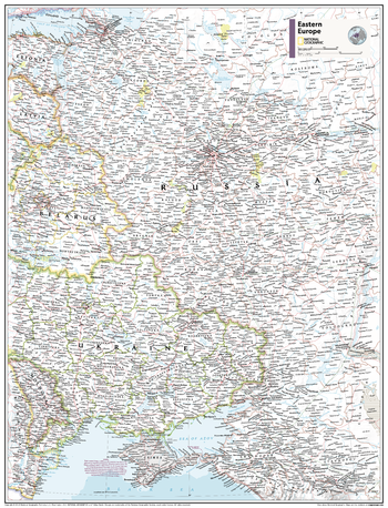
Eastern Europe - Atlas of the World, 11th Edition
This Eastern Europe map of physical and political features can fit in any space. Showcasing the countries in stunning detail with state-of-the-art cartographic techniques delivering accuracy and exceptional quality, the innovative and engaging design makes the content easily accessible and user-friendly.
Ideal for classrooms with an emphasis on teaching geography or environmental themes. The inclusion of physical features gives your students a genuine feel for how our world appears.
This map uses a bright, easy to read color palette featuring blue oceans and stunning shaded relief that has been featured on National Geographic wall maps for over 75 years. It is drawn in Conic projection, in which an area of the earth is projected onto a cone whose vertex is usually above one of the poles, then unrolled onto a flat surface.
Names of geographic features are carefully placed on the map to maintain legibility.
This map is found in National Geographic's 11th Edition World Atlas and is now available as a stand alone product.
Page Size: 24 x 31.5 in (610 x 798 mm)
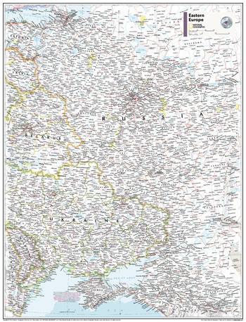
Eastern Europe - Atlas of the World, 11th Edition - Compact
This Eastern Europe map of physical and political features can fit in any space. Showcasing the countries in stunning detail with state-of-the-art cartographic techniques delivering accuracy and exceptional quality, the innovative and engaging design makes the content easily accessible and user-friendly.
Ideal for classrooms with an emphasis on teaching geography or environmental themes. The inclusion of physical features gives your students a genuine feel for how our world appears.
This map uses a bright, easy to read color palette featuring blue oceans and stunning shaded relief that has been featured on National Geographic wall maps for over 75 years. It is drawn in Conic projection, in which an area of the earth is projected onto a cone whose vertex is usually above one of the poles, then unrolled onto a flat surface.
Names of geographic features are carefully placed on the map to maintain legibility.
This map is found in National Geographic's 11th Edition World Atlas and is now available as a stand alone product.
Page Size: 16.25 x 21.5 in (413 x 540 mm)
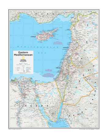
Eastern Mediterranean - Atlas of the World, 10th Edition
Cyprus, Gaza Strip, Israel, Jordan, Lebanon, West Bank
Page Size: 22 x 28 in (559 x 711 mm)