Ocean Floor around Antarctica - Atlas of the World, 11th Edition - Compact
National Geographic
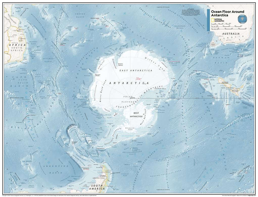
This map of physical features can fit in any space. Showcasing the ocean floor around Antarctica in stunning detail with state-of-the-art cartographic techniques delivering accuracy and exceptional quality, the innovative and engaging design makes the content easily accessible and user-friendly.
Ideal for classrooms with an emphasis on teaching geography or environmental themes. The mapping of the ocean terrain gives your students a unique glimpse into how our world appears under the sea.
This physical map of the ocean floor around Antarctica uses stunning contrasts to highlight the ocean floor and its physical features. Drawn in the Azimuthal Equidistant projection, this map ensures that all points on the map are at proportionally correct distances from the center point, in this case, the South Pole.
This map is found in National Geographic's 11th Edition World Atlas and is now available as a stand alone product.
Page Size: 21.5 x 16.25 in (540 x 413 mm)
Buy this map on MapTrove.ca