top of page
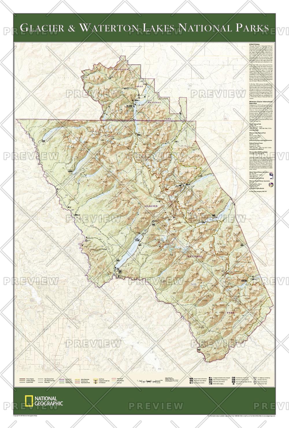
Glacier and Waterton Lakes National Parks
National Geographic
The wall map of Glacier and Waterton Lakes National Parks, based on the popular Trails Illustrated map of the area, provides rich topographic detail to show the Montana and Alberta parks' magnificent scenery, as well as updated trail and road information for the "Crown of the Continent."
Page Size: 24 x 36 in (610 x 914 mm)
Buy this map on MapTrove.ca or MapTrove.com
bottom of page