top of page
Federal Lands in the Fifty States - Published 1996
National Geographic
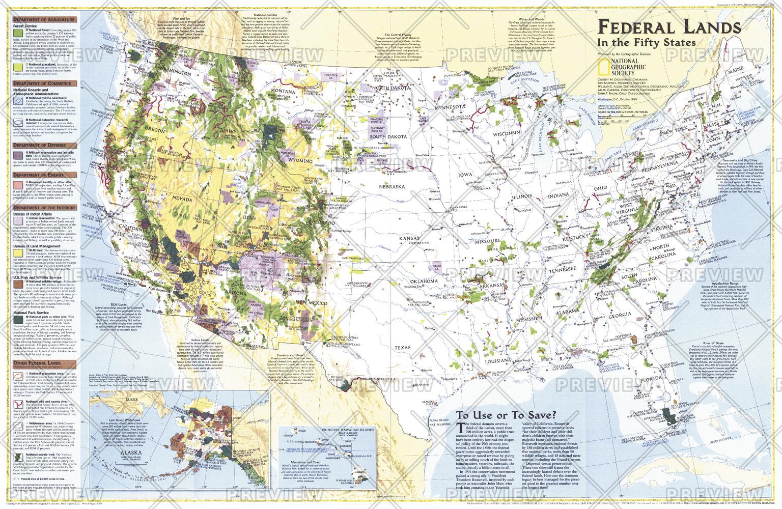
Considered by many to be the finest map of United States federal lands ever published. This map shows which land areas are controlled by each federal agency, and describes how each land type is managed. Published in October 1996 as a companion to "United States, the Physical Landscape."
Page Size: 31.5 x 20.5 in (795 x 517 mm)
Buy this map on MapTrove.ca or MapTrove.com
bottom of page