top of page
British Isles - Published 1979
National Geographic
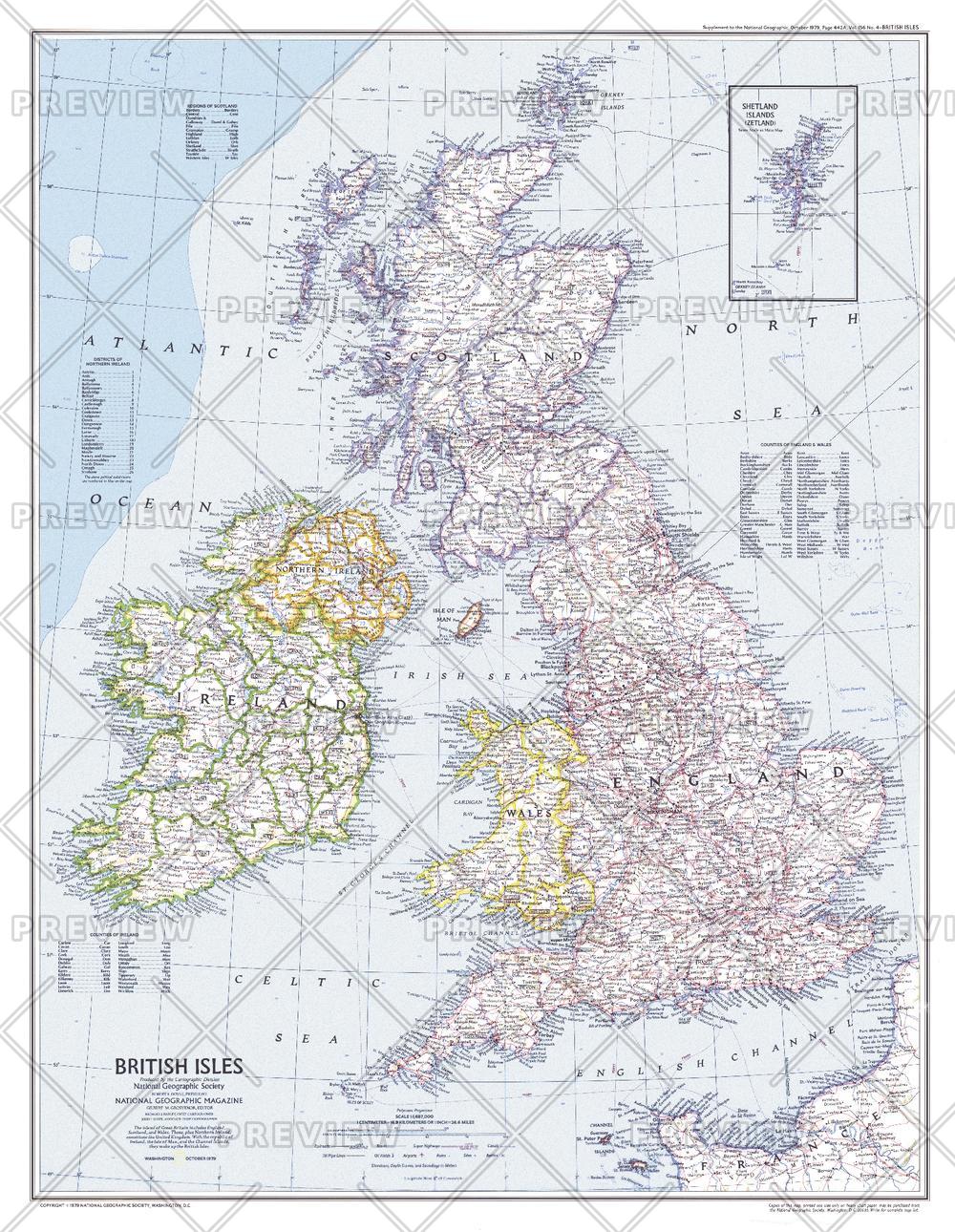
This attractive modern map of the British Isles includes ferry routes along with places of interest such as ruins and battle sites. Published in October 1979 as a companion to the historical map "Medieval England".
Page Size: 22.75 x 29.5 in (576 x 743 mm)
Buy this map on MapTrove.ca or MapTrove.com
bottom of page