top of page
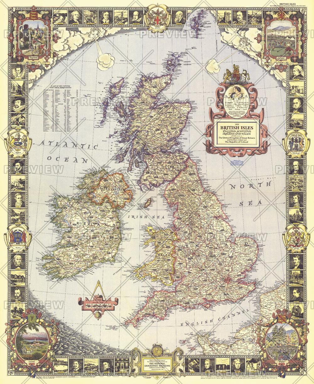
British Isles - Published 1949
National Geographic
With its elaborate, illustrated border and stylish legend, this map of the British Isles was made for framing. Published in April 1949, it is both a work of art as well as an informative map, containing an abundance of places of interest including cathedrals, ruins, battlefields, and more.
Page Size: 26.5 x 32.5 in (670 x 820 mm)
Buy this map on MapTrove.ca or MapTrove.com

bottom of page


